- DuBois, Pennsylvania
-
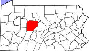
DuBois, Pennsylvania — City — Map showing DuBois in Clearfield County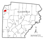 Map showing Clearfield County in Pennsylvania
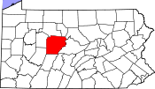 Pennsylvania
 DuBois, Pennsylvania
Coordinates: 41°07′13″N 78°45′43″W / 41.12028°N 78.76194°WCoordinates: 41°07′13″N 78°45′43″W / 41.12028°N 78.76194°W Country United States State Pennsylvania County Clearfield Settled 1812 Laid out 1872 Incorporated (borough) 1881 Incorporated (city) 1914 Government – Type City Council – Mayor Gary Gilbert Area – Total 3.3 sq mi (8.7 km2) Population (2000) – Total 8,123 – Density 2,429.8/sq mi (939.0/km2) Time zone Eastern (EST) (UTC-5) – Summer (DST) EDT (UTC-4) Zip code 15801 Area code(s) 814 Website www.duboispa.gov DuBois (IPA: /ˈduːbɔɪz/ DOO-boys) is a city in Clearfield County, Pennsylvania, 91 miles (146 km) northeast of Pittsburgh. It is the principal city in the DuBois, Pa Micropolitan Statistical Area.
Contents
History
Settled in 1812, laid out in 1872, DuBois was incorporated as a borough in 1881 and as a city in 1914. While DuBois was founded as a lumber town, the mining of bituminous coal quickly became the chief industry in DuBois, supporting a population of 9,375 in 1900; 12,623 in 1910; 13,681 in 1920; and 12,080 in 1940. The population was 8,123 at the 2000 census. Over the years there have been numerous unsuccessful attempts to combine the city with surrounding Sandy Township.
The town was founded by John Rumbarger, for whom the town was originally named. The Rumbarger Cemetery is all that survives of this original settlement. The town was later renamed for local lumber magnate John DuBois, who came from a longstanding American family of French Huguenot descent.
The Commercial Hotel was listed on the National Register of Historic Places in 1985, and the DuBois Historic District was listed in 1997.[1]
Geography
DuBois is located at 41°7′13″N 78°45′43″W / 41.12028°N 78.76194°W (41.120304, -78.761962)[2].
Demographics
As of the census[3] of 2000, there were 8,123 people, 3,614 households, and 2,099 families residing in the City of DuBois. The population density was 2,429.8 people per square mile (939.0/km²). There were 3,956 housing units at an average density of 1,183.4 per square mile (457.3/km²). The racial makeup of the city was 98.18% White, 0.30% African American, 0.10% Native American, 0.53% Asian, 0.05% Pacific Islander, 0.09% from other races, and 0.76% from two or more races. Hispanic or Latino of any race were 0.42% of the population.
There were 3,614 households out of which 26.1% had children under the age of 18 living with them, 42.6% were married couples living together, 12.0% had a female householder with no husband present, and 41.9% were non-families. 36.2% of all households were made up of individuals and 18.2% had someone living alone who was 65 years of age or older. The average household size was 2.23 and the average family size was 2.91.
In the city the population was spread out with 23.1% under the age of 18, 10.0% from 18 to 24, 26.6% from 25 to 44, 20.7% from 45 to 64, and 19.6% who were 65 years of age or older. The median age was 38 years. For every 100 females there were 87.2 males. For every 100 females age 18 and over, there were 83.5 males.
The median income for a household in the city was $27,748, and the median income for a family was $36,575. Males had a median income of $29,306 versus $18,601 for females. The per capita income for the city was $17,079. About 12.5% of families and 15.9% of the population were below the poverty line, including 23.4% of those under age 18 and 8.1% of those age 65 or over.
DuBois is considered the commercial retail center of north-central Pennsylvania. The DuBois, PA market area draws on a population base approaching 100,000. Average daily car counts in the commercial district involving state route 255, Interstate Highway 80, and Shaffer Road all approach 20,000 vehicles per day.
Culture and the arts
The DuBois tri-county area is building a strong reputation in local entertainment and the arts. DuBois is the hometown of Educational Entertainment Specialist Gene Allen, known for his character education programs for schools and libraries. More traditional arts can be found at the Winkler Gallery, which shows and merchandises the works of local artists including founder Perry Winkler, as well as the annual arts festival. The theater group the "Reitz Theater Players" along with "Cultural Resources Inc." also performs a selection of theater productions each year at the Paul G. Reitz Theater in downtown DuBois.[4]
The Brewery
There seems to be some debate as to exactly when Frank Hahne came to DuBois and broke ground on his own facility. One source claims 1898, another 1897. It seems most likely that this occurred between April and the end of 1896. It was on April 16, 1896, that the DuBois Weekly Courier reported: "Some new developments in connection with the brewery may be looked for in the near future."
There were a number of reasons Hahne chose the DuBois site for his facility, but the most frequently cited was the excellence of the water supply. He purchased 2,300 acres (9.3 km2) surrounding the local reservoir to protect the watershed from pollution.
By 1906, the brewery had four products on the market: DuBois Wurzburger, Hahne's Export Pilsener, DuBois Porter, and DuBois Budweiser. The Budweiser name would be at the center of controversy for 60 years between DuBois Brewing and Anheuser-Busch.
The DuBois brands soon traveled far and wide for a brewery of its size; ranging up to 150 miles (240 km) away and selling well in Buffalo, Erie and Pittsburgh. The brewery's 300 barrel kettle was kept busy churning out brands, while the left-over grain materials were pressed and sold for cattle feed and grist mills in the rural areas surrounding DuBois.
As with many other American breweries, DuBois Brewing moved right along until 1918 and the advent of Prohibition. The brewery shifted production to "near beer" and soft drinks and opened the H&G Ice Company. According to the April 7, 1933, DuBois Courier, the brewery won the honor of being one of only two breweries in the entire nation that had never violated or been suspected of violating the Prohibition laws since the 18th Amendment went into effect. As a result, DuBois Brewing Company was issued license number G-2, allowing them to resume brewing immediately upon the enaction of the 21st Amendment. Other breweries had to wait for varying periods as a form of punishment. On the first day of beer production, DuBois products sold at between 10 and 15 cents per pint bottle. A glass at local taverns was 10 cents.
Frank Hahne died in 1932, and the brewery was passed to his son, Frank Jr. Frank Jr. was the Hahne's only son, and his only son died in infancy, leaving the family without an heir. Hahne Jr. sold the brewery to Pittsburgh Brewing in 1967.
The new owners of the Budweiser name reportedly "settled" with Anheuser-Busch to the tune of a $1 million dollar profit for Pittsburgh Brewing. Five years later, in May 1972, the brewery was closed forever, leaving 100 workers out of a job.
The Brewery was torn down in late 2008 to make way for business development. One group rumored to be interested in the site is Dr. Gary Ott and the DuBois Regional Medical Center (DRMC). Dr. Ott intends on opening a women's health center on the lot, built in 2011.
Transportation
DuBois is served by DuBois Regional Airport (IATA: DUJ). Gulfstream Airlines, as a codeshare partner with Continental Airlines, operates three to four daily flights to and from Cleveland Hopkins International Airport.
The city is located just south of Interstate 80 with exits at mile markers 97 and 101.
The city is located on U.S. Route 219, which follows Brady Street, Liberty Boulevard, and West DuBois Avenue through the city, then becoming the Rich Highway. It connects with Buffalo, NY to the north and Johnstown, PA to the south.
The city is located just north of U.S. Route 322, which is known as Blinker Parkway and couples with Federal Route 219, known as Carson Hill Road, eastbound until Luthersburg, where it splits. It is known as Behringer Highway westbound. It connects the city with Reynoldsville to the west and Clearfield to the east as well as other points east and west.
U.S. Route 119 begins as Blinker Parkway just south of the city. It connects the city with Punxsutawney, PA and eventually leads to southwestern Pennsylvania and West Virginia.
Pennsylvania Route 255 begins just north of the city and follows East DuBois Avenue, then becoming the Bee-Line highway, connecting to Saint Mary's, becoming Million Dollar Highway).
Greyhound operates a bus terminal via Fullington Auto Bus Company with a station located on Maple Avenue at the base of the hill past the intersection of Maple Avenue and Shaffer Road. It is part of the Trailways Transportation System.
Notable people
- Sparky Lyle - retired Major League Baseball player
- Tom Mix - early star of Western and cowboy films
- Major General Paul E. Vallely - retired general and military analyst for Fox News Channel
- Jim Conner, former Executive Vice President, Motor & Equipment Manufacturers Association[citation needed]
- Paul Butler - Tight End for The University of Akron
- Charles H. MacDonald- American WWII Fighter Ace
- Adam Lawrence - Former Linebacker for Robert Morris University
- Benny Gordon- USAR ProCup Driver/NASCAR Nationwide Series Rookie
- Jim Pittsley- MLB player for the Kansas City Royals and Milwaukee Brewers
- Duff McEnteer - Flying Tigers pilot who earned a Silver Star, Chinese Air Medal, and a Purple Heart while flying under General Clair Chennault during World War II
- Paul "PJ" Monella-the youngest candidate for County Commissioner in Pennsylvania, has a significant background in the DuBois Area. At just 18, he will appear on the ballot for Clearfield County Commissioner in 2011.
References
- ^ "National Register Information System". National Register of Historic Places. National Park Service. 2010-07-09. http://nrhp.focus.nps.gov/natreg/docs/All_Data.html.
- ^ "US Gazetteer files: 2010, 2000, and 1990". United States Census Bureau. 2011-02-12. http://www.census.gov/geo/www/gazetteer/gazette.html. Retrieved 2011-04-23.
- ^ "American FactFinder". United States Census Bureau. http://factfinder.census.gov. Retrieved 2008-01-31.
- ^ http://www.reitztheater.com/
External links
Municipalities and communities of Clearfield County, Pennsylvania City DuBois
Boroughs Brisbin | Burnside | Chester Hill | Clearfield | Coalport | Curwensville | Falls Creek‡ | Glen Hope | Grampian | Houtzdale | Irvona | Lumber City | Mahaffey | New Washington | Newburg | Osceola Mills | Ramey | Troutville | Wallaceton | Westover
Townships CDPs Hyde | Plymptonville | Sandy | Treasure Lake
Other
communitiesHelvetia | Sylvan Grove | West Decatur
Footnotes ‡This populated place also has portions in an adjacent county or counties
Categories:- Cities in Pennsylvania
- Populated places established in 1812
- Populated places in Clearfield County, Pennsylvania

Wikimedia Foundation. 2010.