- Curwensville, Pennsylvania
-
Curwensville, Pennsylvania — Borough — Map showing Curwensville in Clearfield County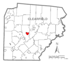 Map showing Clearfield County in Pennsylvania
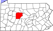 Pennsylvania
 Curwensville, Pennsylvania
Coordinates: 40°58′24″N 78°21′10″W / 40.97333°N 78.35278°WCoordinates: 40°58′24″N 78°21′10″W / 40.97333°N 78.35278°W Country United States State Pennsylvania County Clearfield Settled 1799 Incorporated 1851 Government – Type Borough Council – Mayor Don Hoover Area – Total 2.3 sq mi (6.1 km2) Population (2000) – Total 2,650 – Density 1,178.4/sq mi (454.7/km2) Time zone Eastern (EST) (UTC-5) – Summer (DST) EDT (UTC-4) Zip code 16833 Area code(s) 814 Website Curwensville Official Website Curwensville is a borough located in Clearfield County, Pennsylvaniain the United States of America, 34 miles (55 km) northwest of Altoona on the West Branch Susquehanna River. Coal mining, tanning, and the manufacture of fire bricks were the industries at the turn of the 20th century. In 1900, 1,937 people lived in the borough, and in 1910, 2,549 lived there. As of the 2000 U.S. census, the borough had a total population of 2,650.
Contents
Businesses
NARCO was a brick plant in Curwensville. The "Brick Yard" as most called it in the community made many different types of brick. Seneca, acid, and cardic brick were all manufactured in NARCO. They were also noted for hot gun models and specialty shapes.
Geography
Curwensville is located at 40°58′24″N 78°31′20″W / 40.97333°N 78.52222°W (40.973408, -78.522318),[1] along the banks of the West Branch Susquehanna River.
According to the United States Census Bureau, the borough has a total area of 2.3 square miles (6.0 km2), of which, 2.2 square miles (5.7 km2) of it is land and 0.1 square miles (0.26 km2) of it is water. The total area is 3.85% water.
Demographics
As of the census[2] of 2000, there are 2,650 people, 1,144 households, and 758 families residing in the borough. The population density is 1,178.4 people per square mile (454.7/km²). There are 1,254 housing units at an average density of 557.7 per square mile (215.2/km²). The ethnic composition of the borough is 99.02% White, 0.34% African American, 0.23% Native American, 0.08% Asian, 0.00% Pacific Islander, 0.04% from other races, and 0.30% from two or more races. 0.30% of the population are Hispanic or Latino of any race.
There are 1,144 households of which 28.9% have children under the age of 18 living with them, 50.2% are married couples living together, 11.2% have a female householder with no husband present, and 33.7% are not nuclear families. 30.6% of all households are made up of solitary dwellers of varying ages with 15.9% of those being a person who is 65 years of age or older. The average household size is 2.29 people and the average family size is 2.84 people.
The ages of persons living in the Curwensville borough are widely varied with 22.8% under the age of 18, 7.5% from 18 to 24, 26.6% from 25 to 44, 24.0% from 45 to 64, and 19.2% who are 65 years of age or older. The median age is 40 years. For every 100 females there are 82.0 males. For every 100 females age 18 and over, there are 80.0 males.
The median income for a household in the borough is $27,281, and the median income for a family is $36,197. Males have a median income of $28,145 versus $18,598 for females. The per capita income for the borough is $14,829. 16.0% of the population and 12.8% of families are below the poverty line. Out of the total population, 29.0% of those under the age of 18 and 12.7% of those 65 and older are living below the poverty line.
Notable people
Notable current and former residents of Curwensville include:
- Charles Emory Patton (1859–1937), Republican member of the United States House of Representatives from 1911 to 1915.
- Charles Wall (c. 1903-1995), resident superintendent of George Washington's estate at Mount Vernon for 39 years starting 1937.[3]
References
- ^ "US Gazetteer files: 2010, 2000, and 1990". United States Census Bureau. 2011-02-12. http://www.census.gov/geo/www/gazetteer/gazette.html. Retrieved 2011-04-23.
- ^ "American FactFinder". United States Census Bureau. http://factfinder.census.gov. Retrieved 2008-01-31.
- ^ Thomas, Robert McG., Jr. "Charles Wall, 91, Long Director Of George Washington's Home", The New York Times, May 5, 1995. Accessed July 23, 2010.
Municipalities and communities of Clearfield County, Pennsylvania City 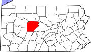
Boroughs Brisbin | Burnside | Chester Hill | Clearfield | Coalport | Curwensville | Falls Creek‡ | Glen Hope | Grampian | Houtzdale | Irvona | Lumber City | Mahaffey | New Washington | Newburg | Osceola Mills | Ramey | Troutville | Wallaceton | Westover
Townships CDPs Hyde | Plymptonville | Sandy | Treasure Lake
Other
communitiesHelvetia | Sylvan Grove | West Decatur
Footnotes ‡This populated place also has portions in an adjacent county or counties
Categories:- Populated places established in 1799
- Populated places on the Susquehanna River
- Boroughs in Clearfield County, Pennsylvania

Wikimedia Foundation. 2010.