- Chester Hill, Pennsylvania
-
Chester Hill, Pennsylvania — Borough — Map showing Chester Hill in Clearfield County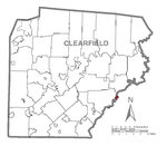 Map showing Clearfield County in Pennsylvania
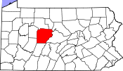 Pennsylvania
 Chester Hill, Pennsylvania
Coordinates: 40°53′30″N 78°13′44″W / 40.89167°N 78.22889°WCoordinates: 40°53′30″N 78°13′44″W / 40.89167°N 78.22889°W Country United States State Pennsylvania County Clearfield Settled 1849 Incorporated 1883 Government – Type Borough Council – Mayor Area – Total 0.5 sq mi (1.3 km2) Population (2000) – Total 918 – Density 1,852.6/sq mi (708.9/km2) Time zone Eastern (EST) (UTC-5) – Summer (DST) EDT (UTC-4) Zip code Area code(s) 814 Chester Hill is a borough in Clearfield County, Pennsylvania, United States. The population was 918 at the 2000 census.
Geography
Chester Hill is located at 40°53′30″N 78°13′44″W / 40.89167°N 78.22889°W (40.891595, -78.228778)[1].
According to the United States Census Bureau, the borough has a total area of 0.5 square miles (1.3 km2), all of it land.
Demographics
As of the census[2] of 2000, there were 918 people, 399 households, and 264 families residing in the borough. The population density was 1,852.6 people per square mile (708.9/km²). There were 434 housing units at an average density of 875.9 per square mile (335.1/km²). The racial makeup of the borough was 99.24% White, 0.11% Native American, 0.11% Asian, and 0.54% from two or more races. Hispanic or Latino of any race were 0.22% of the population.
There were 399 households out of which 29.8% had children under the age of 18 living with them, 43.4% were married couples living together, 16.5% had a female householder with no husband present, and 33.8% were non-families. 29.8% of all households were made up of individuals and 14.3% had someone living alone who was 65 years of age or older. The average household size was 2.30 and the average family size was 2.74.
In the borough the population was spread out with 24.0% under the age of 18, 9.7% from 18 to 24, 28.9% from 25 to 44, 21.8% from 45 to 64, and 15.7% who were 65 years of age or older. The median age was 37 years. For every 100 females there were 84.7 males. For every 100 females age 18 and over, there were 82.2 males.
The median income for a household in the borough was $24,271, and the median income for a family was $28,500. Males had a median income of $24,464 versus $20,735 for females. The per capita income for the borough was $14,256. About 24.0% of families and 26.8% of the population were below the poverty line, including 40.9% of those under age 18 and 15.2% of those age 65 or over.
References
- ^ "US Gazetteer files: 2010, 2000, and 1990". United States Census Bureau. 2011-02-12. http://www.census.gov/geo/www/gazetteer/gazette.html. Retrieved 2011-04-23.
- ^ "American FactFinder". United States Census Bureau. http://factfinder.census.gov. Retrieved 2008-01-31.
Municipalities and communities of Clearfield County, Pennsylvania City 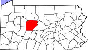
Boroughs Brisbin | Burnside | Chester Hill | Clearfield | Coalport | Curwensville | Falls Creek‡ | Glen Hope | Grampian | Houtzdale | Irvona | Lumber City | Mahaffey | New Washington | Newburg | Osceola Mills | Ramey | Troutville | Wallaceton | Westover
Townships CDPs Hyde | Plymptonville | Sandy | Treasure Lake
Other
communitiesHelvetia | Sylvan Grove | West Decatur
Footnotes ‡This populated place also has portions in an adjacent county or counties
Categories:- Populated places established in 1849
- Boroughs in Clearfield County, Pennsylvania

Wikimedia Foundation. 2010.