- U.S. Route 119
Infobox U.S. Route
article_route=119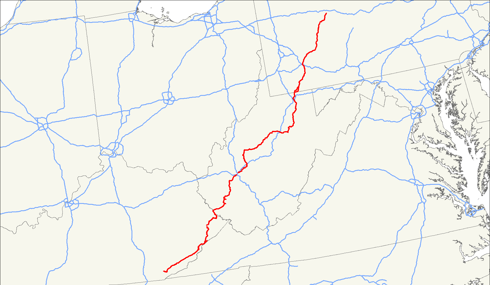
length_mi=585
length_ref= [http://www.us-highways.com/us1830.htm US Highways from US 1 to US 830] Robert V. Droz]
yrcom=1926
direction_a=South
from=Jct|state=KY|US|25E in Pineville, KY
junction=Jct|state=KY|US|23|US|460|KY|80 in Pikeville, KY
Jct|state=WV|I|64|I|77 in Charleston, WV
Jct|state=WV|US|33 from Spencer to Buckhanon, WV
Jct|state=WV|I|79 near Weston, WV
Jct|state=WV|US|50 in Grafton, WV
Jct|state=WV|I|68 at Morgantown, WV
Jct|state=PA|PA|43 in Uniontown, PA
Jct|state=PA|US|40 in Uniontown, PA
Jct|state=PA|PA|51 near Uniontown, PA
Jct|state=PA|I|70|I|76|PATP in New Stanton, PA
direction_b=North
to=Jct|state=PA|US|219 in Sandy Township, PA
spur_of=19U.S. Route 119, commonly abbreviated as US 119, is a spur of US 19. It is a north-south route that was an original
United States highway of 1926. It is often referred to asCorridor G east of US 23 and KY 80 inKentucky toInterstate 64 atCharleston, West Virginia .Route description
Kentucky
US 119 is a two and four-lane highway running from Pineville at US 25 (Daniel Boone Parkway) to the West Virginia state line at South Williamson.
From Pineville to US 23 (Country Music Highway) at Jenkins, it is part of
Corridor F . During its concurrency from Jenkins north to Pikeville, where it departs eastward towards West Virginia, it is part ofCorridor B . From US 23/KY 80 at Pikeville eastward towards the state line, it is part ofCorridor G .US 119 passes near Harlan and Pikeville.
West Virginia
US 119 enters from Kentucky via Corridor G, a four-lane limited-access highway stretching from Williamson to Charleston. The earliest segment of Corridor G to open was in 1972 and was finished in 1997. Formerly, US 119 was a typical two-lane mountain highway. Old US 119 now comprises all or parts of US 52, WV 44, WV 10, WV 17, WV 85, WV 3, WV 94 and WV 61.
The US route becomes a mostly two-lane highway north of Charleston, having functionally been replaced by
Interstate 79 . Compared to its replacement, US 119 takes a rather winding course. A trip from the Charleston area to the Morgantown area (I-79/US 119 Exit #1 to I-68 Exit #1) is convert|147|mi via I-79 and convert|182|mi via US 119. The travel time is about double taking US 119, over 4 hours instead of about 2 hours.From Charleston, US 119 heads roughly east along the Elk River to Clendenin, where it turns north for convert|29|mi to Spencer. At Spencer, it begins to head east with US 33 for convert|81.4|mi. Along the way, it passes through Glenville and Weston, where it intersects parent route US 19 and replacement I-79. From I-79 to WV 20 at Buckhannon, US 33/US 119 follow
Corridor H .At Buckhannon, US 119 again turns north - first with WV 20 then by itself as it travels to Philippi. At Philippi it joins with US 250 for convert|12|mi. From there, US 119 heads on its own through Grafton and towards Morgantown.
Just south of Morgantown, US 119 intersects Interstate 68's Exit #1, immediately east of its end at I-79. US 119 then enters downtown Morgantown, again meeting with US 19. It leaves town via the narrow and winding North Willey Street and congested Mileground.
Just after the Mileground, US 119 intersects with the Monongalia County Route 857 connector to I-68 Exit #7, which effectively allows through traffic to bypass Morgantown. US 119 finally turns north to enter
Pennsylvania near Point Marion. Much of this last stretch of US 119 heading towardsUniontown, Pennsylvania is already bypassed by traffic using I-68, Monongalia County Route 857 and PA 857. While this alternate route is longer, it has a better alignment and is faster to travel. This phenomenon of through traffic leaving US 119 will likely accelerate once theMon-Fayette Expressway is complete.Pennsylvania
"see:
U.S. Route 119 (Pennsylvania) "US 119 travels through Connellsville, Greensburg, and Punxsutawney, and bypasses Uniontown and Indiana. There are numerous other boroughs and villages along its 133 mile route in the Keystone State.
The southern entrance of US 119 is at the West Virginia state line one-half mile south of Point Marion. The northern terminus is at US 219 two miles south of
DuBois, Pennsylvania .US 119's control cities include
Morgantown, West Virginia ,Uniontown , Connellsville, New Stanton (for northbound traffic only), Greensburg, Blairsville, Indiana, Punxsutawney, and DuBois.History
Kentucky
West Virginia
The routing of US 119 south of Charleston changed drastically with the opening of
Corridor G from 1972 to 1997.The original routing southeast of capital city was WV 61 to Marmet, where it took WV 94 southwest to Racine Rand McNally. Atlas. 1970.] . From Racine to Danville, it followed today's WV 3 and onward to Madison. From Madison south to Logan, it followed today's WV 17.
South of Logan to Mountain View, it followed WV 44. At Mountain View, it junctioned US 52 and overlapped it northwest to Williamson, where it entered Kentucky.
See also
*
List of U.S. Routes References
###@@@KEYEND@@@###
Wikimedia Foundation. 2010.