- Marmet, West Virginia
-
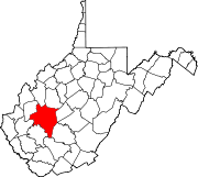
City of Marmet — City — Location within the state of West Virginia
 City of Marmet
Coordinates: 38°14′43″N 81°34′3″W / 38.24528°N 81.5675°WCoordinates: 38°14′43″N 81°34′3″W / 38.24528°N 81.5675°W Country  United States
State  West Virginia
County Kanawha Government - Mayor Billy L. Pauley (D) Area - Total 1.6 sq mi (4.0 km2) - Land 1.4 sq mi (3.6 km2) - Water 0.1 sq mi (0.4 km2) Elevation 610 ft (186 m) Population (2000) - Total 1,693 - Density 1,202.7/sq mi (464.4/km2) Time zone Eastern (EST) (UTC-5) - Summer (DST) EDT (UTC-4) ZIP codes 25315, 25365 Area code(s) 304 FIPS code 54-51724[1] GNIS feature ID 1542771[2] Marmet (pronounced mar-MET) is a city in Kanawha County, West Virginia, USA, along the Kanawha River.
Geography
Marmet is located at 38°14′43″N 81°34′3″W / 38.24528°N 81.5675°W (38.245148, -81.567510)[3].
According to the United States Census Bureau, the city has a total area of 1.5 square miles (4.0 km²), of which, 1.4 square miles (3.7 km²) of it is land and 0.1 square miles (0.4 km²) of it (9.03%) is water.
References
- ^ "American FactFinder". United States Census Bureau. http://factfinder.census.gov. Retrieved 2008-01-31.
- ^ "US Board on Geographic Names". United States Geological Survey. 2007-10-25. http://geonames.usgs.gov. Retrieved 2008-01-31.
- ^ "US Gazetteer files: 2010, 2000, and 1990". United States Census Bureau. 2011-02-12. http://www.census.gov/geo/www/gazetteer/gazette.html. Retrieved 2011-04-23.
Municipalities and communities of Kanawha County, West Virginia County seat: Charleston Cities Charleston | Dunbar | Marmet | Montgomery‡ | Nitro‡ | St. Albans | Smithers‡ | South Charleston
Towns Belle | Cedar Grove | Chesapeake | Clendenin | East Bank | Glasgow | Handley | Pratt
CDPs Alum Creek‡ | Big Chimney | Chelyan | Coal Fork | Cross Lanes | Elkview | Jefferson | Pinch | Rand | Shrewsbury | Sissonville | Upper Falls
Other
localitiesAarons | Acme | Acup | Amandaville | Amelia | Annfred | Barren Creek | Blackhawk | Blakeley | Blount | Blue Creek | Blundon | Bream | Brounland | Burnwell | Cabin Creek | Carbon | Cinco | Coalburg | Coalridge | Coco | Corton | Crede | Crown Hill | Davis Creek | Dawes | Decota | Dial | Diamond | Dickinson | Donwood | Dry Branch | Dungriff | Dupont City | East Nitro | East Side | Edgewood | Elk | Elk Forest | Elk Hills | Emmons‡ | Eskdale | Etowah | Falling Rock | Ferrell | Fivemile | Forest Hills | Forks of Coal | Fort Hill | Frame | Gallagher | Giles | Green Valley | Greencastle | Grippe | Guthrie | Hansford | Hernshaw | Hicumbottom | Highlawn | Hillsdale | Hitop | Holly | Hollygrove | Hollyhurst | Hugheston | Institute | Island Branch | Ivydale | Jarrett | Jarretts Ford | Joplin | Kanawha Estates | Kayford | Kelly Hill | Kendalia | Laing | Leewood | London | Lower Falls | Malden | Mammoth | Meadowbrook | Miami | Mink Shoals | Ohley | Pocatalico | Pond Gap | Port Amherst | Quick | River Bend | Riverside | Ruth | Ruthdale | Sharon | Snow Hill | Standard | Tad | Tornado | Victor | Wallace | Whittaker | Winifrede
Footnotes ‡This populated place also has portions in an adjacent county or counties
Categories:- Cities in West Virginia
- Populated places in Kanawha County, West Virginia
- Kanawha River
- Charleston, West Virginia metropolitan area


Wikimedia Foundation. 2010.