- Clendenin, West Virginia
-
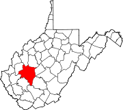
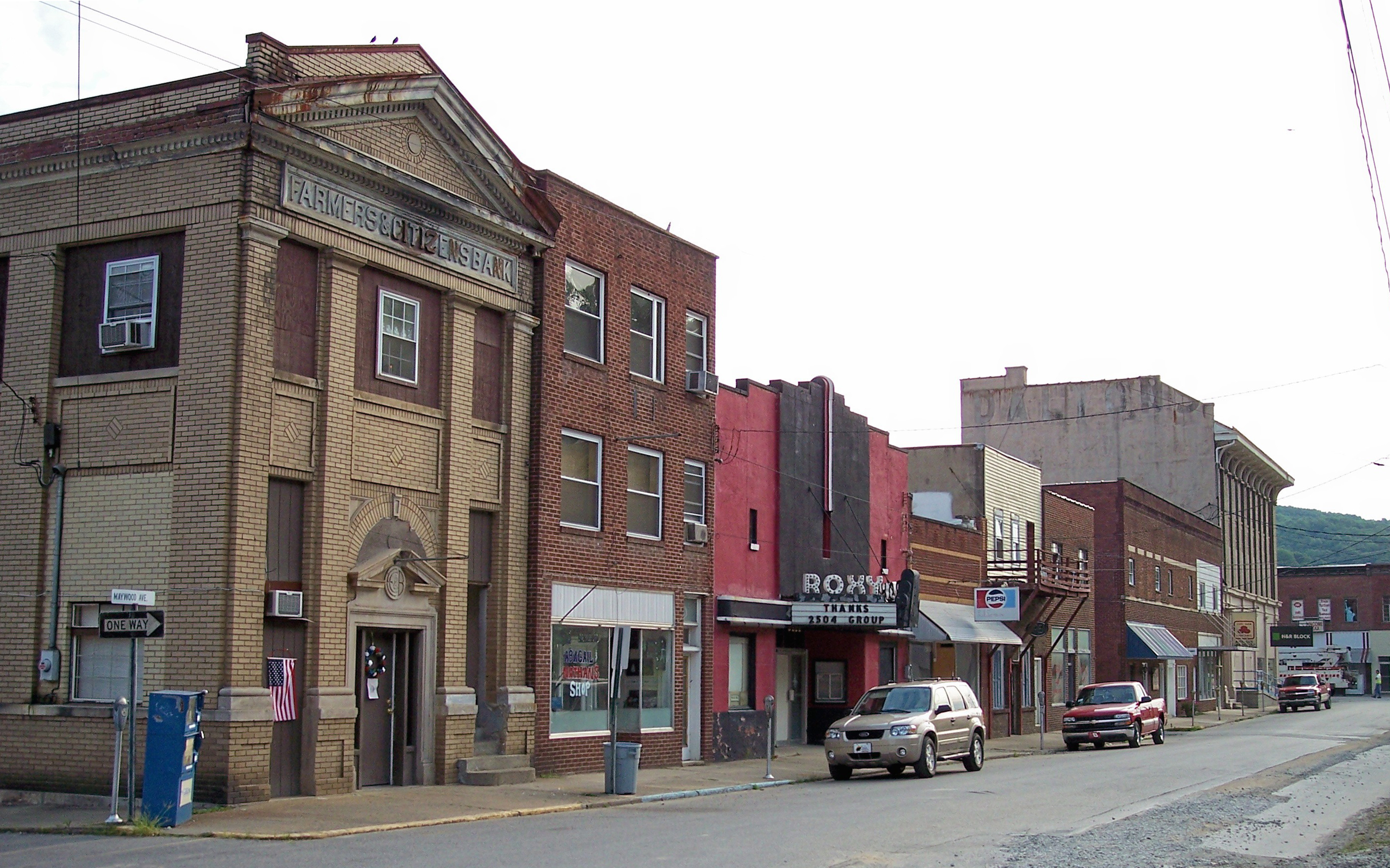
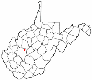
Clendenin, West Virginia — Town — Maywood Avenue in downtown Clendenin in 2007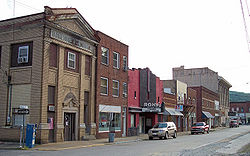 Location of Clendenin, West Virginia
Coordinates: 38°29′19″N 81°20′56″W / 38.48861°N 81.34889°WCoordinates: 38°29′19″N 81°20′56″W / 38.48861°N 81.34889°W Country United States State West Virginia County Kanawha Government - Type Strong City Council - Mayor Robert Ore - Recorder Robert Evans Area - Total 1.4 sq mi (3.6 km2) - Land 1.3 sq mi (3.4 km2) - Water 0.1 sq mi (0.2 km2) Elevation 623 ft (190 m) Population (2010) - Total 1,227 - Density 838.8/sq mi (323.9/km2) Time zone Eastern (EST) (UTC-5) - Summer (DST) EDT (UTC-4) ZIP code 25045 Area code(s) 304 FIPS code 54-16012[1] GNIS feature ID 1537398[2] Clendenin is a town in Kanawha County, West Virginia along the Elk River. The population was 1,227 at the 2010 census. Clendenin was incorporated in 1904 and named for the Clendenins, an early pioneer family in the Kanawha River Valley. Charleston, WV retains the namesake of George Clendenin's father, Charles Clendenin. George Clendenin owned a large portion of present-day Charleston and settled at the confluence of the Elk and Kanawha rivers with several other families.
The first petrochemical plant in the world was built in Clendenin in 1920. This plant was the original Union Carbide Corporation facility. Other chief economic staples included (and to some extent still include) timber, coal, gas, oil, and salt.
In the 1960s, the hillside on the south side of town featured a sign reading, "Clendenin's Beauty is Everyone's Duty."
The current mayor of Clendenin is Mayor Robert Ore. Town elections (including the office of mayor and city council) occur every two years. Recent efforts have been made by the Business and Industrial Development Corporation (headquartered in Charleston) to enhance economic and cultural development in the town.
Contents
Notable Natives
- Billy Joe Mantooth -1970 All American at Ferrum College, transferred to West Virginia University in 1971, Also played in the NFL for the Philadelphia Eagles and Houston Oilers.
- Dave Stephenson -Played in the NFL for the Los Angeles Rams and Green Bay Packers.
Geography
Clendenin is located at 38°29′19″N 81°20′56″W / 38.48861°N 81.34889°W (38.488638, -81.348812)[3].
According to the United States Census Bureau, the town has a total area of 1.4 square miles (3.6 km²). 1.3 square miles (3.4 km²) of it is land and 0.1 square miles (0.2 km²) of it (4.32%) is water.
Demographics
As of the census[1] data from the 2009 American Community Survey, there were 1,176 people, 475 households, and 326 families residing in the town. The population density was 838.8 inhabitants per square mile (324.0/km²). There were 525 housing units at an average density of 394.6 per square mile (152.4/km²). The racial makeup of the town was 99.01% White, 0.09% African American, 0.09% Native American, 0.09% Asian, and 0.72% from two or more races. Hispanic or Latino of any race were 0.18% of the population.
There were 475 households out of which 24.8% had children under the age of 18 living with them, 53.1% were married couples living together, 10.3% had a female householder with no husband present, and 31.2% were non-families. 27.4% of all households were made up of individuals and 15.2% had someone living alone who was 65 years of age or older. The average household size was 2.32 and the average family size was 2.80.
In the town the population was spread out with 20.3% under the age of 18, 6.7% from 18 to 24, 28.0% from 25 to 44, 25.7% from 45 to 64, and 19.3% who were 65 years of age or older. The median age was 42 years. For every 100 females there were 89.5 males. For every 100 females age 18 and over, there were 85.4 males.
The median income for a household in the town was $32,000, and the median income for a family was $38,021. Males had a median income of $30,000 versus $18,500 for females. The per capita income for the town was $16,587. About 9.7% of families and 14.6% of the population were below the poverty line, including 13.7% of those under age 18 and 20.2% of those age 65 or over.
Trivia
Several people in the town have claimed to have seen local legendary monsters such as the Mothman, the Flatwoods, WV Green Monster, and the White Tiger.
References
- ^ a b "American FactFinder". United States Census Bureau. http://factfinder.census.gov. Retrieved 2008-01-31.
- ^ "US Board on Geographic Names". United States Geological Survey. 2007-10-25. http://geonames.usgs.gov. Retrieved 2008-01-31.
- ^ "US Gazetteer files: 2010, 2000, and 1990". United States Census Bureau. 2011-02-12. http://www.census.gov/geo/www/gazetteer/gazette.html. Retrieved 2011-04-23.
External links
- Official Site for the Town of Clendenin
- Home of the Clendenin Town & Country Newspaper, clendenin-news.com
- The Country Times, a Clendenin newspaper
Municipalities and communities of Kanawha County, West Virginia Cities Charleston | Dunbar | Marmet | Montgomery‡ | Nitro‡ | St. Albans | Smithers‡ | South Charleston
Towns Belle | Cedar Grove | Chesapeake | Clendenin | East Bank | Glasgow | Handley | Pratt
CDPs Alum Creek‡ | Big Chimney | Chelyan | Coal Fork | Cross Lanes | Elkview | Jefferson | Pinch | Rand | Shrewsbury | Sissonville | Upper Falls
Other
localitiesAarons | Acme | Acup | Amandaville | Amelia | Annfred | Barren Creek | Blackhawk | Blakeley | Blount | Blue Creek | Blundon | Bream | Brounland | Burnwell | Cabin Creek | Carbon | Cinco | Coalburg | Coalridge | Coco | Corton | Crede | Crown Hill | Davis Creek | Dawes | Decota | Dial | Diamond | Dickinson | Donwood | Dry Branch | Dungriff | Dupont City | East Nitro | East Side | Edgewood | Elk | Elk Forest | Elk Hills | Emmons‡ | Eskdale | Etowah | Falling Rock | Ferrell | Fivemile | Forest Hills | Forks of Coal | Fort Hill | Frame | Gallagher | Giles | Green Valley | Greencastle | Grippe | Guthrie | Hansford | Hernshaw | Hicumbottom | Highlawn | Hillsdale | Hitop | Holly | Hollygrove | Hollyhurst | Hugheston | Institute | Island Branch | Ivydale | Jarrett | Jarretts Ford | Joplin | Kanawha Estates | Kayford | Kelly Hill | Kendalia | Laing | Leewood | London | Lower Falls | Malden | Mammoth | Meadowbrook | Miami | Mink Shoals | Ohley | Pocatalico | Pond Gap | Port Amherst | Quick | River Bend | Riverside | Ruth | Ruthdale | Sharon | Snow Hill | Standard | Tad | Tornado | Victor | Wallace | Whittaker | Winifrede
Footnotes ‡This populated place also has portions in an adjacent county or counties
Categories:- Populated places in Kanawha County, West Virginia
- Towns in West Virginia
- Charleston, West Virginia metropolitan area

Wikimedia Foundation. 2010.