- Elk River (West Virginia)
Geobox|River
name = Elk River
native_name =
other_name =
other_name1 =
image_size =
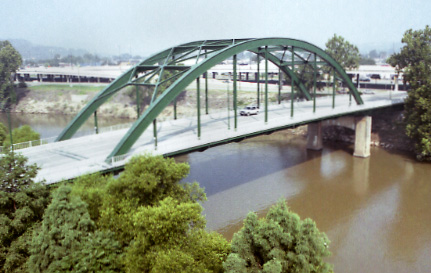
image_caption = Elk River in Charleston
country = United States
country_
state = West Virginia
state_
region_type = Counties
region = Pocahontas
region1 = Randolph
region2 = Webster
region3 = Braxton
region4 = Clay
region5 = Kanawha
city =
city1 =
city2 =
length_imperial = 172
length_note =
watershed_imperial =
watershed_note =
discharge_location = Queen Shoals, WV
discharge_imperial = 2650
discharge_max_imperial = 14000
discharge_max_note = (1972)
discharge_min_imperial = 271
discharge_min_note = (1976)
discharge_note = cite web
url = http://waterdata.usgs.gov/wv/nwis/uv/?site_no=03197000&PARAmeter_cd=00065,00060,62614
title = USGS 03197000 ELK RIVER AT QUEEN SHOALS, WV
accessdate = 2008-04-22
publisher =U.S. Geological Survey ]
discharge1_location =
discharge1_imperial =
discharge1_note =
source_name = Old Field Fork
source_location = Elk Mountain
source_district =
source_region = Pocahontas County
source_state = WV
source_country =
source_lat_d = 38
source_lat_m = 18
source_lat_s = 24
source_lat_NS = N
source_long_d = 80
source_long_m = 06
source_long_s = 18
source_long_EW = W
source_elevation_imperial = 3557
source_elevation_note = cite web
url = http://gisdata.usgs.gov/XMLWebServices/TNM_Elevation_Service.asmx/getElevation?X_Value=-80.105&Y_Value=38.306667&Elevation_Units=FEET&Source_Layer=-1&Elevation_Only=FALSE
title = USGS Elevation Query: Old Field Fork Source
accessdate = 2008-04-22
publisher =U.S. Geological Survey ]
source_length_imperial =
source_note = cite gnis|1552376|Old Field Fork|2008-04-21]
source1_name = Big Spring Fork
source1_location = Pocahontas County
source1_district =
source1_region =
source1_state = WV
source1_country =
source1_lat_d = 38
source1_lat_m = 22
source1_lat_s = 32
source1_lat_NS = N
source1_long_d = 80
source1_long_m = 00
source1_long_s = 34
source1_long_EW = W
source1_elevation_imperial = 3655
source1_elevation_note = cite web
url = http://gisdata.usgs.gov/XMLWebServices/TNM_Elevation_Service.asmx/getElevation?X_Value=-80.009444&Y_Value=38.375556&Elevation_Units=FEET&Source_Layer=-1&Elevation_Only=FALSE
title = USGS Elevation Query: Big Spring Fork Source
accessdate = 2008-04-22
publisher =U.S. Geological Survey ]
source1_length_imperial =
source1_note = cite gnis|1550348|Big Spring Fork|2008-04-22]
source_confluence_location = Slatyfork
source_confluence_district =
source_confluence_region =
source_confluence_state = WV
source_confluence_country =
source_confluence_lat_d = 38
source_confluence_lat_m = 25
source_confluence_lat_s = 08
source_confluence_lat_NS = N
source_confluence_long_d = 80
source_confluence_long_m = 07
source_confluence_long_s = 48
source_confluence_long_EW = W
source_confluence_elevation_imperial = 2667
source_confluence_elevation_note = cite web
url = http://gisdata.usgs.gov/XMLWebServices/TNM_Elevation_Service.asmx/getElevation?X_Value=-80.13&Y_Value=38.418889&Elevation_Units=FEET&Source_Layer=-1&Elevation_Only=FALSE
title = USGS Elevation Query: Elk River Source Confluence
accessdate = 2008-04-22
publisher =U.S. Geological Survey ]
mouth_name =Kanawha River
mouth_location = Charleston
mouth_district =
mouth_region =
mouth_state = WV
mouth_country =
mouth_lat_d = 38
mouth_lat_m = 21
mouth_lat_s = 18
mouth_lat_NS = N
mouth_long_d = 81
mouth_long_m = 38
mouth_long_s = 42
mouth_long_EW = W
mouth_elevation_imperial = 574
mouth_note = cite gnis|1551032|Elk River|2008-04-22]
tributary_left = Birch River
tributary_left1 =
tributary_left2 =
tributary_right = Holly River
tributary_right1 =
free_name =
free_value =
map_size =
map_caption = The Elk River is atributary of theKanawha River , convert|172|mi longcite web|url=http://reference.allrefer.com/gazetteer/E/E01951-elk-river.html|title=Columbia Gazetteer of North America: Elk River|date=2000|publisher=Columbia University Press|accessdate=2008-04-23] , in centralWest Virginia in theUnited States . Via the Kanawha and Ohio Rivers, it is part of the watershed of theMississippi River .Course
The Elk is the longest river in West Virginia which flows entirely within the state's boundaries. It is formed in the
Allegheny Mountains in Pocahontas County by the confluence of two short streams, the Big Spring Fork and the Old Field Fork, which join near the community of Slatyfork. It flows above ground for several miles before it sinks into a network of caverns and flows underground for more than five miles. The old riverbed of solid rock, however, remains above ground in this section known as "The Dries." It follows a generally westward course across the unglaciatedAllegheny Plateau , through Randolph, Webster, Braxton, Clay, and Kanawha Counties, past the towns of Webster Springs, Sutton, Gassaway, Clay, Clendenin, and Elkview before joining the Kanawha River at Charleston.At Sutton, a
U.S. Army Corps of Engineers dam causes the Elk to formSutton Lake .The Elk's largest tributaries are the Holly River and the Birch River, both of which join it in Braxton County.
The upper portion of the river, above Sutton Lake, is a popular coldwater trout stream. Below Sutton Lake, it is a high-gradient warmwater fishery well-known for its muskellunge, walleye and smallmouth bass fishing.
Variant names
According to the
Geographic Names Information System , the Elk River has also been known historically as:
*Pe-quo-ni
*Pe-quo-ni-cepe
*Pequoni
*Tis-chil-waugh
*Tiskelewah
*Tiskelwah
*To-que-man
*To-qui-min-cepeTrivia
In the motion picture The Silence of the Lambs, the victim
Clarice Starling autopsied was found in the Elk River in Clay County.ee also
*
List of West Virginia rivers External links
* [http://www.lrh.usace.army.mil/projects/lakes/sut/ Sutton Lake website]
References
*DeLorme (1997). "West Virginia Atlas & Gazetteer". Yarmouth, Maine: DeLorme. ISBN 0-89933-246-3.

Wikimedia Foundation. 2010.