- Mineral County, West Virginia
-
Mineral County, West Virginia 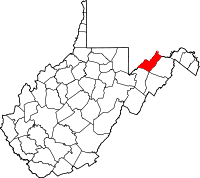
Location in the state of West Virginia
West Virginia's location in the U.S.Founded 1866 Seat Keyser Area
- Total
- Land
- Water
329 sq mi (852 km²)
328 sq mi (850 km²)
1 sq mi (3 km²), 0.43%Population
- (2000)
- Density
27,078
83/sq mi (32/km²)Website www.mineralcountywv.com Mineral County is a county located in the U.S. state of West Virginia. It is part of the Cumberland, MD-WV Metropolitan Statistical Area. As of 2010, the population was 28,212. Its county seat is Keyser.[1]
Contents
History
Ancient history
Indigenous peoples lived throughout the highlands along rivers in this area for thousands of years. Archeologists have identified artifacts of the Adena culture, dating from 1000 BC to 200 BC. They were among the several early Native American cultures who built major earthwork mounds for ceremonial and burial use. Remnants of their culture have been found throughout West Virginia. They were followed by other indigenous peoples.
With the growth of fur trading to the north after European encounter in the coastal areas, the nations of the Haudenosaunee (or Iroquois Confederacy), based in present-day New York, moved into the Ohio Valley in search of new hunting grounds. By the 17th century they had conquered other tribes, pushed them out to the west, and preserved the area for hunting.
Colonial Virginia history
John Lederer, a German physician and explorer employed by Sir William Berkeley, colonial governor of Virginia, is believed to be the first European to set foot in present-day Mineral County. He explored the area in 1669.
The first recorded grants of land in West Virginia were made to Isaac and John Van Meter in 1730. This was in the Frankfort district of Mineral County. In 1749 English colonists built the first frontier fort, Fort Ohio, at Ridgeley. They constructed Fort Ashby in 1755, which is the last standing unit in the chain of forts built under the orders of George Washington. Fort Sellers was built near present day Short Gap, and Fort Cocke near Headsville. In 1750 a frontier blockhouse, New Creek Blockhouse, was built about 1-mile (1.6 km) west of New Creek to protect local settlers.
Prior to 1738, the Orange County, Virginia, today located on the east side of the Blue Ridge Mountains, included all of Virginia west of the Blue Ridge. In that year, the Virginia Assembly passed an act dividing this territory into two counties: Frederick and Augusta. Hampshire County was formed from those two counties in 1753.
Virginia state history 1776 to 1863
Ultimately Hardy County in 1785 and part of Morgan County in 1820 were formed from Hampshire County.
West Virginia history 1863 to present
It was not until after West Virginia became a state in 1863 that present-day Mineral County was organized. It was created in 1866 by an Act of the West Virginia Legislature from the existing Hampshire County. The name was selected due to its reserves of minerals, especially coal (although, technically, coal is not a true mineral).
Historical sites
 Saddle Mountain as viewed from Highland Acres Farm
- New Creek Blockhouse
- Northwestern Turnpike
- Patterson Creek Manor
- Saddle Mountain
- Traveler's Rest
- Weaver’s Antique Service Station
- Wind Lea
Notable people from Mineral County
- Colonel James Allen
- John Ashby
- Woodrow Wilson Barr
- Thomas Carskadon
- Henry G. Davis
- Thomas Beall Davis
- Lynndie England
- Henry Louis Gates
- Nancy Hanks
- Jonah Edward Kelley
- John Kruk
- Leo Mazzone
Government
County Commission
Mineral County is governed by a three member commission, one member to be elected every two years to a six year term of office. The County Commission, as the governing body, is responsible for the fiscal affairs and general administration of county government. The County Commission does not possess inherent rights of self government but are creations of the State with the authority to carry out those functions specified by the WV Constitution or by legislative enactment.
Commissioners
- Cynthia L. Pyles, Democrat Commission President: term ending 2013
- Janice LaRue, Republican: term ending 2015
- Richard Lechliter, Republican: term ending 2017
Appointed commissions
- Planning Commission - Administers ordinances involved with land use and construction.
- Development Authority - Administers Industrial Parks and seeks news business to the county.
Office of Assessor
- Assessor: Rose Anne Hanna-Maine, Republican: term ending 2009
Circuit Clerk
- Krista Johnson Dixon, Republican: term ending 2017[2]
County Clerk
The Clerk is elected to a six year term with the right to succeed himself/herself. The primary duties and responsibilities of the Clerk of the County Commission may be identified as two basic functions:
- to act as clerk (fiscal officer, secretary) of the County Commission, and
- to act as the receiver of fees charged for the instruments to be filed and recorded within the county. The official books and papers of the Office of the Clerk of the County Commission are considered permanent public records.
The County Clerk shall have the custody of all deeds and other papers presented for record in their counties and they shall be preserved therein. They shall have jurisdiction in all matters of probate, the appointment and qualification of personal representatives, guardians, committees, curators and the settlement of their accounts. The Clerk shall have custody of all election records, payroll and budgetary accounting, and accounts payable.[citation needed]
County Clerk: Lauren Ellifritz, Republican, term ending 2011
State Representatives
House of Delegates
District Representative Party County of Residence 48 Allen V. Evans Rep Grant 49 Gary G. Howell Rep Mineral 50 Ruth Rowan Rep Hampshire Senate
District Senator Party County/Counties 14 David Sypolt Republican Barbour, Grant (part), Mineral,
Monongalia (part), Preston, Taylor, TuckerBob Williams Democratic Industrial parks
The Mineral County Economic Development Authority operates industrial parks near Keyser, featuring rail access, and near Fort Ashby, with fiber optics and sitewide wireless Internet.[citation needed]
Education
Colleges
Potomac State College, a two year school, is located in the county seat of Keyser, West Virginia on the site of Civil War Fort Fuller.
Eastern West Virginia Community & Technical College holds classes at Mineral Counties Vocational and Technical School.
High schools
Mineral County Schools includes two high schools: Frankfort High School located near Short Gap and Keyser High School located south of Keyser.
Geography
According to the U.S. Census Bureau, the county has a total area of 329 square miles (852 km²), of which 328 square miles (849 km²) is land and 1 square mile (4 km²) (0.43%) is water.
Major highways
 U.S. Highway 50
 U.S. Highway 220
 West Virginia Route 28
 West Virginia Route 42
Mountains
The northern terminus of the Allegheny Front in West Virginia lies in Mineral County, and contains the highest point in the county. Known as the Pinnacle it is 3,104 feet (946 m) above sea level. From the abandoned fire tower you can see four states on a clear day, Pennsylvania, Maryland, West Virginia, and Virginia. The Allegheny Front is the largest mountain in the county; on the north end it is also known as Green Mountain. On top of the Allegheny Plateau is located the town of Elk Garden, West Virginia in the southwestern portion of the county. The Potomac River Valley lies to west and north of the mountain, and the New Creek Valley lies to the east.
Knobly Mountain lies between the New Creek and Patterson Creek valleys. It is the longest mountain in Mineral County stretching from the Grant County line in the south to the Potomac River in the north at Ridgeley, West Virginia.
To the east of the Patterson Creek Valley lie a series of low hills which form the eastern border of the county with Hampshire County.
Rivers
- North Branch Potomac River is the largest river, though not actually in the county. It forms the northern border of the county and the state border with actual border being the low water mark on the south side. Jennings Randolph Lake is located on this stream.
- New Creek enters the North Branch Potomac River at Keyser with the headwaters starting at Dam Site 14 in Grant County, West Virginia. It is the water supply for the city of Keyser.[citation needed]
- Patterson Creek enters the Potomac River east of Cumberland, Maryland with headwaters being in Grant County, West Virginia. The Patterson Creek watershed contains two-thirds of Mineral County.[citation needed]
Minerals
Mineral County is the easternmost West Virginia county with coal deposits. No coal is found east of the Allegheny Front, and coal mining is only found on top of the Allegheny Plateau.[citation needed]
Natural gas is found east of the Allegheny Front as well as iron ore deposits. The county no longer produces iron, but several abandoned iron furnaces from the 19th century still exist.
Demographics
Historical populations Census Pop. %± 1870 6,332 — 1880 8,630 36.3% 1890 12,085 40.0% 1900 12,883 6.6% 1910 16,674 29.4% 1920 19,849 19.0% 1930 20,084 1.2% 1940 22,215 10.6% 1950 22,333 0.5% 1960 22,354 0.1% 1970 23,109 3.4% 1980 27,234 17.9% 1990 26,697 −2.0% 2000 27,078 1.4% 2010 28,212 4.2% As of the census[3] of 2010, there were 28,212 people, 10,784 households, and 7,710 families residing in the county. The population density was 83 people per square mile (32/km²). There were 12,094 housing units at an average density of 37 per square mile (14/km²). The racial makeup of the county was 96.16% White, 2.55% Black or African American, 0.11% Native American, 0.20% Asian, 0.01% Pacific Islander, 0.21% from other races, and 0.76% from two or more races. 0.58% of the population were Hispanic or Latino of any race.
There were 10,784 households out of which 30.40% had children under the age of 18 living with them, 57.90% were married couples living together, 9.70% had a female householder with no husband present, and 28.50% were non-families. 25.00% of all households were made up of individuals and 11.50% had someone living alone who was 65 years of age or older. The average household size was 2.46 and the average family size was 2.93.
In the county, the population was spread out with 23.40% under the age of 18, 8.60% from 18 to 24, 27.10% from 25 to 44, 25.90% from 45 to 64, and 15.10% who were 65 years of age or older. The median age was 39 years. For every 100 females there were 95.80 males. For every 100 females age 18 and over, there were 93.00 males.
The median income for a household in the county was $31,149, and the median income for a family was $37,866. Males had a median income of $32,337 versus $20,090 for females. The per capita income for the county was $15,384. About 11.50% of families and 14.70% of the population were below the poverty line, including 21.10% of those under age 18 and 11.60% of those age 65 or over.
Cities, towns, and districts
Incorporated
Unincorporated
- Claysville
- Cross
- Dans Run
- Emoryville
- Foote Station
- Forge Hill
- Fort Ashby
- Fountain
Districts
- Elk District
- New Creek District
- Welton District
- Frankfort District
- Cabin Run District
- Piedmont Independent District
Travel and tourism
Transportation
- Greater Cumberland Regional Airport
- Rail Transportation
- CSX lines run along the Potomac River on the northern border of the county.
- Amtrak service is available in Cumberland, Maryland, just across from Ridgeley, West Virginia. Keyser's railroad station closed in the 1980s.
Parks and public recreational attractions
Larenim Park
Owned by Mineral County, the park size is 365 acres (1.48 km2). Includes two pavilions with 10 tables, an amphitheater with seating capacity of 600. One Little League field and one softball field. Fishing Areas; two flood control dams stocked by WVDNR, 5 acres (20,000 m2) and 2.5 acres (10,000 m2). All 365 acres (1.48 km2) are open to public hunting by permit. Approximately 5 miles of trails. An arboretum is under construction at Larenim to include a Shale Barrens Conservancy. Larenim Park is also home to the local theater group, McNeill's Rangers.[citation needed]
Barnum Whitewater Area
Owned by Mineral County with size of approximately 40 acres (160,000 m2). Includes four miles (6 km) of rail/trail. This area has approximately 1-mile (1.6 km) of river frontage on the North Branch of the Potomac River below Jennings Randolph Lake, along the old Western Maryland Railway right-of-way. It is one of the best trout streams in West Virginia and also provides seven miles (11 km) of whitewater rafting and canoeing for the entire family to enjoy. Public hunting permitted on surrounding state lands.
MINCO Park
Owned by the Mineral County Board of Education, MINCO Park's size is 13.5 acres (55,000 m2). Its facilities include two pavilions with 50 picnic tables, nine cabins, a dining field, a chapel, meeting room, and bath/shower facilities.
Van Myra Campground
Owned by the State of West Virginia and leased by Mineral County, the campground area is 10 acres (40,000 m2). Three picnic tables, four mini-pavilions, and picnic area only comprise this facility.
Dam Site #21
Owned by Mineral County, 178 acres (0.72 km2), with no facilities. Fishing 10 acres (40,000 m2) flood control dam.
Jennings Randolph Lake
Jennings Randolph Lake, named for Senator Jennings Randolph, near Elk Garden offers extensive recreational opportunity with its 952 acres (3.85 km2) and more than 13 miles (21 km) of shoreline. Howell Run Picnic Area overlooks the lake and contains 40 picnic sites, two pavilions, a playground and vault toilets. The Howell Run Boat Launch consists of a two lane concrete ramp. the Robert W. Craig Campground is situated on a high ridge overlooking the dam site and features 87 campsites, potable water, hot showers, vault toilets and a playground. A 3/4 mile long interpretive trail has been developed in the area. The West Virginia Overlook area contains a two tier Visitor Center. Waffle Rock, a unique natural rock formation, can also be viewed from the Overlook.
Golf courses – public
Polish Pines – Privately owned, nine holes, Club House Mill Creek – Privately owned, nine holes, Club House
Swimming pools – public
City of Keyser – One pool open to public City of Piedmont – One pool open to public
See also
- Allegheny Wildlife Management Area
- National Register of Historic Places listings in Mineral County, West Virginia
- USS Mineral County (LST-988)
References
- ^ "Find a County". National Association of Counties. http://www.naco.org/Counties/Pages/FindACounty.aspx. Retrieved 2011-06-07.
- ^ http://times-news.com/local/x652352795/Ridgeley-mayor-Lechliter-upsets-incumbent-county-commissioner
- ^ "American FactFinder". United States Census Bureau. http://factfinder.census.gov. Retrieved 2008-01-31.

Allegany County, Maryland Garrett County, Maryland 
Hampshire County  Mineral County, West Virginia

Grant County Hardy County Municipalities and communities of Mineral County, West Virginia City 
Towns Carpendale | Elk Garden | Piedmont | Ridgeley
CDPs Other
localitiesAntioch | Atlantic Hill | Barnum | Beryl | Blaine | Champwood | Claysville | Cross | Dans Run | Emoryville | Forge Hill | Fountain | Hampshire | Harrison | Hartmansville | Headsville | Keymont | Laurel Dale | Limestone | Markwood | Nethkin | New Creek | Oakmont | Patterson Creek | Reeses Mill | Ridgeville | Rocket Center | Russelldale | Short Gap | Skyline | Sulphur City | Wagoner
 State of West Virginia
Topics Cities · Towns · Villages · Census-designated places · History · Geography · People · Governors · Delegations · Colleges and universities · Visitor Attractions
Regions Allegheny Mountains · Allegheny Plateau · Baltimore-Washington Metropolitan Area · Blue Ridge · Charleston Metropolitan Area · Cumberland Plateau · Cumberland Mountains · Eastern Panhandle · Huntington Metropolitan Area · North-Central West Virginia · Northern Panhandle · Potomac Highlands · Ridge-and-valley Appalachians · Shenandoah Valley · Southern West Virginia · Western West Virginia
Major cities Smaller cities Beckley · Bluefield · Clarksburg · Elkins · Fairmont · Martinsburg · Weirton
Counties Barbour · Berkeley · Boone · Braxton · Brooke · Cabell · Calhoun · Clay · Doddridge · Fayette · Gilmer · Grant · Greenbrier · Hampshire · Hancock · Hardy · Harrison · Jackson · Jefferson · Kanawha · Lewis · Lincoln · Logan · Marion · Marshall · Mason · McDowell · Mercer · Mineral · Mingo · Monongalia · Monroe · Morgan · Nicholas · Ohio · Pendleton · Pleasants · Pocahontas · Preston · Putnam · Raleigh · Randolph · Ritchie · Roane · Summers · Taylor · Tucker · Tyler · Upshur · Wayne · Webster · Wetzel · Wirt · Wood · Wyoming
Categories:- West Virginia counties
- 1866 establishments
- Mineral County, West Virginia
- Potomac River counties


Wikimedia Foundation. 2010.