- Cacapon Resort State Park
Geobox|Protected Area
name = Cacapon Resort State Park
native_name =
other_name =
other_name1 =
category = West Virginia State Park
iucn_category =
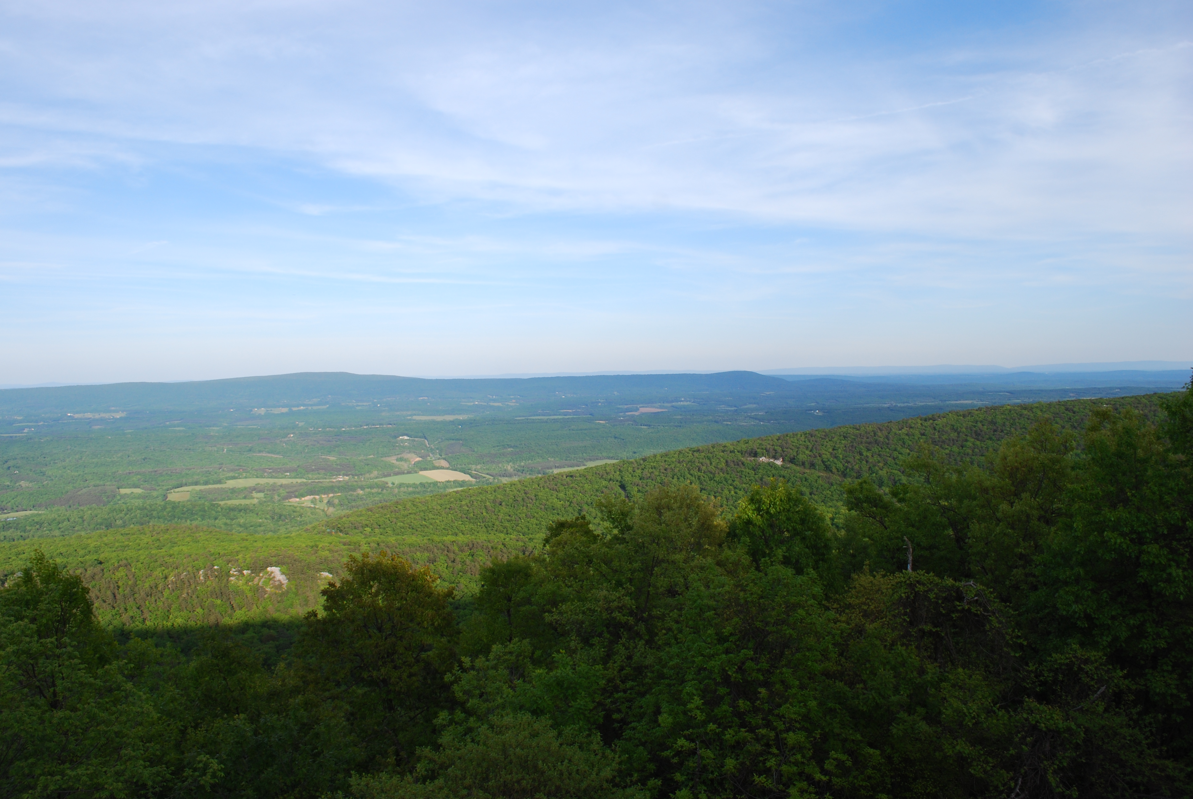
image_caption = Looking southeast from atopCacapon Mountain
etymology_type =
etymology =
country = United States
country_
state = West Virginia
state_
region_type = County
region = Morgan
district_type =
district =
district1 =
district2 =
city =
city1 =
location =
lat_d = 39
lat_m = 30
lat_s = 21
lat_NS = N
long_d = 78
long_m = 18
long_s = 00
long_EW = W
elevation_imperial = 948
elevation_round = 1
area_unit = acre
area_imperial = 6115
area_round = 1
area_note = [http://www.wvstateparks.com/recreation/WVSP_facilities_grid.PDF West Virginia State Parks Facilities Grid, accessed March 29, 2008] ]
area1_imperial =
area1_type =
length_imperial =
length_orientation =
width_imperial =
width_orientation =
highest =
highest location =
highest_lat_d =
highest_lat_m =
highest_lat_s =
highest_lat_NS =
highest_long_d =
highest_long_m =
highest_long_s =
highest_long_EW =
highest_elevation_imperial =
lowest =
lowest_location =
lowest_lat_d =
lowest_lat_m =
lowest_lat_s =
lowest_lat_NS =
lowest_long_d =
lowest_long_m =
lowest_long_s =
lowest_long_EW =
lowest_elevation_imperial =
biome =
biome_share =
biome1 =
biome1_share =
geology =
geology1 =
plant =
plant1 =
animal =
animal1 =
established_type = Opened
established =1937-07-01
established_note = cite book|title=Where People and Nature Meet: A History of the West Virginia State Parks|publisher=Pictorial Histories Publishing Company|location=Charleston,West Virginia |date=April 1988|isbn=0-933126-91-3]established1_type =
established1 =
owner =West Virginia Division of Natural Resources
management_location =
management_lat_d =
management_lat_m =
management_lat_s =
management_lat_NS =
management_long_d =
management_long_m =
management_long_s =
management_long_EW =
management_elevation =
visitation =
visitation_year =
free_type = Nearest city
free_label = Nearest city
free = Berkeley Springs,West Virginia
free1_type =
free1 =

map_caption = Location of Cacapon Resort State Park in West Virginia
map_locator = West Virginia
map_first =
website = [http://www.cacaponresort.com Cacapon Resort State Park]Opened in 1933, the convert|6115|acre|adj=on Cacapon Resort State Park is located on the eastern slopes of
Cacapon Mountain in Morgan County,West Virginia .Panorama Overlook , at the southern end of the park and convert|2320|ft|m above sea level, is the highest point in the park and in Morgan County. [ [http://www.berkeleysprings.com/trail/gwtrail-15.html Washington Heritage Trail in Morgan County web site, assessed August 3, 2006.] ]Features
* 48-room Lodge
* 12-room Old Inn
* 25 cabins (two fully accessible for the disabled)
* Efficieny bungalows
* 18 hole, 72 par golf course
* Lake swimming
* Rowboat and paddle boat rentals
* Horseback riding
*Fishing
* Conference rooms
* Picnic Shelters
* Gift Shop
* Tennis courts
* Basketball court
* Volleyball courtAccessibility
Accessibility for thedisable d was assessed byWest Virginia University . The assessment found the campground, picnic areas, and lake swimming to be accessible. [ [http://www.cedwvu.org/programs/realchoice/recreation/ "Guide to Accessible Recreation and Travel in WV", WVU Center for Excellence in Disabilities web site, accessed July 31, 2006] ] During the 2005 assessment some issues were identified concerning signage and the width of the sidewalk to the playground. Two of the newest park cabins were specifically design to be accessible.Photo gallery
See also
*
List of West Virginia state parks References
External links
* [http://www.cacaponresort.com/ Cacapon Resort State Park website]

Wikimedia Foundation. 2010.