- Watoga State Park
-
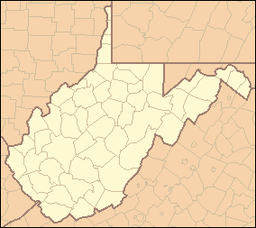
Watoga State Park West Virginia State Park Watoga LakeCountry United States State West Virginia County Pocahontas Elevation 2,894 ft (882.1 m) Coordinates 38°06′13″N 80°08′59″W / 38.10361°N 80.14972°W Area 10,100 acres (4,087.3 ha) [1] Established May 1934 [2] - Watoga State Forest January 1925 [2] - Opened July 1, 1937 [2] Owner West Virginia Division of Natural Resources Nearest city Marlinton, West Virginia Website: Watoga State Park New Deal Resources in Watoga State Park Historic DistrictLocation: HC 82 (9 miles southwest of WV 39), near Marlinton, West Virginia Area: 10,269 acres (4,156 ha) Governing body: State NRHP Reference#: 10001227[3] Added to NRHP: February 4, 2011 Watoga State Park is the largest of West Virginia’s state parks, covering slightly over 10,100 acres (41 km2).[1] It is located near Seebert in Pocahontas County, West Virginia.
Contents
History
The land that forms the nucleus of Watoga was originally acquired in January 1925, when the park was initially planned to be a state forest. In May 1934, a decision was made to instead develop the site as a state park. Much of the development on the site was done by the Civilian Conservation Corps (CCC) and the park was first opened on July 1, 1937.[2]
New Deal Resources in Watoga State Park Historic District
The New Deal Resources in Watoga State Park Historic District is a national historic district encompassing 59 contributing buildings, 35 contributing structures, 2 contributing sites, and 11 contributing objects. They include water fountains; trails; a swimming pool; a reservoir; rental cabins; and picnic shelters; as well as a former CCC camp. The park is the site of the Fred E. Brooks Memorial Arboretum, a 400-acre arboretum that encompasses the drainage of Two Mile Run. Named in honor of Fred E. Brooks, a noted West Virginia naturalist who died in 1933, the Arboretum’s construction began about 1935 and a dedication was held in 1938.[4]
It was listed on the National Register of Historic Places in 2010.[3]
Features
- 36 cabins
- 2 campgrounds with 88 total campsites (50 with electricity)
- Restaurant and Commissary
- Swimming pool
- 11-acre (45,000 m2) fishing lake
- Hiking trails
- Brooks Memorial Arboretum
- Ann Bailey Lookout Tower
- Greenbrier River Trail
See also
References
- ^ a b "West Virginia State Parks Facilities Grid". West Virginia Division of Natural Resources. http://www.wvstateparks.com/recreation/WVSP_facilities_grid.PDF. Retrieved 2008-06-16.
- ^ a b c d Where People and Nature Meet: A History of the West Virginia State Parks. Charleston, West Virginia: Pictorial Histories Publishing Company. April 1988. ISBN 0-933126-91-3.
- ^ a b "National Register of Historic Places Listings". Weekly List of Actions Taken on Properties: 2/14/11 through 2/18/11. National Park Service. 2011-02-25. http://www.nps.gov/history/nr/listings/20110225.htm.
- ^ Lena L. Sweeten (July 2010). "National Register of Historic Places Inventory Nomination Form: New Deal Resources in Watoga State Park Historic District". State of West Virginia, West Virginia Division of Culture and History, Historic Preservation. http://www.wvculture.org/shpo/nr/pdf/pocahontas/10001227.pdf. Retrieved 2011-09-01.
External links
U.S. National Register of Historic Places in West Virginia Lists by county Barbour • Berkeley • Boone • Braxton • Brooke • Cabell • Calhoun • Clay • Doddridge • Fayette • Gilmer • Grant • Greenbrier • Hampshire • Hancock • Hardy • Harrison • Jackson • Jefferson • Kanawha • Lewis • Lincoln • Logan • Marion • Marshall • Mason • McDowell • Mercer • Mineral • Mingo • Monongalia • Monroe • Morgan • Nicholas • Ohio • Pendleton • Pleasants • Pocahontas • Preston • Putnam • Raleigh • Randolph • Ritchie • Roane • Summers • Taylor • Tucker • Tyler • Upshur • Wayne • Webster • Wetzel • Wirt • Wood • Wyoming

Other lists Categories:- National Register of Historic Places in West Virginia
- Historic districts in West Virginia
- History of West Virginia
- West Virginia state parks
- Protected areas of Pocahontas County, West Virginia
- IUCN Category V
- Protected areas established in 1934
- Civilian Conservation Corps in West Virginia
- Pocahontas County, West Virginia geography stubs
Wikimedia Foundation. 2010.


