- Tu-Endie-Wei State Park
Geobox|Protected Area
name = Tu-Endie-Wei State Park
native_name =
other_name =
other_name1 =
category = West Virginia State Park
iucn_category =
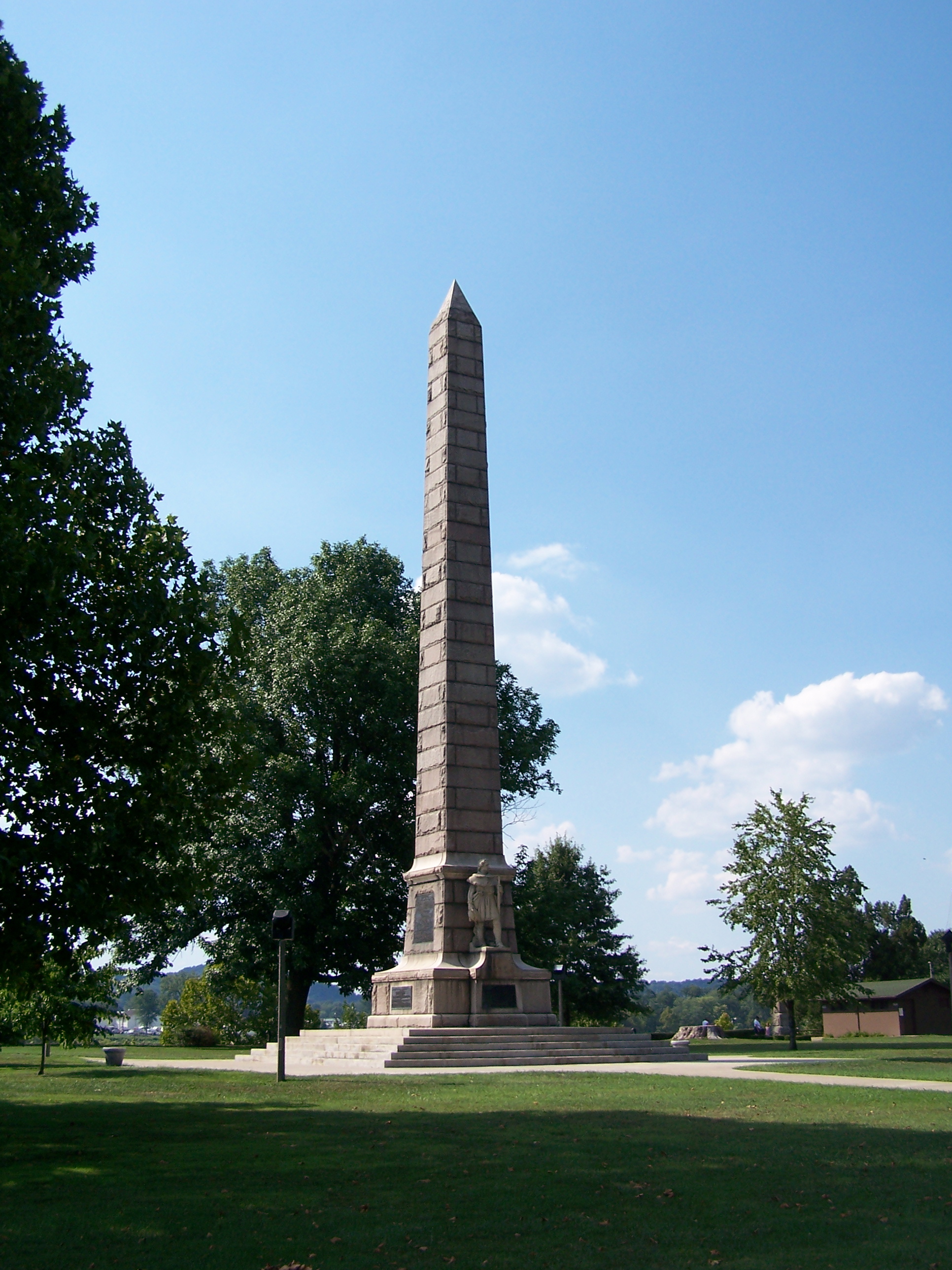
image_caption = Monument to theBattle of Point Pleasant that is the focal point of Tu-Endie-Wei State Park
etymology_type =
etymology =
country = United States
country_
state = West Virginia
state_
region_type = County
region = Mason
district_type =
district =
district1 =
district2 =
city =
city1 =
location =
lat_d = 38
lat_m = 50
lat_s = 21
lat_NS = N
long_d = 82
long_m = 08
long_s = 27
long_EW = W
elevation_imperial = 541
elevation_round = 1
area_unit = acre
area_imperial = 4
area_round = 1
area1_imperial =
area1_type =
length_imperial =
length_orientation =
width_imperial =
width_orientation =
highest =
highest location =
highest_lat_d =
highest_lat_m =
highest_lat_s =
highest_lat_NS =
highest_long_d =
highest_long_m =
highest_long_s =
highest_long_EW =
highest_elevation_imperial =
lowest =
lowest_location =
lowest_lat_d =
lowest_lat_m =
lowest_lat_s =
lowest_lat_NS =
lowest_long_d =
lowest_long_m =
lowest_long_s =
lowest_long_EW =
lowest_elevation_imperial =
biome =
biome_share =
biome1 =
biome1_share =
geology =
geology1 =
plant =
plant1 =
animal =
animal1 =
established_type = Dedicated
established =1901-10-10
established_note = cite book|title=Where People and Nature Meet: A History of the West Virginia State Parks|publisher=Pictorial Histories Publishing Company|location=Charleston,West Virginia |date=April 1988|isbn=0-933126-91-3]
established1_type = Acquired
established1 = 1956
established1_note =
owner =West Virginia Division of Natural Resources
management_location =
management_lat_d =
management_lat_m =
management_lat_s =
management_lat_NS =
management_long_d =
management_long_m =
management_long_s =
management_long_EW =
management_elevation =
visitation =
visitation_year =
free_type = Nearest city
free_label = Nearest city
free = Point Pleasant,West Virginia
free1_type =
free1 =

map_caption = Location of Tu-Endie-Wei State Park in West Virginia
map_locator = West Virginia
map_first =
website = [http://www.tu-endie-weistatepark.com Tu-Endie-Wei State Park]Tu-Endie-Wei State Park is located at the confluence of the
Kanawha River and theOhio River in downtownPoint Pleasant, West Virginia . The park commemorates theBattle of Point Pleasant , fought between the settler militia ofVirginia and the forces ofShawnee Chief Cornstalk on October 10, 1774. The militia victory by the settlers weakened the alliance between native forces and the British and freed settlers from westernVirginia to cross theAllegheny Mountains and join in theRevolutionary War .The name "Tu-Endie-Wei" refers to the
Wyandot Indian phrase meaning "the point between two waters" in English. [ [http://www.tu-endie-weistatepark.com/ Tu-Endie-Wei State Park web site, accessed July 20, 2006] ]The Battle of Point Pleasant has been recognized as the first battle of the
American Revolutionary War by the National Society of Daughters of the American Revolution. [ [http://www.pointpleasantwv.org/Parks&Campgrounds/StateParks/BattleMonument/BattleStory.htm "Battle of Point Pleasant, First Battle of the American Revolution", Livia Nye Simpson Poffenbarger,1909, web site reproduction, accessed July 20, 2006.] ] Female descendants of battle veterans are allowed to join the D.A.R. The historical debate about the first battle claim may not yet be resolved. [ [http://www.wvculture.org/history/journal_wvh/wvh56-5.html "Manufactured History": Re-Fighting the Battle of Point Pleasant", J. WV History, Volume 56 (1997), pp. 76-87. (Article considers the historical debate regarding the claim that the Battle of Point Pleasant was a battle of the American Revolutionary War.)] ]ee also
*
List of West Virginia state parks References
External links
* [http://www.tu-endie-weistatepark.com/ Official Site]
* [http://photosynth.net/view.aspx?cid=aca0b9ac-7332-44dd-84ed-b888c8cdd565&i=0:0:21&z=503.8690993711942&g=0&p=-30.2507:-52.2869&m=false&c=49.1539:-7.04309:-0.102958&d=2.45233:2.20149:2.94291 Microsoft Photosynth representation of Point Pleasant Battle Monument]

Wikimedia Foundation. 2010.