- Cathedral State Park
Geobox|Protected Area
name = Cathedral State Park
native_name =
other_name =
other_name1 =
category = West Virginia State Park
iucn_category =
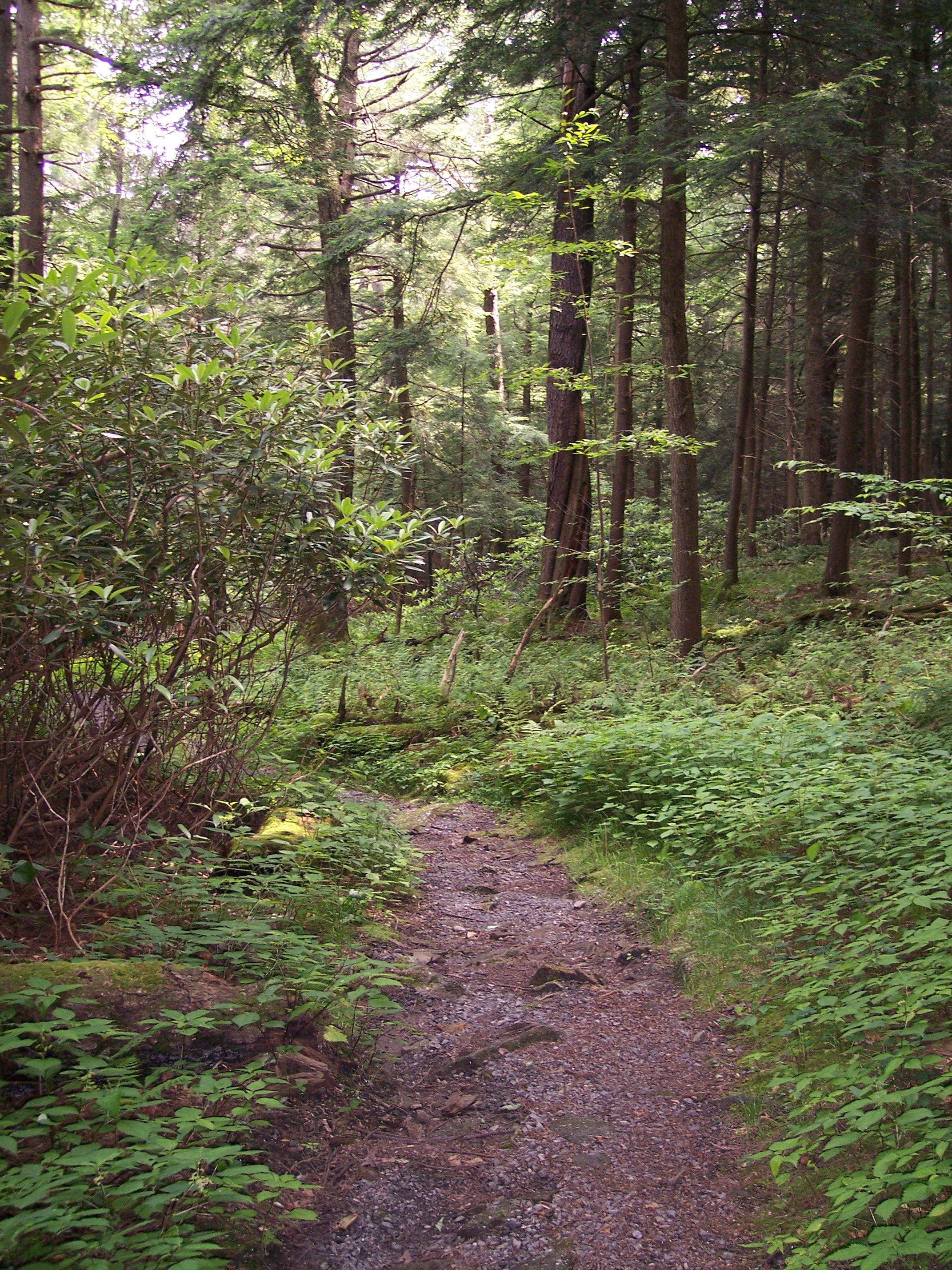
image_caption = Cathedral Trail
etymology_type =
etymology =
country = United States
country_
state = West Virginia
state_
region_type = County
region = Preston
district_type =
district =
district1 =
district2 =
city =
city1 =
location =
lat_d = 39
lat_m = 19
lat_s = 36
lat_NS = N
long_d = 79
long_m = 32
long_s = 17
long_EW = W
elevation_imperial = 2579
elevation_round = 1
area_unit = acre
area_imperial = 132
area_round = 1
area_note = [http://www.wvstateparks.com/recreation/WVSP_facilities_grid.PDF West Virginia State Parks Facilities Grid, accessed March 29, 2008] ]
area1_imperial =
area1_type =
length_imperial =
length_orientation =
width_imperial =
width_orientation =
highest =
highest location =
highest_lat_d =
highest_lat_m =
highest_lat_s =
highest_lat_NS =
highest_long_d =
highest_long_m =
highest_long_s =
highest_long_EW =
highest_elevation_imperial =
lowest =
lowest_location =
lowest_lat_d =
lowest_lat_m =
lowest_lat_s =
lowest_lat_NS =
lowest_long_d =
lowest_long_m =
lowest_long_s =
lowest_long_EW =
lowest_elevation_imperial =
biome =
biome_share =
biome1 =
biome1_share =
geology =
geology1 =
plant =
plant1 =
animal =
animal1 =
established_type = Established
established = 1942
established_note = cite book|title=Where People and Nature Meet: A History of the West Virginia State Parks|publisher=Pictorial Histories Publishing Company|location=Charleston,West Virginia |date=April 1988|isbn=0-933126-91-3]
established1_type =
established1 =
owner =West Virginia Division of Natural Resources
management_location =
management_lat_d =
management_lat_m =
management_lat_s =
management_lat_NS =
management_long_d =
management_long_m =
management_long_s =
management_long_EW =
management_elevation =
visitation =
visitation_year =
free_type = Nearest city
free_label = Nearest city
free = Aurora,West Virginia
free1_type =
free1 =

map_caption = Location of Cathedral State Park in West Virginia
map_locator = West Virginia
map_first =
website = [http://www.cathedralsp.com Cathedral State Park]Cathedral State Park is the largest virgin timber tract remaining in
West Virginia . Located on convert|132|acre about one mile (1.6 km) east of the town of Aurora, Cathedral is a mixed forest of predominantlyeastern hemlock . [ [http://www.asecular.com/forests/cathedral.htm Forests of the Appalachians Project web site, accessed July 22, 2006.] ]The
United States National Park Service has designated the park as aNational Natural Landmark . [http://www.cathedralstatepark.com/ Cathedral State Park web site, access July 22, 2006] ]While the state of
West Virginia has protected the trees of Cathedral State Park from the chainsaw, the park is under significant threat from thehemlock woolly adelgid , which has been detected within convert|20|mi|km of the park. [ [http://travel.sundaygazettemail.com/?display=mc-hemlocks "Trees last stand: Park may be last place to see uncut hemlock forest in state", "Charleston Gazette", December 19, 2004, accessed July 22, 2006.] ]References
See also
*
List of West Virginia state parks
*State park
*List of old growth forests
*List of National Natural Landmarks External links
* [http://www.cathedralstatepark.com/ Official site]

Wikimedia Foundation. 2010.