- Dayton State Park
-
Dayton State Park Nevada State Park Country  United States
State  Nevada
County Lyon Location Dayton - elevation 4,360 ft (1,329 m) [1] - coordinates 39°14′54″N 119°35′19″W / 39.24833°N 119.58861°W Area 152 acres (61.5 ha) Founded 1977 Management Nevada Division of State Parks 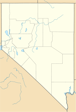
 Location of Dayton State Park in Nevada
Dayton State Park is a state park of Nevada, USA, preserving the site of the Rock Point Stamp Mill, which was built in 1861 to process silver ore mined from the Comstock Lode. Located within the town of Dayton, it is in the Western Nevada Region of Nevada State Parks. The property was deeded to the state in 1954 under the management of the Nevada Department of Transportation, and was officially established as a state park in 1977.[2]
Contents
The park
Lower park
The park is separated into two distinct sections by U.S. Route 50, which runs through the center of the park. The park's main entrance is in the "lower" or eastern portion which preserves a section of woodlands along the Carson River. In 1997 the valley flooded and permanently changed the course of the river. It now runs significantly farther to the east than it once did. The former dry riverbed can still seen. Nature trails along the ever changing Carson River provide for bird and wildlife viewing. Day-use and group picnic areas and a 10-site campground are also located here.
Upper park
The "upper" or western section of the park can be accessed through a pedestrian tunnel that runs beneath U.S. 50 to the Rock Point Mill ruins. The Rock Point Stamp Mill was built in 1861 to process ore from Silver City and Virginia City. Wooden flumes (the remains of which are also visible) provided the necessary water for the milling process from the nearby Carson River. Rock Point was one of the largest processing mills along the Carson River and was finally dismantled and moved to Silver City in 1920. The area was then used as the Dayton town garbage dump for the next 30 years.
Foundations are all that remain of the mill. Remnants of the garbage dump are visible as well as a section of the old U.S. 50.
Facilities
- 10 site campground
- Day use picnic areas
- Group use picnic pavilion (available for reservation)
- Nature trails
- Historic Rock Point Mill ruins
References
- ^ "Dayton State Park". Geographic Names Information System. United States Geological Survey. 1990-03-01. http://geonames.usgs.gov/pls/gnispublic/f?p=gnispq:3:::NO::P3_FID:850759. Retrieved 2011-03-31.
- ^ Scanland, Jenny; Steve Weaver, Domenic Bravo, and Linda Wimberly (2007). Dayton State Park 2007 Master Plan. Nevada Division of State Parks. http://parks.nv.gov/masterplans/Dayton/PDF%20MASTER%20PLAN%202007.pdf. Retrieved 2011-03-31.
External links
Categories:- Protected areas of Lyon County, Nevada
- Nevada state parks
- Protected areas established in 1977

Wikimedia Foundation. 2010.