- Weepah Spring Wilderness
Infobox_protected_area | name = Weepah Spring Wilderness
iucn_category = Ib
caption =
locator_x =
locator_y =
location =Nevada USA
nearest_city =Hiko, Nevada
lat_degrees = 38
lat_minutes = 00
lat_seconds = 06
lat_direction = N
long_degrees = 115
long_minutes = 05
long_seconds = 09
long_direction = W
area = convert|51480|acre|km2|1|sing=off
established =2004
governing_body =U.S. Bureau of Land Management Weepah Spring Wilderness is a convert|51480|acre|km2|1|sing=on
wilderness area in Lincoln and Nye Counties, in the U.S. state ofNevada . The Wilderness lies approximately convert|35|mi|km|0|sing=off south of the town of Alamo and is administered by theU.S. Bureau of Land Management . [http://www.nv.blm.gov/ely/wilderness/fact_sheet_weepah_spring.htm Nevada BLM] - Weepah Spring Wilderness]Weepah Spring Wilderness contains
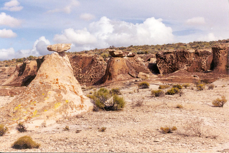
Timber Mountain and lies within theSeaman Range , an excellent example of aGreat Basin mountain range. It lacks a single defined ridgeline and contains isolated peaks, maze-like canyons, walls of fossil bearing rocks,natural arch es, andvolcanic hoodoo s. The Wilderness also has the largest stand ofponderosa pine in eastern Nevada and 4,000 year oldrock art .Archeology
Within the Weepah Springs Wilderness is the
White River Narrows Archaeological District , listed on theNational Register of Historic Places . The district encompasses one of the largest and most well-known concentrations ofpetroglyphs in Nevada. Other prehistoric sites in the District include shelter caves, hunting blinds, and campsites.References
ee also
*
List of wilderness areas in Nevada
*List of U.S. Wilderness Areas
*Wilderness Act External links
* [http://www.nv.blm.gov/ely/wilderness/fact_sheet_weepah_spring.htm Nevada Bureau of Land Management] - Weepah Spring Wilderness fact sheet
* [http://www.nevadawilderness.org/library/area.asp?nMode=1&nLibraryID=198 Friends of Nevada Wilderness] - Weepah Spring Wilderness
* [http://www.nv.blm.gov/ely/wilderness/map_weepah_spring.pdf Nevada Bureau of Land Management] - Weepah Spring Wilderness map
Wikimedia Foundation. 2010.