- Mount Moriah Wilderness
-
For other uses, see Moriah (disambiguation).
Mt. Moriah Wilderness IUCN Category Ib (Wilderness Area)

Location White Pine County, Nevada USA Nearest city Ely, NV Coordinates 39°16′N 114°12′W / 39.267°N 114.2°WCoordinates: 39°16′N 114°12′W / 39.267°N 114.2°W Area 89,790 acres (363.4 km2) Established December 5, 1989 Governing body U.S. Bureau of Land Management The Mt. Moriah Wilderness is a 89,790-acre (363 km2) wilderness area in the northern part of the Snake Range of White Pine County, in the eastern section of the state of Nevada in the western United States.
The Mt. Moriah Wilderness was designated in 1989 and is administered by the Humboldt-Toiyabe National Forest and the U.S. Bureau of Land Management, as some 8,700 acres (35 km2) in the northern portion of the Wilderness lies on BLM land.[1]
Contents
Topography
Mount Moriah, the namesake of the Wilderness, rises 12,050 feet (3,673 m) above the Snake Valley on its east flank and the Spring Valley on the west. At 11,000 feet (3,353 m) and stretching north and west of the peak is a unique plateau called the Table.[2] Much of the area is composed of limestone and shallow caves are common in the Wilderness.[1]
Archeology
Archaeological sites including caves utilized by Native Americans, pictographs, and lithic scatters are found in the Wilderness.[3]
Vegetation
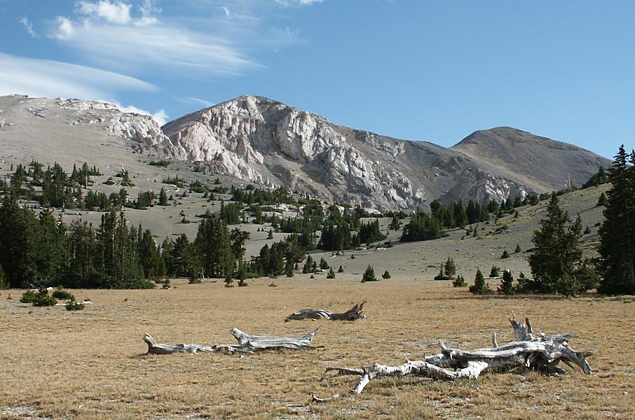
 Mt. Moriah in Mt. Moriah Wilderness
- See: Category: Flora of the Great Basin desert region
The Mount Moriah Wilderness lies within the Intermountain sagebrush/ponderosa pine ecosystem and vegetation varies with the elevation. Pinyon pine and juniper dominate the lower slopes, while aspen, mountain mahogany, white and Douglas fir, limber pine, and bristlecone pine are found in the upper elevations.[3]
Wildlife
- See: Category: Fauna of the Great Basin desert region
A variety of wildlife and fish species inhabit the Mt. Moriah Wilderness. The majority of the area is summer range for mule deer, although some of the lower elevation benches and riparian areas are used year-round. Rocky Mountain bighorn sheep can be found throughout the year in the area, as well as blue grouse, sage grouse, and chukar. Rainbow trout, brook trout, and the unique Bonneville cutthroat trout are found in the area's perennial streams, including Hampton Creek, Hendry's Creek, and Smith Creek.[3]
See also
- Nevada Wilderness Areas
- List of wilderness areas in Nevada
- List of U.S. Wilderness Areas
- Wilderness Act
References
- ^ a b Mt. Moriah Wilderness - Wilderness.net
- ^ Mt. Moriah Wilderness - Humboldt-Toiyabe National Forest
- ^ a b c Mount Moriah Wilderness - GORP
External links
- Humbolt-Toiyabe National Forest: official Mount Moriah Wilderness website
- Friends of Nevada Wilderness: Mt. Moriah Wilderness
- Wilderness.net: Mount Moriah Wilderness
- GORP: Mt. Moriah Wilderness
- Trails.com: Nevada Hikes - Mount Moriah
- official Humboldt-Toiyabe National Forest website
- National Atlas: Map of Humboldt-Toiyabe National Forest
Categories:- IUCN Category Ib
- Humboldt-Toiyabe National Forest
- Wilderness Areas of Nevada
- Protected areas of White Pine County, Nevada
- Bureau of Land Management areas in Nevada

Wikimedia Foundation. 2010.