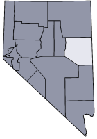
- White Pine County, Nevada
Infobox U.S. County
county = White Pine County
state = Nevada
map size =
founded = 1869
seat = Ely | area_total_sq_mi =8897
area_land_sq_mi = 8876
area_water_sq_mi =21
area percentage = 0.23%
census yr = 2006
pop = 9542
density_km2 = 040
web= www.whitepinecounty.net|White Pine County is a
county located in theU.S. state ofNevada . The 2000 census recorded its population to be 9,181; a 2006 estimate placed its population at 9,542. Itscounty seat is ElyGR|6. It is the home ofGreat Basin National Park . The name derives fromWhite Pine , an old name for theLimber Pine , a common tree in the county's mountains.History
White Pine County was created in 1869 out of eastern Lander County and was named for the heavy growth of pine trees in the area, thought to be white pine. Hamilton was the first county seat from 1869 to 1887 when it was replaced after a fire by Ely.
Geography
According to the U.S. Census Bureau, the county has a total area of 8,897
square mile s (23,042km² ), of which, 8,876 square miles (22,989 km²) of it is land and 21 square miles (53 km²) of it (0.23%) is water.Several sections of the
Humboldt-Toiyabe National Forest exist within the county, as does Ward Charcoal Ovens State Historical Park.In the southeastern part of the county is
Great Basin National Park .Wilderness
White Pine County is home to a number of designated
wilderness area s. They were created on December 20, 2006, by the "White Pine County Conservation, Recreation, and Development Act of 2006." [http://www.wilderness.net/index.cfm?fuse=NWPS&sec=fastFacts Fast facts about America's wilderness] - Wilderness.net]*
Bald Mountain Wilderness
*Becky Peak Wilderness
*Bristlecone Wilderness
*Goshute Canyon Wilderness
*Government Peak Wilderness
*High Schells Wilderness
*Highland Ridge Wilderness
*Mount Grafton Wilderness
*Mt. Moriah Wilderness
*Red Mountain Wilderness
*Shellback Wilderness
*South Egan Range Wilderness
*White Pine Range Wilderness .Adjacent counties
*
Elko County, Nevada - north
*Eureka County, Nevada - west
*Nye County, Nevada - southwest
*Lincoln County, Nevada - south
*Millard County, Utah - east
*Juab County, Utah - east
*Tooele County, Utah - northeastNational
protected area s*
Great Basin National Park
*Humboldt-Toiyabe National Forest (part)
*Ruby Lake National Wildlife Refuge (part)Economy
From the late nineteenth century until near the end of the twentieth century, the major industry was
mining the region's deposits ofcopper ,silver , andgold . The most notable of these operations included a series of open-pit copper mines near the town of Ruth, and a copper smelter in McGill, run by theKennecott Utah Copper Corporation .Demographics
As of the
census GR|2 of 2000, there were 9,181 people, 3,282 households, and 2,159 families residing in the county. Thepopulation density was 1.0 people per square mile (0.40/km²). There were 4,439 housing units at an average density of 0.50 per square mile (0.19/km²). The racial makeup of the county was 86.35% White, 4.14% Black or African American, 3.29% Native American, 0.78% Asian, 0.24% Pacific Islander, 3.09% from other races, and 2.10% from two or more races. 10.98% of the population were Hispanic or Latino of any race.There were 3,282 households out of which 31.20% had children under the age of 18 living with them, 51.80% were married couples living together, 9.3% had a female householder with no husband present, and 34.2% were non-families. 29.6% of all households were made up of individuals and 11.5% had someone living alone who was 65 years of age or older. The average household size was 2.42 and the average family size was 3.01.
In the county the population was spread out with 24.2% under the age of 18, 7.6% from 18 to 24, 29.9% from 25 to 44, 24.8% from 45 to 64, and 13.5% who were 65 years of age or older. The median age was 38 years. For every 100 females there were 128.6 males. For every 100 females age 18 and over, there were 138.5 males.
The median income for a household in the county was $36,688, and the median income for a family was $44,136. Males had a median income of $36,083 versus $26,425 for females. The
per capita income for the county was $18,309. About 10.3% of families and 11.0% of the population were below thepoverty line , including 11.8% of those under age 18 and 7.6% of those age 65 or over.Cities and towns
*Baker
*Cherry Creek
*Crosstimbers
*East Ely
*Ely
*Lages Station
*Lund
*Majors Place
*McGill
*Reipetown
*Ruth
*Schellbourne
*StrawberryReferences
External links
* [http://www.wilderness.org/WhereWeWork/Nevada/ScientistsSupportWhitePineCountyWilderness.cfm "Scientists Voice Their Overwhelming Support for Wilderness Designations in White Pine County, Nevada"] by the Wilderness Society
Wikimedia Foundation. 2010.