- Nye County, Nevada
-
Nye County, Nevada 
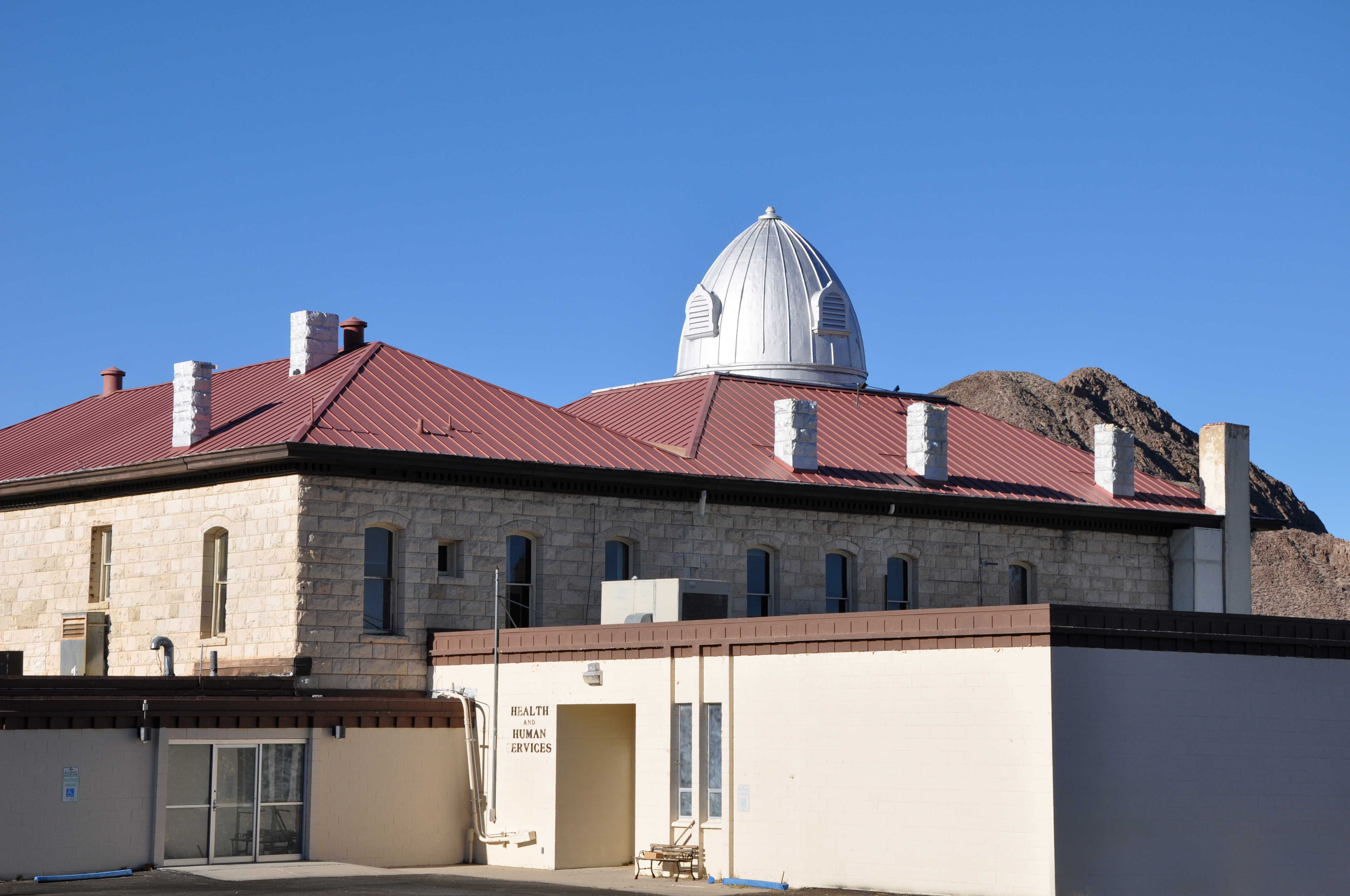
Nye County Courthouse in Tonopah 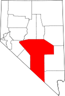
Location in the state of Nevada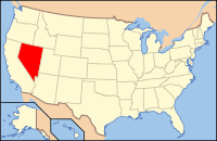
Nevada's location in the U.S.Founded 1864 Seat Tonopah Area
- Total
- Land
- Water
18,159 sq mi (47,032 km²)
18,147 sq mi (47,001 km²)
12 sq mi (31 km²), 0.07%Population
- (2010)
- Density
43,946
3/sq mi (1/km²)Website www.nyecounty.net Nye County is a county located in the U.S. state of Nevada. As of the 2000 census, the population was 32,485. As of 2010, the population was estimated to be 43,946.[1] At 18,159 square miles (47,030 km2), Nye is the third largest county in terms of area in the contiguous United States (thus excluding the boroughs of Alaska). Its county seat is Tonopah.[2] The center of population of Nevada is located in Nye County, very near Yucca Mountain.[3] The largest community in Nye County is Pahrump, an unincorporated town.
The Nevada Test Site and proposed Yucca Mountain nuclear waste repository are located in the southwestern part of the county and are the focus of a great deal of political and public controversy in the state. The federal government also manages 92 percent of the land in the county. This is also a controversial subject for the county and for the state.
The county features several environmentally sensitive areas, including Ash Meadows National Wildlife Refuge, the White River Valley, several Great Basin sky islands and a portion of Death Valley National Park. Visitors to Death Valley often stay at Beatty or Amargosa Valley.
Nye County is one of 11 Nevada counties where prostitution is legal.
The county has no incorporated cities. The seat of government in Tonopah is 160 miles (260 km) from Pahrump, where about 86 percent of the county's population resides. Nye County is nicknamed "The Kingdom of Nye" from the radio program Coast to Coast AM, created by Pahrump resident Art Bell.[citation needed]
Contents
History
Nye County was established in 1864 and named after James W. Nye, who served as the first governor of the Nevada Territory and later as a U.S. Senator from the state. The first county seat was Ione in 1864, followed by Belmont in 1867, and finally by Tonopah in 1905.
The county's first boom came in the early 20th century, when Rhyolite and Tonopah, as well as Goldfield in nearby Esmeralda County were all experiencing mining booms. In 1906, Goldfield had 30,000 residents, Tonopah had nearly 10,000 people, and Rhyolite peaked at about 10,000. All of those cities were linked by the Tonopah and Tidewater Railroad.[4]
After the boom died, Nye County withered. By 1910, the population had plummeted to about 7,500 before sinking to near 3,000 in the middle of the century.[5] It wasn't until development at the test site that the population stabilized, and dramatic growth didn't occur until the 1990s, when Pahrump became a bedroom community for Las Vegas.
From time to time, there have been discussions of moving the county seat south to Pahrump, or splitting off the southern portion of the county, but neither of these ideas appears to have sufficient support at the county or state government level.[6]
From 1987 to 1989, Bullfrog County, Nevada was split off from Nye County territory to form a separate political region. The population of Bullfrog County was 0; the county's creation was strictly a political manoeuvre.
Geography
According to the U.S. Census Bureau, the county has a total area of 18,159 square miles (47,030 km2). 18,147 square miles (47,000 km2) of it is land and 12 square miles (31 km2) of it (0.07%) is water. The highest point in the county is Mount Jefferson at 11,814 feet (3,601 m) [7]
Nye County is located in south central Nevada. Nye is the largest county in Nevada and is the third largest county in the continental United States, after San Bernardino County in California and Coconino County in Arizona. With a land area of 11,560,960 acres (46,785.5 km2), Nye County is larger than the combined total area of Massachusetts, Rhode Island, New Jersey, and Delaware. Of this vast land area, only 822,711 acres (3,329.39 km2), or just over seven percent of the total, is private land; the majority of the county's land are public lands managed by the federal government. According to the United States Census Bureau the county's Census Tract 9805, with a land area of 4,225.415 square miles (10,943.77 km2), comprising the Nevada Test Site and Nye County's portion of the Nevada Test and Training Range, is the largest census tract in the United States that has absolutely no resident population (as of the 2000 census).
Las Vegas, in Clark County, is 100 miles (160 km) southeast of Yucca Mountain. Many Pahrump residents commute 60 miles (97 km) each way to Las Vegas via Nevada State Route 160, which for much of its length is a four-lane divided highway.
Major highways
Nye County has a long stretch of U.S. Route 95, the main road connecting the state's population center in Las Vegas with the state capital in Carson City. Beatty and Tonopah both rely heavily on through traffic to sustain their economies. As of 2006, an average of 2,000 cars daily traveled U.S. 95 near Tonopah.[8]
 U.S. Route 6
 U.S. Route 95
 State Route 160
 State Route 373
 State Route 374
Adjacent counties
- Churchill County, Nevada - northwest
- Lander County, Nevada - north
- Eureka County, Nevada - north
- White Pine County, Nevada - northeast
- Lincoln County, Nevada - east
- Clark County, Nevada - east
- Esmeralda County, Nevada - west
- Mineral County, Nevada - west
- Inyo County, California - south

Churchill County Lander County and Eureka County White Pine County Esmeralda County and Mineral County 
Lincoln County and Clark County  Nye County, Nevada

Inyo County, California National protected areas
- Ash Meadows National Wildlife Refuge
- Death Valley National Park (part)
- Humboldt-Toiyabe National Forest (part)
- Spring Mountains National Recreation Area (part)
Demographics
As of the census[9] of 2000, there were 32,485 people, 13,309 households, and 9,063 families residing in the county. The population density was 2 people per square mile (1/km²). There were 15,934 housing units at an average density of 1 per square mile (0/km²). The racial makeup of the county was 89.63% White, 1.18% Black or African American, 1.96% Native American, 0.78% Asian, 0.32% Pacific Islander, 2.98% from other races, and 3.15% from two or more races. 8.35% of the population were Hispanic or Latino of any race.
In 2006 there were 42,693 people living in Nye County, representing a growth of 31.3% since 2000. This was slightly faster growth rate than recorded during the same period for Clark County, where Las Vegas is located.
Even as the Pahrump area grew thanks to its proximity to Las Vegas, the racial makeup of Nye County was very different from that of Clark County. Non-Hispanic whites now constitute 82.7% of the county population. African-Americans were now 1.7% of the population, which meant actual increase of the number of African Americans residing in the county was over 50%. Native Americans were only 1.8% of the population now. Asians were a full one percent of the population. Pacific Islanders were 0.5% of the population and Latinos made up 11.0% of the population.[10]
In 2000 there were 13,309 households out of which 26.40% had children under the age of 18 living with them, 56.30% were married couples living together, 7.40% had a female householder with no husband present, and 31.90% were non-families. 25.70% of all households were made up of individuals and 10.30% had someone living alone who was 65 years of age or older. The average household size was 2.42 and the average family size was 2.90.
In the county the population was spread out with 23.70% under the age of 18, 5.40% from 18 to 24, 24.00% from 25 to 44, 28.50% from 45 to 64, and 18.40% who were 65 years of age or older. The median age was 43 years. For every 100 females there were 105.10 males. For every 100 females age 18 and over, there were 104.70 males.
The median income for a household in the county was $36,024, and the median income for a family was $41,642. Males had a median income of $37,276 versus $22,394 for females. The per capita income for the county was $17,962. About 7.30% of families and 10.70% of the population were below the poverty line, including 13.10% of those under age 18 and 8.30% of those age 65 or over.
Like many rural counties of the western United States, Nye County experiences a relatively high suicide rate.[11] According to the Centers for Disease Control,[12] the annual suicide rate in Nye County averaged 28.7561 per 100,000 people during 1989–1998, the most recent period for which data is available. This was the third-highest rate amongst Nevada counties, behind White Pine (34.3058) and Lyon County (30.8917), but ahead of the overall rate of 22.96 for Nevada, which leads the nation.[13]
Settlements and unincorporated towns
- Amargosa Valley
- Beatty
- Carvers
- Crystal
- Currant
- Duckwater
- Gabbs
- Hadley
- Lockes
- Manhattan
- Mercury
- Pahrump
- Scotty's Junction
- Sunnyside
- Round Mtn.
- Tonopah
- Yomba
Ghost towns
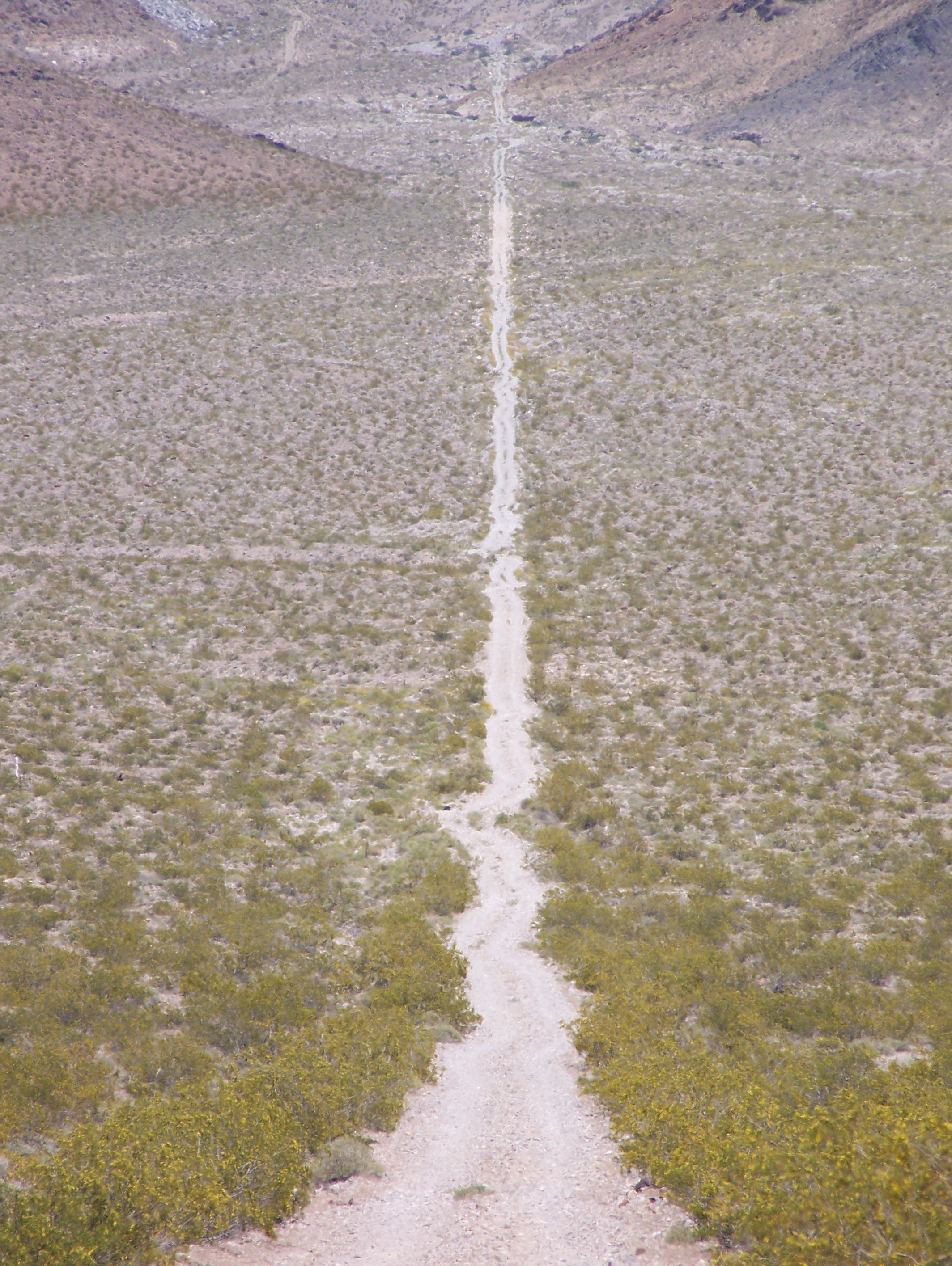
 Road from Carrara, Nevada towards the marble quarry in the background.
- Belmont
- Bonnie Claire
- Bullfrog
- Berlin
- Cactus Springs
- Carrara [7]
- Gold Center
- Ione
- Nyala
- Pioneer
- Potts
- Rhyolite
- Warm Springs
Films
- Nye County was a featured location in two episodes of Studio 60 on the Sunset Strip.
See also
- National Register of Historic Places listings in Nye County, Nevada
- South Egan Range Wilderness
- Weepah Spring Wilderness
Notes
- ^ 2007 Estimates by County
- ^ "Find a County". National Association of Counties. http://www.naco.org/Counties/Pages/FindACounty.aspx. Retrieved 2011-06-07.
- ^ Population and Population Centers by State: 2000
- ^ Ghost Towns and History of the American West
- ^ Nye County, NV Population by Decades
- ^ [1] View Newspapers: Resident proposes new county formation
- ^ [2] Peakbagger.com
- ^ [3] Nevada Department of Transportation AADT report
- ^ "American FactFinder". United States Census Bureau. http://factfinder.census.gov. Retrieved 2008-01-31.
- ^ Nye County QuickFacts from the US Census Bureau
- ^ [4] Las Vegas Review-Journal: Rural Suicide: Soaring rates puzzling
- ^ [5] CDC.gov
- ^ [6] CDC.gov
References
- Nye County and Census Tract 9805, Nye County, Nevada United States Census Bureau
External links
Municipalities and communities of Nye County, Nevada CDPs 
Unincorporated
communitiesAmargosa Valley | Belmont | Berlin | Cactus Springs | Carvers | Crystal | Currant | Duckwater | Gabbs | Hadley | Ione | Lockes | Manhattan | Mercury | Nyala | Potts | Rhyolite | Round Mountain | Scotty's Junction | Sunnyside | Warm Springs | Yomba
 State of Nevada
Topics - Delegations
- Geography
- Government
- History
- People
- Transportation
- Visitor attractions
Society - Crime
- Demographics
- Economy
- Education
- Politics
Regions - Black Rock Desert
- Eagle Valley
- Great Basin
- Lake Mead
- Lake Tahoe
- Las Vegas Valley
- Mojave Desert
- Pahranagat Valley
- Sierra Nevada
Metro areas - Las Vegas-Paradise
- Reno-Sparks
- Carson City
Counties Cities and
communities- Alamo
- Amargosa Valley
- Austin
- Baker
- Battle Mountain
- Beatty
- Boulder City
- Caliente
- Carlin
- Carson City
- Elko
- Ely
- Enterprise
- Eureka
- Fallon
- Fernley
- Gardnerville Ranchos
- Gerlach
- Goldfield
- Hawthorne
- Henderson
- Incline Village
- Las Vegas
- Laughlin
- Lovelock
- Mesquite
- Minden
- North Las Vegas
- Pahrump
- Paradise
- Pioche
- Primm
- Rachel
- Reno
- Spanish Springs
- Sparks
- Spring Creek
- Spring Valley
- Stateline
- Summerlin South
- Sun Valley
- Sunrise Manor
- Tonopah
- Virginia City
- West Wendover
- Winnemucca
- Whitney
- Winchester
- Yerington
Former counties Categories:- Nevada counties
- Nye County, Nevada


Wikimedia Foundation. 2010.