- Battle Mountain, Nevada
-
For the Korean War battle, see Battle of Battle Mountain.
Battle Mountain, Nevada — CDP —  Location of Battle Mountain, Nevada
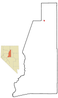
Coordinates: 40°38′22″N 116°56′14″W / 40.63944°N 116.93722°W Country United States State Nevada Government – Senate Dean Rhoads (R) – Assembly John Marvel (R) – U.S. Congress Open Seat Elevation 4,511 ft (1,375 m) Population (2000) – Total 2,871 – Density 1,588.3/sq mi (613.2/km2) Time zone Pacific (PST) (UTC-8) – Summer (DST) PDT (UTC-7) ZIP code 89820 Area code(s) 775 FIPS code 32-04900 GNIS feature ID 0838652 Battle Mountain is an unincorporated community and census-designated place in Lander County, Nevada, United States. The population was 2,871 at the 2000 census. Though it has no legal status as a municipality, it still functions as the county seat of Lander County.[1] Its primary economic base is gold mining and to a lesser extent, legalized gaming. The town is located on Interstate 80 between Winnemucca and Elko.
Contents
History
 Gold and copper mines in the Battle Mountain Mining District
The Battle Mountain area was home to the Northern Paiute and Shoshone peoples. The area was noted by fur trappers in the 1820s and 30s. It served as a waypoint for westward bound travel on the emigrant trail along the Humboldt River by 1845. According to local legends the name stems from confrontations between native Americans and early settlers during the 1850s and 60s.[2]
When copper ore was discovered in 1866 and mining began, the Central Pacific Railroad started a station to support the mining activity and in 1870 moved the Argenta station to Battle Mountain and established a townsite to serve the Battle Mountain copper and gold mining district.[3]
In 1874, the Nevada Legislature overrode the Governor’s veto and approved a railroad from Austin to Battle Mountain. The Nevada Central Railroad from Battle Mountain to Austin, Nevada was completed in 1880. The rail line was constructed to connect the silver mines around Austin to the Central Pacific line at Battle Mountain. The rail line served the Austin area until it was abandoned in 1938.[4]
Ulysses S. Grant spoke in the town in 1879 during his western speaking tour.
President Woodrow Wilson established Battle Mountain Indian Colony by executive order (Lander) in 1917.
In 1919, Nevada's Red Scare Miners held a ten-day strike at Battle Mountain Copper Mines.
In a 1979 ruling, the Nevada Supreme Court moved the Lander County seat to Battle Mountain.
Chiefs Frank Temoke and Frank Brady refused the government's offer of a payoff under the Treaty of Ruby Valley 1863 at Battle Mountain on December 11, 1992.
A 2008 earthquake of 6.3 magnitude that hit Northeastern Nevada severely damaged one of the city's oldest historical buildings, The Lemaire Building, which was condemned.
Geography and climate
 Location map along the Humboldt River
Battle Mountain is located at the confluence of two rivers, the Humboldt and the Reese. The town is in the Humboldt valley between the Shoshone Range to the southeast, Battle Mountain to the southwest and the Sheep Creek Range across the Humboldt to the north.
According to the United States Census Bureau, the community has a total area of 1.9 square miles (4.9 km2), all of it land.
Battle Mountain's climate is semi-arid (Köppen climate classification BSk).
Climate data for Battle Mountain Month Jan Feb Mar Apr May Jun Jul Aug Sep Oct Nov Dec Year Average high °F (°C) 43
(6)50
(10)58
(14)65
(18)75
(24)86
(30)96
(36)95
(35)84
(29)71
(22)54
(12)44
(7)68 Daily mean °F (°C) 30
(−1)36
(2)42
(6)48
(9)57
(14)66
(19)74
(23)72
(22)62
(17)51
(11)38
(3)30
(−1)51 Average low °F (°C) 17
(−8)22
(−6)27
(−3)31
(−1)39
(4)46
(8)51
(11)49
(9)40
(4)30
(−1)23
(−5)16
(−9)33 Precipitation inches (mm) 0.86
(21.8)0.68
(17.3)0.85
(21.6)0.91
(23.1)1.30
(33)0.77
(19.6)0.28
(7.1)0.34
(8.6)0.68
(17.3)0.67
(17)0.71
(18)0.72
(18.3)8.77
(222.8)Source: Weather Channel[5] Transportation
Battle Mountain is located along Interstate 80, approximately halfway between Reno, NV and Salt Lake City, Utah.
Battle Mountain is the starting point of Nevada State Route 305 which heads southward to Austin, Nevada.
The Union Pacific Railroad line runs through Battle Mountain.
The historic narrow-gauge Nevada Central Railroad line ran from Battle Mountain to Austin (long defunct).
Demographics
As of the census[6] of 2000, there were 2,871 people, 1,053 households, and 731 families residing in the community. The population density was 1,588.3 people per square mile (612.4/km²). There were 1,455 housing units at an average density of 804.9 per square mile (310.4/km²). The racial makeup of the community was 81.30% White, 0.14% African American, 2.54% Native American, 0.49% Asian, 0.03% Pacific Islander, 11.81% from other races, and 3.69% from two or more races. Hispanic or Latino of any race were 23.58% of the population.
There were 1,053 households out of which 41.9% had children under the age of 18 living with them, 54.6% were married couples living together, 9.9% had a female householder with no husband present, and 30.5% were non-families. 25.2% of all households were made up of individuals and 4.8% had someone living alone who was 65 years of age or older. The average household size was 2.71 and the average family size was 3.28.
The population is spread out with 33.8% under the age of 18, 8.1% from 18 to 24, 29.0% from 25 to 44, 22.4% from 45 to 64, and 6.7% who were 65 years of age or older. The median age was 32 years. For every 100 females there were 104.1 males. For every 100 females age 18 and over, there were 104.4 males.
The median income for a household in the community was $42,981, and the median income for a family was $50,995. Males had a median income of $45,313 versus $25,417 for females. The per capita income for the community was $16,975. About 7.8% of families and 11.8% of the population were below the poverty line, including 14.1% of those under age 18 and 20.0% of those age 65 or over.
Sports
Among human-powered vehicle enthusiasts, Battle Mountain is famous for hosting annual bike races on a long, straight, flat stretch of Highway 305 just outside of town. Pedaling a streamlined two-wheeler at 83 mph (134 km/h) over a 200 meter distance in 2002, Sam Whittingham established himself as "the fastest man alive". This event is known as the 'World Human Powered Speed Challenge'[2] On September 18, 2008, Sam established a new record of 82.33 miles per hour (132.50 km/h), thereby winning the .decimach prize for going one tenth the speed of sound (with adjustments for slope and altitude).[7]
During 2009, a Canadian man and a French woman set world bicycle speed records at the annual event in northeastern Nevada. Sam Whittingham and Barbara Buatois pedaled recumbent bikes to the records on Nevada Route 305 near Battle Mountain, about 220 miles (350 km) northeast of Reno. The 32-year-old Buatois' speed of 75.46 mph (121.44 km/h) Friday night broke the women's record, set in 2005, by 8.8 mph (14.2 km/h). The 37-year-old Whittingham's speed of 82.4 mph (132.6 km/h) Tuesday eclipsed the men's record he set last year by 0.1 mph (0.16 km/h).
Also annually held on the same stretch of road is the 'Pony Express',[8] an open road event from Battle Mountain to Austin and back again. This make the longest open road race in the country, averaging a total of 130 miles (210 km). This race consists of cars from the 60's era muscle cars to the most modern European sports cars.
Entertainment
Education
Notable residents
- Joyce Collins - Jazz pianist, singer, and educator.
- The Dann Sisters (Carrie and Mary Dann) - (Crescent Valley) Western Shoshone Activists for cultural and spiritual rights and land rights.
- James H. Ledlie - Union officer in the Civil War whom Ulysses S. Grant called, "the greatest coward of the war."
- Jeannette Walls – Author of The Glass Castle, of which a portion takes place in Battle Mountain, and former gossip columnist for MSNBC.com
National recognition
On January 2, 2009 The New York Times released an article entitled "A Nevada Town Escapes the Slump, Thanks to Gold". The article regards the national economic depression and discusses Battle Mountain's economy.
2001: The Washington Post crowns Battle Mountain with the title of "Armpit of America". Old Spice was quick to capitalize on this media attention and the company sponsored the town's 1st annual "Armpit Festival".
References
- ^ "Find a County". National Association of Counties. http://www.naco.org/Counties/Pages/FindACounty.aspx. Retrieved 2011-06-07.
- ^ Battle Mountain Community, Lander County Online Government
- ^ About Battle Mountain
- ^ Michael Brown, Nevada Central Narrow Gauge, in Narrow Gauge and Short Lines Railroads of the West
- ^ Weather Channel - Monthly Averages for Battle Mountain, NV—[1]. Retrieved 14 August 2010.
- ^ "American FactFinder". United States Census Bureau. http://factfinder.census.gov. Retrieved 2008-01-31.
- ^ http://www.recumbents.com/decimach/default.htm
- ^ http://www.popularhotrodding.com/events/0502phr_pony_express_130/index.html
External links
Coordinates: 40°38′22″N 116°56′14″W / 40.63944°N 116.93722°W
- Complete Battle Mountain information with Photo Gallery
- Battle Mountain history and description
- Battle Mountain Chamber of Commerce
- Lander County
- Battle Mountain Branch Library
- Battle Mountain Bugle
- Battle Mountain Arts
- Pony Express 130
- Weingarten, Gene. "Why Not the Worst?" Washington Post Magazine, 2 December 2001.
- Battle Mountain Human-Powered Vehicle Race Site
- A Nevada Town Escapes the Slump, Thanks to Gold
- Nevada Central Narrow Gauge
Municipalities and communities of Lander County, Nevada County seat: Battle MountainCDP Battle Mountain

Unincorporated
communities State of Nevada
Topics - Delegations
- Geography
- Government
- History
- People
- Transportation
- Visitor attractions
Society - Crime
- Demographics
- Economy
- Education
- Politics
Regions - Black Rock Desert
- Eagle Valley
- Great Basin
- Lake Mead
- Lake Tahoe
- Las Vegas Valley
- Mojave Desert
- Pahranagat Valley
- Sierra Nevada
Metro areas - Las Vegas-Paradise
- Reno-Sparks
- Carson City
Counties Cities and
communities- Alamo
- Amargosa Valley
- Austin
- Baker
- Battle Mountain
- Beatty
- Boulder City
- Caliente
- Carlin
- Carson City
- Elko
- Ely
- Enterprise
- Eureka
- Fallon
- Fernley
- Gardnerville Ranchos
- Gerlach
- Goldfield
- Hawthorne
- Henderson
- Incline Village
- Las Vegas
- Laughlin
- Lovelock
- Mesquite
- Minden
- North Las Vegas
- Pahrump
- Paradise
- Pioche
- Primm
- Rachel
- Reno
- Spanish Springs
- Sparks
- Spring Creek
- Spring Valley
- Stateline
- Summerlin South
- Sun Valley
- Sunrise Manor
- Tonopah
- Virginia City
- West Wendover
- Winnemucca
- Whitney
- Winchester
- Yerington
Former counties Categories:- Humboldt River
- Unincorporated communities in Nevada
- Populated places in Lander County, Nevada
- Census-designated places in Nevada
- County seats in Nevada
- Unincorporated towns in Nevada


Wikimedia Foundation. 2010.