- Nevada State Route 305
-
State Route 305
Austin – Battle Mountain Road Route information Maintained by NDOT Length: 87.717 mi[1] (141.167 km) Existed: 1976 – present Major junctions South end:  US 50 in Austin
North end:  SR 304 in Battle Mountain
Highway system ← SR 304SR 306  →
→State Route 305 (SR 305) is a state highway in Lander County, Nevada. It is the only state highway to connect the southern and northern areas of the county. It runs north from U.S. Route 50 at Austin to Battle Mountain, where it crosses Interstate 80 and ends at State Route 304.
Contents
Route description
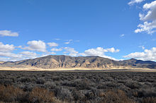
 SR 305 with the Toiyabe Range in the background
State Route 305 begins just northwest of the town limits of Austin, Nevada.[2] From there, the route heads in a northerly direction through the Reese River Valley, generally paralleling the Reese River. The highway passes near many ranches and mining sites. After about 20 miles (32 km), SR 305 curves slightly more westward, crossing through the Shoshone Range.[3] The route continues northward, passing the Valley of the Moon along the trek through Reese River Valley.[4] As the route nears the vicinity of Battle Mountain, it curves northeast to head to the town of the same name. Along this stretch of highway, near milepost 110, are several dirt roads providing access to numerous mining sites.[5] Soon afterward, SR 305 enters Battle Mountain along Broad Street, crossing under Interstate 80 and ending in the middle of the town at an intersection with Front Street (SR 304/I-80 Business).[6]
History
The road dates to back to at least 1929. At that time, it appeared on state maps one segment of the much longer State Route 8A. At the time, it was an unimproved road in the state highway system, and the road approached Battle Mountain from a more southerly direction.[7] The northern end of the current highway alignment southwest of Battle Mountain, serving the present-day mining establishments near the town, was constructed by 1952, although SR 8A continued to follow the previous alignment according to maps.[8] The entire highway was paved by 1953,[9] and the SR 8A designation was moved onto the newer section near Battle Mountain by 1954.[10]
On July 1, 1976, Nevada began renumbering its state highways. In this process, the Austin – Battle Mountain Road segment of SR 8A was reassigned to a new State Route 305. This change was first seen on state maps in 1978.[11] The route has remained relatively unchanged since then.
Major intersections
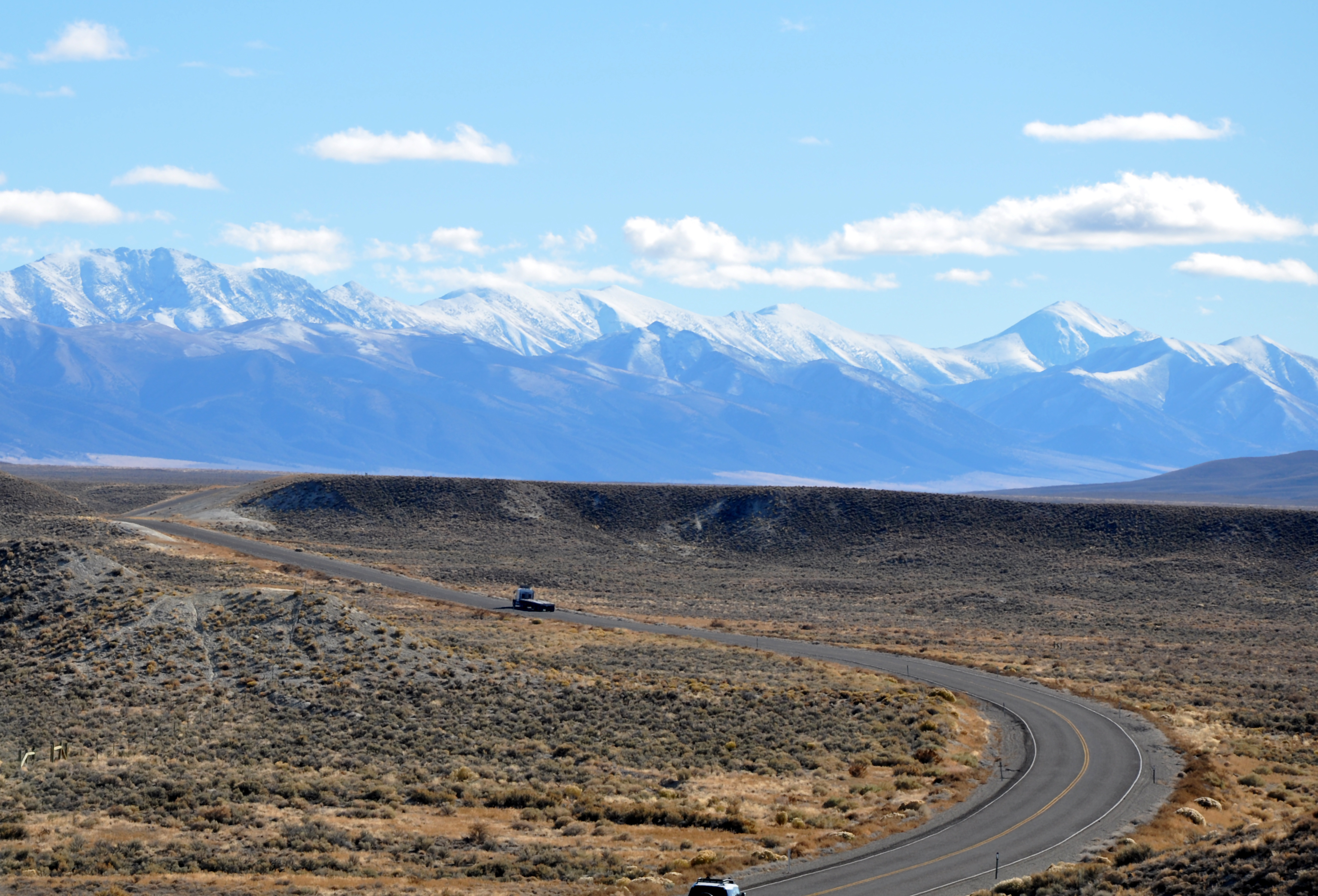
 The Shoshone Range, as seen from SR 305 near Battle Mountain
The entire route is in Lander County.
Location Mile[1] Destinations Notes Austin 30.8 US 50 – Fallon, EurekaBattle Mountain  I-80 – Lovelock, Elko
 SR 304 (Front Street) / I-80 Bus.
1.000 mi = 1.609 km; 1.000 km = 0.621 mi See also
Other segments of former State Route 8A:
- State Route 140, the northern segment that ran west from U.S. Route 95 via Denio to northwestern Nevada.
- State Route 376, the southern segment that ran from near Tonopah to near Austin.
References
- ^ a b "State Maintained Highways of Nevada: Descriptions and Maps - Quarter 2 Update". Nevada Department of Transportation. July 2011. http://www.nevadadot.com/About_NDOT/NDOT_Divisions/Planning/Roadway_Systems/State_Maintained_Highways,_Descriptions,_Index___Maps.aspx. Retrieved 29 July 2011.
- ^ Nevada Department of Transportation (2006) (PDF). Austin Area (Map). http://www.nevadadot.com/uploadedFiles/NDOT/Traveler_Info/Maps/austin.pdf. Retrieved 26 Jan 2011.
- ^ Nevada Department of Transportation (2008) (PDF). Quadrangle 5-7 (Map). http://www.nevadadot.com/uploadedFiles/NDOT/Traveler_Info/Maps/quad0507.pdf. Retrieved 26 Jan 2011.
- ^ Nevada Department of Transportation (2010) (PDF). Quadrangle 4-7 (Map). http://www.nevadadot.com/uploadedFiles/NDOT/Traveler_Info/Maps/quad0407.pdf. Retrieved 26 Jan 2011.
- ^ Nevada Department of Transportation (2005) (PDF). Quadrangle 3-7 (Map). http://www.nevadadot.com/uploadedFiles/NDOT/Traveler_Info/Maps/quad0307.pdf. Retrieved 26 Jan 2011.
- ^ Nevada Department of Transportation (2005) (PDF). Battle Mountain Area (Map). http://www.nevadadot.com/uploadedFiles/NDOT/Traveler_Info/Maps/battlemountain.pdf. Retrieved 26 Jan 2011.
- ^ Nevada Department of Highways (1929). Highway Map State of Nevada (Map). http://contentdm.library.unr.edu/u?/hmaps,457. Retrieved 26 Jan 2011.
- ^ Nevada Department of Highways (1952). Official Highway Map of the State of Nevada (Map). Section C4. http://contentdm.library.unr.edu/u?/hmaps,491. Retrieved 26 Jan 2011.
- ^ Nevada Department of Highways (1953). Official Highway Map of the State of Nevada (Map). Section C4,D4. http://contentdm.library.unr.edu/u?/hmaps,491. Retrieved 26 Jan 2011.
- ^ Nevada Department of Highways (1954). Official Highway Map of the State of Nevada (Map). Section C4. http://contentdm.library.unr.edu/u?/hmaps,493. Retrieved 26 Jan 2011.
- ^ Nevada Department of Highways (1978). Official Highway Map of Nevada (Map). Section B3,C3. http://contentdm.library.unr.edu/u?/hmaps,535. Retrieved 26 Jan 2011.
Categories:- State highways in Nevada


Wikimedia Foundation. 2010.