- Interstate 210 and State Route 210 (California)
-
Interstate 210, State Route 210

Foothill Freeway 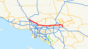
Route information Defined by S&HC § 510 Maintained by Caltrans Length: 86 mi[1] (138 km)
Length includes the unconstructed freeway section.History: 1933 as a highway, 1964 as a number Major junctions West end:  I-5 near San Fernando
 SR 134 in Pasadena
 I-605 in Irwindale
 SR 57 in Glendora
 I-15 in Rancho Cucamonga
 I-215 in San Bernardino
East end:  I-10 in Redlands
Highway system Auxiliary route of the Interstate Highway System
Main • Auxiliary • BusinessState highways in California(list • pre-1964)
History • Unconstructed • Deleted • Freeway • Scenic←  SR 207
SR 211  →
→Interstate 210 (I-210) and State Route 210 (SR 210) together form a contiguous highway, called the Foothill Freeway, in the Greater Los Angeles area of the U.S. state of California. The western portion of the route is an auxiliary Interstate Highway, while the eastern portion is a state highway. The entire route was upgraded to Interstate Highway standards by 2007, and the California Department of Transportation (Caltrans) has requested permission to re-sign the eastern portion as an Interstate Highway.
The name Foothill Freeway is a reference to Foothill Boulevard and the San Gabriel Mountains, both of which run parallel to the freeway for most of its length. The freeway connects Los Angeles with its northern suburbs following the foothills of these mountains. The freeway runs from the Sylmar district of Los Angeles east to Redlands.
Currently all of the Foothill Freeway is designated Route 210. Historically, the Foothill Freeway spanned multiple numerical designations. Additionally, the I-210 designation has changed routings; previously including a portion of what is now the Orange Freeway (SR 57). East of Pasadena the Foothill Freeway parallels, and in some parts replaced, the route of former U.S. Route 66.
Contents
Route description
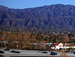
 Freeway as seen from the Metro Gold Line Sierra Madre Villa Station
I-210's western terminus is at its junction with the Golden State Freeway (I-5), near the Sylmar district of Los Angeles. From that point, the freeway's alignment is generally diagonal as it heads southeast through the northeastern San Fernando Valley and the Crescenta Valley. After leaving Los Angeles, it enters North Glendale and meets with the Glendale Freeway (State Route 2) before turning due south towards the junction with the Ventura Freeway (State Route 134) in Pasadena. At this interchange, the Foothill Freeway shifts its alignment and direction, becoming an east-west freeway. From the north, the primary through lanes of I-210 become the unsigned northern stub of unfinished I-710, while from the east, the through lanes of the Ventura Freeway become I-210 as the Ventura Freeway reaches its official eastern terminus. After intersecting the northern terminus of I-605 (The San Gabriel River Freeway), I-210 then continues east to the Orange Freeway (State Route 57) in Glendora. Heading east from the Orange Freeway interchange, until its eastern terminus at I-10 in Redlands, 210 is currently signed as a state route.
Portions of the Metro Gold Line of the LACMTA run in the median of the Foothill Freeway from Pasadena to Arcadia.
State Route 210 presently has two distinct segments:
The western freeway segment serves as the easternmost portion of the Foothill Freeway (Interstate 210). Consisting of newer freeway, beginning at the east end of I-210 near San Dimas, SR 210 extends eastward, eventually paralleling Highland Avenue, as it continues through Fontana. It intersects Interstate 15, an artery between Southern California and Nevada a few miles before it meets with Interstate 215 in San Bernardino.
The segment east of Interstate 215 is the former alignment of State Route 30. This segment extends eastward to junctions with Interstate 215, State Route 259, State Route 18 and State Route 330 in Highland. State Route 210 then curves southward and ends in a junction with Interstate 10 in Redlands.
The Glendora Curve is the former colloquial name for the interchange between State Route 57 and the Foothill Freeway, Interstate 210.[2] The "curve" portion refers to the interchange from the northbound lanes of State Route 57 to the westbound lanes of I-210, and from the eastbound lanes of I-210 to the southbound lanes of State Route 57. The origin of the name comes from its location in the city of Glendora. Prior to 2002, this interchange was entirely part of I-210, and the eastern terminus of I-210 ended several miles south of the curve at the Kellogg Interchange at the junctions of the Chino Valley Freeway, State Route 71, the San Bernardino Freeway, I-10, and Route 57. After the portion of I-210 south of the Glendora Curve was transferred to Route 57 in 2002, effectively extending Route 210 east past the Glendora Curve, the name Glendora Curve fell out of popular use.[3]
This route is part of the California Freeway and Expressway System[4] and is eligible for the State Scenic Highway System.[5]
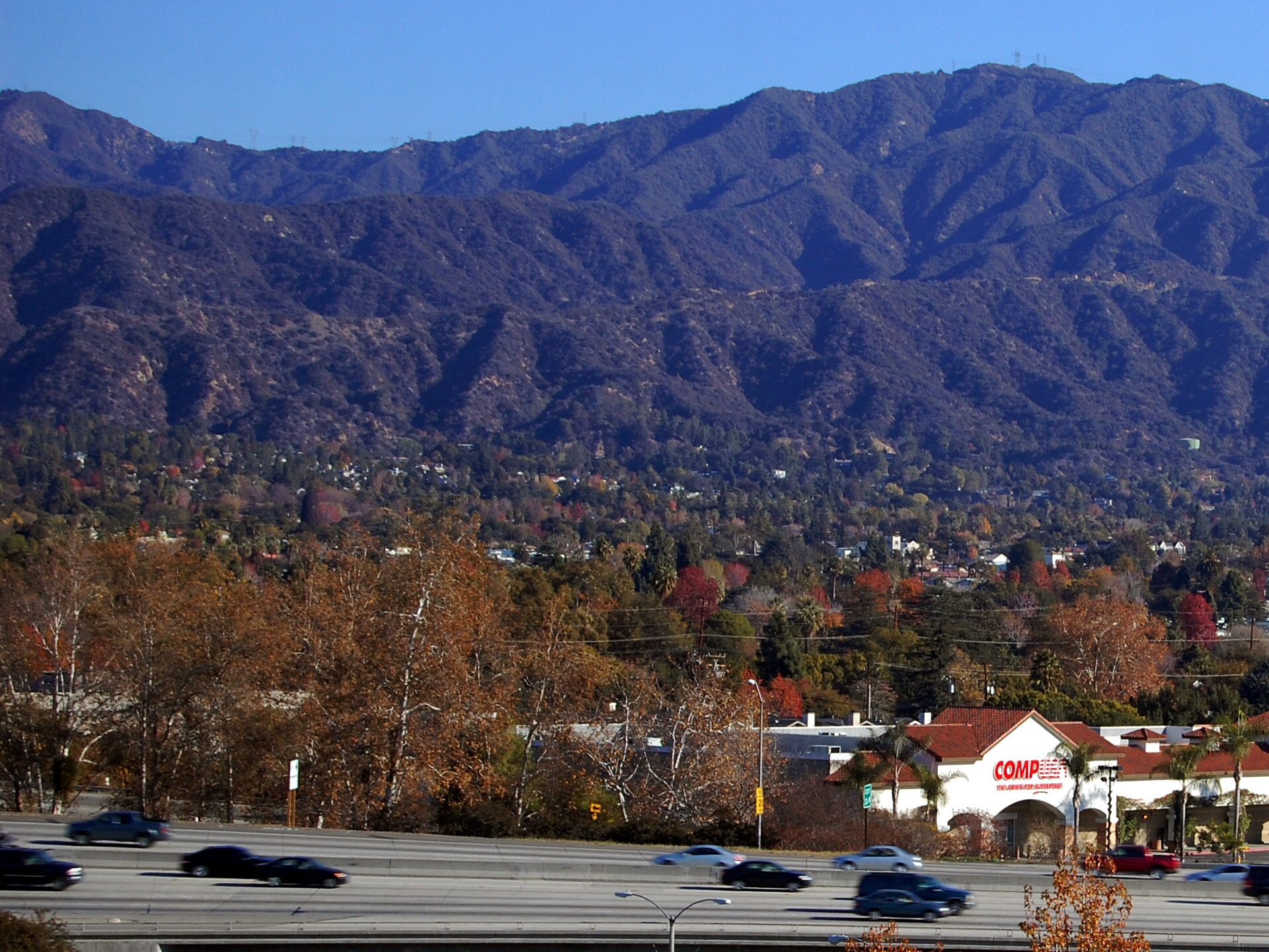
 Elevated portion of freeway in Monrovia.
History
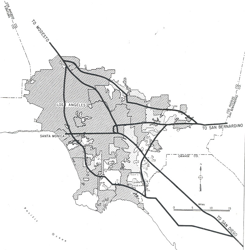
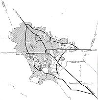 1955 map of the planned Interstates in the Greater Los Angeles Area. The original proposal for present-day I-210 includes its original eastern terminus in Pomona.
The construction began on the freeway in 1958. The first section, between Flintridge, now La Cañada Flintridge and Canada Avenue in Pasadena, was opened in 1966; it was then signed as State Route 118. In 1968, the Atchison, Topeka and Santa Fe Railway depot at Santa Anita, a historic structure built in 1890, was moved to the Los Angeles County Arboretum and Botanic Garden to make way for a section of the freeway passing through Arcadia.[6][7] The section from State Route 134 to the Kellogg Interchange with Interstate 10 at Pomona, California was completed in 1976.[8] The section between the Kellogg interchange and Glendora is no longer part of I-210. In 2003, this piece was renumbered as part of State Route 57, and known as the Orange Freeway.
In the 1990s, Caltrans began constructing extensions to the freeway from Glendora east to the former Interstate 215/State Route 30 interchange in San Bernardino. In 2003, a 20-mile (32 km) segment east from Glendora to Fontana was completed, with the portion proceeding south from Glendora renumbered SR 57. The remaining section east of Interstate 15 between Fontana and Interstate 215 was opened on July 24, 2007.
Caltrans has petitioned AASHTO, the trade organization that oversees the designation and naming of the Interstate Highway system, to re-sign the entire Foothill Freeway, including the entire segments of State Routes 210 and 30, as I-210. Upon completion of the new freeway segment west of I-215, State Route 30 from I-215 to I-10 in Redlands was re-signed as State Route 210. The re-signing in 2003 of the former portion of I-210 now signed as State Route 57 truncated I-210 from its parent route, I-10. Presuming that authority is given at some point in the future to re-sign the entirety of 210 as interstate, then I-210 will once again connect to its parent route, but much further east in Redlands.
The western freeway segment, planned since the 1970s and completed in 2002, replaced a western surface street segment that began with Base Line Road (sometimes spelled Baseline Road) at its intersection with Foothill Boulevard in San Dimas and extends eastward into Upland. In Upland it became 16th Street, then turned northward onto Mountain Avenue, then turned eastward onto 19th Street. It left Upland and continued eastward into Rancho Cucamonga. It then seemed to turn northward onto Haven Avenue and end at the western freeway segment. This segment is probably still signed as SR 30 — at least in some places if not ubiquitously — but some recently published maps are reflecting a signage change.
State Route 30 is the former designation of State Route 210 and State Route 330. Route 30 ran from its interchange with I-210 in Glendora east to State Route 18 at Big Bear Lake. The easternmost portion of Route 30 was transferred to Route 330 in 1972. Thereafter, Route 30 was routed south to I-10 in Redlands. In 1999, the entirety of Route 30 from the Glendora Curve to Redlands was transferred to Route 210.
Route 210 from Route 5 to Route 10 in Redlands is known as the Foothill Freeway, as named by Senate Concurrent Resolution 29, Chapter 128 in 1991.[9]
State Route 30
SR 30 was adopted as a state route in 1933 as part of Legislative Route 190. It was an unsigned highway, running from LRN 9 (formerly US 66, Foothill Blvd) near San Dimas to LRN 26 (SR 38) near Redlands. It also ran from LRN 26 near Redlands to LRN 43 near Big Bear Lake, which would become part of SR 38.[10] During the renumbering of California routes, LRN 190 was split into two different routes. The western portion, between I-210 in San Dimas and Highland became SR 30. The eastern portion, between SR 38 in Redlands and Highland was combined with LRN 207 (currently SR 330) to form SR 106. In 1972, the northern portion of SR 106, between SR 30 and SR 18 would be renumbered SR 330.[11] The southern portion, between SR 30 and I-10 (SR 106 was moved to I-10 in 1965) was combined with SR 30.[12]
Initial freeway construction started in 1968, and constructed the freeway between SR 259 and Cedar St. in San Bernardino. Construction continued east in 1971, which brought the freeway just west of SR 330. Construction did not resume until 1989 which extended the freeway west to I-215. The last phase of construction started in 1992, which connected the route south to I-10.[13]
In 1968, the State requested that SR 30 be incorporated into the interstate system, but was declined.[12] The next effort started in 1998. The State decided to close the 25-mile gap between I-210 and SR 30. It also decided to number the new freeway as SR 210, in preparation of the route becoming an interstate. Also, when the new freeway was close to the existing route, the entire route would be renumbered SR 210. In addition, the short section of the Orange Freeway, which was numbered I-210 would be renumber SR 57, to match the number used for the rest of the freeway. Construction started on the eastern end, and slowly moved west. In 2007, the mainline freeway section was completed, which ended SR 30. The final phase of the project is expected to be completed in 2011, which includes upgrading the interchange at I-215 to a full interchange.[14] The latter interchange was built with missing moves (210 EB to 215 SB, 215 NB to 210 WB) as the flyover plans for these moves had to be recast to address potential soil liquefaction in the event of rupture of existing or undiscovered faults in the area during an earthquake.[15]
Future
With the completion of a central freeway segment in July 2007, Caltrans is expected to ask the AASHTO to designate the entire route as part of Interstate 210. Once approved, the SR 210 green State Route signs will be replaced with Interstate 210 ones.[citation needed]
Exit list
- Note: Except where prefixed with a letter, postmiles were measured in 1964, based on the alignment as it existed at that time, and do not necessarily reflect current mileage. The numbers reset at county lines; the start and end postmiles in each county are given in the county column.
County Location Postmile
[1][16][17]Exit
[18]Destinations Notes Los Angeles
LA R0.00-R52.15Los Angeles R0.00 1 I-5 (Golden State Freeway) – Los Angeles, SacramentoWestbound exit and eastbound entrance; signed as exits 1A (north) and 1B (south) R0.84 1C Yarnell Street Signed as exit 1 eastbound R1.92 2 Roxford Street – Sylmar R3.28 3 Polk Street R4.11 4 Hubbard Street R4.94 5 Maclay Street – San Fernando R5.91 6A  SR 118 west (Ronald Reagan Freeway)
Signed as exit 6B westbound R6.01 6B Paxton Street Signed as exit 6A westbound R7.82 8 Osborne Street – Lake View Terrace R9.44 9 Wheatland Avenue – Lake View Terrace R11.08 11 Sunland Boulevard – Sunland, Tujunga R14.17 14 La Tuna Canyon Road Glendale R15.62 16 Lowell Avenue – Tujunga R16.77 17A Pennsylvania Avenue – La Crescenta Signed as exit 17 eastbound R17.38 17B La Crescenta Avenue – La Crescenta Westbound exit and eastbound entrance R18.22 18 Ocean View Boulevard – Montrose Glendale R18.87 19  SR 2 west (Glendale Freeway) – Los Angeles
West end of SR 2 overlap La Cañada Flintridge R19.88 20 SR 2 east (Angeles Crest Highway) – La Cañada FlintridgeEast end of SR 2 overlap R20.60 21 Gould Avenue Eastbound exit and westbound entrance R20.85 21 Foothill Boulevard Westbound exit and eastbound entrance Pasadena R21.53 22A Berkshire Avenue, Oak Grove Drive R22.49 22B Arroyo Boulevard, Windsor Avenue R23.19 23 Lincoln Avenue, Washington Boulevard R24.06 24 Seco Street, Mountain Street R24.86 25A Colorado Boulevard – Pasadena Eastbound exit and westbound entrance R24.96 25A  SR 710 south (Long Beach Freeway) / Del Mar Boulevard, California Boulevard
Westbound exit is via exit 26A R24.96 25B SR 134 west (Ventura Freeway) – Ventura, GlendaleSigned as exit 26A westbound R25.29 25 Fair Oaks Avenue, Marengo Avenue Westbound exit and eastbound entrance; signed as exits 25A (south) and 25B (north) R26.33 26 Lake Avenue Signed as exit 26B westbound R26.94 27A Hill Avenue Signed as exit 27 eastbound R27.41 27B Allen Avenue Westbound exit and eastbound entrance R28.25 28 Altadena Drive, Sierra Madre Boulevard Westbound exit is via exit 29A R28.68 29A San Gabriel Boulevard – San Marino R29.29 29B Madre Street R29.49 30  SR 19 south (Rosemead Boulevard) / Michillinda Avenue
Signed as exits 30A (south) and 30B (north) eastbound Arcadia R30.82 31 Baldwin Avenue – Sierra Madre R31.88 32 Santa Anita Avenue – Arcadia R32.89 33 Huntington Drive – Monrovia, Arcadia Monrovia R33.91 34 Myrtle Avenue – Monrovia R34.74 35A Mountain Avenue Duarte R35.24 35B Buena Vista Street Irwindale R36.41 36A I-605 south (San Gabriel River Freeway)Signed as exit 36B westbound R36.41 36B Mount Olive Drive (via I-605 north) Signed as exit 36A westbound R37.86 38 Irwindale Avenue – Irwindale Azusa R38.96 39 Vernon Avenue R39.60 40  SR 39 (Azusa Avenue)
R40.60 41 Citrus Avenue – Covina Glendora R41.59 42 Grand Avenue – Glendora R43.16 43 Sunflower Avenue R44.20 44 Lone Hill Avenue R44.38 45 SR 57 south (Orange Freeway) – Santa AnaEast end of I-210; west end of SR 210; former I-210 east San Dimas R45.46 46 San Dimas Avenue – San Dimas La Verne R46.63 47  SR 66 east (Foothill Boulevard) – La Verne
Former US 66 R48.08 48 Fruit Street Claremont R49.53 50 Towne Avenue R51.85 52 Base Line Road Former SR 30 San Bernardino
SBD 0.00-R33.18Upland 1.50 54 Mountain Avenue – Mount Baldy 3.47 56 Campus Avenue Rancho Cucamonga 4.60 57 Carnelian Street 5.90 58 Archibald Avenue 6.91 59 Haven Avenue 7.91 60 Milliken Avenue 9.14 61 Day Creek Boulevard 11.50 64A I-15 (Ontario Freeway) – Barstow, San DiegoFontana 11.93 64B Cherry Avenue 12.93 Beech Avenue HOV-only interchange 13.93 66 Citrus Avenue 14.93 67 Sierra Avenue Rialto R16.03 68 Alder Avenue R17.39 70 Ayala Drive 19.00 71 Riverside Avenue 19.67 72 Pepper Avenue Proposed interchange San Bernardino 20.69 73 State Street, University Parkway R21.87 74 I-215 north (Barstow Freeway) – BarstowFormer I-15E R22.94 75A H Street Signed as exit 75 eastbound R23.10 75B To I-215 south (SR 259 south) – Downtown San Bernardino, Los Angeles, RiversideEastbound exit is via exit 75 R24.22 76  SR 18 north (Waterman Avenue)
R25.72 78 Del Rosa Avenue R26.73 79 Highland Avenue R28.66 81  SR 330 north – Running Springs, Big Bear Lake
Highland R29.32 82 Base Line Road R30.23 83 5th Street, Greenspot Road Redlands R32.34 84 San Bernardino Avenue R33.18 85 I-10 – Los Angeles, IndioEastbound exit and westbound entrance; signed as exits 85A (west) and 85B (east) 1.000 mi = 1.609 km; 1.000 km = 0.621 mi
Concurrency terminus • Closed/Former • Incomplete access • UnopenedReferences
- ^ a b California Department of Transportation, State Truck Route List (XLS file), accessed February 2008
- ^ City Minutes referencing colloquial name.
- ^ Glendora Interchange
- ^ CA Codes (shc:250-257)
- ^ CA Codes (shc:260-284)
- ^ "Early California History" (PDF). Los Angeles County Arboretum & Botanic Garden. http://www.arboretum.org/images/uploads/EARLY_CALIFORNIA_HISTORY(2).pdf. Retrieved 2009-09-09.
- ^ "Caminos – Newsletter of the Arcadia Historical Society" (PDF). Arcadia Historical society. 2007-07. http://www.ci.arcadia.ca.us/docs/caminosjul07.pdf. Retrieved 2009-09-09.
- ^ http://www.dot.ca.gov/hq/structur/strmaint/brlog/logpdf/logd07.pdf dot.ca.gov
- ^ 2007 Named Freeways, Highways, Structures and Other Appurtenances in California. Caltrans. p. 60. http://www.dot.ca.gov/hq/tsip/hseb/products/Named_Freeways.pdf. Retrieved 2007-03-28.
- ^ Route 185-192. CAHighway.org. Accessed: 03-05-2010.
- ^ Route 105-112. CAHighway.org. Accessed: 03-05-2010.
- ^ a b Route 25-32. CAHighway.org. Accessed: 03-05-2010.
- ^ California Department of Transportation, Log of Bridges on State Highways, July 2009
- ^ I-215 North SR 210/215 Connector Project Fact Sheet. Caltrans. Accessed 03-05-2010.
- ^ http://www.sanbag.ca.gov/projects/mi_fwy_foothill_fly-overs.html SANBAG Measure I Freeway Projects. Accessed 10-18-2010
- ^ California Department of Transportation, Log of Bridges on State Highways, July 2007
- ^ California Department of Transportation, All Traffic Volumes on CSHS, 2005 and 2006
- ^ California Department of Transportation, California Numbered Exit Uniform System, Interstate 210 Freeway Interchanges, Retrieved on 2009-02-07.
External links
- California @ WestCoastRoads - Interstate 210
- Caltrans: Interstate 210 highway conditions
- California Highways: Interstate 210
- SANBAG Projects: State Route 210 - Foothill Freeway
Auxiliary routes of Interstate 10 California: 110 • 110 (former) • 210 • 710 — Arizona: 410 (unbuilt) • 510 (former) • 710 (unbuilt) — Texas: 110 • 410 • 610 — Louisiana: 110 • 210 • 310 • 310 (unbuilt) • 410 (unbuilt) • 410 (unbuilt) • 510 • 610 • 910 (unsigned) — Mississippi: 110 • 310 (proposed) — Alabama: 210 (former) — Florida: 110
Freeways in Greater Los Angeles Radial Hollywood (US 101/SR 170) • Golden State (I-5) • Antelope Valley (SR 14) • Glendale (SR 2) • Pasadena/Arroyo Seco Pkwy (SR 110) • San Bernardino (I-10) • Pomona (SR 60) • Santa Ana (I-5/US 101) • Laguna (SR 133) • Corona del Mar (SR 73) • Long Beach (I-710) • Seaside (SR 47) • Terminal Island (SR 103) • Harbor (I-110/SR 110) • Marina (SR 90) • Santa Monica (I-10)Circumferential Ventura (US 101/SR 134) • Foothill (I-210) • San Gabriel River (I-605) • Orange (SR 57) • Costa Mesa (SR 55) • Artesia (SR 91) • Garden Grove (SR 22) • Century (I-105) • Gardena (SR 91) • San Diego (I-405) • Moorpark (SR 23) • Ojai (SR 33) • Ronald Reagan (SR 118) • Santa Paula (SR 126)Inland Empire Chino Valley (SR 71) • Foothill (SR 210) • Moreno Valley (SR 60) • Riverside (SR 91) • San Bernardino (I-10/I-215) • I-10 • I-15 • I-215 • SR 259 • SR 330Toll Interstate Highways in California Signed Unsigned Business Loops Former Categories:- Interstate Highways in California
- State highways in California
- Roads in Los Angeles County, California
- Roads in San Bernardino County, California
- Southern California freeways
- Three-digit Interstate Highways
- Interstate 10
- Transportation in the San Fernando Valley
- Transportation in Pasadena, California


Wikimedia Foundation. 2010.