- Mount San Antonio
-
Mount San Antonio 
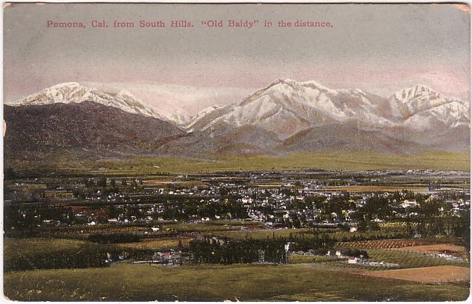
Postcard image of Mount Baldy circa 1910Elevation 10,068 ft (3,069 m) NAVD 88[1][2] Prominence 6,224 ft (1,897 m) [2] Parent peak San Gorgonio Mountain [3] Location Location in California
 Mount San Antonio
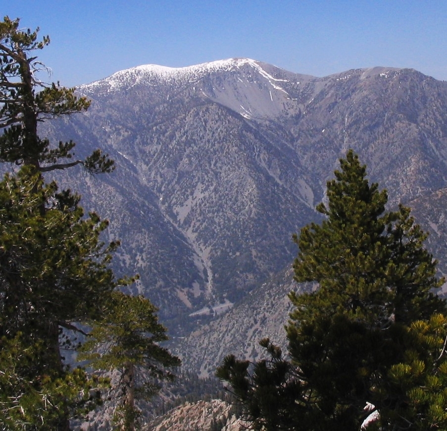
Location Los Angeles County / San Bernardino County, California, USA Range San Gabriel Mountains Coordinates 34°17′20″N 117°38′48″W / 34.28889°N 117.64667°WCoordinates: 34°17′20″N 117°38′48″W / 34.28889°N 117.64667°W[4] Topo map USGS Mount San Antonio Geology Type Granitic Climbing Easiest route Ski lift to Baldy Notch, Devil's Backbone Trail (hike) Mount San Antonio, commonly known as Old Baldy or Mt Baldy, at 10,068 ft (3,069 m), is the highest peak in the San Gabriel Mountains, and the highest point in Los Angeles County. Mount San Antonio's sometimes snow-capped peaks are visible on clear days and dominate the view of the Los Angeles skyline.
Contents
Geography
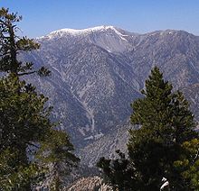
Mount San Antonio has two peaks: the main peak, with an elevation of 10,068 feet (3,069 m), and a sub-peak, West Baldy, at 9,988 feet (3,044 m).[5] Nearby are San Antonio Creek and San Antonio Falls.[6] The creek descends through a gorge and forms several waterfalls. The last drop has a height of about 75 feet (23 m).
History
The peak, which marks a boundary between San Bernardino County and Los Angeles County,[7] is called Baldy because of the absence of trees around the summit. The Tongva tribe call the mountain Yoát or Joat, which means snow, and the Mohave call it Avii Kwatiinyam.[8]
Between 1922 and 1927, American physicist Albert Michelson performed a number of experiments involving bouncing a beam of light onto a reflector at Lookout Mountain,[4] a prominence on the south ridge of the mountain 3.2 miles (5.1 km) southwest of the peak, from the observatory at Mount Wilson some 22 miles (35 km) distant. The exact distance was very accurately surveyed and, using the measurements, the speed of light was calculated to be 299,796±4 km/s.[9]
Mount San Antonio, along with the nearby peak known as Thunder Mountain, is currently home to the family owned and operated ski resort Mount Baldy Ski Lifts, the closest resort to Los Angeles. Nearby lies Mt Baldy Village, a small seasonal community. The village has its own fire department, church, visitor's center and school district. Mt. Baldy School (the abbreviation is the standard usage) has about 88 students.[10]
Recreation
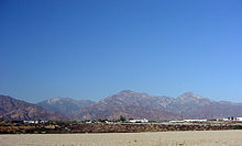
 The peak from the southeast, showing Baldy Bowl
Hiking trails access the summit from three sides of the mountain and one route is assisted on summer weekends by the availability of a running ski-area chair lift.[11] Many areas in the foothills are suitable for rock climbing and bouldering. There are dozens of off-ramp accessible trails that are known for vigorous hikes.
For mountaineers, the winter and spring offer a snow climbing challenge. The "Baldy Bowl" south of the summit can be climbed with crampons and ice ax. The bowl can be treacherous for inexperienced climbers as some sections have slopes of 45° to 50°. These can only safely be climbed when the snow conditions are good.
Since 1965, each Labor Day, the San Antonio Canyon Town Hall has sponsored a "Run-to-the-Top" on Mt Baldy in which a 8-mile (13 km) course over roads and trails ends at the 10,068-foot (3,069 m) summit for a 4,000-foot (1,200 m) elevation gain.[12]
See also
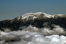 Mt. San Antonio above the clouds, Sep 2007
References
- ^ a b "Mount San Antonio". Peakbagger.com. http://www.peakbagger.com/peak.aspx?pid=1338. Retrieved 2009-01-25.
- ^ "California P 2000 Summits". Peaklist. http://www.peaklist.org/USlists/CAP2000.html. Retrieved 2009-08-14.
- ^ a b "Mount San Antonio". Geographic Names Information System, U.S. Geological Survey. http://geonames.usgs.gov/pls/gnispublic/f?p=gnispq:3:::NO::P3_FID:273439. Retrieved 2008-08-30.
- ^ "West Baldy, California". Peakbagger.com. http://www.peakbagger.com/peak.aspx?pid=27784. Retrieved 2009-08-14.
- ^ "San Antonio Falls". Geographic Names Information System, U.S. Geological Survey. http://geonames.usgs.gov/pls/gnispublic/f?p=gnispq:3:::NO::P3_FID:273436. Retrieved 2009-08-14.
- ^ "Official Boundaries of the County of Los Angeles". Los Angeles Almanac. http://www.laalmanac.com/geography/ge20.htm. Retrieved 2008-08-30.
- ^ Munro, Pamela; Nellie Brown, and Judith G. Crawford (1992). "A Mojave dictionary". UCLA occasional papers in linguistics (Los Angeles: University of California, Los Angeles) no. 10. OCLC 28561333.
- ^ Garner, C. L., Captain (retired) (April 1949). "A Geodetic Measurement of Unusually High Accuracy". U. S. Coast and Geodetic Survey Journal (Coast and Geodetic Survey): 68–74. http://www.pvaa.us/nightwatch/GeodeticMeasurementOfUnusuallyHighAccuracy.pdf. Retrieved 2009-08-13.
- ^ "Mt Baldy School". Mt Baldy School District. http://www.mtbaldy.k12.ca.us/. Retrieved 2009-08-14.
- ^ "Scenic Chair Rides". http://www.mtbaldy.com/mtbaldy/002/index.php. Retrieved 2010-10-04.
- ^ "Mount Baldy Run to the Top". http://www.run2top.com/info.lasso.
Categories:- San Gabriel Mountains
- Angeles National Forest
- Landmarks in Los Angeles, California
- Mountains of San Bernardino County, California
- Mountains of Los Angeles County, California


Wikimedia Foundation. 2010.