- San Antonio
-
This article is about the U.S. city. For other uses, see San Antonio (disambiguation).
City of San Antonio — City — 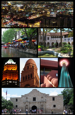

Flag
SealNickname(s): River City, San Antone,
Alamo City, Countdown CityLocation in the state of Texas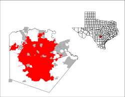 Location in the United States
 City of San Antonio
Coordinates: 29°25′N 98°30′W / 29.417°N 98.5°W Country United States State Texas County Bexar, Medina Government - Type Council-Manager - City Council Mayor Julian Castro[1]
Diego M. Bernal
Ivy R. Taylor
Jennifer V. Ramos
Rey Saldaña
David Medina, Jr.
Ray Lopez
Cris Medina
W. Reed Williams
Elisa Chan
Carlton Soules- City Manager Sheryl Sculley Area - City 412.1 sq mi (1,067.3 km2) - Land 407.6 sq mi (1,055.7 km2) - Water 4.5 sq mi (11.7 km2) Elevation 650 ft (198 m) Population (2010) - City 1,327,408 (7th) - Density 3,400.9/sq mi (1,313.1/km2) - Metro 2,142,508 (25th) - Demonym San Antonian Time zone Central (UTC-6) - Summer (DST) Central (UTC-5) Area code(s) 210(majority), 830(portions) Website www.sanantonio.gov San Antonio (
 /ˌsænænˈtoʊni.oʊ/) is the seventh-largest city in the United States of America and the second-largest city within the state of Texas, with a population of 1.33 million.[2] Located in the American Southwest and the south–central part of Texas, the city serves as the seat of Bexar County. In 2011, it was estimated to be the 24th largest metropolitan area in the U.S. with a population of 2.2 million according to U.S. Census Bureau figures tabulated by Business First. San Antonio has characteristics of other western urban centers in which there are sparsely populated areas and a low density rate outside of the city. It was the fourth-fastest growing large city in the nation from 2000 to 2006[3] and the fifth-fastest-growing from 2007 to 2008.[4] The San Antonio–New Braunfels metropolitan area has a population of over 2.14 million based on the 2010 U.S. Census, making it the 25th-largest metropolitan area in the United States and third-largest in Texas.
The city was named for San Antonio de Padua, whose feast day is on June 13, when a Spanish expedition stopped in the area in 1691. Famous for Spanish missions, the Alamo, the River Walk, the Tower of the Americas, the Alamo Bowl, Marriage Island and host to SeaWorld and Six Flags Fiesta Texas theme parks, the city is visited by approximately 26 million tourists per year according to the San Antonio Convention and Visitors Bureau. The city is home to the four-time NBA champion San Antonio Spurs and the annual San Antonio Stock Show & Rodeo, one of the largest in the country.
San Antonio has a strong military presence—it is home to Fort Sam Houston, Lackland Air Force Base, Randolph Air Force Base, and Brooks City-Base, with Camp Bullis and Camp Stanley outside the city. Kelly Air Force Base operated out of San Antonio until 2001, when the airfield was transferred over to Lackland AFB and the remaining portions of the base became Port San Antonio, an industrial/business park. San Antonio is home to five Fortune 500 companies and the South Texas Medical Center, the only medical research and care provider in the South Texas region.
Contents
History
Main article: History of San Antonio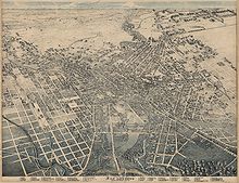 Lithograph of San Antonio in 1886.
Native Americans originally lived near the San Antonio River Valley, in the San Pedro Springs area, calling the vicinity "Yanaguana," meaning "refreshing waters." In 1691, a group of Spanish explorers and missionaries came upon the river and Native American settlement on June 13, the feast day of St. Anthony of Padua, Italy and named the place and river "San Antonio" in his honor.[5]
Early Spanish settlement of San Antonio began with the Martin de Alarcon expedition and the establishment of the San Antonio de Valero Mission (now the Alamo) as a means to reassert Spanish dominance over Texas from the nearby French in Louisiana. The viceroy, at the instigation of Father Antonio de San Buenaventura y Olivares, made the suppression of illicit trade from Louisiana a primary objective. He also pledged support for the Franciscan missions in Texas. Father Olivares had earlier visited a site on the San Antonio River in 1709, and from that time forward he was determined to found a mission and civilian settlement there. The viceroy gave formal approval for a halfway mission and presidio in late 1716, and assigned responsibility for their establishment to Martin de Alarcón, the governor of Coahuila and Texas. A series of delays, however, occasioned in part by differences between Alarcón and Olivares, postponed definitive action until 1718.[6] The families clustered around the presidio and mission formed the beginnings of Villa de Béxar, destined to become the most important town in Spanish Texas.[7] On May 1, on the San Antonio River, the governor founded Mission San Antonio de Valero (later famous as the Alamo), and on May 5 established Presidio San Antonio de Béxar. Presidio defending walls or breastworks would never be completed or necessary, as the mission itself would later become the principal unit of walled defense. San Antonio de Béxar Presidio, the center of Spanish defense in western Texas, was founded by Martín de Alarcón on May 5, 1718, on the west side of the San Antonio River one-fourth league from the San Antonio de Valero Mission.[6]
On February 14, 1719, the Marquis of San Miguel de Aguayo made a report to the king of Spain proposing that 400 families be transported from the Canary Islands, Galicia, or Havana to populate the province of Texas. His plan was approved, and notice was given the Canary Islanders (isleños) to furnish 200 families; the Council of the Indies suggested that 400 families should be sent from the Canaries to Texas by way of Havana and Veracruz. By June 1730, twenty-five families had reached Cuba and ten families had been sent on to Veracruz before orders from Spain to stop the movement arrived. Under the leadership of Juan Leal Goraz, the group marched overland to the presidio of San Antonio de Béjar (then spelled as "Bexar," a homonym city in Spain), where they arrived on March 9, 1731. The party had increased by marriages on the way to fifteen families, a total of fifty-six persons. They joined a military community that had been in existence since 1718. The immigrants formed the nucleus of the villa of San Fernando de Béxar, the first regularly organized civil government in Texas. Several of the old families of San Antonio trace their descent from the Canary Island colonists. María Rosa Padrón was the first baby born of Canary Islander descent in San Antonio.[8]
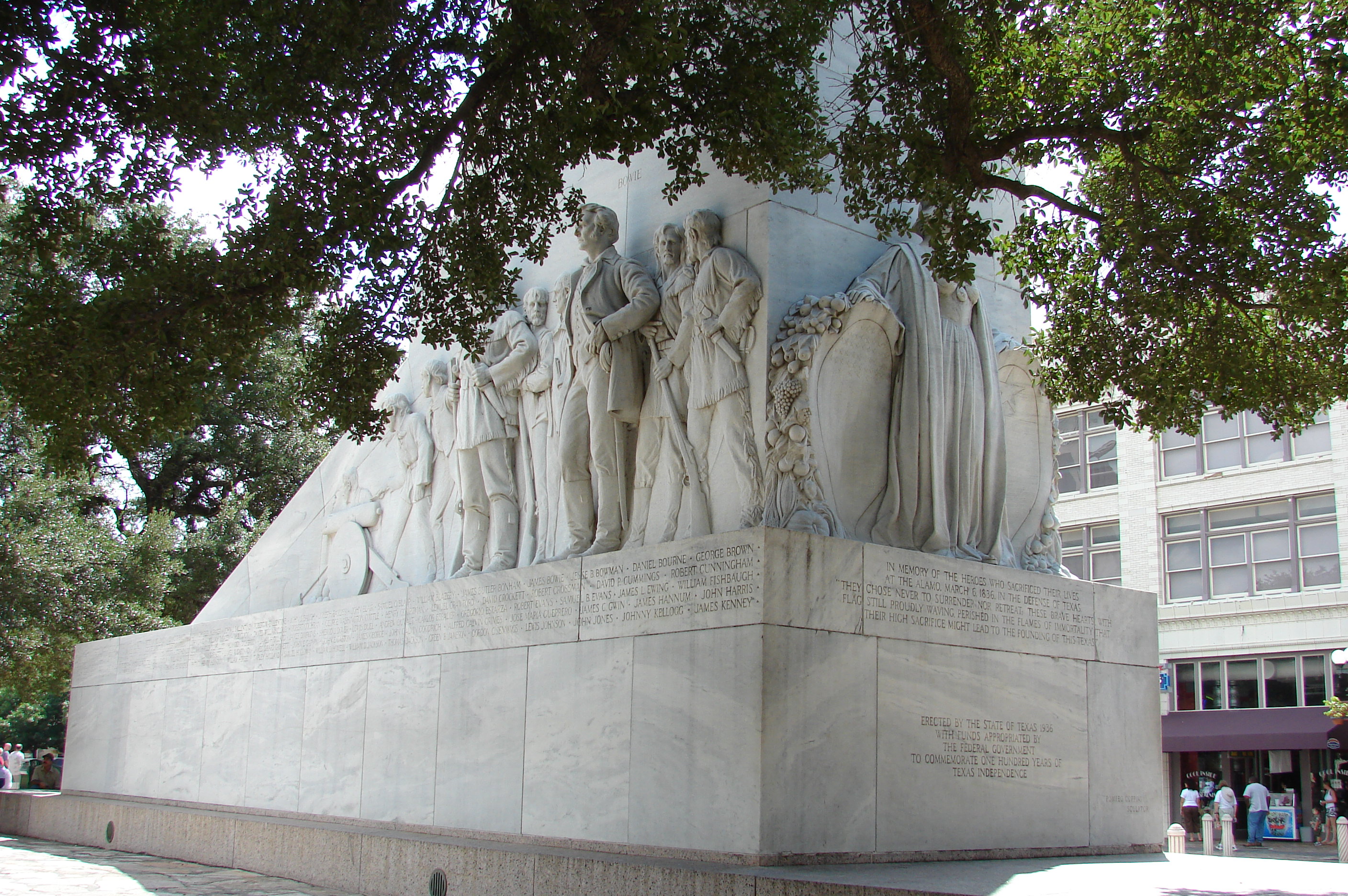
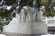 Memorial to the Alamo defenders
San Antonio grew to become the largest Spanish settlement in Texas, and for most of its history, the capital of the Spanish, later Mexican, province of Tejas. From San Antonio the Camino Real, today Nacogdoches Road in San Antonio, ran to the American border at the small frontier town of Nacogdoches. When Antonio López de Santa Anna unilaterally rescinded the Mexican Constitution of 1824 violence ensued in many states of Mexico. In a series of battles the Texian Army succeeded in forcing Mexican soldiers out of the settlement areas east of San Antonio. Under the leadership of Ben Milam, in the Battle of Bexar, December, 1835, Texian forces captured San Antonio from forces commanded by General Martin Perfecto de Cos, Santa Anna's brother in law. In the spring of 1836 Santa Anna marched on San Antonio. A volunteer force under the command of James C. Neill occupied and fortified the deserted mission. Upon his departure, the joint command of William Barrett Travis and James Bowie were left in charge of defending the old mission. The Battle of the Alamo took place from February 23 to March 6, 1836. The outnumbered Texian force was ultimately defeated, with all of the Alamo defenders killed. These men were seen as "martyrs" for the cause of Texas freedom and "Remember the Alamo" became a rallying cry in the Texian Army's eventual success at defeating Santa Anna's army.[9]
Juan Seguín, who organized the company of Hispanic patriots, that fought and died for Texas independence at the Battle of the Alamo, fought at the Battle of Concepcion, Siege of Bexar, and the Battle of San Jacinto, and served as mayor of San Antonio. He was forced out of that office, due to threats on his life, by sectarian newcomers and political opponents in 1842, becoming the last Hispanic mayor for nearly 150 years.[10]
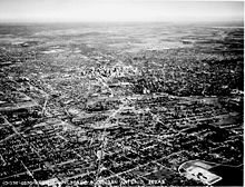 Aerial view of the city, San Antonio, December 4, 1939
In 1845, the United States finally decided to annex Texas and include it as a state in the Union. This led to the Mexican-American War.[dubious ] Though the U.S. ultimately won, the war was devastating to San Antonio, and, at its end, the population of the city had been reduced by almost two thirds, to only 800 inhabitants.[11] By 1860, at the start of the Civil War, San Antonio had grown to a city of 15,000 people.
Following the Civil War, San Antonio prospered as a center of the cattle industry. During this period, San Antonio remained a frontier city, but its mixture of cultures also gave it a reputation as being beautiful and exotic. Frederick Law Olmstead, the architect who designed Central Park in New York City, once described San Antonio as having a, "jumble of races, costumes, languages, and buildings," which gave it a quality which only New Orleans could rival in, "odd and antiquated foreignness."[12]
In 1877, the first railroad reached San Antonio and the city was no longer on the frontier but began to enter the mainstream of American society. At the beginning of the 20th century, the streets of downtown were widened to accommodate street cars and modern traffic, destroying many historic buildings in the process.[13]
Like many municipalities in the American Southwest, San Antonio experiences steady population growth. The city's population has nearly doubled in 35 years, from just over 650,000 in the 1970 census to an estimated 1.2 million in 2005 through both steady population growth and land annexation (considerably enlarging the physical area of the city).[citation needed]
Geography
San Antonio Climate chart (explanation) J F M A M J J A S O N D 1.762391.867421.974502.680574.786664.39172295742.69574390693.982592.6714926441Average max. and min. temperatures in °F Precipitation totals in inches Source: NOAA Metric conversion J F M A M J J A S O N D 4217444206482410662714120301910933225235236535237632209828156622950185Average max. and min. temperatures in °C Precipitation totals in mm San Antonio is located near 29.5°N 98.5°W about 80 miles southwest of Austin. According to the United States Census Bureau, in 2000 the city had a total area of 412.07 square miles (1,067.3 km2)—407.56 square miles (1,055.6 km2) (98.9%) of land and 4.51 square miles (11.7 km2) (1.1%) of water. The city sits on the Balcones Escarpment.The altitude of San Antonio is 772 feet (235 m) above sea level.
The primary source of drinking water for the city is the Edwards Aquifer. Impounded in 1962 and 1969, respectively, Victor Braunig Lake and Calaveras Lake were among the first reservoirs in the country built to use recycled treated wastewater for power plant cooling, reducing the amount of groundwater needed for electrical generation.
Neighborhoods
Further information: Neighborhoods of San AntonioFurther information: Downtown San AntonioClimate
San Antonio lies near the western edge of the humid subtropical climate zone. Its weather is alternately dry or humid depending on prevailing winds, turning hot in the summer, warm to cool winters subject to descending northern cold fronts in the winter with cool to cold nights, and comfortably warm and rainy in the spring and fall. San Antonio receives about a dozen sub-freezing nights each year, occasionally (about once every couple of winters) seeing some sort of wintry precipitation (i.e. sleet/freezing rain), but accumulation and snow itself is not very common. Many winters may pass without any freezing precipitation at all. According to the National Weather Service, there have been 31 instances of snowfall (a trace or more) in the city in the past 122 years, for an average of about once every four years. However a decade or more may pass between snowfalls.[14] In San Antonio, July and August tie for the average warmest months with an average high of 95 degrees Fahrenheit (35 °C). The highest temperature ever to be recorded was 111 °F (44 °C) on September 5, 2000.[14] The average coolest month is January. The lowest recorded temperature ever was 0 °F (−18 °C) on January 31, 1949.[14] May, June, and October have quite a bit of precipitation. For the last 135 years, the average annual precipitation has been 29.05 inches (738 mm), with a maximum of 52.28 inches (1,328 mm) and a minimum of 10.11 inches (256.8 mm) in one year.[15]
Climate data for San Antonio Month Jan Feb Mar Apr May Jun Jul Aug Sep Oct Nov Dec Year Record high °F (°C) 89
(32)100
(38)100
(38)101
(38)103
(39)107
(42)106
(41)108
(42)111
(44)99
(37)94
(34)90
(32)111
(44)Average high °F (°C) 62.1
(16.7)67.1
(19.5)74.3
(23.5)80.4
(26.9)86.0
(30.0)91.4
(33.0)94.6
(34.8)94.7
(34.8)90.0
(32.2)82.0
(27.8)71.4
(21.9)64.0
(17.8)79.8 Average low °F (°C) 38.6
(3.7)42.4
(5.8)49.9
(9.9)56.9
(13.8)65.5
(18.6)71.6
(22.0)74.0
(23.3)73.6
(23.1)68.8
(20.4)59.4
(15.2)48.6
(9.2)40.8
(4.9)57.5 Record low °F (°C) 0
(−17.8)4
(−15.6)19
(−7.2)31
(−0.6)43
(6)48
(9)60
(16)57
(14)46
(8)27
(−2.8)21
(−6.1)6
(−14.4)0
(−17.8)Precipitation inches (mm) 1.66
(42.2)1.75
(44.5)1.89
(48)2.60
(66)4.72
(119.9)4.30
(109.2)2.03
(51.6)2.57
(65.3)3.00
(76.2)3.86
(98)2.58
(65.5)1.96
(49.8)32.92
(836.2)Avg. precipitation days (≥ 0.01 in) 7.6 6.8 7.9 7.3 9.2 7.7 4.6 5.2 6.5 6.9 7.3 7.8 84.8 Sunshine hours 158.1 172.3 217.0 210.0 223.2 276.0 310.0 294.5 234.0 217.0 171.0 148.8 2,631.9 Source: NOAA (normals, 1971-2000) [16], The Weather Channel (records) [17], HKO (sun, 1961-1990) [18] Culture
Further information: Culture of San AntonioDemographics
Historical populations Census Pop. %± 1850 3,488 — 1860 8,235 136.1% 1870 12,256 48.8% 1880 20,550 67.7% 1890 37,673 83.3% 1900 53,321 41.5% 1910 96,614 81.2% 1920 161,379 67.0% 1930 231,542 43.5% 1940 253,854 9.6% 1950 408,442 60.9% 1960 587,718 43.9% 1970 654,153 11.3% 1980 785,940 20.1% 1990 935,933 19.1% 2000 1,144,646 22.3% 2010 1,327,407 16.0% historical data sources:[19] At the 2010 Census, there were 1,327,407 people residing in San Antonio, an increase of 16.0% since 2000.
According to the 2010 Census, 26.6% of the population was non-Hispanic White, 6.3% non-Hispanic Black or African American, 0.2% non-Hispanic American Indian and Alaska Native, 2.3% non-Hispanic Asian, 0.1% non-Hispanic Native Hawaiian and Other Pacific Islander, 0.2% from some other race (non-Hispanic) and 1.2% from two or more races (non-Hispanic). 63.2% of San Antonio's population was of Hispanic, Latino, or Spanish origin (they may be of any race).
According to the 2000 U.S. Census, the city had a population of 1,144,646,[20] ranking it the ninth-most populated city in the country. Due to San Antonio's low density rate and lack of significant population surrounding the city limits, the metropolitan area ranked just 30th in the U.S. with a population of 1,592,383.[21]
Subsequent population counts, however, indicate continued growth in the area. The 2010 U.S. Census showed the city's population at 1,327,407,[22] making it the second-most populous city and the third-most populous metro area in Texas, as well as the seventh-most populous city in the U.S. The 2010 U.S. Census count for the eight-county San Antonio–New Braunfels metropolitan area placed its population at 2,142,508[23] making it the third-most populous metro area in Texas and the 25th-most populous metro area in the U.S. The metropolitan area is bordered to the northeast by Austin–Round Rock–San Marcos, and the two metropolitan areas together combine to form a region of about 3.9 million people.
There are 405,474 households, and 280,993 families residing in San Antonio. The population density is 2,808.5 people per square mile (1,084.4 km2). There are 433,122 housing units at an average density of 1,062.7 per square mile (410.3 km2).
The age of the city's population is spread out with 28.5% under the age of 18, 10.8% from 18 to 24, 30.8% from 25 to 44, 19.4% from 45 to 64, and 10.4% who are 65 years of age or older. The median age is 32 years. In San Antonio, 48% of the population are males, and 52% of the population are females. For every 100 females there are 93.5 males. For every 100 females age 18 and over, there are 89.7 males.
The median income for a household in the city is $36,214, and the median income for a family is $53,100. Males have a median income of $30,061 versus $24,444 for females. The per capita income for the city is $17,487. 17.3% of the population and 14.0% of families are below the poverty line. Out of the total population, 24.3% of those under the age of 18 and 13.5% of those 65 and older are living below the poverty line.
According to the 2006–2008 American Community Survey, the racial composition of San Antonio was as follows:
- White: 68.9% (Non-Hispanic Whites: 28.9%)
- Black or African American: 6.6%
- American Indian: 0.6%
- Asian: 2.0%
- Native Hawaiian and Other Pacific Islander: 0.1%
- Some other race: 19.4%
- Two or more races: 2.4%
- Hispanic or Latino (of any race): 61.2%
Source:[24]
Economy
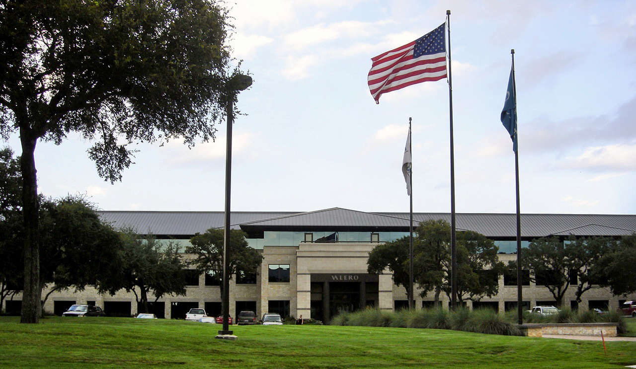
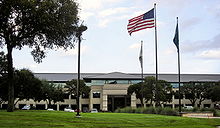 Headquarters of Valero Energy Corporation
San Antonio has a diversified economy with four primary focuses: financial services, government, health care, and tourism. Located northwest of the city center is the South Texas Medical Center, which is a conglomerate of various hospitals, clinics, and research (see Southwest Research Institute) and higher educational institutions.
The city is also home to one of the largest military concentrations in the United States. The defense industry in San Antonio employs over 89,000 and provides a $5.25 billion impact to the city's economy.[25]
Twenty million tourists visit the city and its attractions every year, contributing substantially to the city's economy.[26] The Henry B. Gonzalez Convention Center alone hosts more than 300 events each year with over 750,000 convention delegates from around the world. Tourism employs 94,000 citizens and makes an economic impact of over $10.7 billion in the local economy as revealed in the Economic Impact Study conducted every two years by the San Antonio Tourism Council and the research team of Dr. Richard Butler and Dr. Mary Stefl of Trinity University. Tourism also brings new annual revenues to the City of San Antonio and other governmental entities with the hotel & motel tax, sales taxes and other revenues from hospitality agreements and contracts. This number exceeded over $160 million in the 2004 study.
Of the 140 Fortune Global 500 companies headquartered in the US, San Antonio is home to two: Valero Energy Corp #33, and Tesoro Petroleum Corp #317.
San Antonio is home to five Fortune 500 companies: Valero Energy Corp, Tesoro, USAA, Clear Channel Communications and NuStar Energy.[27] H-E-B, the 19th largest private company in the United States[28] is also headquartered in San Antonio. Other companies headquartered in San Antonio are: Kinetic Concepts, Frost National Bank, Harte-Hanks, Eye Care Centers of America, Bill Miller Bar-B-Q Enterprises, Taco Cabana, Whataburger, and Rackspace.
Other large companies that operate regional headquarters in the city include: Nationwide Mutual Insurance Company, Kohl's, Allstate, Chase Bank, Philips, Wells Fargo, Toyota, Medtronic, Sysco, Caterpillar Inc., AT&T, West Corporation, Citigroup, Boeing, QVC, and Lockheed Martin.
In between the beginning of 1997 and March 11, 1998, San Antonio lost several major company headquarters. In 1997 Titan Holdings and USLD Communications had sold their operations to larger companies. After a Los Angeles buyout specialist purchased Builders Square, the company's operations were moved out of San Antonio.[29]
Attractions
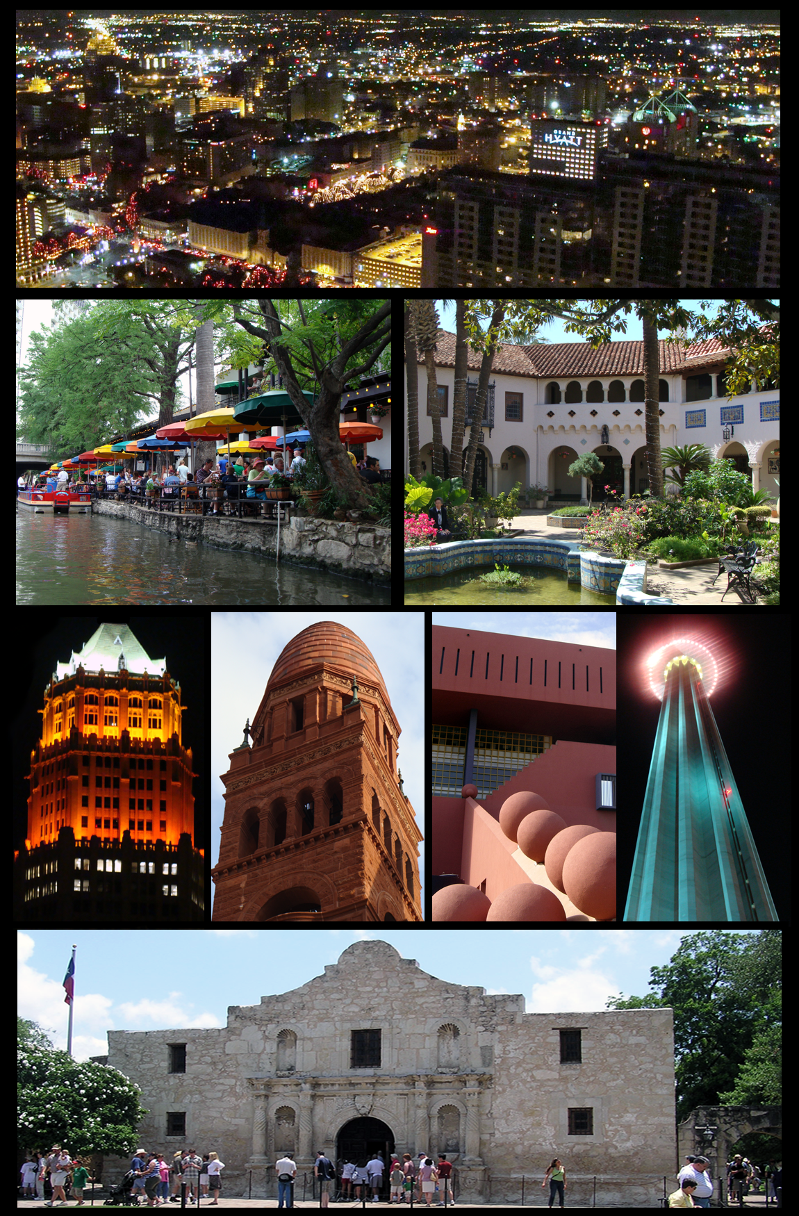
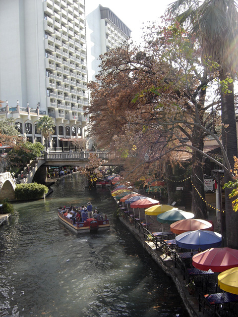
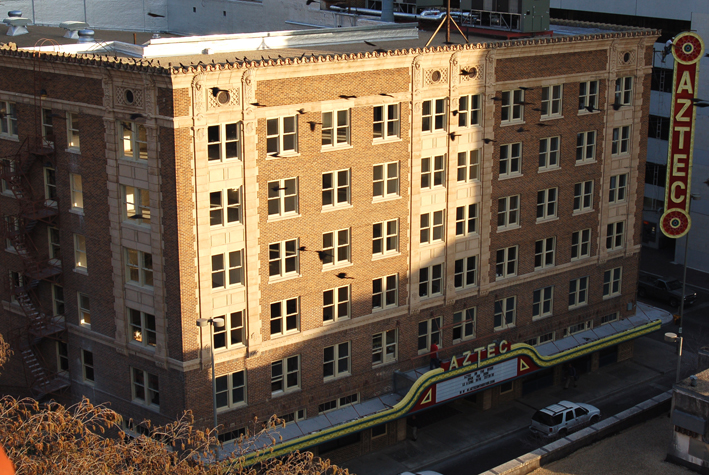
San Antonio is a popular tourist destination. The jewel of the city is the River Walk, which meanders through the downtown area. Lined with numerous shops, bars, and restaurants, as well as the Arneson River Theater, this attraction is transformed into an impressive festival of lights during the Christmas and New Year holiday period, and is suffused with the local sounds of folklorico and flamenco music during the summer, particularly during celebrations such as the Fiesta Noche del Rio. Also based along the River Walk is the newly restored Aztec On The River, the only surviving exotic-themed movie palace in Texas.
The Alamo, located nearby, is Texas' top tourist attraction, while the River Walk is the second most visited attraction. SeaWorld, located 16 miles (26 km) west of downtown, is the number 3 attraction. Also, there is the very popular Six Flags Fiesta Texas. Morgan's Wonderland is a theme park for special needs children.
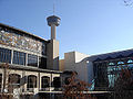
The downtown area also features Cathedral of San Fernando, The Majestic Theatre, HemisFair Park (home of the Tower of the Americas and the Institute of Texan Cultures), La Villita, El Mercado, the Spanish Governor's Palace, and the historic Menger Hotel. On the northern side of the Alamo complex, beside the Emily Morgan Hotel, is the San Antonio Cavalry Museum, which features cavalry artifacts and exhibits and is frequented by local re-enactors.
The Fairmount Hotel, built in 1906 and San Antonio's second oldest hotel, is in the Guinness World Records as one of the heaviest buildings ever moved intact. It was placed in its new location, three blocks south of the Alamo, over four days in 1985, and cost $650,000 to move.
-

The Alamo, San Antonio's most famous attraction
-
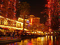
The River Walk around Christmastime
-
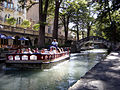
San Antonio's historic River Walk extends some 2½ miles, attracting several million visitors every year.
-

Another view of the city's downtown area
-

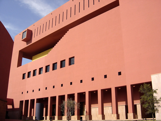
Central Library of The San Antonio Public Library
-
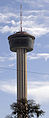
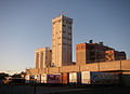
The Tower of the Americas characterizes the city's skyline
-

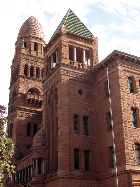
The historic Bexar County Courthouse
-
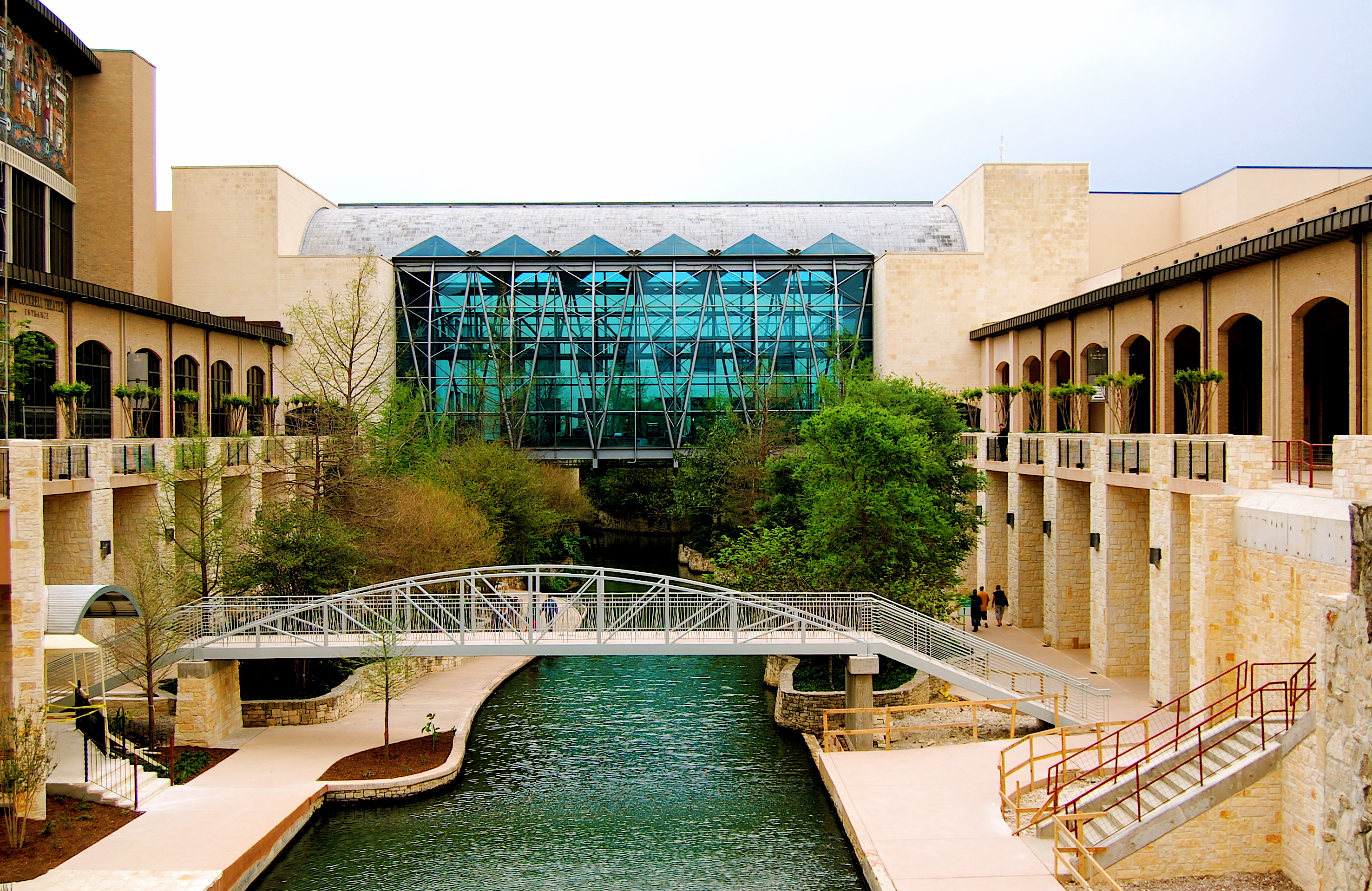
The San Antonio Convention Center
-
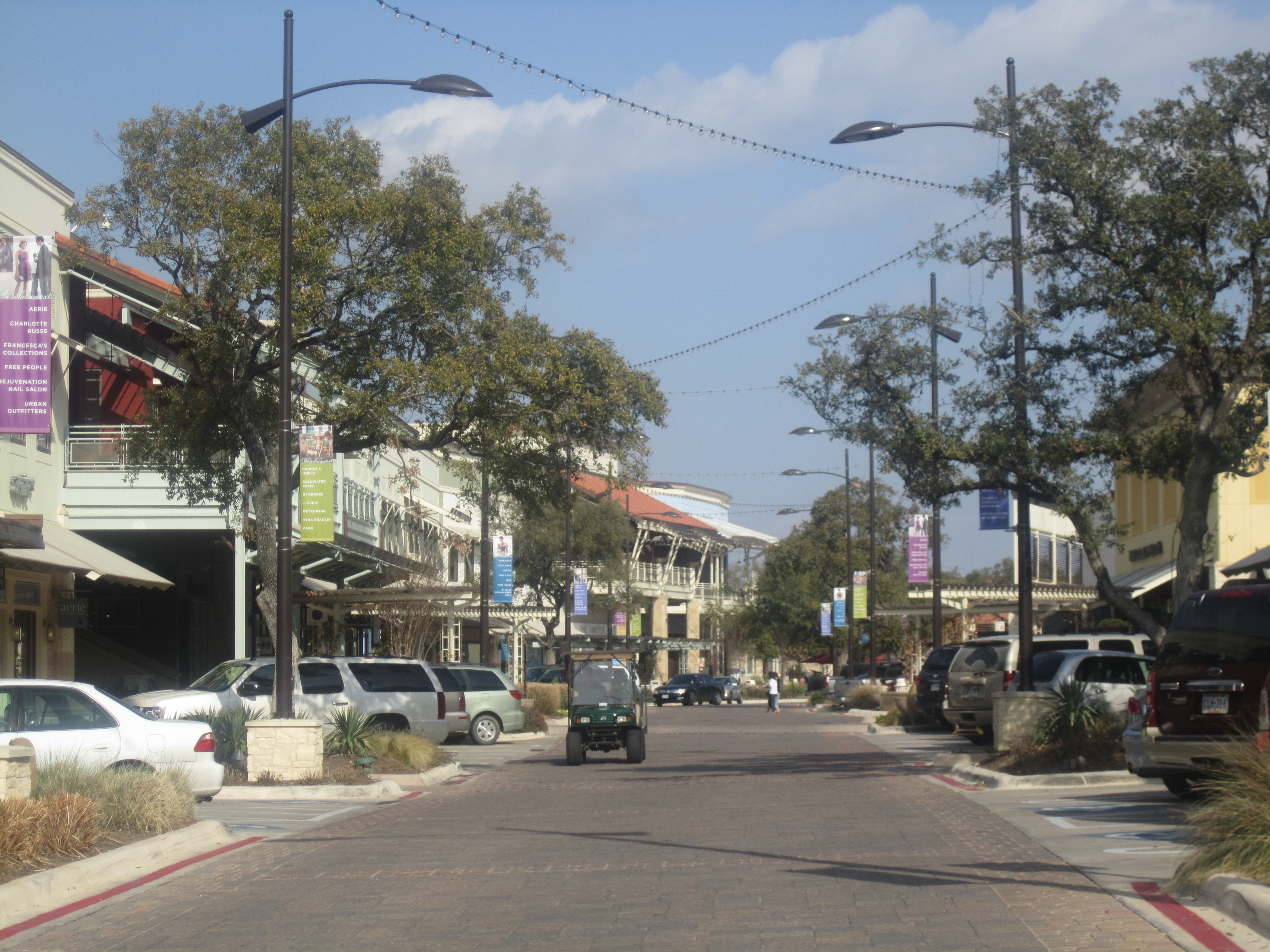
The Shops at La Cantera is a non-enclosed shopping mall located near the University of Texas at San Antonio in the northwestern portion of the city.
-

Aztec On The River Theater
-

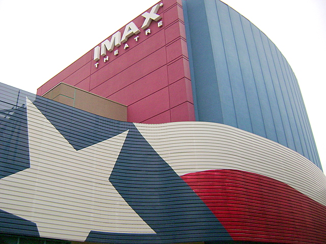
IMAX Theater
-
C.H. Guenther and Sons flour mill and grain elevator
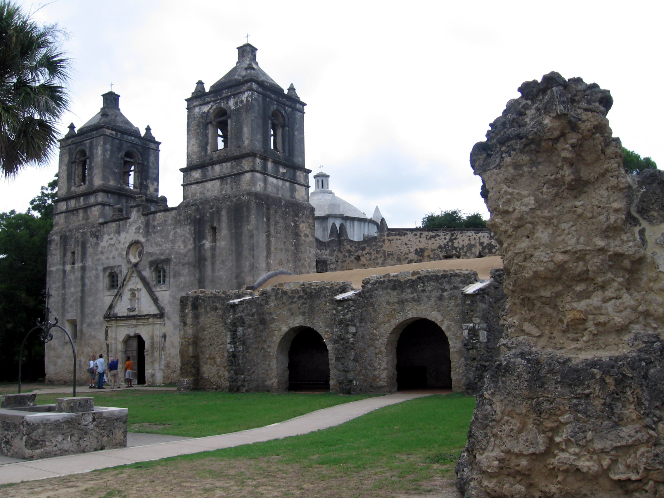
San Antonio is home to the first museum of modern art in Texas, the McNay Art Museum. Other places of interest include The Woodlawn Theatre, the San Antonio Zoo, the Japanese Tea Gardens, Kumamoto, Brackenridge Park, the missions of the San Antonio Missions National Historical Park, the Museo Alameda, the San Antonio Museum of Art, the Witte Museum, the Texas Rangers Museum, the Buckhorm Museum, ArtPace, Blue Star Contemporary Art Center, SeaWorld San Antonio, Six Flags Fiesta Texas, the Texas Transportation Museum, and Splashtown San Antonio. Visitors can also experience something of the cowboy culture year round, they can see the 40-foot (12 m) tall cowboy boots at North Star Mall.
Beyond taking in the sights and sounds of San Antonio, tourists can sample some of its world famous Tex-Mex cuisine at the many fine restaurants located throughout the city. Mexican restaurants are abundant in virtually all parts of town, and most are relatively inexpensive. Some outstanding examples of Tex-Mex eateries include Jacala, on West Avenue on the near Northwest side, La Hacienda de Los Barrios, on the North East side, Tommy's on Nogalitos at I-35 near downtown, and Los Barrios, on the near North side of town.
Sports
Main article: Sports in San Antonio, TexasSport League Club Founded Venue League championships Championship years Basketball NBA San Antonio Spurs 1967 AT&T Center 4 1999, 2002–03, 2004–05, 2006–07 Basketball WNBA San Antonio Silver Stars 1997 AT&T Center 0 N/A Hockey AHL San Antonio Rampage 2002 AT&T Center 0 N/A Baseball TL San Antonio Missions 1968 Nelson W. Wolff Municipal Stadium 12 1897, 1903, 1908, 1933, 1950, 1961, 1964, 1997, 2002, 2003, 2007, 2011 Soccer NASL San Antonio Scorpions 2010 Heroes Stadium 0 N/A Arena Football AFL San Antonio Talons 2000 Alamodome 2 2003, 2007 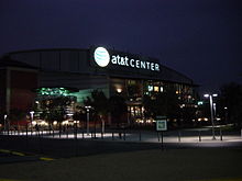 The AT&T Center
The city's only top-level professional sports team, and consequently the team most San Antonians follow, is the San Antonio Spurs of the National Basketball Association. Previously, the Spurs played at the Alamodome, which was built for football, and before that the HemisFair Arena, but the Spurs built—with public money—and moved into the SBC Center in 2002, since renamed the AT&T Center.
The AT&T Center is also home to the San Antonio Rampage of the American Hockey League and the San Antonio Silver Stars of the WNBA, both owned by the Spurs Organization. San Antonio is home to the Double-A Minor League affiliate of the San Diego Padres, the San Antonio Missions who play at Nelson Wolff Stadium on the west side of the city. (San Antonio is the largest city in the country with neither a Major League nor AAA baseball team.) San Antonio hosts the NCAA football Alamo Bowl each December.
San Antonio has two rugby union teams, the Alamo City Rugby Football Club, and San Antonio Rugby Football Club.
The city is also home to St. Mary's University and the University of Texas San Antonio who field the only two collegiate Mens Rugby teams in the city. Both schools compete in Division III Texas Rugby Union, both schools are city and division rivals.
The University of Texas at San Antonio fields San Antonio's only NCAA Division I athletic teams known as the UTSA Roadrunners. The University recently added football, hiring former University of Miami coach Larry Coker as its initial head coach. Roadrunner football will begin play in 2011.
The city is also home of the U.S. Army All-American Bowl,[30] played annually in the Alamodome and televised live on NBC. The Bowl is an East versus West showdown featuring the nation's top 90 high school senior football players. The game has featured NFL stars Reggie Bush, Vince Young, Adrian Peterson, and many other college and NFL stars.
City officials are said to be attempting to lure the National Football League permanently to San Antonio and have also said that a strong showing at the Alamodome for the three local Saints games was vital to showing that San Antonio can support an NFL franchise. NFL Commissioner Paul Tagliabue stated San Antonio was successful in hosting the team, and that the city would be on the short list for any future NFL expansions. The city has also hosted the Dallas Cowboys and Houston Oilers preseason camps in the past, and they have signed a contract with the Cowboys in which the Cowboys will practice in San Antonio through 2011.[31] Cowboys owner Jerry Jones has acknowledged his support for the city's efforts to become home to an NFL franchise.[32] Although it is the second largest city in the United States without an NFL team (after Los Angeles), San Antonio's smaller metropolitan population has so far contributed to its lack of landing an NFL, MLB, or NHL team.
The city got its first professional soccer team, the San Antonio Scorpions of the North American Soccer League, in 2010. They are expected to begin playing in 2012 initially in Heroes Stadium pending the completion of a soccer-specific facility in the STAR Soccer Complex.
San Antonio will be getting a National Premier Soccer League expansion team in 2010.[33]
Government
Further information: List of mayors of San AntonioThe City of San Antonio runs under a Council-Manager form of government. The city is divided into 10 council districts designed to ensure equal population distribution between all districts. Each district elects one person to sit on the City Council with the mayor elected on a city-wide basis. All members of the City Council, which includes the mayor, are elected to two-year terms and are limited to four terms in total (except for those who were in office in November, 2008 and are limited to a total of two terms). Houston and Laredo have similar term limits to those in San Antonio. All positions are elected on non-partisan ballots as required by Texas law. Council members are paid $20 per meeting, while the Mayor earns $4,000 a year. Most council members maintain full-time employment in addition to their positions on the council.[34] The current mayor is Julian Castro.
The council hires the City Manager to handle day to day operations. The council effectively functions as the city's legislative body with the City Manager acting as its Chief Executive, responsible for the management of day to day operations and execution of council legislation. The current City Manager is Sheryl Sculley.
The city operates its own electric and gas utility service, CPS Energy.
The city stretches into several national congressional districts and is represented in Congress by the following:[35]
- Senate
- Kay Bailey Hutchison (R)
- John Cornyn (R)
- House of Representatives
- Texas District 20: Charlie Gonzalez (D)
- Texas District 21: Lamar Smith (R)
- Texas District 23: Quico Canseco (R)
- Texas District 28: Henry Cuellar (D)
- State Governor
- Rick Perry (R)
Growth policy
Unlike most large cities in the U.S., San Antonio is not completely surrounded by independent suburban cities, and under Texas law[36] it exercises extraterritorial jurisdiction (ETJ) over much of the surrounding unincorporated land,[37] including planning major thoroughfares and enforcing rules for platting and subdivision. It pursues an aggressive annexation policy and opposes the creation of other municipalities within its ETJ.[38] Nearly three-fourths of its current land area has been annexed since 1960.[39] In the 2000s the city has annexed several long narrow corridors along major thoroughfares in outlying areas to facilitate eventual annexation of growth developing along the routes. The city planned to annex nearly forty additional square miles by 2009.[40] In May 2010, the San Antonio agreed to release thousands of acres of land in its extraterritorial jurisdiction along Interstate 10 to Schertz. The agreement releases a total of 3,486 acres (14.11 km2) of San Antonio's ETJ lands north of I-10 to Schertz. The ETJ lands are in an area bordered by FM 1518 to the west, Lower Seguin Road to the north, Cibolo Creek to the east and I-10 to the south. [41]
Involuntary annexation is a controversial issue in those parts of unincorporated Bexar County affected by it. Residents, attracted to the outlying areas by lower taxes and affordable real estate values, often see annexation as a mechanism to increase property tax rates (primarily driven by school district taxes) without a corresponding improvement in services such as police and fire protection, while the city regards its annexation policy as essential to its overall prosperity.[42]
State and federal representation
The Texas Department of Criminal Justice (TDCJ) operates the Parole Division Region IV headquarters in the San Antonio Metro Parole Complex. San Antonio district parole offices I and III are in the parole complex, while office II is in another location.[43]
The Texas Department of Transportation operates the San Antonio District Office in San Antonio.[44]
The United States Postal Service operates the San Antonio Main Post Office.[45] Other post offices are located throughout San Antonio.
Education
Main article: Education in San AntonioSan Antonio hosts over 100,000 students across its 31 higher-education facilities which include The University of Texas Health Science Center at San Antonio, the University of Texas at San Antonio, Texas A&M University–San Antonio, and the Alamo Community College District. Some of the private schools include Baptist University of the Américas, St. Mary's University, Our Lady of the Lake University, University of the Incarnate Word, Trinity University, and Wayland Baptist University. The San Antonio Public Library serves all of these institutions along with the 17 school districts within San Antonio.
The city is also home to more than 30 private schools and charter schools. These schools include: Central Catholic Marianist High School, Incarnate Word High School, Saint Mary's Hall, The Atonement Academy, Antonian College Preparatory High School, San Antonio Academy, Holy Cross High School, Providence High School, The Carver Academy, Keystone School, TMI — The Episcopal School of Texas, St. Anthony Catholic High School, Lutheran High School of San Antonio, and Harmony Science Academy.
San Antonio is also home to U.S. Air Force Basic Military Training,. The Air Force only has one location for enlisted basic training: the 737th Training Group, at Lackland Air Force Base. All new Air Force recruits go through the same basic training at Lackland. Each year, over 35,000 new recruits go through AFBMT. METC, (Military Education and Training Campus) which is the U.S. Military Medical Training at Fort Sam Houston hosts 30 programs and over 24,000 annual graduates. It is the largest Medical education center in the world.
Transportation
Air
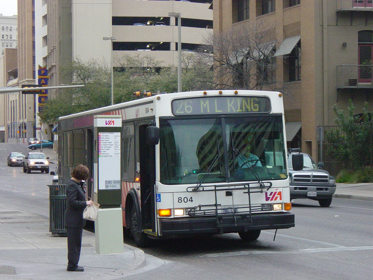
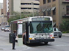 A VIA bus stopped at a downtown intersection
The San Antonio International Airport (SAT) is located in north central San Antonio, approximately eight miles from downtown. It has two terminals and is served by 21 airlines serving 43 destinations including three in Mexico. Stinson Municipal Airport is a reliever airport located six miles (10 km) south of downtown San Antonio’s central business district. The airport has two runways and it is also home to the Texas Air Museum.
Mass transit
A bus and rubber tired streetcar (bus) system is provided by the city's metropolitan transit authority, VIA Metropolitan Transit. VIA's full fare monthly unlimited Big Pass is only $30 per month making VIA the most economically priced large transit authority in the nation. In August 2010, VIA Metropolitan Transit unveiled the next set of buses that are powered by diesel-electric hybrid technology. The 30 hybrid buses are being put into service on VIA’s express routes to serve daily commuters across the city. This set of buses follows the introduction of new vehicles powered by compressed natural gas, which were unveiled in May 2010. In the fall of 2010, VIA will begin taking delivery of three new buses that will be powered by electricity from on-board batteries. These buses will service the downtown core area, and they will be the first revenue vehicles VIA operates that have zero emissions.[46] VIA offers 84 regular bus routes and three downtown streetcar routes. This includes express service from downtown to park and ride locations in the South, West, Northwest, North Central and Northeast areas of the city with service to UTSA, Six Flags Fiesta Texas and SeaWorld. VIA also offers a special service to city events including Spurs games and city parades from its park and ride locations. VIA has among its many routes, one of the longest local transit routes in the nation. Routes 550 (Clockwise) and 551 (Counterclockwise) travels 48 miles (77 km) one way as it loops around the city.[47] San Antonio became the largest city in the U.S. to not have a intra-city rail system when Phoenix, the former city that had this title, got such a system in 2008. VIA is currently in the process of creating a Bus Rapid Transit line known as VIA Primo.[48] A proposed passenger rail line, LSTAR, would link the city to Austin.[49]
Rail
Amtrak, the national passenger rail service, provides service to San Antonio at San Antonio Amtrak Station, operating its Texas Eagle daily between San Antonio and Chicago's Union Station.[50] Amtrak also operates its Sunset Limited three times a week in each direction through San Antonio between Los Angeles and Orlando, Florida (currently truncated to New Orleans due to the effects of Hurricane Katrina).[51] The Texas Eagle section travels between San Antonio and Los Angeles as part of the Sunset Limited. The old Sunset Station is now an entertainment venue owned by VIA and neighbored by the current station and the Alamodome.[52]
Road
San Antonio is served by these major freeways:
- Interstate 10: McDermott Freeway (Northwest) runs west toward El Paso, Phoenix and Los Angeles. Jose Lopez Freeway (East) runs east toward Seguin, Houston, New Orleans and Jacksonville
- Interstate 35: Pan Am Expressway (Northeast/Southwest)—runs south toward Laredo and runs north toward Austin, Dallas–Fort Worth, Oklahoma City, Kansas City and Minneapolis
- Interstate 37: Lucian Adams Freeway (Southeast)—runs from San Antonio through its junction with U.S. Highway 281 south (Edinburg and McAllen) near Three Rivers and into Corpus Christi through its junction with U.S. Highway 77 south (Kingsville, Harlingen and Brownsville) to its southern terminus at Corpus Christi Bay.
- Interstate 410: Connally Loop—simply called Loop 410 (four-ten) by locals is a 53-mile (85 km) inner beltway around the city.
- U.S. 90: Cleto Rodriguez Freeway (West) through Uvalde and Del Rio to its western terminus at I-10 in Van Horn. Prior to I-10 East and US 90 West expressway being built US 90 traveled through the west side via West Commerce St. (westbound) and Buena Vista St. (eastbound) and Old Hwy 90. On the east side it traveled along East Commerce St. to its current alignment which runs concurrent with I-10 East to Seguin.
- U.S. 281: McAllister Freeway (North) to Johnson City and Wichita Falls. Southbound, it runs concurrent with I-37, then I-410 for 4 miles (6 km), then heads south to Pleasanton. Prior to I-37 and McAllister Fwy. being built US 281 traveled through the north side via San Pedro Ave. and the south side via Roosevelt Ave.
- State Highway 151: Stotzer Freeway runs from US Hwy 90 West through Westover Hills which includes SeaWorld to its western terminus at State Loop 1604.
- State Loop 1604: Charles W. Anderson Loop—simply called 1604 (sixteen-oh-four) by locals—is a 96-mile (154 km) outer beltway around San Antonio
Other highways include:
- U.S. 87: Southbound to Victoria along Roland Avenue then Rigsby Avenue. It runs concurrent with I-10 for 52 miles (84 km) where it goes to San Angelo northbound.
- U.S. 181: Starts 0.5 miles (0.8 km) south of I-410/I-37/US 281 interchange and heads toward Corpus Christi via Beeville. Prior to I-37 being built US 181 traveled along Presa St. from downtown to its current alignment.
- State Highway 16: From Freer, it runs concurrent with I-410 for 17 miles (27 km) along southwest San Antonio, over to Bandera Road to Bandera.
- State Loop 345: Fredericksburg Road is the business loop for I-10 West/US-87 North.[53]
- State Loop 368: Broadway and Austin Highway is the business loop for I-35 North.[54]
- State Loop 353: Nogalitos Street and New Laredo Highway is the business loop for I-35 South.[55]
- State Loop 13: Is the city's inner loop on the south side serving Lackland AFB, Port San Antonio, South Park Mall and Brooks CityBase traveling along Military Dr. on the south side and WW White Rd. on the east side to its junction with I-35/I-410. The northern arc of the loop is now I-410.
Bicycle paths
San Antonio has approximately 136 miles (219 km) of bike lanes, routes or off-road paths.[56] Off-road trails travel along the San Antonio River, linear greenways, or city parks. Although largely disconnected, the progress to create a bicycle-friendly environment was recognized when San Antonio was designated a Bronze-Level Bicycle Friendly Community by the League of American Bicyclists.[57]
Bicycle sharing
A bike sharing service was approved by the city council on June 17, 2010.[58] The initial program will consist of 140 bikes at 14 locations supported by a "central hub" and is expected to serve both residents and visitors. San Antonio Bike Share, a non-profit, is being formed to oversee the operation, which will be locally operated and maintained by Bike World. B-Cycle, the same system being used in Denver, will be supplying the bike share system. It started operation March 2011.[59]
Walkability
A 2011 study by Walk Score ranked San Antonio the fortieth most walkable of fifty largest cities in the United States.[60]
Notable natives and residents
Further information: Notables of San Antonio, TexasMedia and entertainment
Print
San Antonio has one major newspaper, the San Antonio Express-News, which has served the area since 1865. Robert Rivard, who currently serves as the paper's executive vice president and editor,[61] was named Managing Editor in 1994 and then Editor in 1997. The Express-News currently circulates as the largest newspaper service in South Texas. The Hearst Corporation, which owned a second newspaper, the San Antonio Light, purchased the Express-News from News Corp. in 1992 and shut down the Light after failing to find a buyer. Hearst, using the Express-News brand, also produces Conexion, a weekly magazine written by an entirely Hispanic staff with a Hispanic spin on weekly events. The San Antonio Current is the free "alternative" paper published weekly with local political issues, art and music news, restaurant listings and reviews, and listings of events and nightlife around town. In addition, the San Antonio Business Journal covers general business news. La Prensa, a bilingual publication, also has a long history in San Antonio. The San Antonio River Walk Current covers general San Antonio news.
Radio
- See also: Broadcast media in San Antonio
FM: 28 AM: 20
About 50 radio stations can be heard in the San Antonio area — 30 of them are actually located in the city. San Antonio is home to Clear Channel Communications, the largest operator of radio stations in the U.S. Its flagship, WOAI AM-1200, is known for its local news operation, considered among the best in the country. The first radio station to broadcast in South Texas was KTSA AM-550 in 1922. Some of KTSA AM-550's better known local talk show hosts include Jack Riccardi, Trey Ware and Ricci Ware.
There are three National Public Radio stations in San Antonio, which belong to Texas Public Radio (www.TPR.org); KSTX 89.1 FM is NPR news/talk, KPAC 88.3 is a 24-hour classical music station, and KTXI 90.1 is a mix of NPR news/talk and classical music broadcast for the West Central Texas Hill County. KSTX also broadcasts "Riverwalk Jazz", featuring Jim Cullum Jazz Band at The Landing, a fixture on the River Walk since 1963. KRTU 91.7 is a non-commercial radio station based out of Trinity University. Unlike other college radio stations throughout the U.S. the station plays jazz 17 hours a day and college rock/indie rock at night. College Alternative station KSYM, 90.1 FM, is owned by the Alamo Community College District and operated by San Antonio College students and like KRTU it plays the Third Coast music network during the day and alternative music at night.
Most Latin stations in the area play regional Mexican, Tejano or contemporary pop. On January 12, 2006, Univision-owned KCOR-FM "La Kalle 95.1" changed its format from Hispanic-Rhythmic Contemporary Hits to Spanish Oldies, then named "Recuerdo 95.1". However, Univision announced on November 10, 2006, that it flipped KLTO Tejano 97.7's format to Reggaeton in an attempt to reintroduce the format to San Antonio again. Then, 97.7 was flipped again to feature a rock format. The station no longer broadcasts anything in English and while still owned by Univision, it now broadcasts music from artists such as Linkin Park. On the other hand, 95.1 was then flipped back to the "La Kalle" format again after being flipped more than a year ago to feature a "95X" format. KLTO was acquired earlier in the year and operated as a simulcast of KXTN Tejano 107.5. San Antonio has quickly diversified in recent years, with the influx of non-Tejano Latinos, mostly from the East Coast, who are serving in the city's various military bases, as well as immigrants from Mexico. Therefore, just like in the rest of the country, radio station conglomerates have been changing formats in San Antonio to reflect shifting demographics.
Television
 WOAI-TV is San Antonio's NBC affiliate
While the city is one of the ten largest in the United States, its television market is only the 37th in the United States, according to marketing research firm ACNielsen.[62] This is primarily due to the relatively low population-density of the outlying areas and the close proximity of Austin, which truncates the potential market area. San Antonio-based TV stations are WOAI channel 4 (NBC), KSAT channel 12 (ABC), KENS channel 5 (CBS), KABB channel 29 (Fox Broadcasting Company), KCWX channel 2 (myNetworkTV), KMYS channel 35 (The CW) and KLRN channel 9 (PBS). The market is also home to six Spanish language stations, three religious stations, three independent stations and one Internet-based station (210 TV). The San Antonio market has 65% cable TV penetration.
Sister cities
 - Monterrey, Mexico (1953)[63]
- - Guadalajara, Mexico (1974)[63]
 - Las Palmas de Gran Canaria, Spain (1975)[63]
 - Kwangju, South Korea (1981)[63]
 - Kaohsiung, Taiwan (1981)[63]
- - Santa Cruz de Tenerife, Spain (1983)[63]
 - Kumamoto, Japan (1987)[63]
 - Chennai, India (2008)[64][63]
Alliance/Friendship cities
 - Wuxi, Jiangsu, China (2010 friendship city)[63][65]
- - Suzhou, Jiangsu, China) (2010 friendship city)[63][66]
 - Dresden, Saxony, Germany (2009 alliance agreement)[63]
 - Tel Aviv, Israel (2011 economic pact)[67]
See also
- Chisholm Trail
- Fiesta San Antonio
- National Register of Historic Places listings in Bexar County, Texas
References
- ^ "GOVERNMENT Links on the San Antonio Community Portal". Sanantonio.gov. http://www.sanantonio.gov/mayor/indexcastro.asp. Retrieved 2010-06-30.
- ^ Mildenberg, David (February 18, 2011). "Population growth in Texas eclipses national rate". The Washington Post. http://www.washingtonpost.com/wp-dyn/content/article/2011/02/17/AR2011021707179.html?nav=hcmoduletmv.
- ^ Christie, Les (June 28, 2007). "The fastest growing U.S. cities - June 28, 2007". CNN. http://money.cnn.com/2007/06/27/real_estate/fastest_growing_cities/. Retrieved May 23, 2010.
- ^ Ayala, Elaine (July 1, 2009). "S. A. Again Census Standout". San Antonio Express News. pp. B1. http://www.mysanantonio.com/news/local_news/SA_again_census_standout.html. Retrieved 2009-07-01.
- ^ "San Antonio: The City of St. Anthony - June 2004 Issue of St. Anthony Messenger Magazine Online". Americancatholic.org. http://www.americancatholic.org/Messenger/Jun2004/Feature2.asp#F1. Retrieved 2010-06-30.
- ^ a b [1] Spanish Texas, Texas State Historical Society: The Handbook of Texas Online
- ^ [2] Martin de Alarcon, Texas State Historical Society: The Handbook of Texas Online
- ^ [3] The Canary Islanders, Texas State Historical Society: The Handbook of Texas Online
- ^ John H. Jenkins, ed., Papers of the Texas Revolution (10 vols.; Austin: Presidial Press, 973),13
- ^ Gonzalez, Juan. Harvest of Empire. Penguin, 2000.
- ^ Fisher, Lewis F. (1996). Saving San Antonio: the precarious preservation of a heritage. Lubbock: Texas Tech University Press.
- ^ A Journey Through Texas by Frederick Olmstead ISBN 978-1-144-80380-1
- ^ Saving San Antonio by Lewis F. Fisher ISBN 978-0-89672-372-6
- ^ a b c "San Antonio Climate Summary" (PDF). National Weather Service. http://www.srh.noaa.gov/images/ewx/sat/satclisum.pdf. Retrieved August 19, 2010.
- ^ "MONTHLY/ANNUAL/AVERAGE PRECIPITATION SAN ANTONIO, TX (1871–2010)" (PDF). National Weather Service. http://www.srh.noaa.gov/images/ewx/sat/satmonrain.pdf. Retrieved August 19, 2010.
- ^ "NCDC: U.S. Climate Normals". National Oceanic and Atmospheric Administration. http://cdo.ncdc.noaa.gov/climatenormals/clim20/tx/417945.pdf. Retrieved 2010-04-20.
- ^ "Average Weather for San Antonio, TX - Temperature and Precipitation". The Weather Channel. http://www.weather.com/weather/wxclimatology/monthly/graph/USTX1200. Retrieved 2010-04-20.
- ^ "Climatological Normals of San Antonio". Hong Kong Observatory. http://www.hko.gov.hk/wxinfo/climat/world/eng/n_america/us/san_antonio_e.htm. Retrieved 2010-05-12.
- ^ "1990 Population and Housing Unit Counts: United States (CPH-2)". http://www.census.gov/prod/cen1990/cph2/cph-2-1-1.pdf. Retrieved 2008-08-11.
- ^ Census 2000: Incorporated Places of 100,000 or More, Ranked by Population, U.S. Census Bureau.
- ^ Census 2000: Metropolitan Areas Ranked by Population, U.S. Census Bureau.
- ^ [4], U.S. Census Bureau.
- ^ [5][dead link], U.S. Census Bureau.
- ^ American FactFinder, United States Census Bureau. "San Antonio city, Texas - ACS Demographic and Housing Estimates: 2006–2008". Factfinder.census.gov. http://factfinder.census.gov/servlet/ADPTable?_bm=y&-geo_id=16000US4865000&-qr_name=ACS_2008_3YR_G00_DP3YR5&-ds_name=ACS_2008_3YR_G00_&-_lang=en&-_sse=on. Retrieved 2010-06-30.
- ^ "Welcome to the City of San Antonio Economic Development Department-Index". Sanantonio.gov. http://www.sanantonio.gov/edd/. Retrieved 2010-06-30.
- ^ San Antonio Tourism, San Antonio Riverwalk.com. Retrieved January 7, 2007.
- ^ "Fortune 500 2009: States: Texas Companies". CNN. http://money.cnn.com/magazines/fortune/fortune500/2009/states/TX.html. Retrieved May 23, 2010.
- ^ "America's Largest Private Companies". Forbes.com. October 28, 2009. http://www.forbes.com/lists/2009/21/private-companies-09_Americas-Largest-Private-Companies_Rank.html. Retrieved 2010-06-30.
- ^ Nowlin, Sanford. "Aquila bids for sale or merger." San Antonio Express-News. March 11, 1998. Business 1E. Published in: Polishuk, Paul. Utilities Telecommunications News. Information Gatekeepers Inc. 8-9. Retrieved from Google Books on July 21, 2010. ISSN 1079-2937.
- ^ "Welcome to the 2009 U.S. Army All American Bowl". Usarmyallamericanbowl.com. http://www.usarmyallamericanbowl.com/. Retrieved 2010-06-30.
- ^ Football: Cowboys returning to S.A. in '07[dead link], San Antonio Express-News, April 1, 2006.
- ^ Football: Cowboys' Jones backs S.A. team, San Antonio Express-News, May 5, 2006.
- ^ "New Expansion Teams". Npsl.myeliteclub.com. Archived from the original on April 3, 2008. http://web.archive.org/web/20080403084937/http%3A//npsl.myeliteclub.com/LoadPage.aspx%3FiPage%3D24-48. Retrieved 2010-06-30.
- ^ "City of San Antonio | Official Web Site - City Council". Sanantonio.gov. http://www.sanantonio.gov/council/. Retrieved 2010-06-30.
- ^ http://www.sanantonio.gov/planning/pdf/GIS/map_download/0702GG24.pdf
- ^ Texas Local Government Code section 212.003, Extension of Rules to Extraterritorial Jurisdiction
- ^ Extraterritorial Jurisdiction Boundary (PDF), City of San Antonio Planning Department. July 28, 2006.
- ^ San Antonio Master Plan, Public Studio (San Antonio Chapter American Institute of Architects). Retrieved January 7, 2007.
- ^ San Antonio Trends, Challenges, and Opportunities (PowerPoint), City of San Antonio Planning Department. Retrieved January 7, 2007.
- ^ Three-year annexation plan (PDF), City of San Antonio Planning Department, January 6, 2006.
- ^ San Antonio agrees to release ETJ to Schertz
- ^ MySA.com: Public Safety[dead link]
- ^ "Parole Division Region IV." Texas Department of Criminal Justice. Retrieved on May 21, 2010.
- ^ "San Antonio District Office." Texas Department of Transportation. Retrieved on January 11, 2010.
- ^ "Post Office Location - SAN ANTONIO." United States Postal Service. Retrieved on May 22, 2010.
- ^ VIA Metropolitan Transit - Communications
- ^ "VIA Metropolitan Transit". http://www.viainfo.net/.
- ^ VIA Primo www.viabrt.net
- ^ Lone Star Rail District www.lonestarrail.com
- ^ "Amtrak's Texas Eagle | Welcome aboard!". Texaseagle.com. http://www.texaseagle.com/home.htm. Retrieved 2010-06-30.
- ^ "Routes - California". Amtrak. http://www.amtrak.com/servlet/ContentServer?pagename=Amtrak/am2Route/Horizontal_Route_Page&c=am2Route&cid=1081442673803&ssid=132. Retrieved 2010-06-30.
- ^ "Sunset Station San Antonio near the Convention Center, Alamo and River Walk Hotels". Sunset-station.com. http://www.sunset-station.com/. Retrieved 2010-06-30.
- ^ Texas Department of Transportation. "Highway Designation File - State Highway Loop No. 345". http://www.dot.state.tx.us/tpp/hwy/SL/SL0345.htm.
- ^ Texas Department of Transportation. "Highway Designation File - State Highway Loop No. 368". http://www.dot.state.tx.us/tpp/hwy/SL/SL0368.htm.
- ^ Texas Department of Transportation. "Highway Designation File - State Highway Loop No. 353". http://www.dot.state.tx.us/tpp/hwy/SL/SL0353.htm.
- ^ City of San Antonio | Official Web Site - San Antonio Bikes
- ^ Alamo City named bike-friendly city - San Antonio Business Journal
- ^ News Release - Bike Share Program
- ^ Bicycling proposals gear up
- ^ "2011 City and Neighborhood Rankings". Walk Score. 2011. http://www.walkscore.com/rankings/cities/. Retrieved Aug 28, 2011.
- ^ MySA.com: Express-News About Us[dead link]
- ^ Designated Market Areas, Nielson Media Research.
- ^ a b c d e f g h i j k http://www.sainternationalrelations.org/sister-cities-program.html
- ^ "Mayor announces Chennai, India Sister City Agreement". Sanantonio.gov. 2008-02-28. http://www.sanantonio.gov/news/NewsMayorCouncil/nrChennaiSisterCity.asp?res=1280&ver=true. Retrieved 2010-06-30.
- ^ http://www.gsaccc.org/content/view/137/98/
- ^ http://www.gsaccc.org/content/view/137/98/
- ^ http://www.jta.org/news/article/2011/07/14/3088550/texas-mayor-signs-agreements-during-israel-trip
External links
- City of San Antonio
- San Antonio Convention & Visitors Bureau
- San Antonio travel guide from Wikitravel
- San Antonio Neighborhood information
- San Antonio International Airport
- San Antonio area parks
- South and West Texas, a National Park Service Discover Our Shared Heritage Travel Itinerary
- San Antonio Missions: Spanish Influence in Texas, a National Park Service Teaching with Historic Places (TwHP) lesson plan
- San Antonio from the Handbook of Texas Online
- Census quickfacts
- San Antonio City Data
- San Antonio Housing Statistics
- Port San Antonio
- Downtown San Antonio
- Greater San Antonio Chamber of Commerce
- The University of Texas at San Antonio houses a collection of papers by John Kight that documents the history of mass transit in San Antonio.
Coordinates: 29°25′N 98°30′W / 29.417°N 98.5°W
Municipalities and communities of Bexar County, Texas County seat: San Antonio Cities Alamo Heights | Balcones Heights | Castle Hills | Cibolo‡ | Converse | Elmendorf | Fair Oaks Ranch‡ | Grey Forest | Helotes | Hill Country Village | Kirby | Leon Valley | Live Oak | Lytle‡ | Olmos Park | San Antonio‡ | Schertz‡ | Selma‡ | Shavano Park | Somerset | Terrell Hills | Universal City‡ | Von Ormy | Windcrest
Towns CDPs Unincorporated
communitiesFootnotes ‡This populated place also has portions in an adjacent county or counties
Municipalities and communities of Comal County, Texas County seat: New Braunfels Cities Bulverde | Fair Oaks Ranch‡ | Garden Ridge | New Braunfels‡ | San Antonio‡ | Schertz‡ | Selma‡
CDP Unincorporated
communitiesBracken | Fischer | Spring Branch
Ghost town Footnotes ‡This populated place also has portions in an adjacent county or counties
Municipalities and communities of Medina County, Texas County seat: Hondo Cities 
Unincorporated
communitiesFootnotes ‡This city also has portions in adjacent county or counties.
 State of Texas
Austin (capital) Topics Architecture · Climate · Geography · Government · History · Languages · Literature · Sports · Texans · Transportation · Symbols · Visitor Attractions
Society Regions Ark‑La‑Tex · Big Bend · Blackland Prairies · Brazos Valley · Central Texas · Coastal Bend · Cross Timbers · Deep East Texas · East Texas · Edwards Plateau · Golden Triangle · Hill Country · Llano Estacado · Northeast Texas · North Texas · Osage Plains · Panhandle · Permian Basin · Piney Woods · Rio Grande Valley · Southeast Texas · South Plains · South Texas · Trans-Pecos · West Texas
Metropolitan
areasAbilene · Amarillo · Austin–Round Rock–San Marcos · Beaumont–Port Arthur · Brownsville–Harlingen · College Station–Bryan · Corpus Christi · Dallas–Fort Worth–Arlington · El Paso · Houston–Sugar Land–Baytown · Killeen–Temple–Fort Hood · Laredo · Longview · Lubbock · McAllen–Edinburg–Mission · Midland · Odessa · San Angelo · San Antonio–New Braunfels · Sherman–Denison · Texarkana · Tyler · Victoria · Waco · Wichita Falls
Counties See: Table of Texas counties or List
All-America City Award: Hall of Fame Akron, Ohio • Anchorage, Alaska • Asheville, North Carolina • Baltimore, Maryland • Boston, Massachusetts • Cincinnati, Ohio • Cleveland, Ohio • Columbus, Ohio • Dayton, Ohio • Des Moines, Iowa • Edinburg, Texas • Fort Wayne, Indiana • Grand Island, Nebraska • Grand Rapids, Michigan • Hickory, North Carolina • Independence, Missouri • Kansas City, Missouri • Laurinburg, North Carolina • New Haven, Connecticut • Peoria, Illinois • Philadelphia, Pennsylvania • Phoenix, Arizona • Roanoke, Virginia • Rockville, Maryland • Saint Paul, Minnesota • San Antonio, Texas • Seward, Alaska • Shreveport, Louisiana • Tacoma, Washington • Toledo, Ohio • Tupelo, Mississippi • Wichita, Kansas • Worcester, Massachusetts
50 most populous cities of the United States - New York
- Los Angeles
- Chicago
- Houston
- Philadelphia
- Phoenix
- San Antonio
- San Diego
- Dallas
- San Jose
(2010 United States Census Bureau) Mayors of cities with populations exceeding 100,000 in Texas - Annise Parker (Houston)
- Julian Castro (San Antonio)
- Mike Rawlings (Dallas)
- Lee Leffingwell (Austin)
- Betsy Price (Fort Worth)
- John Cook (El Paso)
- Robert Cluck (Arlington)
- Joe Adame (Corpus Christi)
- Phil Dyer (Plano)
- Raul Gonzalez Salinas (Laredo)
- Tom Martin (Lubbock)
- Ronald E. Jones (Garland)
- Beth Van Duyne (Irving)
- Debra McCartt (Amarillo)
- Tony Martinez (Brownsville)
- Charles England (Grand Prairie)
- Johnny Isbell (Pasadena)
- John Monaco (Mesquite)
- Richard F. Cortez (McAllen)
- Ron Branson (Carrollton)
- Virginia DuPuy (Waco)
- Bill Whitfield (McKinney)
- Mark Burroughs (Denton)
- Timothy L. Hancock (Killeen)
- Norm Archibald (Abilene)
- Becky Ames (Beaumont)
- Wes Perry (Midland)
- Alan McGraw (Round Rock)
- Dean Ueckert (Lewisville)
- Bill Keffler (Richardson)
- Lanham Lyne (Wichita Falls)
- Larry Melton (Odessa)

Other states: AL • AK • AZ • AR • CA • CO • CT • DE • FL • GA • HI • ID • IL • IN • IA • KS • KY • LA • ME • MD • MA • MI • MN • MS • MO • MT • NE • NV • NH • NJ • NM • NY • NC • ND • OH • OK • OR • PA • RI • SC • SD • TN • TX • UT • VT • VA • WA • WV • WI • WY County seats of Texas A B Baird · Ballinger · Bandera · Bastrop · Bay City · Beaumont · Beeville · Bellville · Belton · Benjamin · Big Lake · Big Spring · Boerne · Bonham · Boston · Brackettville · Brady · Breckenridge · Brenham · Brownfield · Brownsville · Brownwood · Bryan · BurnetC Caldwell · Cameron · Canadian · Canton · Canyon · Carrizo Springs · Carthage · Center · Centerville · Channing · Childress · Clarendon · Clarksville · Claude · Cleburne · Coldspring · Coleman · Colorado City · Columbus · Comanche · Conroe · Cooper · Corpus Christi · Corsicana · Cotulla · Crane · Crockett · Crosbyton · Crowell · Crystal City · CueroD E F Fairfield · Falfurrias · Farwell · Floresville · Floydada · Fort Davis · Fort Stockton · Fort Worth · Franklin · FredericksburgG Gail · Gainesville · Galveston · Garden City · Gatesville · George West · Georgetown · Giddings · Gilmer · Glen Rose · Goldthwaite · Goliad · Gonzales · Graham · Granbury · Greenville · Groesbeck · Groveton · GuthrieH Hallettsville · Hamilton · Haskell · Hebbronville · Hemphill · Hempstead · Henderson · Henrietta · Hereford · Hillsboro · Hondo · Houston · HuntsvilleJ K L M N O P Paducah · Paint Rock · Palestine · Palo Pinto · Panhandle · Paris · Pearsall · Pecos · Perryton · Pittsburg · Plains · Plainview · Port Lavaca · PostQ R Rankin · Raymondville · Refugio · Richmond · Rio Grande City · Robert Lee · Roby · Rockport · Rocksprings · Rockwall · RuskS San Angelo · San Antonio · San Augustine · San Diego · San Marcos · San Saba · Sanderson · Sarita · Seguin · Seminole · Seymour · Sherman · Sierra Blanca · Silverton · Sinton · Snyder · Sonora · Spearman · Stanton · Stephenville · Sterling City · Stinnett · Stratford · Sulphur Springs · SweetwaterT, U V, W, Z Van Horn · Vega · Vernon · Victoria · Waco · Waxahachie · Weatherford · Wellington · Wharton · Wheeler · Wichita Falls · Woodville · ZapataCategories:- San Antonio, Texas
- Populated places established in 1718
- Populated places in Bexar County, Texas
- Populated places in Comal County, Texas
- San Antonio metropolitan area
- Cities in Texas
- County seats in Texas
- United States colonial and territorial capitals
- Populated places in Texas with Hispanic majority populations


Wikimedia Foundation. 2010.