- Goliad, Texas
Infobox Settlement
official_name = Goliad, Texas
settlement_type =City
nickname =
motto = |imagesize =
image_caption =Historic district of downtown Goliad, Texas; the Von Dohlen Building is named for a former member of theTexas House of Representatives ,Tim Von Dohlen .
image_
mapsize = 250px
map_caption = Location of Goliad, Texas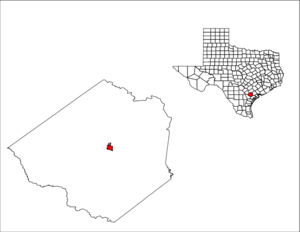
mapsize1 = 250px
map_caption1 =subdivision_type = Country
subdivision_name =United States
subdivision_type1 = State
subdivision_name1 =Texas
subdivision_type2 = County
subdivision_name2 = Goliadgovernment_footnotes =
government_type =
leader_title =
leader_name =
leader_title1 =
leader_name1 =
established_title =
established_date =unit_pref = Imperial
area_footnotes =
area_magnitude =
area_total_km2 = 4.0
area_land_km2 = 4.0
area_water_km2 = 0.0
area_total_sq_mi = 1.5
area_land_sq_mi = 1.5
area_water_sq_mi = 0.0population_as_of = 2000
population_footnotes =
population_total = 1975
population_density_km2 = 499.7
population_density_sq_mi = 1294.3timezone = Central (CST)
utc_offset = -6
timezone_DST = CDT
utc_offset_DST = -5
elevation_footnotes =
elevation_m = 50
elevation_ft = 164
latd = 28 |latm = 40 |lats = 8 |latNS = N
longd = 97 |longm = 23 |longs = 31 |longEW = Wpostal_code_type =
ZIP code
postal_code = 77963
area_code = 361
blank_name = FIPS code
blank_info = 48-30080GR|2
blank1_name = GNIS feature ID
blank1_info = 1358133GR|3
website =
footnotes =Goliad is a city in Goliad County,
Texas ,United States . It it had a population of 1,975 at the 2000census . It is thecounty seat of Goliad County.GR|6 It is part of theVictoria, Texas Metropolitan Statistical Area. TheSan Antonio River , best known for the River Walk in San Antonio, passes through Goliad en route to theGulf of Mexico . Goliad is located onU.S. Highway 59 , named also for the lateU.S. Senator Lloyd M. Bentsen .History
pain
In 1747, the Spanish government sent
José de Escandón to inspect the northern frontier of its North American colonies, includingSpanish Texas . In his final report, Escandónt recommended thatPresidio La Bahia be moved from its Guadalupe River location to the banks of the San Antonio River, so that it would be more capable of assisting settlements along theRio Grande .Roell (1994), p. 13.] Both the presidio and the mission it protected, Mission of Nuestra Señora del Espíritu Santo de Zúñiga, likely moved to their new location in October 1749. Escandón proposed that 25 Mexican families be relocated near the presidio to form a civilian settlement but was unable to find enough willing settlers.Roell (1994), p. 14.]With the conclusion of the
Seven Years War in 1763, France ceded Louisiana, and French claims to Texas, to Spain. [Weber (1992), p. 198.] With France no longer a threat to Spain's North American interests, the Spanish monarchy commissioned the Marquis de Rubi to inspect all of the presidios on the northern frontier of New Spain and make recommendations for the future.Chipman (1992), p. 173.] Rubi recommended that several presidios but closed, but that La Bahia be kept and rebuilt in stone. La Bahia was soon "the only Spanish fortress for the entire Gulf Coast from the mouth of the Rio Grande to the Mississippi River".Roell (1994), p. 15.] The presidio now sat at the heart of several major trade and military routes. It quickly became one of the three most important areas in Texas, alongside Béxar and Nacogdoches. A civil settlement, then known as La Bahia, soon developed near the presidio. By 1804 the settlement had one of only two schools in Texas.Roell (1994), p. 19.]In early August 1812, during the
Mexican War of Independence , Mexican revolutionaryBernardo Gutiérrez de Lara and his recruits, calling themselves theRepublican Army of the North , invaded Texas. [Almaráz (1971), p. 159.] In November, the invaders captured Presidio La Bahia. [Almaráz (1971), p. 164.] For the next four months, Texas governorManuel María de Salcedo laid siege to the fort.Roell (1994), p. 20.] Unable to win a decisive victory, Salcedo lifted the siege onFebruary 19 ,1813 and turned towards San Antonio de Bexar. [Almaráz (1971), p. 168.] The rebels remained in control of the presidio until July or August 1813, whenJosé Joaquín de Arredondo led royalist troops in retaking all of Texas.Roell (1994), p. 21.] A member of the Republican Army of the North, Henry Perry, led forces back to Texas in 1817 and attempted to recapture La Bahia. The presidio was reinforced by soldiers from San Antonio, and Perry and his men were defeated onJune 18 near Coleto Creek. Roell (1994), p. 21.]The area was again the target of invaders in 1821. After the United States and Spain signed the
Adams-Onís Treaty , giving all rights to Texas to Spain, many Americans were angry. OnOctober 4 , the 52 members of theLong Expedition captured La Bahia. Four days later, Colonel Ignacio Pérez arrived with troops from Bexar; Long surrendered.Roell (1994), p. 23.] By the end of 1821, Mexico had achieved its independence from Spain, and Texas became part of the newly created country. [Weber (1992), p. 300.]Mexico
In 1829, the name of the village of La Bahía was changed to Goliad, an
anagram of "Hidalgo" (omitting the silent initial "H"), in honor of the patriot priestMiguel Hidalgo , the father ofMexico 's independencia.On
October 9 ,1835 , in the early days of theTexas Revolution , a group ofTexian s attacked the presidio in theBattle of Goliad . After a thirty-minute skirmish, the Mexican garrison surrendered, leaving the Texians in control of the fort. The first declaration of independence of theRepublic of Texas was signed here onDecember 20 ,1835 . Texians held the area until March 1836, when the Texian garrison underColonel James Fannin was defeated at the nearbyBattle of Coleto . The Texian survivors were imprisoned at the presidio untilPalm Sunday ,March 27 ,1836 , when they were executed in theGoliad Massacre .Goliad was the birthplace of the famous Mexican General
Ignacio Zaragoza , commander against theFrench Army in the battle ofCinco de mayo onMay 5 ,1862 .United States
On
May 18 ,1902 , a devastating tornado struck Goliad, killing 114 persons. It is tied for the deadliest tornado in Texas history and the 10th deadliest in the United States.Geography
Goliad is located at coor dms|28|40|8|N|97|23|31|W|city (28.668865, -97.391850).GR|1
According to the
United States Census Bureau , the city has a total area of 1.5square mile s (4.0km² ), all of it land.Demographics
As of the
census GR|2 of 2000, there were 1,975 people, 749 households, and 518 families residing in the city. Thepopulation density was 1,294.3 people per square mile (498.4/km²). There were 877 housing units at an average density of 574.7/sq mi (221.3/km²). The racial makeup of the city was 75.44% White, 6.08% African American, 0.35% Native American, 0.61% Asian, 14.99% from other races, and 2.53% from two or more races. Hispanic or Latino of any race were 49.72% of the population.There were 749 households out of which 33.9% had children under the age of 18 living with them, 51.7% were married couples living together, 12.8% had a female householder with no husband present, and 30.8% were non-families. 28.7% of all households were made up of individuals and 15.8% had someone living alone who was 65 years of age or older. The average household size was 2.49 and the average family size was 3.04.
In the city, the population was spread out with 26.3% under the age of 18, 7.2% from 18 to 24, 24.4% from 25 to 44, 21.3% from 45 to 64, and 20.8% who were 65 years of age or older. The median age was 39 years. For every 100 females there were 91.0 males. For every 100 females age 18 and over, there were 84.1 males.
The median income for a household in the city was $26,200, and the median income for a family was $33,438. Males had a median income of $28,889 versus $20,167 for females. The
per capita income for the city was $13,997. About 19.7% of families and 23.1% of the population were below thepoverty line , including 31.5% of those under age 18 and 17.6% of those age 65 or over.Education
Goliad Independent School District [http://www.goliadisd.org/] serves Goliad.Attractions
*
Texas Mile - a weekendMotorsports racing festival held twice a year (March and October) at the Goliad Airport near Berclair, Texas.Footnotes
References
*Citation|last=Almaráz|first=Félix D., Jr.|title=Tragic Cavalier: Governor Manuel Salcedo of Texas, 1808–1813|publisher=
Texas A&M University Press |location=College Station, TX |date=1971|isbn=089096503X|edition=2nd
*Citation|last=Chipman|first=Donald E.|title=Spanish Texas, 1519–1821|publisher=University of Texas Press |location=Austin, TX |date=1992|isbn=0292776594
*citation|last=Roell|first=Craig H.|title=Remember Goliad! A History of La Bahia|publisher=Texas State Historical Association|date=1994|location=Austin, TX|series=Fred Rider Cotten Popular History Series|number=9|isbn=087611141X
*Citation|last=Weber|first=David J.|title=The Spanish Frontier in North America|publisher=Yale University Press |location=New Haven, CT |series=Yale Western Americana Series|date=1992|isbn=0300051980External links
* [http://www.goliad.org/ City of Goliad]
* [http://www.tsha.utexas.edu/handbook/online/articles/GG/hjg5.html] "Handbook of Texas " Online article
* [http://www.texasmile.net] "www.texasmile.com "

Wikimedia Foundation. 2010.