- San Antonio River
Infobox River | river_name = San Antonio River
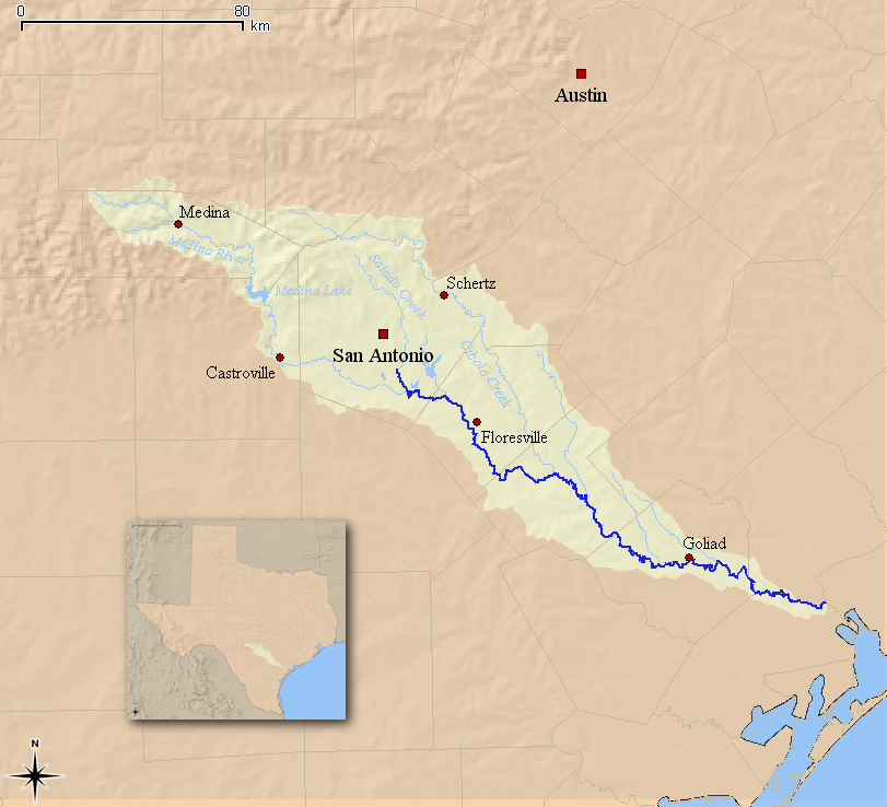
caption = Map of the San Antonio River and its associated watershed in South Texas.
origin = TheSan Antonio Springs near theUniversity of the Incarnate Word inSan Antonio, Texas .
mouth = Flows into the Guadalupe River, 10 mi northwest of theSan Antonio Bay .
basin_countries = US
length = 240 mi (386 km)
elevation = 715 ft (215 m)
discharge = 400 ft³/s (11 m³/s) [ [http://waterdata.usgs.gov/tx/nwis/uv?08188500 USGS National Water Information System] ]
watershed = 934 mi² (2419 km²) [Ockerman and McNamara (2001). " [http://pubs.usgs.gov/wri/wri03-4030/ Simulation of Streamflow and Estimation of Streamflow Constituent Loads in the San Antonio River Watershed, Bexar County, Texas, 1997–2001] , "USGS"]The San Antonio River is a major waterway that originates in central
Texas near San Antonio and follows a roughly southeastern path through the state. It eventually feeds into the Guadalupe River about ten miles fromSan Antonio Bay on theGulf of Mexico . The river is 240 miles long and crosses five counties: Bexar, Goliad, Karnes, Refugio, and Wilson.History
The first documented record of the river was from
Álvar Núñez Cabeza de Vaca on his explorations ofTexas in 1535. The river was later named after San Antonio de Padua by the first governor ofSpanish Texas ,Domingo Terán de los Ríos in 1691. [Handbook of Texas|id=SS/rns6|name=San Antonio River] During theTexas Revolution , the river was host to several major conflicts, including theBattle of Concepcion , theGrass Fight , the siege of Bexar, theGoliad Campaign , and theBattle of the Alamo .Notable features
Five major 18th century Spanish missions are lined up along the historical course of the river, including Mission Espada,
Mission Concepcion , Mission San José, and Mission San Juan Capistrano. The most famous mission is the Álamo.The waterway is also host to the
San Antonio River Walk , one of San Antonio's primary tourist destinations and the centerpiece of the city.See also
*
San Antonio Missions National Historical Park Notes
External links
* [http://www.sara-tx.org/ San Antonio River Authority]
* [http://www.edwardsaquifer.net/sariver.html Edwards Aquifer data on the San Antonio River]
* [http://thesanantonioriverwalk.com/ Official site of the San Antonio River Walk]
Wikimedia Foundation. 2010.