- Grey Forest, Texas
Infobox Settlement
official_name = Grey Forest, Texas
settlement_type =City
nickname =
motto =
imagesize =
image_caption =
image_
mapsize = 250x200px
map_caption = Location of Grey Forest, Texas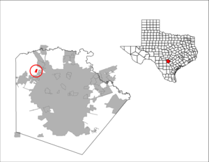
mapsize1 = 250px
map_caption1 =subdivision_type = Country
subdivision_name =United States
subdivision_type1 = State
subdivision_name1 =Texas
subdivision_type2 = County
subdivision_name2 = Bexargovernment_footnotes =
government_type =
leader_title =
leader_name =
leader_title1 =
leader_name1 =
established_title =
established_date =unit_pref = Imperial
area_footnotes =area_magnitude =
area_total_km2 = 1.9
area_land_km2 = 1.9
area_water_km2 = 0.0
area_total_sq_mi = 0.7
area_land_sq_mi = 0.7
area_water_sq_mi = 0.0population_as_of = 2000
population_footnotes =
population_total = 418
population_density_km2 = 218.5
population_density_sq_mi = 565.9timezone = Central (CST)
utc_offset = -6
timezone_DST = CDT
utc_offset_DST = -5
elevation_footnotes =
elevation_m = 348
elevation_ft = 1142
latd = 29 |latm = 37 |lats = 1 |latNS = N
longd = 98 |longm = 41 |longs = 5 |longEW = Wpostal_code_type =
ZIP code
postal_code = 78023
area_code = 210
blank_name = FIPS code
blank_info = 48-31100GR|2
blank1_name = GNIS feature ID
blank1_info = 1337019GR|3
website =
footnotes =Grey Forest is a city in Bexar County,
Texas ,United States . The population was 418 at the 2000 census.Geography
Grey Forest is located on Scenic Loop Road at coor dms|29|37|1|N|98|41|5|W|city (29.616828, -98.684635)GR|1.
According to the
United States Census Bureau , the city has a total area of 0.7square mile s (1.9km² ), all of it land.Demographics
As of the
census GR|2 of 2000, there were 418 people, 179 households, and 127 families residing in the city. Thepopulation density was 565.9 people per square mile (218.1/km²). There were 211 housing units at an average density of 285.6/sq mi (110.1/km²). The racial makeup of the city was 98.80% White, 0.24% Native American, 0.72% from other races, and 0.24% from two or more races. Hispanic or Latino of any race were 7.66% of the population.There were 179 households out of which 28.5% had children under the age of 18 living with them, 59.2% were married couples living together, 8.9% had a female householder with no husband present, and 28.5% were non-families. 22.3% of all households were made up of individuals and 6.1% had someone living alone who was 65 years of age or older. The average household size was 2.34 and the average family size was 2.75.
In the city the population was spread out with 19.9% under the age of 18, 5.7% from 18 to 24, 26.3% from 25 to 44, 33.5% from 45 to 64, and 14.6% who were 65 years of age or older. The median age was 44 years. For every 100 females there were 95.3 males. For every 100 females age 18 and over, there were 91.4 males.
The median income for a household in the city was $47,614, and the median income for a family was $51,875. Males had a median income of $37,188 versus $29,464 for females. The
per capita income for the city was $26,475. About 0.7% of families and 1.9% of the population were below thepoverty line , including none of those under age 18 and 8.5% of those age 65 or over.Education
Residents are zoned to schools in the
Northside Independent School District .Students are zoned to:
* Helotes Elementary School (Helotes)
* Stinson Middle School (San Antonio)
*Sandra Day O'Connor High School (Helotes, Texas) (Helotes)References
External links

Wikimedia Foundation. 2010.