- Kirby, Texas
Infobox Settlement
official_name = Kirby, Texas
settlement_type =City
nickname = "Hobo Capital of Texas" [http://www.clickitsa.com/content/view/18948/411/]
motto =
imagesize =
image_caption =
image_
seal_size = 80px
mapsize = 250x200px
map_caption = Location of Kirby, Texas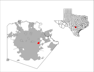
mapsize1 = 250px
map_caption1 =subdivision_type = Country
subdivision_name =United States
subdivision_type1 = State
subdivision_name1 =Texas
subdivision_type2 = County
subdivision_name2 = Bexargovernment_footnotes =
government_type =
leader_title =
leader_name =
leader_title1 =
leader_name1 =
established_title =
established_date =unit_pref = Imperial
area_footnotes =area_magnitude =
area_total_km2 = 4.9
area_land_km2 = 4.8
area_water_km2 = 0.1
area_total_sq_mi = 1.9
area_land_sq_mi = 1.9
area_water_sq_mi = 0.0population_as_of = 2000
population_footnotes =
population_total = 8673
population_density_km2 = 1792.0
population_density_sq_mi = 4641.1timezone = Central (CST)
utc_offset = -6
timezone_DST = CDT
utc_offset_DST = -5
elevation_footnotes =
elevation_m = 209
elevation_ft = 686
latd = 29 |latm = 27 |lats = 40 |latNS = N
longd = 98 |longm = 23 |longs = 20 |longEW = Wpostal_code_type =
ZIP code
postal_code = 78219
area_code = 210
blank_name = FIPS code
blank_info = 48-39448GR|2
blank1_name = GNIS feature ID
blank1_info = 1339154GR|3
website =
footnotes =Kirby is a city in Bexar County,
Texas ,United States . Founded as an agricultural settlement along theSouthern Pacific railroad, the city was transformed into a suburban community upon its incorporation in 1955. The population of 8,673 (2000 census) is made up of diverse individuals with numerous backgrounds. German, Hispanic, and hobo elements have all affected the overall culture of the city.Geography
Kirby is located at coor dms|29|27|40|N|98|23|20|W|city (29.461032, -98.388763)GR|1.
According to the
United States Census Bureau , the city has a total area of 1.9square mile s (4.9km² ), of which, 1.9 square miles (4.8 km²) of it is land and 0.04 square miles (0.1 km²) of it (1.58%) is water.Demographics
As of the
census GR|2 of 2000, there were 8,673 people, 2,975 households, and 2,317 families residing in the city. Thepopulation density was 4,641.1 people per square mile (1,790.7/km²). There were 3,137 housing units at an average density of 1,678.7/sq mi (647.7/km²). The racial makeup of the city was 64.27% White, 14.56% African American, 0.53% Native American, 2.06% Asian, 0.14% Pacific Islander, 14.83% from other races, and 3.61% from two or more races. Hispanic or Latino of any race were 41.69% of the population.There were 2,975 households out of which 39.2% had children under the age of 18 living with them, 54.1% were married couples living together, 18.4% had a female householder with no husband present, and 22.1% were non-families. 18.1% of all households were made up of individuals and 5.9% had someone living alone who was 65 years of age or older. The average household size was 2.92 and the average family size was 3.29.
In the city the population was spread out with 30.3% under the age of 18, 8.9% from 18 to 24, 29.2% from 25 to 44, 22.6% from 45 to 64, and 9.1% who were 65 years of age or older. The median age was 33 years. For every 100 females there were 95.7 males. For every 100 females age 18 and over, there were 89.3 males.
The median income for a household in the city was $38,919, and the median income for a family was $42,329. Males had a median income of $28,699 versus $22,086 for females. The
per capita income for the city was $15,615. About 8.9% of families and 11.0% of the population were below thepoverty line , including 18.1% of those under age 18 and 7.0% of those age 65 or over.History
Kirby was founded as an agricultural community by German immigrants in the early 1900s. Its name derived from the Kirby yard of the
Southern Pacific Railroad that crossed through the town. In 1920 the population was around 18 people, made up of mostly farmers. At this time German was a commonly spoken language.In the 1950s, the composition of the city shifted from mostly agricultural to military as individuals settled in homes to commute to work at
Randolph AFB . The population grew to 600 at this point, and German was less commonly spoken. In 1955 the city was incorporated. A two-year long drought began in 1957, which ultimately caused many farm failures. Unable to make a profit, the farmers decided to sell their land to the city. Homes and roads were constructed on the purchased land, and the city was further transformed into thesuburban area it is today. [ Lopez, Raquel. [http://www.accd.edu/pac/faculty/rhines/StudentProjects/2006/Kirby/history.htm Small Town Research Project] , "Palo Alto College",2006-05-31 . ]Government
Kirby is characterized as a "home rule" city as permitted under Texas law. The city can govern itself, and mandate ordinances and actions as long as they do not infringe on state or federal law. The government is set up by the 1988 City Charter that calls for a legislative body of six members (
City Council ) and aMayor that heads the legislative body and represents the city. The current mayor is Johnny Duffek. The charter also identifies acity manager to be directed by the council, and accountable for the operation of the city. [ [http://www.kirbytx.org/docs/cityhall/cityhall_govttype.html City of Kirby] , April 10, 2008 ]Education
Residents of Kirby are zoned to
Judson Independent School District .They are zoned to [http://www.kirbytx.org/docs/newsinfo/profile.pdf] :
*Hopkins Elementary School
*Kirby Middle School
*Karen Wagner High School Description
Kirby is located in eastern
Bexar County . The northern and southern sections of the city differ both in culture and appearance. The city has a large community sector and much support for the city comes from the public. Kirby takes full advantage of its natural resources found both in the neighborhoods and the agricultural sector alike.Northern Kirby
The northern section of the city comprises
Kirby Middle School , Old Seguin Road, FM 78, Gibbs Sprawl as well as the Southern Pacific railroad tracks. Because of the railroad tracks, Kirby has been dubbed "Thehobo capital of Texas" [ [http://www.clickitsa.com/content/view/18948/411/ Northeast Herald] , March 20, 2008] because of its large population ofhomeless people living under the 410 overpass. It is because of this that the city held its first annual "hobo festival" during the first weekend of May 2008, including a "hobo parade" through the streets of Kirby. [ [http://www.kirbytx.org/docs/news/kirby_minutes.html City of Kirby] November 6 2007 ] Kirby Manor and the Old Town neighborhoods are included in this area.outhern Kirby
The southern section of the city contains
Hopkins Elementary School named after longtime principal Joseph Hopkins. This area of the city is divided between a stricly agricultural sector between Hopkins Elementary and Candlewood Elementary and the homes of the astronaut streets on the other side of Binz Engleman. Ackerman is the main road here; it leads toInterstate 10 .Community sector
Kirby is characterized as strictly a suburban area of
San Antonio and because of this, the city hall discourages small business. Kirby has its own fire and police departments. The city hall is across the street from the Fire Department, and inside its complex is the Post Office. The city has two parks on both sides of Binz Engleman separated by Ackerman. The western half of the park consists of mostly baseball fields, and the eastern section is accommodated with a full range of recreational activities.Natural resources
Kirby is a major producer of
pecans , which grow there naturally. Pecans produce in large quantities between September and November except for some trees, which do not produce every four years. 1996, 2000, and 2004 were all years when the pecan production was extremely low. It is projected that 2008 will also have low levels of production.Rosillo Creek is the main stream in Kirby; it once provided the farmers in the agricultural sector with water to irrigate their crops. The creek flows from under the railroad tracks on Gibbs Sprawl Road and further downstream divides Hopkins and Candlewood Elementries before dispensing towards Interstate 10.Neighborhoods
The Neighborhoods of Kirby can be placed under three categories: Kirby Manor, Old Town, and the Astronaut Streets.
Kirby Manor
Kirby Manor is located within Old Seguin Road to its north, Ackerman Road to its east and Binz Engleman to its south. The houses of Kirby Manor were built between the 1950s and 1960s. The citizens are a mix of the native settlers in this area and the newer crowd of young people moving in from other San Antonio suburbs and urban areas to start a life. Kirby Manor's proximity to the police station on Ackerman is the main reason why this area has a lower crime rate than the other areas of Kirby.
Old Town
Old Town is located between Old Seguin Road and FM 78. Its eastern and western boundaries include Gibbs Sprawl Road and Kirby Middle School, respectively. This is the area where the first homes of Kirby were built. The area is also where Kirby City Hall, Kirby Post Office and the Kirby Fire Department are located. The inhabitants of this area are increasingly becoming younger as the older citizens die off, but there is still a large elderly population.
Astronaut Streets
The Astronaut Streets are the southernmost section of Kirby. The area is given this name due to the streets, which are named after famous
Astronaut s. This is the newest section of Kirby and has a large young population. To its north is FM 78, to its south is Ackerman Road, to its west is Springfield and to its east is Binz Engleman.External links

Wikimedia Foundation. 2010.