- Freer, Texas
Infobox Settlement
official_name = Freer, Texas
settlement_type =City
nickname =
motto =
imagesize = 250px
image_caption = Freer welcome sign
image_
mapsize = 250px
map_caption = Location of Freer, Texas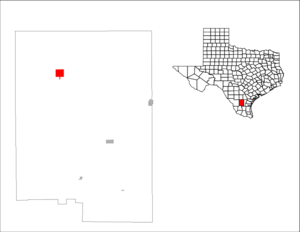
mapsize1 = 250px
map_caption1 =subdivision_type = Country
subdivision_name =United States
subdivision_type1 = State
subdivision_name1 =Texas
subdivision_type2 = County
subdivision_name2 = Duvalgovernment_footnotes =
government_type =
leader_title =
leader_name =
leader_title1 =
leader_name1 =
established_title =
established_date =unit_pref = Imperial
area_footnotes =area_magnitude =
area_total_km2 = 10.5
area_land_km2 = 10.4
area_water_km2 = 0.1
area_total_sq_mi = 4.1
area_land_sq_mi = 4.0
area_water_sq_mi = 0.0population_as_of = 2000
population_footnotes =
population_total = 3241
population_density_km2 = 310.5
population_density_sq_mi = 804.3timezone = Central (CST)
utc_offset = -6
timezone_DST = CDT
utc_offset_DST = -5
elevation_footnotes =
elevation_m = 158
elevation_ft = 518
latd = 27 |latm = 52 |lats = 45 |latNS = N
longd = 98 |longm = 36 |longs = 58 |longEW = Wpostal_code_type =
ZIP code
postal_code = 78357
area_code = 361
blank_name = FIPS code
blank_info = 48-27432GR|2
blank1_name = GNIS feature ID
blank1_info = 1336186GR|3
website =
footnotes =Freer is a city in Duval County,
Texas ,United States . The population was 3,241 at the 2000census . The city and county are heavilyHispanic in ethnicity and Democratic in votinghistory . From the 1930s-1960s, the county was dominated by thepolitical boss , called a patron inSouth Texas ,George Parr , a supporter ofU.S. President Lyndon B. Johnson . Parr's influence waned thereafter, and he committedsuicide at his Los Harcones ranch in 1975.Like Sweetwater, the seat of Nolan County in
West Texas , Freer holds an annualrattlesnake roundup inMarch .The first
oil well in Texas was drilled in Freer in 1860, a year after the discovery inTitusville, Pennsylvania , but it was unproductive. In 1907, oil was again discovered in Duval County, six years afterSpindletop near Beaumont.Darrell "Hap" Holcomb
Darrell H. "Hap" Holcomb (
July 14 ,1911 —June 14 ,1995 ) was a Freer community leader originally from Tishomingo in Johnston County in southernOklahoma , whose contributions have been honored with an historical marker. OnMay 18 ,1984 , Freer held "Hap Holcomb Day". He was described as "a symbol of the heart and strength of the people of the town he loved --Freer."Historical marker honoring Darrell "Hap" Holcomb, Freer, Texas]Holcomb relocated to Freer in 1938 to work in the oil business. He started Hap's Well Service in 1950. He was active in
Little League , YouthRodeo ,Rotary International ,Lions Club , and the Quarterback Club. He was a member of the FirstBaptist Church of Freer. He received the "Buckaroo Spirit" award. Holcomb was survived by his wife, Frankie, and four children.Geography
Freer is located at coor dms|27|52|45|N|98|36|58|W|city (27.879156, -98.616237)GR|1.
According to the
United States Census Bureau , the city has a total area of 4.1square mile s (10.5km² ), of which, 4.0 square miles (10.4 km²) of it is land and 0.04 square miles (0.1 km²) of it (0.98%) is water.Demographics
USCensusPop
1940=2346
1950=2280
1960=2734
1970=2804
1980=3213
1990=3271
2000=3241As of the
census GR|2 of 2000, there were 3,241 people, 1,111 households, and 845 families residing in the city. Thepopulation density was 804.3 people per square mile (310.5/km²). There were 1,334 housing units at an average density of 331.1/sq mi (127.8/km²). The racial makeup of the city was 80.59% White, 0.46% African American, 0.68% Native American, 0.25% Asian, 14.87% from other races, and 3.15% from two or more races. Hispanic or Latino of any race were 77.38% of the population.There were 1,111 households out of which 42.0% had children under the age of 18 living with them, 56.3% were married couples living together, 14.3% had a female householder with no husband present, and 23.9% were non-families. 21.5% of all households were made up of individuals and 9.2% had someone living alone who was 65 years of age or older. The average household size was 2.92 and the average family size was 3.40.
In the city the population was spread out with 33.1% under the age of 18, 9.8% from 18 to 24, 26.3% from 25 to 44, 19.9% from 45 to 64, and 10.9% who were 65 years of age or older. The median age was 30 years. For every 100 females there were 95.9 males. For every 100 females age 18 and over, there were 96.2 males.
The median income for a household in the city was $25,078, and the median income for a family was $26,475. Males had a median income of $26,789 versus $17,159 for females. The
per capita income for the city was $11,457. About 18.4% of families and 21.6% of the population were below thepoverty line , including 26.5% of those under age 18 and 25.4% of those age 65 or over.Education
The City of Freer is served by the
Freer Independent School District .References
External links

Wikimedia Foundation. 2010.