- Colorado Springs, Colorado
-
Colorado Springs, Colorado — City — Colorado Springs with the Front Range in background

FlagNickname(s): The Springs, C-Springs, C-S-C, The 719 Location in El Paso County and the state of Colorado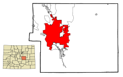 Location in the U.S.
 Colorado Springs, Colorado
Coordinates: 38°51′48″N 104°47′31″W / 38.86333°N 104.79194°WCoordinates: 38°51′48″N 104°47′31″W / 38.86333°N 104.79194°W Country United States State Colorado County[1] El Paso County seat Incorporated June 19, 1886[2] Government – Type Home Rule Municipality[1] – Mayor Steve Bach since 7. June 2011 (NP) Area – City 186.1 sq mi (482.1 km2) – Land 185.7 sq mi (481.1 km2) – Water 0.4 sq mi (1.0 km2) Elevation 5,870–7,200 ft (1,832 m) Population (2010)[3] – City 416,427 (US: 41st) – Density 1,942.9/sq mi (767.25/km2) – Metro 645,613 Time zone MST (UTC−7) – Summer (DST) MDT (UTC−6) ZIP codes[4] 80901-80951, 80960, 80962, 80970, 80977, 80995, 80997 Area code(s) 719 FIPS code 08-16000 GNIS feature ID 0204797 Highways I-25, US 24, US 85, SH 29, SH 83, SH 94, SH 115 Website www.springsgov.com Second most populous Colorado cityColorado Springs is a Home Rule Municipality that is the county seat and most populous city of El Paso County, Colorado, United States. Colorado Springs is located in South-Central Colorado, in the southern portion of the state. It is situated on Fountain Creek and is located 61 miles (98 km) south of the Colorado State Capitol in Denver. At 6,035 feet (1839 m) the city stands over one mile (1.6 km) above sea level, though some areas of the city are significantly higher. Colorado Springs is situated near the base of one of the most famous American mountains, Pikes Peak, in the eastern edge of the Southern Rocky Mountains.
With a population of 416,427 as of the 2010 Census,[3] it is the second most populous city in the state of Colorado, behind Denver, and the 41st most populous city in the United States,[5] while the Colorado Springs Metropolitan Statistical Area had an estimated population of 645,613 in 2010.[6] The city covers 186.1 square miles (482 km2), making it Colorado's largest city in area. Colorado Springs was selected as the No. 1 Best Big City in "Best Places to Live" by Money magazine in 2006,[7] and placed number one in Outside's 2009 list of America's Best Cities.[8]
Contents
History
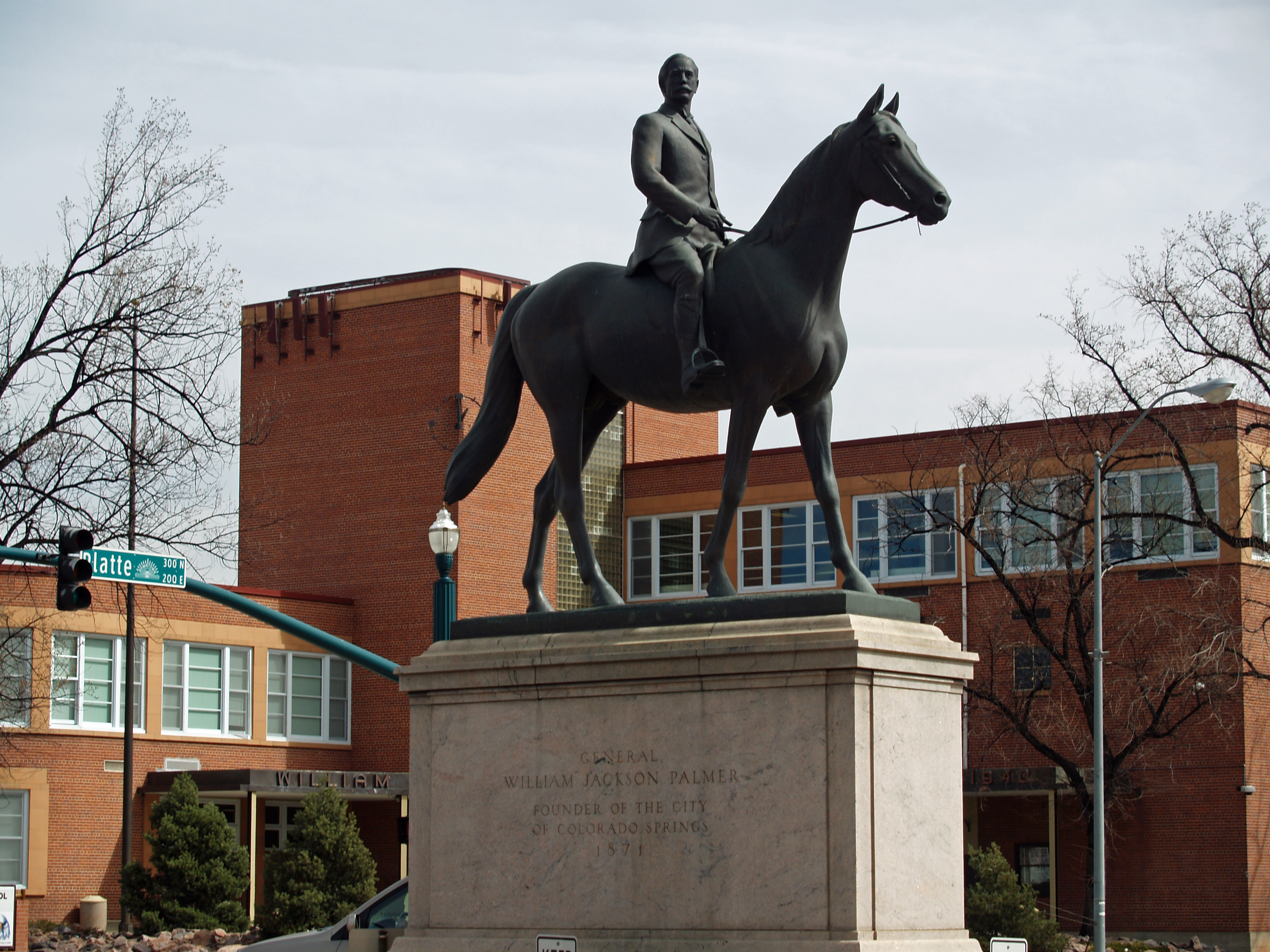
General Palmer, city founder
 Statue of General William Palmer in front of Palmer High School.
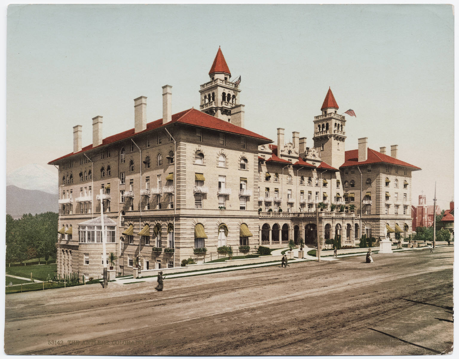
 The Antlers
William Jackson Palmer, a Civil War General (brevet) and Medal of Honor recipient, came to the Colorado Territory as a surveyor with the Kansas Pacific Railroad. He explored the area south of Denver searching for possible railroad routes for the Kansas Pacific to strategically occupy.[9] Palmer favorably viewed the valley in the shadow of Pikes Peak as an ideal town site.[10] Since he could not persuade the Kansas Pacific to follow the Arkansas River to Pueblo and from there north to Denver, Palmer secured legislation and funding to build the Denver & Rio Grande Railroad south from Denver with the declared intention of reaching Mexico City, Mexico.[9] Palmer founded Colorado Springs on July 31, 1871,[10] as the first destination served by his railroad. He had the intention of creating a high-quality resort community, and the infant town was soon nicknamed "Little London" because of the many English tourists and settlers who came, owing partly to Palmer's financial connections in England who provided the capital for his railroad, and partly to his associate Dr. William Bell who actively recruited both investors and settlers.[9][11] The stunning mountain view from anywhere in the valley as well as the nearby Garden of the Gods made the city's location a natural choice.
Within two years, his flagship resort the Antlers Hotel opened, welcoming US and international travelers as well as health-savvy individuals seeking the high altitude, sunshine, and dry climate, and Palmer's visions of a thriving, quality resort town were coming true. Palmer's Denver & Rio Grande Railroad became a critical regional railroad, faithfully serving the city and propelling the railroad south toward Pueblo. He maintained his presence in the city's early days by making many grants or sales of land to civic institutions. Palmer and his wife saw Colorado Springs develop into one of the most popular travel destinations in the late 19th century United States.
The town of Palmer Lake, the Palmer Divide, and other more minor features are named after him, and a bronze sculpture of Palmer on a horse is prominently displayed downtown in front of Palmer High School, at the center of a busy intersection. To many residents who lived in Colorado Springs in the years since, Palmer became known as "the man on the iron horse",[12] a fitting appellation because of his long association with the Rio Grande Railroad.
Old Colorado City and the Pikes Peak Gold Rush
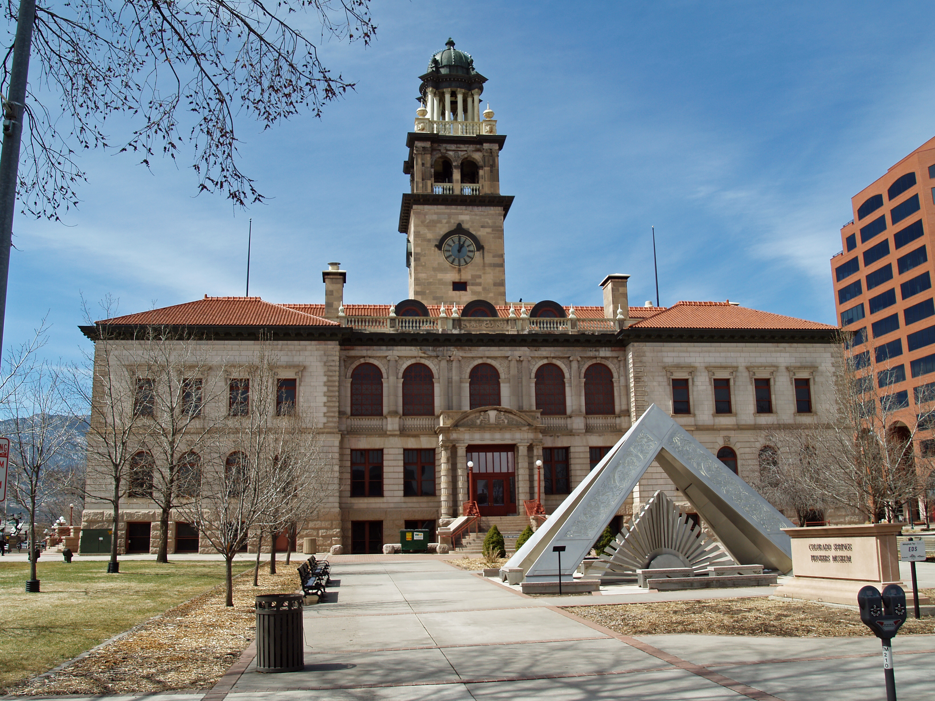
 The Pioneers Museum (old court house) contains displays of the city's founding and history.
Colorado Springs' present downtown location, where General Palmer first founded the city, was partly due to Palmer's dislike of nearby rough-and-ready Colorado City (now called Old Colorado City, and not to be confused with present-day Colorado City) and its many saloons. Palmer ensured his new planned city stayed alcohol free by buying a huge tract of land to the east of Colorado City. Legally, Colorado Springs stayed dry until the end of Prohibition in 1933, but practically, alcohol was readily available. Conveniently located druggists advertised whiskey, ale, stout and beer for "medicinal purposes."
In its earliest days of 1859–1860, Colorado City was a major hub for sending mining supplies to South Park, where a major strike in the Pike's Peak Gold Rush was found. After the Cripple Creek gold discovery in 1891, ore mills in Colorado City processed much of the gold ore at the Golden Cycle Mill using Palmer's railroads. The affluent, who made money from the gold rush and industry, did not stay in Colorado City but built their large houses in the undeveloped downtown area of Colorado Springs (i.e. Wood Ave). Early pictures show several large stone buildings like Colorado College, St. Mary's Church, the first Antlers Hotel, the library, and the county courthouse (pictured at right) sitting in large empty plains.[13] This is unique during this period, to anticipate a city's civic infrastructure in stone with wide streets laid out before there was a population to justify the expense.[14]
Colorado City remained the county seat of El Paso County until 1873, when the courthouse moved to Colorado Springs. Colorado City was the location of a 1903 labor strike that spread to Cripple Creek and eventually led to the Colorado Labor Wars.[15]
W. S. Stratton, early benefactor
In 1891, Winfield Scott Stratton discovered and developed one of the richest gold mines on earth in the nearby Cripple Creek and Victor area, and was perhaps the most generous early contributor to those communities and to Colorado Springs.
After he made his fortune he declined to build a mansion as the other gold rush millionaires were doing; instead, in later years, he lived in a house in Colorado Springs he had built when he was a carpenter in pre-gold days.
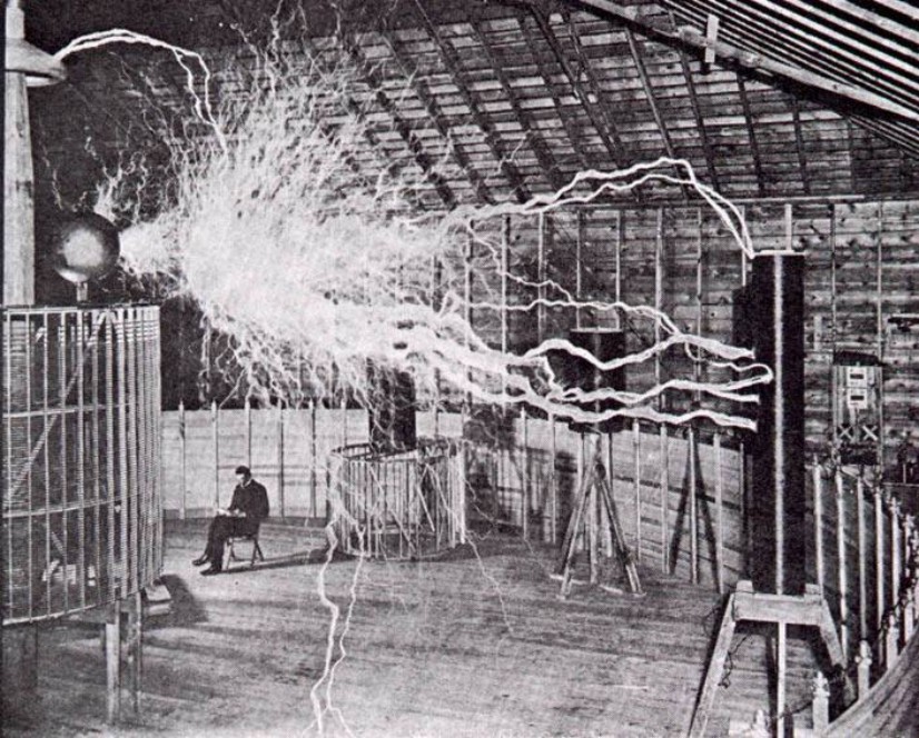
 A publicity photo of Nikola Tesla sitting in the Colorado Springs experimental station with his "Magnifying transmitter" generating millions of volts.
In Colorado Springs, he funded the Myron Stratton Home for housing itinerant children and the elderly, donated land for City Hall, the Post Office, the Courthouse (which now houses the Pioneer Museum), and a park; he also greatly expanded the city's trolley car system and built the Mining Exchange building, and gave to all three communities in many other ways, great and small.
As Stratton's generosity became known, he was also approached by many people looking for money, and he became reclusive and eccentric in his later years.
Spencer Penrose, early benefactor
Spencer Penrose also made his mark on Colorado Springs in its early years—though not until two decades after its founding. Penrose started as a ladies-man and an adventurer. After making a fortune in the gold fields of nearby Cripple Creek in the 1890s, he married Julie Villiers Lewis McMillan, and settled down.
Penrose used his wealth to invest in other national mineral concerns and financed construction of the Broadmoor Hotel, the Cheyenne Mountain Zoo, the Will Rogers Shrine of the Sun, the Pikes Peak Highway, what is now known as Penrose-St Francis Health Services, and established the El Pomar Foundation, which still oversees many of his contributions in Colorado Springs today.
End of the Colorado Gold Rush and the start of health tourism
The flow of gold and silver ebbed as the decades passed, and Colorado City's economic fortunes faded with it; the miners and those who processed the ore left or retired. Because of the healthy[citation needed] natural scenic beauty, mineral waters, and extremely dry climate, Colorado Springs became a tourist attraction and popular recuperation destination for tuberculosis patients. The healthy waters in Colorado Springs contained so much natural fluoride that some peoples’ teeth developed Colorado Stain. In 1909, Dr. Frederick McKay of Colorado Springs discovered the Colorado Stain connection and that a little fluoride added to water would prevent cavities, according to the permanent health exhibit at the Pioneers Museum. On June 14, 1950 Colorado Springs annexed Roswell which was founded in 1888 by coal miners and became a neighborhood. Other locations such as Austin Bluffs, Broadmoor, Woodman Valley, Pikeview, Papeton, Knob Hill, Ivywild, Stratton Meadows, Stratmoor, Elsmare, Cimarron Hills, Kelker, Stratmoor Hills, La Foret, Skinners, and Colorado City (now called Old Colorado City) became part of Colorado Springs. Old Colorado City is located on the west side of Colorado Springs and is a historic district and on the National Register of Historic Places. Its old Victorian brick buildings and main street currently offer several tourist, boutique, and antique shops.
Latter 20th century military boom
Colorado Springs saw its first military base in 1942 shortly after Pearl Harbor was attacked. For several years the city had been trying to attract a military installation to boost its flagging economy. In 1941, the city purchased 25,000 acres (100 km2) of what is now Fort Carson to try to lure a prospective Army installation. During this time the U.S. Army established Camp Carson near the southern borders of the city in order to train and house troops in preparation for World War II. It was also during this time that the Army began using Colorado Springs Municipal Airport. It was renamed Peterson Field and used as a training base for heavy bombers (the airport and base still share parts of the flightline).
 Hi-res Kodachrome of downtown Colorado Springs, 1951.
The Army expanded Camp Carson, a venture that increased growth in Colorado Springs and provided a significant area of industry for the city. Camp Carson was named for the Army scout General Christopher "Kit" Carson, who explored the vast western frontier during the 19th century.[16] After World War II the military stepped away from the Springs, Camp Carson was declining and the military was activating and deactivating Peterson Field irregularly. That all changed when the Korean War erupted. Camp Carson, which had declined to only 600 soldiers, was revitalized along with many other parts of the Springs. In 1951, the United States Air Defense Command moved to Colorado Springs and opened Ent Air Force Base (named for Major General Uzal Girard Ent, commander of the Ninth Air Force during World War II).
After the Korean War, Peterson Field was renamed Peterson Air Force Base and was permanently activated. In 1954 Camp Carson became Fort Carson, Colorado Springs' first Army post. Later that same year, President Dwight D. Eisenhower selected Colorado Springs, out of 300 other sites around the nation, to be the site of the United States Air Force Academy. A new and growing Army post, an Air Force Base, and the Air Force's military academy together jump-started Colorado Springs' growth.
The military boom continued and in 1963, NORAD's main facility was built in Cheyenne Mountain. This placed NORAD directly next to Colorado Springs and permanently secured the city's military presence. During the Cold War the city greatly expanded due to increased revenue from various industries and the prevailing military presence in the city. In the mid 1970s, Ent Air Force Base was shut down and later converted into the United States Olympic Training Center. Military presence was further increased in 1983 with the founding of Falcon Air Force Base (later changed to Schriever Air Force Base), a base primarily tasked with missile defense and satellite control. Fort Carson and Peterson are still growing and continue to contribute to the city's growth. Air Force Space Command is located on Peterson AFB.
Geography
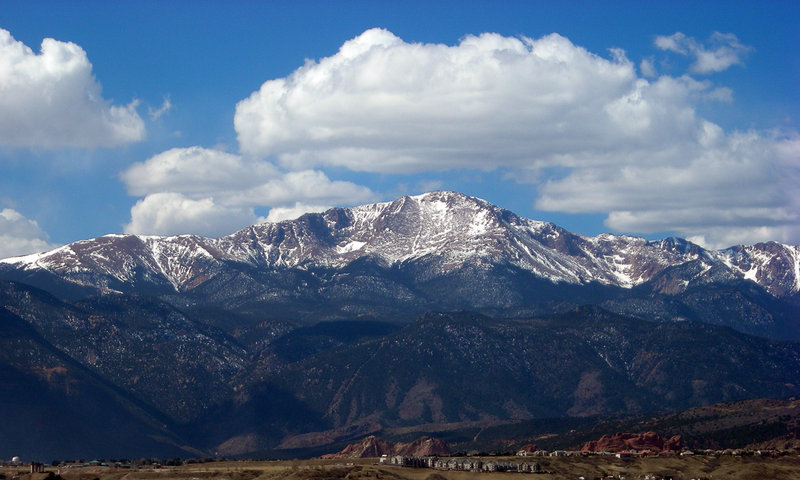
 Pikes Peak, the Eastern-most 14er in the United States.
 Ackerman Overlook near United States Air Force Academy off Interstate 25 in Colorado Springs is named for Jasper D. Ackerman (1896–1988), a banker and rancher.[17]
Geography
According to the United States Census Bureau, the city has a total area of 186.1 square miles (482.1 km²), of which 185.7 square miles (481.1 km²) is land and 0.4 square mile (1.0 km²) (0.21%) is water.
Climate
Colorado Springs features a semi-arid climate (Köppen BSk). The city receives approximately 16.2 inches (41 cm) of annual precipitation, which includes rain and snow. Snowfall rarely occurs outside the months between October and May with an average snowfall of 42.7 inches (108 cm). Due to unusually low precipitation for several years after flooding in 1999, Colorado Springs enacted lawn water restrictions in 2002. These were lifted in 2005.[18]
January averages 28.1 °F (−2.2 °C), yet the city has relatively mild winters, with large snow accumulations in the downtown area relatively rare, a strong warming sun due to the elevation, and only occasional episodic periods of sub-zero cold snaps and blizzards from October 31 to March/April. Snow often melts very quickly in arid climates as well, which makes the winters mild. Summers are typically very warm with occasional heat waves and generally arid with episodic heavy rainfalls and large hail, with a July average of 69.6 °F (20.9 °C) and highs reaching 90 °F (32 °C) on 16 days per annum. The normal high temperatures during the day are in the mid-80s into the low 90s, with cooler days in the low 80s and upper 70s. Also very hot days can reach the mid to upper 90s relatively often. The summers in Colorado Springs are generally hot and dry, but afternoon thunderstorms are common especially in July and August when the city receives the majority of its annual rainfall.
Colorado Springs is just east of the Southern Rocky Mountains, which protects the city from extreme weather. The city is made up of the mountains to the west, the mountain divide to the north, high plains further east, and desert land to the south once you leave Fountain and approach Pueblo.
The winters in Colorado Springs are normal to mild usually, with winter snow storms occurring, but the snow often melts by the mid-to-late afternoon. The usual high temperatures in the winter are in the mid to upper 40s, with the lows in the mid to upper teens. Winter days into the 50s and 60s are relatively common as well. However, the mountains just west of the city can receive very large amounts of snow.
The hottest temperature ever recorded in Colorado Springs was 101 °F (38 °C) on June 7, 1874, and the coldest temperature ever recorded was −32 °F (−36 °C) on January 20, 1883. Although the coldest average monthly high temperature of the year in Colorado Springs has historically been January, in recent years December has had a colder average monthly high temperature.[19]
Colorado Springs is also one of the most active lightning strike areas in the United States. This natural phenomenon led Nikola Tesla to select Colorado Springs as the preferred location to build his lab and study electricity.
Climate data for Colorado Springs Month Jan Feb Mar Apr May Jun Jul Aug Sep Oct Nov Dec Year Record high °F (°C) 73
(23)76
(24)81
(27)87
(31)95
(35)100
(38)102
(39)101
(38)94
(34)86
(30)78
(26)77
(25)102
(39)Average high °F (°C) 41.7
(5.4)45.4
(7.4)51.6
(10.9)59.2
(15.1)68.4
(20.2)79.2
(26.2)84.4
(29.1)81.6
(27.6)74.1
(23.4)63.4
(17.4)49.8
(9.9)42.4
(5.8)61.8 Average low °F (°C) 14.5
(−9.7)18.0
(−7.8)23.9
(−4.5)31.4
(−0.3)40.7
(4.8)49.5
(9.7)54.8
(12.7)53.6
(12.0)45.4
(7.4)34.3
(1.3)22.6
(−5.2)15.6
(−9.1)33.7 Record low °F (°C) −32
(−36)−27
(−33)−11
(−24)−3
(−19)21
(−6)32
(0)42
(6)39
(4)22
(−6)5
(−15)−11
(−24)−27
(−33)−32
(−36)Precipitation inches (mm) 0.28
(7.1)0.35
(8.9)1.06
(26.9)1.62
(41.1)2.39
(60.7)2.34
(59.4)2.85
(72.4)3.48
(88.4)1.23
(31.2)0.86
(21.8)0.52
(13.2)0.42
(10.7)17.40
(442)Snowfall inches (cm) 5.1
(13)5.1
(13)9.5
(24.1)6.3
(16)1.4
(3.6)0
(0)0
(0)0
(0)0.5
(1.3)3.6
(9.1)5.6
(14.2)6.1
(15.5)43.2
(109.7)Avg. precipitation days (≥ 0.01 in) 4.7 4.4 7.5 8.7 10.7 9.9 12.2 13.4 7.5 5.1 5.0 5.0 94.1 Avg. snowy days (≥ 0.1 in) 5.1 4.4 5.9 4.0 0.8 0 0 0 0.4 1.8 4.0 5.0 31.4 Source no. 1: The Weather Channel[20] Source no. 2: NOAA[21] Demographics
Historical populations Census Pop. %± 1870 1,480 — 1880 4,226 185.5% 1890 11,140 163.6% 1900 21,085 89.3% 1910 29,078 37.9% 1920 30,105 3.5% 1930 33,237 10.4% 1940 36,789 10.7% 1950 45,472 23.6% 1960 70,194 54.4% 1970 135,060 92.4% 1980 214,914 59.1% 1990 281,140 30.8% 2000 360,890 28.4% 2010 416,427 15.4% source:[22][23] As of the April 2010 census, the population of Colorado Springs was 416,427[24] (47th most populous U.S. city),[22] and the estimated population of the Colorado Springs Metropolitan Statistical Area was 617,714 in 2008 (84th most populous MSA),[25] and the population of the Front Range Urban Corridor in Colorado was an estimated 4,166,855.
April 2010 census:[24]
- White: 70.7%
- Black or African American: 6.3%
- Native American: 0.5%
- Asian: 3.0%
- Native Hawaiian and Other Pacific Islander: 0.2%
- Some other race: 5.2%
- Two or more races: 4.6%
- Hispanic or Latino (of any race): 16.1%; Mexican Americans made up 14.5% of the city's population.[26]
Source:[24]
As of the census[27] of 2000 (limited only to the city limits and not including the very diverse Fort Carson area which many view as being a part of the Colorado Springs metropolitan area), there were 360,890 people, 141,516 households, and 93,117 families residing in the city. The population density was 1,942.9 people per square mile (750.2/km²). There were 148,690 housing units at an average density of 800.5 per square mile (309.1/km²). The racial makeup of the city was 80.66% White, 6.56% African American, 0.88% Native American, 2.82% Asian, 0.21% Pacific Islander, 5.01% from other races, and 3.85% from two or more races. 12.01% of the population were Hispanic or Latino of any race.
There were 141,516 households out of which 34.0% had children under the age of 18 living with them, 51.5% were married couples living together, 10.6% had a female householder with no husband present, and 34.2% were non-families. 27.0% of all households were made up of individuals and 6.9% had someone living alone who was 65 years of age or older. The average household size was 2.50 and the average family size was 3.06.
In the city the population was spread out with 26.5% under the age of 18, 10.3% from 18 to 24, 32.8% from 25 to 44, 20.8% from 45 to 64, and 9.6% who were 65 years of age or older. The median age was 34 years. For every 100 females there were 97.8 males. For every 100 females age 18 and over, there were 95.2 males.(Note: City statistics do not include the demographic influence of five local military bases).
The median income for a household in the city was $45,081, and the median income for a family was $53,478. Males had a median income of $36,786 versus $26,427 for females. The per capita income for the city was $22,496. About 6.1% of families and 8.7% of the population were below the poverty line, including 10.8% of those under age 18 and 7.2% of those age 65 or over.
Government
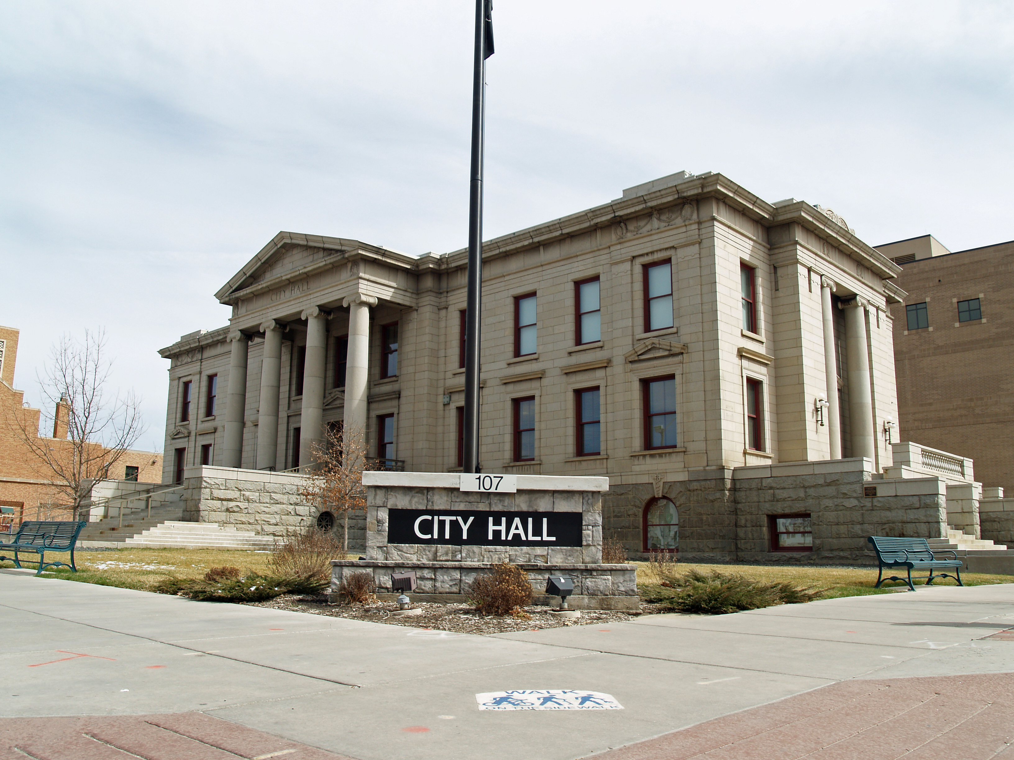
 City Hall.
On November 2, 2010 Colorado Springs voters adopted a strong mayor-council form of government. The City of Colorado Springs transitioned to the new system of government in 2011. Under the strong mayor-council system of government, the mayor is the chief executive and the city council is the legislative branch. The mayor is a full-time elected position and not a member of the city council. The city council has nine members, representing eight districts with one "at-large" seat. The mayor has veto authority, with the city council having the ability to override a mayoral veto by a 2/3 votes (6 out of 9).
Current issues
In order to combat the nearly $38 million budget shortfall projected in 2010 caused by current economic conditions resulting in decreased sales taxes, a proposal to increase property taxes by $10 million over five years was approved for the November 2009 ballot by the city council on August 25, 2009. Issue 2C was voted down on November 3, 2009. An attempt to reform the city's Taxpayers Bill of Rights (TABOR) was considered but not put on the ballot.[28] As a result the city reduced fire and police jobs, stopped paving roads, eliminated evening and weekend bus service, reduced public trash control, turned off city street lights, and asked residents to mow the grass in their neighborhood parks.[29]
Economy
Colorado Springs' economy is driven primarily by the military, the high-tech industry, and tourism, in that order. The city is currently experiencing some growth mainly in the service sectors.
Defense industry
The defense industry plays a major role in the Colorado Springs economy, with some of the city's largest employers coming from the sector.[30] A large segment of this industry is dedicated to the development and operation of various projects for missile defense. With its close ties to defense, the aerospace industry has also influenced the Colorado Springs economy. Although some defense corporations have left or downsized city campuses, a slight growth trend is still recorded.
Significant defense corporations in the city include Boeing, General Dynamics, Harris Corporation, SAIC, ITT, L-3 Communications, Lockheed Martin, and Northrop Grumman.
High-tech industry
A large percentage of Colorado Springs' economy is still based on manufacturing high tech and complex electronic equipment. The high tech sector in the Colorado Springs area has decreased its overall presence over the past six years (from around 21,000 down to around 8,000), with notable reductions in information technology and complex electronic equipment.[31] Due to a slowing in tourism, the high tech sector still remains second to the military in terms of total revenue generated and employment.[32] Current trends project the high tech employment ratio will continue to decrease in the near future.[32][33][34][35]
High tech corporations with connections to the city include:
- Verizon Business – Software development – Formerly WorldCom and MCI, has a fairly large engineering presence. At its peak during the mid-to-late 1990s, with over 5,000 employees and currently has nearly 1300 employees in 2008.[36]
- Hewlett-Packard – Computing – large sales, support, and SAN storage engineering center. The location was built by Digital Equipment Corporation, renamed Compaq in the 1998 acquisition of Digital, and finally renamed Hewlett-Packard after the 2002 merger. Nearly 1000 positions will be transferred out of the Springs[37][38][39]
- SNIA – Computing – home of the SNIA Technology Center
- Agilent – Test and Measurement Manufacturing – In 1999, Agilent was spun off from HP as an independent, publicly traded company.
- Intel– 2009 idled with 250 employees, down from 1000 employees in 2007[40] 2011, facility now used for the centralized unemployment and social services complex.
- LSI Corporation – Designs semiconductors and software that accelerate storage and networking in datacenters and mobile networks.
- Atmel – Chip fabrication. Formerly Honeywell. Recently laid off 245 workers.[41]
- Cypress Semiconductor Colorado Design Center – Chip fabrication R&D site
- Sanmina-SCI Closing facility around December 2007 to January 2008 (800 jobs).[42]
- Apple Inc. Facility sold to Sanmina-SCI in 1996.[43]
Top employers
According to the City's 2009 Comprehensive Annual Financial Report,[44] the top employers in the city are:
# Employer Percentage of County Employment 1 Fort Carson 10.18% 2 Peterson Air Force Base 4.95% 3 United States Air Force Academy 2.77% 4 Schriever Air Force Base 2.55% 5 Memorial Health System 1.99% 6 Colorado Springs School District 11 1.65% 7 Penrose-St. Francis Health Services 1.25% 8 Academy School District 20 1.12% 9 City of Colorado Springs 0.98% 10 The Broadmoor 0.85% Military Installations
The United States Military plays a very important role in the city. Colorado Springs is home to both Army and Air Force bases. All these military installations border the city, to the north, south and east, excluding Schriever Air Force Base, which is located east of the city in El Paso County.
Fort Carson
Main article: Fort CarsonFort Carson is the city's largest military base, and until mid-2006 was home to the 3d Armored Cavalry Regiment, which relocated to Fort Hood, Texas. As of 2009, Fort Carson is the home station of the 4th Infantry Division, which nearly doubles the base's population. Fort Carson is host to various training grounds for infantry, armor, and aviation units (specifically the OH-58 Kiowa Warrior). Fort Carson is also the headquarters of the second and third battalions of the 10th Special Forces Group.
Peterson Air Force Base
Main article: Peterson Air Force Base AFSPC Headquarters, Peterson AFB, Colorado Springs.
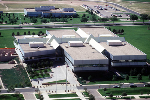
The Air Force has critical aspects of their service based at Colorado Springs which carry on missile defense operations and development. The Air Force bases a large section of the national missile defense operations here, with Peterson Air Force Base set to operate large sections of the program. Peterson AFB is currently the headquarters of the majority of Air Force Space Command and the operations half of Army Space and Missile Defense Command/Army Strategic Command (SMDC/ARSTRAT).
Peterson is also headquarters for the United States Northern Command (USNORTHCOM), one of the Unified Combatant Commands. USNORTHCOM directs all branches of the U.S. military operations in their area of responsibility which includes the continental United States, Alaska, Canada, and Mexico. In the event of national emergencies the President or Secretary of Defense can call upon USNORTHCOM for any required military assistance. Service members from every branch of the US Military are stationed at the command.
Schriever Air Force Base (formerly Falcon AFB)
Main article: Schriever Air Force BaseSchriever Air Force Base is home to the 50th Space Wing, which controls warning, navigational, communications and spy satellites. It is also the home of the Space Warfare Center and the home for the 576th Flight Test Squadron.[45] It is the location of the Global Positioning System (GPS) master control station and GPS Operations Center[46] and the US Naval Observatory Alternate Master Clock,[47] used to synchronize GPS satellite time. Schriever is also developing parts of national missile defense and runs parts of the annual wargames used by the nation's military.
NORAD and Cheyenne Mountain Air Station
Main article: North American Aerospace Defense Command Cadets in front of the Academy Chapel
The North American Aerospace Defense Command (NORAD), a component of America's missile defense system, is located in Cheyenne Mountain Air Station. When it was built at the height of the Cold War, NORAD caused some anxiety for the residents in and around Colorado Springs, who believed the installation would be a primary target during a nuclear attack. Although NORAD still operates today, it is primarily tasked with the tracking of ICBMs, and the military has recently decided to place Cheyenne Mountain's NORAD/NORTHCOM operations on warm standby and move operations to nearby Peterson Air Force Base.[48]
United States Air Force Academy
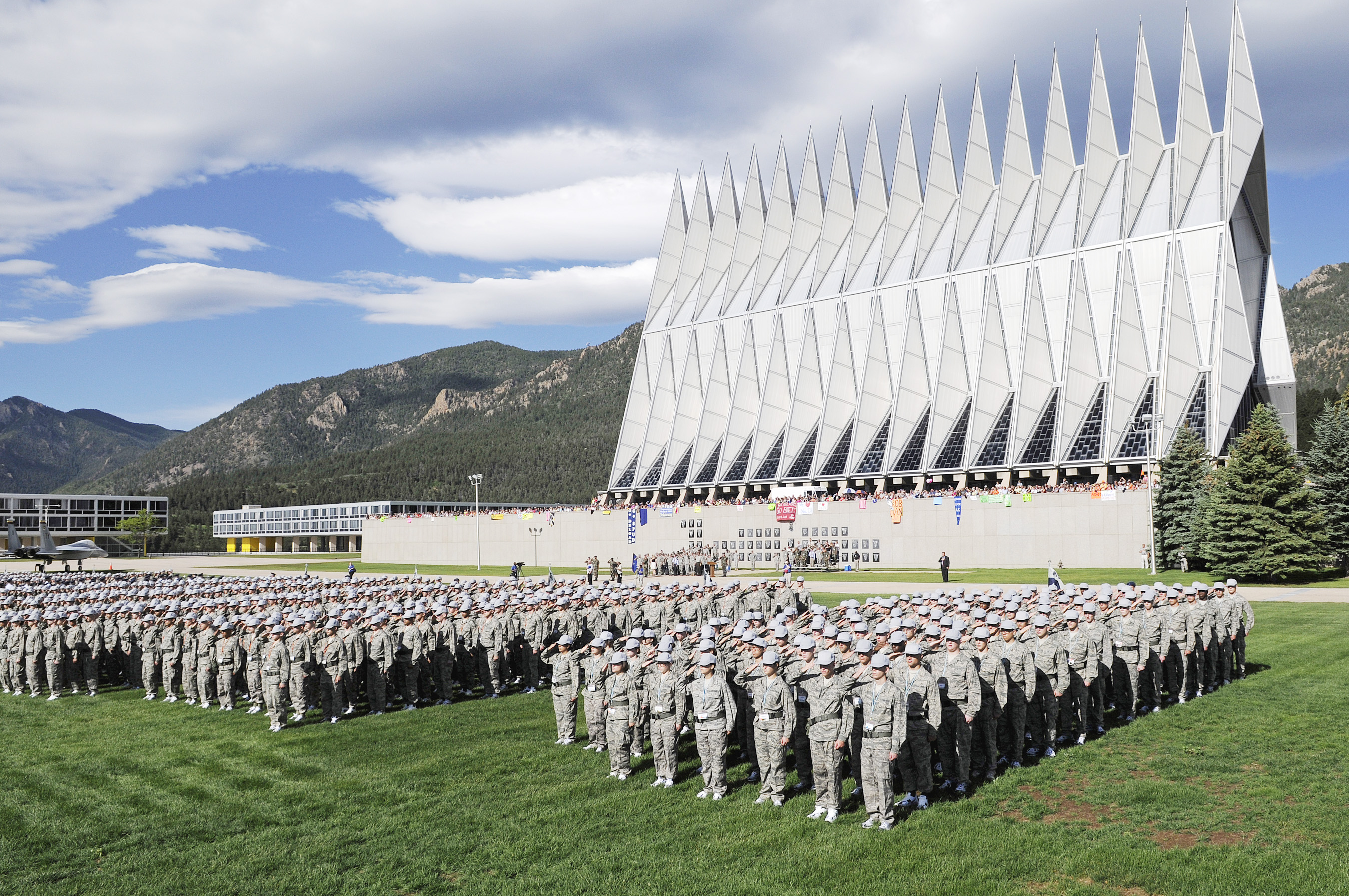
Main article: United States Air Force AcademyThe north end of the city is home to the vast United States Air Force Academy grounds, where cadets train to become officers in the Air Force. The campus is famous for its unique chapel and draws visitors year round. The Air Force sports programs belong to the Mountain West Conference.
Crime
In 2009, Colorado Springs reported 15 murders, 342 rapes, 525 robberies, 1,084 assaults, 3,305 burglaries, 10,340 larceny thefts, and 1,048 auto thefts. Colorado Springs also has gangs, mostly on the east, southeast, and south sides of the city. The East Side Crips (Dog City Crips) are on the east and southeast sides. The Ruthless Ass-Gangsters, another Crip gang, are located in the Prospect Lake area on the east side. The Watergate Crip Gang is another well known Crip set on the Southeast side of town. The Sureños are on the south side of the city. A large gang called the South Side Varrio (Sureños) is located in the Meadows Park neighborhood on the south side. A large population of Bloods are also in Colorado Springs, on the east side and southeast side of the city. A known Blood gang in the city is the Neighborhood 45 Bloods on the southeast side. Another gang in Colorado Springs is the East Dale Street Locos, which are on the east side of the city.[49] Because Referendum 2C for higher funding was not passed, the police have reduced some drug/gang surveillance, and prioritize some police calls, with property crimes having lower priority than others.[50][51] Colorado Springs is also home to one of the chapters of the Sons of Silence Motorcycle Club, which has a history of criminal violence within its ranks.
Tourism
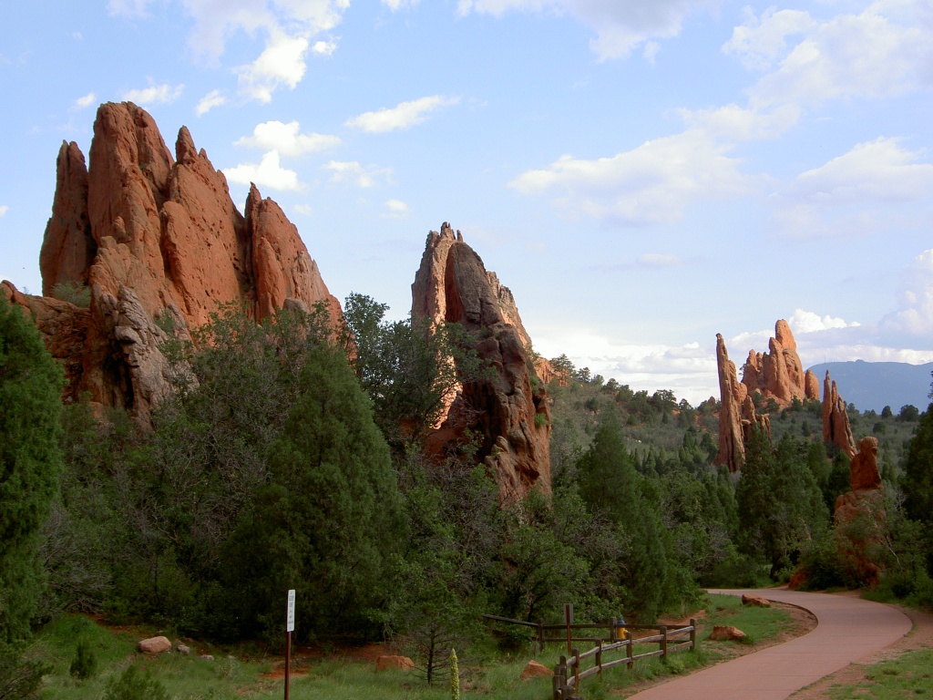
Main article: Colorado Springs TourismWith the city located at the base of the Rocky Mountains, and its many trails and parks, Colorado Springs is a popular destination for tourists seeking scenery, rock formations and other unique geological features, like Pikes Peak, Garden of the Gods park, Seven Falls, and Cave Of The Winds.
Colorado Springs has a variety of cultural, educational, and historical attractions including the Cheyenne Mountain Heritage Center, the ProRodeo Hall of Fame & Museum of the American Cowboy, the Cheyenne Mountain Zoo, the Colorado Springs Fine Arts Center, the Colorado Springs Pioneers Museum, the American Numismatic Association Money Museum, Peterson Air and Space Museum, and the United States Air Force Academy.
The Cultural Office of the Pikes Peak Region (COPPeR), located in downtown Colorado Springs, acts as an umbrella resource to support and advocate for the arts throughout the Pikes Peak Region. COPPeR operates a website called PeakRadar where organizations can post events happening around the city to boost community involvement and cultural awareness.[52]
Sports
Olympic sports
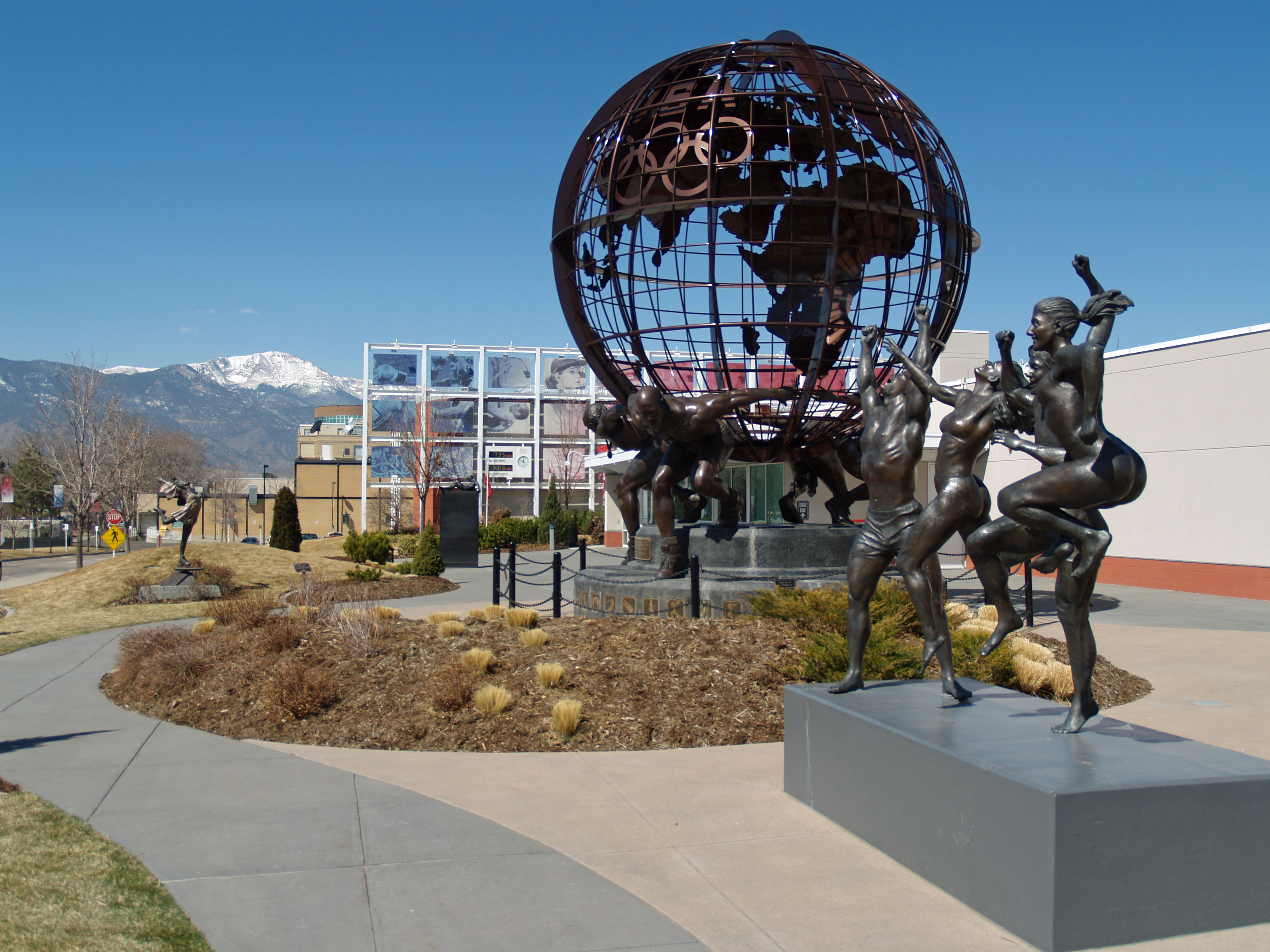
 The United States Olympic Committee headquarters and training facility.
Colorado Springs is home to the United States Olympic Training Center and the headquarters of the United States Olympic Committee. In addition, a number of United States national federations for individual Olympic sports have their headquarters in Colorado Springs, including:
- United States Bobsled and Skeleton Federation
- United States Fencing Association
- United States Figure Skating Association
- USA Basketball
- USA Boxing
- USA Cycling
- USA Judo
- USA Hockey
- USA Swimming
- USA Shooting
- USA Table Tennis
- USA Triathlon
- USA Volleyball
- USA Wrestling
The city has a particularly long association with the sport of figure skating, having hosted the U.S. Figure Skating Championships 6 times and the World Figure Skating Championships 5 times. It is home to the World Figure Skating Museum and Hall of Fame and the Broadmoor Skating Club, a notable training center for the sport. In recent years, the World Arena has hosted skating events such as Skate America and the Four Continents Figure Skating Championships.
Local teams
Name Sport Founded League Venue Colorado Springs Sky Sox Baseball 1988 Minor league; Pacific Coast League Security Service Field Colorado Springs Blizzard Soccer 2004-Folded in 2006 United Soccer Leagues; USL Premier Development League Security Service Field Colorado Rush Men's Premier Soccer 2007 Premier Arena Soccer League; National Premier Soccer League (National Division III) Security Service Field Colorado Springs Rugby Football Club Rugby 1969 Eastern Rockies Rugby Football Union; USA Rugby; (National Division II) Bear Creek Park Colorado Springs Cricket Club Cricket 1999 Colorado Cricket League Rose Bowl, Memorial Park - The local colleges feature many sports teams. Notable among them are the following nationally competitive NCAA Division I teams: United States Air Force Academy (Fighting Falcons) Football, Basketball and Hockey, Colorado College (Tigers) Hockey, and Women's Soccer.
- Colorado Springs hosted the 1962 International Ice Hockey Federation World Championships (together with Denver).
- This nullifies a popular Canadian claim that the 2008 IIHF World Championships in Quebec City and Halifax marked the first time this event was organized on the American continent. However, the 2008 event was the first World Championship on the American continent in which NHL players were eligible to compete.
Other
- Colorado Springs was the original headquarters of the Professional Bull Riders (PBR) from its founding in 1992 until 2005, when the organization was moved to Pueblo; the PBR used to hold an annual Built Ford Tough Series event at the World Arena from 2001 until 2005 when the organization made the move to Pueblo.
Religious institutions
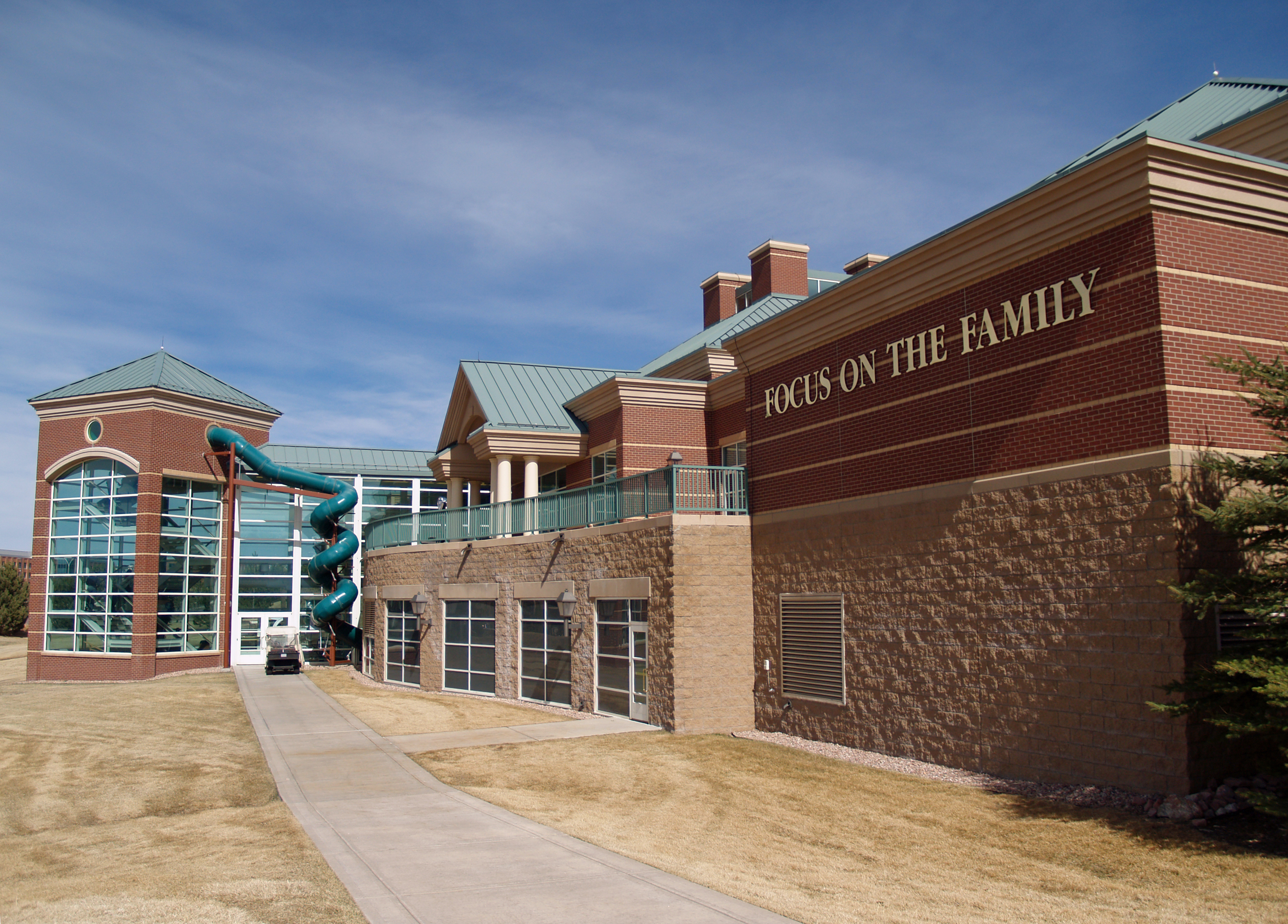
 Focus on the Family Visitors Center
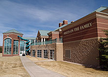
Although houses of worship of almost every major religion can be found in the city, Colorado Springs has attracted a large influx of Evangelical Christians and Christian organizations in recent years. At one time Colorado Springs was counted to be the national headquarters for 81 different religious organizations, earning the city the tongue-in-cheek nickname "the Evangelical Vatican"[53] and "The Christian Mecca"[citation needed]. Religious groups with regional or international headquarters in Colorado Springs include: the Association of Christian Schools International, the Christian and Missionary Alliance, Compassion International, Every Home for Christ, Focus on the Family, HCJB, the International Bible Society, The Navigators, the Roman Catholic Diocese of Colorado Springs, WAY-FM Media Group, Andrew Wommack Ministries, and Young Life. The city is also home to one mosque, the Islamic Society of Colorado Springs.
Transportation
Today, Colorado Springs has many features of a modern urban area, such as parks, bike trails, and urban open-area spaces. However, it is not exempt from problems that typically plague cities that experience tremendous growth like overcrowded roads and highways, crime, sprawl, and government budget issues. Many of the problems are indirectly or directly caused by the city's difficulty in coping with the large population growth experienced in the last 20 years and the annexing of the Banning Lewis Ranch area for 175,000 future residents.
Colorado Springs is served by a bus system called Mountain Metro (short for Mountain Metropolitan Transit). Mountain Metro also operates the Front Range Express (FREX) service, which connects Colorado Springs to Denver and several other metropolitan areas during weekdays. Although the transit system serves much of the city and its nearest suburbs, it lacks service to many important areas and has only limited hours of operation.
Colorado Springs is served by the Colorado Springs Municipal Airport. In the state of Colorado, only Denver International has more passenger traffic. The airport has experienced a higher recovery rate in the post-9/11 era than the rest of the country[54] and is in the process of expanding its maintenance facilities, taxiways, and runways to accommodate future growth. In 2005 it served approximately two million passengers.[54]
Major highways
In 2004, the voters of Colorado Springs and El Paso County established the Pikes Peak Rural Transportation Authority[55] and adopted a 1% sales tax dedicated to improving the region's transportation infrastructure. Together with state funding for the Colorado Springs Metro Interstate Expansion (COSMIX)(2007 completion) and the I-25 interchange with Highway 16 (2008 completion), significant progress has been made since 2003 in addressing the transportation needs of the area. Currently the City is trying to overcome a $23.3 million budget gap created by falling sales taxes and rising expenses.[56]
Colorado Springs is primarily served by the interstate highways I-25 and U.S. Route 24.
 Interstate 25 runs north-south from New Mexico through Colorado Springs to Denver on its way northward towards Wyoming. I-25 in El Paso County running through Colorado Springs is known as Ronald Reagan Highway.
 US 24 traverses through eastern Colorado from Limon through several towns such as Matheson, Simla, Ramah, Calhan, Peyton and Falcon until it reaches the city and leaves the city through the mountains on its way to Minturn, CO.
 SH 21 is a major east side expressway which begins near Black Forest and ends in Security-Widefield, also known more widely as Powers Boulevard.
 SH 83 runs north-south from Denver to Colorado Springs.
 SH 94 runs east-west from western Cheyenne County to Colorado Springs.
 SH 115 begins from the US 50 interchange in Cañon City to US 85 (Nevada Avenue) in the city.
 US 85 US 85 enters the city at Fountain and is signed as Nevada Avenue until it leaves the city at exit 153.
 US 87 US 87 remains concurrent with I-25 throughout Colorado.
In addition, there were plans to develop a "Front Range Toll Road", a privately owned turnpike, which would begin south of Pueblo and end around Fort Collins. This toll road would allow rail and truck traffic to avoid the more highly traveled parts of I-25 along the Front Range. Initially, the project had support but has since been highly contested because of the need to condemn the land of many private citizens, through the use of eminent domain, to make room for the corridor.[57]
Concerns and Improvements
In order to combat congestion the Colorado Department of Transportation widened the Interstate 25 corridor throughout the city from four lanes (two in each direction) to six lanes. Ultimately, the plan is to make the interstate eight lanes through the city when funding becomes available.[58] This plan is similar in nature to Denver's T-Rex expansion plan.
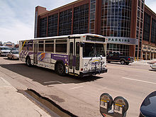 A Metro bus drives past a parking garage in downtown Colorado Springs.
Several suggestions have been made to create a loop around the city though none have been implemented. The original plan to convert Powers Boulevard, a major eastside expressway, into a bypass for I-25 was abandoned, although some interchanges are overpasses and roads further east are being looked at.[59] Easier access to the airport has also been suggested. Overall the new thoroughfares would include one (or two) loop freeways, a spur into the city connecting the main freeway and the loop, east-west expressway upgrades, and easier access to the Colorado Springs Airport.
Two grade separated interchanges were built in order to alleviate congestion at some of the city's worst intersections. Both the intersection at Powers and Woodmen and the intersection at Austin Bluffs and Union were converted into grade separated interchanges. A third interchange is being built at the intersection of Woodmen Road and Academy Boulevard and will be complete by 2011.
In early 2010, the city of Colorado Springs approved an expansion of the northernmost part of Powers Boulevard in order to create an Interstate 25 bypass commonly referred to as the Copper Ridge Expansion. The project developers also have hopes of increasing business at the future I-25 Powers Boulevard connection by building a 2.8 million sq. ft. shopping mall on the East side of the Powers exit.[60] Developers hope to have the project finished by 2013, but have a deadline of 2018.[61]
Colorado Springs is part of a consortium of cities trying to build the Front Range Commuter Rail.
Walkability
A 2011 study by Walk Score ranked Colorado Springs 34th most walkable of fifty largest U.S. cities.[62]
Media
Main article: Media in Colorado Springs, ColoradoEducation
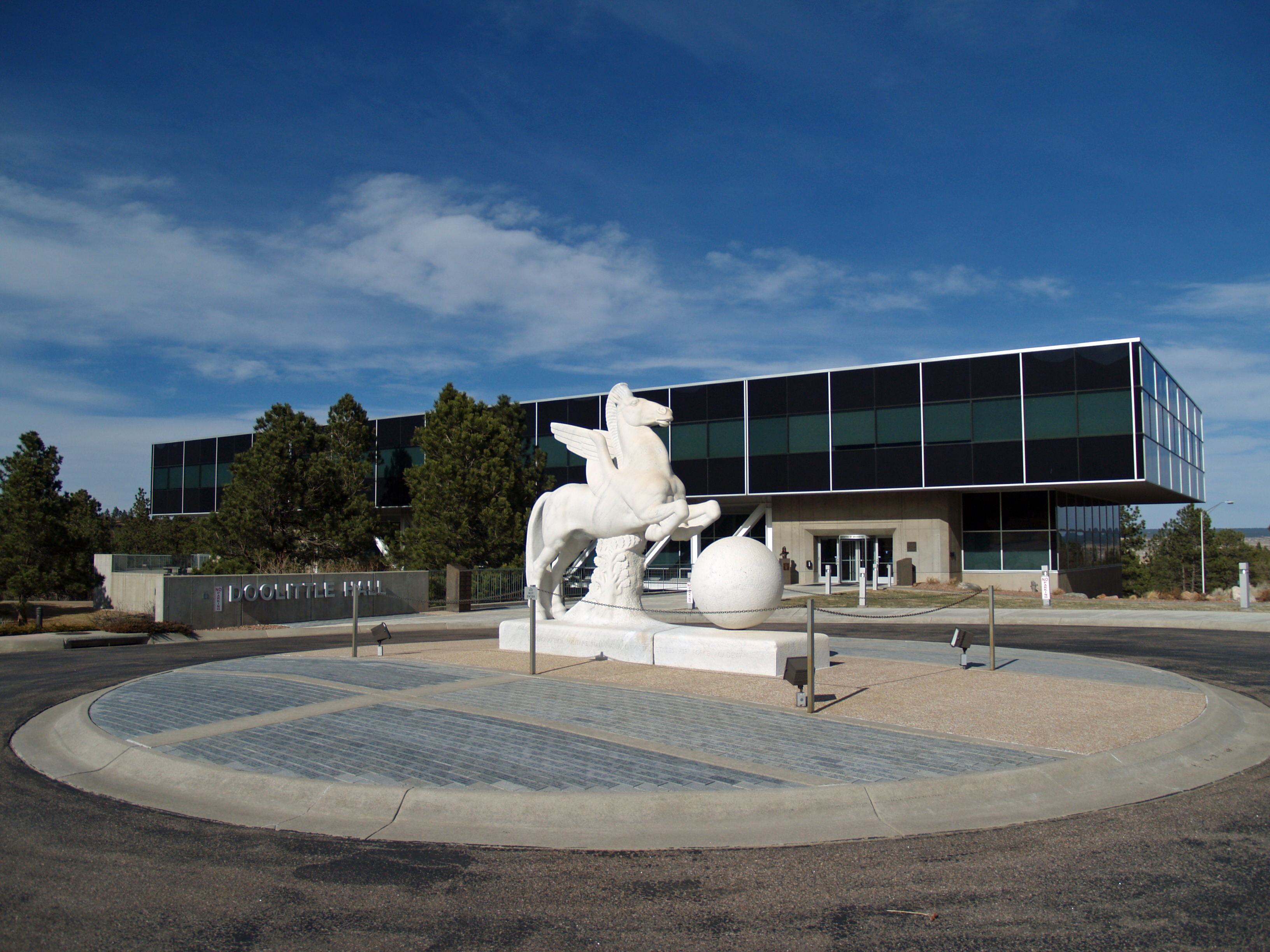
 Doolittle Hall on the campus of the United States Air Force Academy.
Universities, colleges and special schools include:
- Colorado College, founded in 1874
- IntelliTec College, founded in 1969
- The Colorado School for the Deaf and Blind, also founded in 1874
- The United States Air Force Academy, established on its present site in 1958
- The University of Colorado at Colorado Springs (UCCS), established on its present Cragmor grounds in 1965
- Pikes Peak Community College
- Nazarene Bible College
- Remington College, acquired in December 1998 and offering degree and diploma programs[63]
- Colorado Technical University, established in 1965
- Colorado State University–Pueblo, Citadel Campus
- DeVry University
- Regis University, Jesuit University
- University of the Rockies
The city's public schools are divided into several districts:
- Widefield School District 3 On the south end
- Academy School District 20 On the north end
- Colorado Springs School District 11 In the center of the city
- Falcon School District 49 On the east side
- Fountain-Fort Carson School District 8 On the far south end
- Harrison School District 2 In the south central area
- James Irwin Charter Schools In the east central area
- Cheyenne Mountain School District 12 In the southwest corner
- Colorado School for the Deaf and Blind
Private schools:
- The Colorado Springs School[64]
- Colorado Springs Christian Schools
- Evangelical Christian Academy
- Fountain Valley School of Colorado
- Hilltop Baptist School
- Springs Adventist Academy
- St. Mary's High School
- The Colorado Springs School
- Divine Redeemer Catholic School
- Pauline Memorial Catholic School
- Corpus Christi Catholic School
- Pikes Peak Christian School
Sister cities
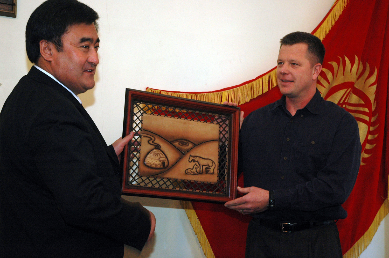
 Bishkek mayor Arstanbek Nogoev presents a gift for Colorado Springs mayor Lionel Rivera to a US airman at Manas Air Base, in a ceremony aimed at reviving ties between the two sister cities[65]
Sister cities of Colorado Springs include:
- Fujiyoshida, Japan (1962)
- Kaohsiung, Taiwan (1983)
- Smolensk, Russia (1993)
- Bishkek, Kyrgyzstan (1994)
- Nuevo Casas Grandes, Mexico (1996)
- Bankstown, Australia (1999)
Colorado Springs' sister city organization began when Colorado Springs became partners with Fujiyoshida. The torii gate erected to commemorate the relationship stands at the corner of Bijou Street and Nevada Avenue, and is one of the city's most recognizable landmarks. The torii gate, crisscrossed bridge and shrine, located in the median between Platte and Bijou Streets in downtown Colorado Springs, were a gift to Colorado Springs, erected in 1966 by the Rotary Club of Colorado Springs to celebrate the friendship between the two communities. A plaque near the torii gate states that "the purpose of the sister city relationship is to promote understanding between the people of our two countries and cities". The Fujiyoshida Student exchange program has become an annual event.
To strengthen relations between the two cities, the Colorado Springs Youth Symphony regularly invites the Taiko drummers from the city to participate in a joint concert in the Pikes Peak Center. The orchestra played in Bankstown, Australia, in 2002 and again in June 2006 as part of their tours to Australia and New Zealand.
Also, in 2006 and 2010, the Bankstown TAP (Talent Advancement Program), performed with the Youth Symphony, and the Colorado Springs Children's Chorale, as a part of the annual In Harmony program.
A notable similarity between Colorado Springs and its sister cities are their geographic positions, three of the six cities being located near the base of a major mountain or range.[66]
Notable residents
Main article: List of People from Colorado Springs, ColoradoColorado Springs has been home to a number of famous artists, including actor Lon Chaney, Sr., members of the band OneRepublic, science fiction author Robert Heinlein, Peanuts creator Charles M. Schulz, conductor-composer Manoah Leide-Tedesco, and jazz guitarist Johnny Smith. Several athletes have also resided in Colorado Springs, including Baseball Hall of Fame member Goose Gossage, NBA Hall of Famer Rick Barry and 2008 Olympic Gold Medalist Henry Cejudo. Additionally many well-known figure skaters, including Olympic champions Hayes Alan Jenkins, David Jenkins, and Peggy Fleming, have lived and trained in Colorado Springs during their competitive careers. Black Pegasus, a well known hip hop artist is from Colorado Springs. Award-winning author and lecturer Michael A. O'Donnell, Ph.D. resides here.
In popular culture
Main article: Colorado Springs in popular cultureColorado Springs has been the subject or setting for many books, movies and television shows, and is especially a frequent backdrop for political thrillers and military-themed stories because of its many military installations and vital importance to the United States' continental defense. Notable television series using the city as a setting include Dr. Quinn, Medicine Woman and the Stargate series Stargate SG-1 and the films WarGames and The Prestige.
See also
- Citadel Mall (Colorado Springs, Colorado)
- Colorado municipalities
- Marketplace At Austin Bluffs
- Pikes Peak Library District
- South Central Colorado Urban Area
References
- ^ a b "Active Colorado Municipalities". State of Colorado, Department of Local Affairs. http://www.dola.state.co.us/dlg/local_governments/municipalities.html. Retrieved September 1, 2007.
- ^ "Colorado Municipal Incorporations". State of Colorado, Department of Personnel & Administration, Colorado State Archives. December 1, 2004. http://www.colorado.gov/dpa/doit/archives/muninc.html. Retrieved September 2, 2007.
- ^ a b Colorado Trend Report 2: State and Complete Places (Sub-state 2010 Census Data). Missouri Census Data Center. Accessed 2011-02-25.
- ^ "ZIP Code Lookup" (JavaScript/HTML). United States Postal Service. http://zip4.usps.com/zip4/citytown.jsp. Retrieved September 7, 2007.
- ^ "What is Colorado Springs' population". July 18, 2009. http://www.springsgov.com/Page.aspx?NavID=115.
- ^ "Tables". U.S. Census bureau. http://factfinder2.census.gov/faces/tableservices/jsf/pages/productview.xhtml?pid=DEC_10_NSRD_GCTPL2.US24PR&prodType=table. Retrieved June 12, 2011.
- ^ "10 Best Big Cities". CNNMoney.com. September 30, 2009. http://money.cnn.com/magazines/moneymag/bplive/2006/top100/bigcities.html. Retrieved October 5, 2009.
- ^ "Best Towns 2009 | Outside Online". OutsideOnline.com. http://outsideonline.com/outside/destinations/200908/best-towns-america-colorado-springs.html. Retrieved October 5, 2009.
- ^ a b c "Taming a Wilderness Part 1". Ghostdepot.com. 1926-01-03. http://www.ghostdepot.com/rg/library/magazine/taming%201.htm. Retrieved 2011-10-23.
- ^ a b [1][dead link]
- ^ Mazel, Darcy. "Bristol Elementary School Historical Wall of Colorado Springs". http://www.cssd11.k12.co.us/bristol/bristol_wall/1880/front_1880_bobbies.htm. Retrieved 23 October 2011.
- ^ The Man on the Iron Horse by Rhoda Davis Wilcox
- ^ Colorado College Tutt Library. Colorado Springs Views Looking West on Pikes Peak Avenue. Inventory of the Colorado Springs Area: Early Views. Glass Plate Negatives C1-C12. Retrieved on: 2011-07-12.
- ^ Loevy, R. (August 1, 2010). The Complete History of the Old North End Neighborhood in Colorado Springs, Colorado, pp. 1-2. Colorado College. Retrieved on: 2011-07-12.
- ^ Colorado's War on Militant Unionism, James H. Peabody and the Western Federation of Miners, George G. Suggs, Jr., 1972, page 47
- ^ "Fort Carson, Colorado". Cdphe.state.co.us. October 29, 1995. http://www.cdphe.state.co.us/hm/ftcarson.htm. Retrieved October 5, 2009.
- ^ Colorado historical marker, Interstate 25, Colorado Springs, Colorado
- ^ "City of Colorado Springs – Drought". November 3, 2010. http://www.springsgov.com/Page.aspx?NavID=1188.
- ^ "Colorado Springs". Climate-zone.com. http://www.climate-zone.com/climate/united-states/colorado/colorado-springs/. Retrieved September 15, 2010.
- ^ "Monthly Averages for Colorado Springs, CO". The Weather Channel. http://www.weather.com/weather/wxclimatology/monthly/graph/USCO0078?from=month_bottomnav_undeclared. Retrieved September 19, 2008.
- ^ "NCDC: U.S. Climate Normals". National Oceanic and Atmospheric Administration. http://cdo.ncdc.noaa.gov/climatenormals/clim20/co/051778.pdf. Retrieved September 14, 2010.
- ^ a b U.S. Census Bureau (2009). "Incorporated Places and Minor Civil Divisions: Coorado" (CSV). 2008 Population Estimates. http://www.census.gov/popest/cities/files/SUB-EST2008-8.csv. Retrieved September 21, 2009.
- ^ Moffatt, Riley. Population History of Western U.S. Cities & Towns, 1850–1990. Lanham: Scarecrow, 1996, 68.
- ^ a b c "SAS Output". Mcdc.missouri.edu. http://mcdc.missouri.edu/webrepts/pl94trends/Colorado_stplace2.html. Retrieved 2011-10-23.
- ^ "Estimates of Population Change for Metropolitan Statistical Areas and Rankings: July 1, 2007 to 1 July 2008". Census.gov. http://www.census.gov/popest/metro/CBSA-est2008-pop-chg.html. Retrieved October 5, 2009.
- ^ "Detailed tables". U.S. Census Bureau. http://factfinder.census.gov/servlet/DTTable?_bm=y&-geo_id=16000US0816000&-ds_name=ACS_2008_3YR_G00_&-redoLog=false&-mt_name=ACS_2008_3YR_G2000_B03001. Retrieved September 15, 2010.
- ^ "American FactFinder". United States Census Bureau. http://factfinder.census.gov. Retrieved 2008-01-31.
- ^ Daniel Chacón (August 25, 2009). "Council's ballot proposals up for formal vote | formal, ballot, city – Public Affairs – Colorado Springs Gazette, CO". Gazette.com. http://www.gazette.com/news/formal-60744-ballot-city.html. Retrieved October 5, 2009.
- ^ Michael Booth (January 31, 2010). "Colorado Springs cuts into services considered basic by many". denverpost.com. http://www.denverpost.com/news/ci_14303473. Retrieved February 1, 2010.
- ^ Colorado Springs Gazette[dead link]
- ^ "(2006–2007 Southern Colorado Economic Forum Publication". p. 18. Archived from the original on May 14, 2008. http://web.archive.org/web/20080514213139/http://web.uccs.edu/scef/data/scef/. Retrieved September 15, 2010.
- ^ a b SCEF – Southern Colorado Economic Forum[dead link]
- ^ "A barren Garden of the Gods". EETimes.com. http://www.eetimes.com/showArticle.jhtml;jsessionid=GSV0A5KE3CCGUQSNDLPCKHSCJUNN2JVN?articleID=196902115. Retrieved October 5, 2009.
- ^ Heilman, Wayne (July 18, 2008). "Colorado jobless rate at its highest since 2005 | percent, rate, colorado – Top Stories – Colorado Springs Gazette, CO". Gazette.com. http://www.gazette.com/articles/percent_38360___article.html/rate_colorado.html. Retrieved October 5, 2009.
- ^ Heilman, Wayne (August 30, 2008). "Manufacturing, tech jobs slipping away from Springs | manufacturing, springs, technology – Top Stories – Colorado Springs Gazette, CO". Gazette.com. http://www.gazette.com/articles/manufacturing_40004___article.html/springs_technology.html. Retrieved October 5, 2009.
- ^ Wayne Heilman gazette.com 09/19/08 email
- ^ Laden, Rich (June 20, 2008). "HP plans to open centers in Arkansas, New Mexico| springs, colorado, new – Breaking News – Colorado Springs Gazette, CO". Gazette.com. http://www.gazette.com/articles/springs_37486___article.html/colorado_new.html. Retrieved October 5, 2009.
- ^ Heilman, Wayne (June 25, 2008). "HP to 800 Springs workers: Move to New Mexico or lose jobs | center, springs, employees – Top Stories – Colorado Springs Gazette, CO". Gazette.com. http://www.gazette.com/articles/center_37622___article.html/springs_employees.html. Retrieved October 5, 2009.
- ^ Heilman, Wayne (June 27, 2008). "HP to IT workers: Move to Fort Collins or lose job | move, workers, employees – Top Stories – Colorado Springs Gazette, CO". Gazette.com. http://www.gazette.com/articles/move_37716___article.html/workers_employees.html. Retrieved October 5, 2009.
- ^ Heilman, Wayne (July 28, 2008). "1,000 Intel workers will get job-hunting help | intel, help, workers – Top Stories – Colorado Springs Gazette, CO". Gazette.com. http://www.gazette.com/articles/intel_38707___article.html/help_workers.html. Retrieved October 5, 2009.
- ^ Wayne Heilman (December 15, 2008). "Atmel lays off 245 employees in Springs | atmel, employees, company – Breaking News – Colorado Springs Gazette, CO". Gazette.com. http://www.gazette.com/articles/atmel_44889___article.html/employees_company.html. Retrieved October 5, 2009.
- ^ Sept 2007, Tammy Fields, Colorado Springs Economic Development Corporation
- ^ http://www.highbeam.com/doc/1G1-18160963.html
- ^ "City of Colorado Springs CAFR" (PDF). http://www.springsgov.com/units/finance/CAFR2009Final.pdf. Retrieved 2011-10-23.
- ^ Wilson, Jim (February 28, 1997). "The New 'Area 51'". Popular Mechanics. http://www.popularmechanics.com/science/air_space/1282451.html?page=3. Retrieved October 5, 2009.
- ^ "GPS Operations Center". Air Force Space Command. http://gps.afspc.af.mil/. Retrieved September 15, 2010.
- ^ Staff Sgt. Don Branum (Updated 6/15/2006). "23:59:60...Atomic clock takes quantum leap". Air Force Space Command. http://www.afspc.af.mil/news/story_media.asp?storyID=123021871. Retrieved September 15, 2010.
- ^ Finley, Bruce (July 27, 2006). "Military to put Cheyenne Mountain on standby – The Denver Post". The Denver Post<!. http://www.denverpost.com/nationworld/ci_4103478. Retrieved October 5, 2009.
- ^ "Gangs in Colorado Springs". The Gazette (Colorado Springs). August 12, 2001. http://findarticles.com/p/articles/mi_qn4191/is_20010812/ai_n9990350/.
- ^ "Service Reduction Impacts". Fire Department. Springsgov.com. http://www.springsgov.com/units/budget/2010/ServiceImpactsforFinal_5-19-2010.pdf. Retrieved September 15, 2010.
- ^ "Police". Springsgov.com. http://www.springsgov.com/units/budget/2010/20-Police.pdf. Retrieved September 15, 2010.
- ^ Culture Office of the Pikes Peak Region Overview. Retrieved on: 2011-07-12.
- ^ Ridgeway, James (January 15, 2010). "Day eight Sunday morning in the 'evangelical Vatican'". The Guardian (London). http://www.guardian.co.uk/world/uselectionroadtrip/2008/oct/20/uselections2008. Retrieved April 30, 2010.
- ^ a b "Colorado Springs Airport – News Releases". Springsgov.com. http://www.springsgov.com/AirportPage.asp?PageID=4704. Retrieved October 5, 2009.
- ^ "PPRTA Homepage". Pprta.com. September 28, 2009. http://www.pprta.com. Retrieved October 5, 2009.
- ^ Zubeck, Pam (August 16, 2008). "Cut, don't raise taxes or fees August 25, 2008". Gazette.com. http://www.gazette.com/articles/million_39774___article.html/council_city.htmlCouncil:. Retrieved October 5, 2009.
- ^ "?". http://www.nosuperslab.org/crap/how_to.html.[dead link]
- ^ "Litter Removal Program". Colorado Department of Transportation’s (CDOT). http://www.cosmixproject.com/. Retrieved September 15, 2010.
- ^ Sealover, Ed (December 24, 2006). "Powers freeway debate restarts | Gazette, The (Colorado Springs)". Findarticles.com. http://findarticles.com/p/articles/mi_qn4191/is_20061224/ai_n17109195. Retrieved October 5, 2009.
- ^ Sealover, Ed (February 3, 2011). "For the love of a road; Colorado Springs Independent, The (Colorado Springs)". http://www.csindy.com. http://www.csindy.com/colorado/for-the-love-of-a-road/Content?oid=2033692. Retrieved February 9, 2011.
- ^ Sealover, Ed (May 13, 2010). "Copper Ridge takes a step; Colorado Springs Independent, The (Colorado Springs) | Find Articles at http://www.csindy.com". http://www.csindy.com. http://www.csindy.com/colorado/noted/Content?oid=1706080. Retrieved February 9, 2011.
- ^ "2011 City and Neighborhood Rankings". Walk Score. 2011. http://www.walkscore.com/rankings/cities/. Retrieved Aug 28, 2011.
- ^ "Remington College | Community Involvement | 3 Lives Blood Drive | Adopt Our School". Community.remingtoncollege.edu. http://community.remingtoncollege.edu/timeline.php. Retrieved 2011-10-23.
- ^ "The Colorado Springs School homepage". http://css.org. Retrieved September 15, 2010.
- ^ Nathaniel, Daniel (March 19, 2007), "Manas Airmen reunite sister cities Bishkek, Colorado Springs", Air Force Link (United States: Department of Defense), http://www.af.mil/news/story.asp?id=123045348, retrieved October 18, 2007
- ^ "City of Colorado Springs – Topic Pages". Springsgov.com. July 6, 2007. http://www.springsgov.com/Page.asp?NavID=1923. Retrieved October 5, 2009.
External links
- City of Colorado Springs website
- Colorado Springs Fine Arts Center
- Colorado Springs Travel Information: Colorado Springs Convention & Visitors Bureau
- Early Capitol and Legislative Assembly Locations
- Colorado City Historical Society
- 1905 Magazine Article with historical photos
Municipalities and communities of El Paso County, Colorado County seat: Colorado SpringsCities Colorado Springs | Fountain | Manitou Springs
Towns Calhan | Green Mountain Falls‡ | Monument | Palmer Lake | Ramah
CDPs Air Force Academy | Black Forest | Cascade-Chipita Park | Cimarron Hills | Ellicott | Fort Carson | Gleneagle | Peyton | Rock Creek Park | Security-Widefield | Stratmoor | Woodmoor
Unincorporated
communitiesFootnotes ‡This populated place also has portions in an adjacent county or counties
50 most populous cities of the United States (2010 United States Census Bureau)Mayors of cities with populations exceeding 100,000 in Colorado - Michael Hancock
(Denver) - Lionel Rivera
(Colorado Springs)
- Doug Hutchinson
(Fort Collins) - Erik Hansen
(Thornton)
- Bob Frie
(Arvada) - Nancy McNally
(Westminster)
- Barbara Vidmar*
(Pueblo)

- President of the Pueblo City Council
Other states: AL • AK • AZ • AR • CA • CO • CT • DE • FL • GA • HI • ID • IL • IN • IA • KS • KY • LA • ME • MD • MA • MI • MN • MS • MO • MT • NE • NV • NH • NJ • NM • NY • NC • ND • OH • OK • OR • PA • RI • SC • SD • TN • TX • UT • VT • VA • WA • WV • WI • WY
Categories:- Cities in Colorado
- Colorado Springs, Colorado
- County seats in Colorado
- Pikes Peak
- Populated places established in 1871
- Populated places in El Paso County, Colorado
- United States colonial and territorial capitals


Wikimedia Foundation. 2010.