- Longmont, Colorado
-
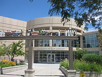
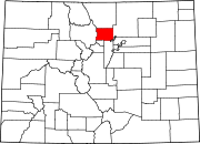
City of Longmont, Colorado — City — Longmont Safety and Justice Center Location in Boulder County and the state of Colorado Coordinates: 40°10′18″N 105°6′33″W / 40.17167°N 105.10917°WCoordinates: 40°10′18″N 105°6′33″W / 40.17167°N 105.10917°W Country USA State  State of Colorado
Counties[1] Boulder County
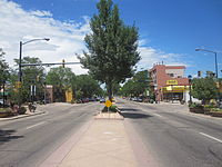
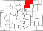
Weld CountyFounded 1871 Incorporated November 15, 1885[2] Named for Stephen Harriman Long and Longs Peak Government – Type Home Rule Municipality[1] – Mayor Bryan L. Baum (List) Area – Total 21.8 sq mi (56.4 km2) – Land 21.8 sq mi (56.4 km2) – Water 0 sq mi (0 km2) Elevation[3] 4,984 ft (1,519 m) Population (2010) – Total 86,270 – Density 3,261.1/sq mi (1,260.5/km2) Time zone MST (UTC-7) – Summer (DST) MDT (UTC-6) ZIP codes[4] 80501-80504 Area code(s) Both 303 and 720 FIPS code 08-45970 GNIS feature ID 0202560 Highways US 287, SH 66, SH 119 Website City of Longmont Thirteenth most populous Colorado city Longmont is a Home Rule Municipality in Boulder and Weld counties in the U.S. state of Colorado. Longmont is located in Northern Colorado. Longmont is the 13th most populous city in the State of Colorado. The word "Longmont" comes from Longs Peak, a prominent mountain named for explorer Stephen H. Long that is clearly visible from Longmont, and "mont" from the French word for mountain. The city is located northeast of the county seat of Boulder and 31 miles (50 km) north-northwest of the Colorado State Capitol in Denver. In contrast to its better-known neighbor, Longmont has a much more quiet and residential feel, although the city has begun to grow rapidly in recent years. The population was 86,270 at the 2010 census.
Also notable, Longmont was declared an "All-America City" by the National Civic League in June 2006. The city was also named number 50 on the 2008 list of the top 100 places to live in the United States by Money Magazine.[5]
Contents
History
Longmont was founded in 1871 by a group of people from Chicago, Illinois.[citation needed] Originally called the Chicago-Colorado Colony, the men sold memberships in the town and with the proceeds purchased the land necessary for the town hall. As the first planned community in Boulder County, the city streets were laid out in a grid plan in a square mile. The city began to flourish as an agricultural community after the building of the Colorado Central Railroad line arrived northward from Boulder in 1877. In the 1940s the city began to grow beyond these original limits, and extended into the western settlements to establish trade relations with nearby colonies. In the 1960s the federal government located an air-traffic control center in town and IBM built a large plant near the city. As agriculture waned, more high technology has come to the city including companies like Seagate and Amgen. In April 2009 GE Energy relocated their control solutions business to the area. The downtown along Main Street, once nearly dead during the 1980s, has seen a vibrant revival in the last decade, and into the turn of the century. In the mid 1990s, the south edge of the city became the location of the first New Urbanist project in Colorado, called Prospect New Town, designed by renowned architects Andres Duany and Elizabeth Plater-Zyberk.
- Further information on Longmont's history, see The Official City of Longmont History and the Longmont Museum & Cultural Center.
Education
In September 2010, the Institute of Business & Medical Careers opened its newest campus in Longmont. The college provides professional training, preparation, and career support for students interested in a career in the business or medical professions.[6]
Longmont is home to a branch of Regis University and the Boulder County Campus of Front Range Community College.
Longmont also offers a variety private schools. Well known private schools in the area include Bloom! Montessori School [1].
Geography
Longmont is located at 40°10′18″N 105°06′33″W / 40.171583°N 105.109085°W.[7] Elevation is about 1525 meters (approx. 5000 feet) above sea level. Official designation for elevation is at Main Street and the St. Vrain River.
According to the United States Census Bureau, the city has a total area of 21.8 square miles (56 km2), of which, 21.8 square miles (56 km2) of it is land and 0.05% is water.
Longmont is an exurb[citation needed] of Denver, on U.S. Highway 287. By 2016, it will be the Route 36 Corridor endpoint for the FasTracks commuter rail network.
Transportation
Longmont is part of the RTD transit district that provides local and regional bus service to Denver and Boulder, Colorado.
Outside of RTD, Longmont is connected to Fort Collins, Loveland, and Berthoud via the FLEX regional bus route.
Media
Longmont Times-Call (official web site Longmont Times-Call) is the local daily newspaper.
Radio stations include KRCN, KGUD, and. KKFN
Demographics
Historical populations Census Pop. %± 1880 773 — 1890 1,543 99.6% 1900 2,201 42.6% 1910 4,256 93.4% 1920 5,843 37.3% 1930 6,029 3.2% 1940 7,406 22.8% 1950 8,099 9.4% 1960 11,489 41.9% 1970 23,209 102.0% 1980 42,942 85.0% 1990 51,555 20.1% 2000 71,093 37.9% 2010 86,270 21.3% U.S. Decennial Census As of the census[8] of 2000, there were 71,093 people, 26,667 households, and 18,453 families residing in the city. The population density was 3,262.3 people per square mile (1,259.7/km²). There were 27,394 housing units at an average density of 1,257.0 per square mile (485.4/km²). The racial makeup of the city was:
- 84.76% White
- 0.54% African American
- 0.97% Native American
- 1.76% Asian
- 0.06% Pacific Islander
- 9.76% from other races
- 2.2% from two or more races.
- Hispanic or Latino of any race were 19.07% of the population.
There were 26,667 households out of which 36.9% had children under the age of 18 living with them, 54.6% were married couples living together, 10.1% had a female householder with no husband present, and 30.8% were non-families. 23.7% of all households were made up of individuals and 7.3% had someone living alone who was 65 years of age or older. The average household size was 2.64 and the average family size was 3.15.
In the city the population was spread out with 27.9% under the age of 18, 8.5% from 18 to 24, 33.1% from 25 to 44, 21.3% from 45 to 64, and 9.2% who were 65 years of age or older. The median age was 34 years. For every 100 females there were 97.9 males. For every 100 females age 18 and over, there were 95.6 males.
The median income for a household in the city was $51,174, and the median income for a family was $58,037. Males had a median income of $40,978 versus $29,582 for females. The per capita income for the city was $23,409. About 5.9% of families and 7.8% of the population were below the poverty line, including 10.6% of those under age 18 and 6.2% of those age 65 or over.
Economy
According to the Longmont Area Economic Council,[9] the top eleven employers in Longmont are:
- St. Vrain Valley Schools (regional school district) with 4875 employees
- Longmont United Hospital with 1282 employees
- Seagate Technology with 1160 employees
- City of Longmont with 814 employees
- Amgen with 789 employees
- Intrado with 762 employees
- Federal Aviation Administration with 540 employees
- DigitalGlobe with 437 employees
- McLane Western with 425 employees
- Butterball, LLC formerly ConAgra (which operates a turkey processing plant) with 381 employees[10]
Notable residents
- Vance D. Brand, former astronaut[11]
- Greg Biekert, professional football player (played football for Longmont High School[12])
- John R. Kelso, U.S. Representative and author (lived and died in Longmont)[13]
- David Pauley, pitcher for the Detroit Tigers[14]
- Kristen Schaal, comedian and actress, grew up in Longmont[15]
- Dan Simmons, author (1990 Hugo Award winner)[16]
- William Oxley Thompson, Pastor of Central Presbyterian Church (Longmont), President of Longmont Presbyterian College, President of Miami University (Ohio) ,President of The Ohio State University.
- Rachel Crow, Contestant on The X Factor (2011)
Mayors
This is a list of Mayors of Longmont.[17]
Mayor Term L. H. Dickson 1881–1885 George T. Dell 1885–1887 Charles H. Baker 1887–1888 John B. Thompson 1888–1889 Ira L. Herron 1889–1890 Frank Stickney 1890–1892 John A. Buckley 1892–1894 Neil C. Sullivan 1894–1896 George W. Coffin 1896–1897 Willis A. Warner 1897–1898 Frank M. Downer 1898–1899 Frank M. Miller 1899–1901 John A. Donovan 1901–1903 Samuel C. Morgan 1903–1905 Charles A. Bradley 1905–1909 Frank P. Secor 1909–1911 Rae H. Kiteley 1911–1921 James F. Hays 1921–1927 Fred W. Flanders 1927–1929 Earl T. Ludlow 1929–1931 Ray Lanyon 1931–1943 Fred C. Ferguson 1943–1947 George A. Richart 1947–1949 Otto F. Vliet 1949–1957 Richard C. Troxell 1957–1959 Albert Will 1959–1961 Ralph R. Price 1961–1969 Alexander Zlaten 1969–1971 Pro Tem Wade Gaddis 1971–1973 Pro Tem Austin P. Stonebreaker 1973–1974 Alvin G. Perenyi 1975–1977 George F. Chandler 1977 Pro Tem E. George Patterson Jr. 1977–1979 Robert J. Askey 1979–1981 William G. Swenson 1981–1985 Larry Burkhardt 1985–1987 Alvin E. Sweney 1987–1989 Fred Wilson 1989–1993 Leona Stoecker 1993–2001 Julia Pirnack 2001–2007 Roger Lange 2007–2009 Bryan L. Baum 2009–2011 Dennis L. Coombs 2011– Sister cities
Longmont is a sister city of these municipalities:
 Chino, Japan
 Guzman, Mexico
See also
- Boulder County, Colorado
- Boulder Metropolitan Statistical Area
- Colorado municipalities
- Denver-Aurora-Boulder Combined Statistical Area
- Front Range Urban Corridor
- Greeley Metropolitan Statistical Area
- List of mayors of Longmont, Colorado
- State of Colorado
- Weld County, Colorado
References
- ^ a b "Active Colorado Municipalities". State of Colorado, Department of Local Affairs. http://www.dola.state.co.us/dlg/local_governments/municipalities.html. Retrieved September 1, 2007.
- ^ "Colorado Municipal Incorporations". State of Colorado, Department of Personnel & Administration, Colorado State Archives. December 1, 2004. http://www.colorado.gov/dpa/doit/archives/muninc.html. Retrieved September 2, 2007.
- ^ "US Board on Geographic Names". United States Geological Survey. 2007-10-25. http://geonames.usgs.gov. Retrieved 2008-01-31.
- ^ "ZIP Code Lookup" (JavaScript/HTML). United States Postal Service. http://zip4.usps.com/zip4/citytown.jsp. Retrieved November 15, 2007.
- ^ "Best places to live 2008 – Top 100 City details: Longmont, CO – from MONEY Magazine". CNNMoney.com. August 2008. http://money.cnn.com/magazines/moneymag/bplive/2008/snapshots/PL0845970.html. Retrieved May 2, 2009.
- ^ IBMC Purpose
- ^ "US Gazetteer files: 2010, 2000, and 1990". United States Census Bureau. 2011-02-12. http://www.census.gov/geo/www/gazetteer/gazette.html. Retrieved 2011-04-23.
- ^ "American FactFinder". United States Census Bureau. http://factfinder.census.gov. Retrieved 2008-01-31.
- ^ Longmont Area Economic Council (October 2009). "LONGMONT AREA TOP EMPLOYERS" (PDF). http://www.longmont.org/media/docs/PDF%20Files/Topemployers.pdf. Retrieved August 25, 2010.
- ^ Wallace, Alicia (June 28, 2008). "Butterball cuts 209 jobs in Longmont". Daily Camera. http://www.dailycamera.com/news/2008/jun/24/butterball-cuts-209-jobs-longmont/. Retrieved February 15, 2009.[dead link]
- ^ "Astronaut Bio: V.D. Brand". National Aeronautics and Space Administration. April 2008. http://www.jsc.nasa.gov/Bios/htmlbios/brand.html. Retrieved May 7, 2009.
- ^ "Looking back at Colorado's best". Denver Post. 2006-11-30. http://www.denverpost.com/devlin/ci_4744449. Retrieved 2010-08-25.
- ^ "KELSO, John Russell". Biographical Directory of the United States Congress. http://bioguide.congress.gov/scripts/biodisplay.pl?index=K000081. Retrieved 2010-08-25.
- ^ "David Pauley Stats, Bio, Photos, Highlights". Major League Baseball. http://mlb.mlb.com/team/player.jsp?player_id=456102. Retrieved 2011-08-16.
- ^ The Kooky Monster – The Age, March 13, 2008. Retrieved on May 16, 2008.
- ^ Evans, Clay (February 7, 2007). "Myth and madness in the frozen north". Boulder Daily Camera. http://www.dailycamera.com/archivesearch/ci_13073336. Retrieved February 19, 2010.
- ^ "Mayors of Longmont since 1881". City of Longmont. November 13, 2007. http://www.ci.longmont.co.us/about/longmont_mayors.htm. Retrieved May 2, 2009.
Note: For Dan Simmons, ref http://www.dansimmons.com/about/bio.htm is for Front Range Colo, not for Longmont.
External links
- City of Longmont website
- CDOT map of the City of Longmont
- History of Longmont
- Longmont Times-Call (local newspaper)
- FreeRangeLongmont.com (local political blog)
- Longmont Channel 8 (Public-access television station)
Municipalities and communities of Boulder County, Colorado Cities Boulder | Lafayette | Longmont‡ | Louisville
Towns CDPs Allenspark | Altona | Bark Ranch | Bonanza Mountain Estates | Coal Creek‡ | Crisman | Eldora | Eldorado Springs | Glendale | Gold Hill | Gunbarrel | Hidden Lake | Lazy Acres | Leyner | Mountain Meadows | Niwot | Paragon Estates | Pine Brook Hill | Sugarloaf | St. Ann Highlands | Seven Hills | Sunshine | Tall Timber | Valmont
Unincorporated
communitiesCaribou | Hygiene | Pinecliffe
Footnotes ‡This populated place also has portions in an adjacent county or counties
Municipalities and communities of Weld County, Colorado Cities Brighton‡ | Dacono | Evans | Fort Lupton | Greeley | Longmont‡ | Northglenn‡ | Thornton‡
Towns CDP Unincorporated
communitiesAdna | Auburn | Briggsdale | Carr | Galeton | Gill | Hereford | Highlandlake | Lucerne | Prospect Valley | Roggen | Stoneham | Tampa | Wattenburg
Ghost towns Footnotes ‡This populated place also has portions in an adjacent county or counties
Categories:- Longmont, Colorado
- Populated places in Boulder County, Colorado
- Populated places in Weld County, Colorado
- Cities in Colorado
Wikimedia Foundation. 2010.


