- Leadville, Colorado
-
"Leadville" redirects here. For the town in Australia, see Leadville, New South Wales.
City of Leadville, Colorado — City — Downtown Leadville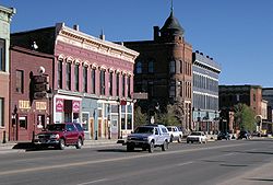
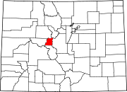
Nickname(s): The Two-Mile-High City Location in Lake County and the State of Colorado U.S. Census Map
Coordinates: 39°14′50″N 106°17′33″W / 39.24722°N 106.2925°W Country  United States
State  State of Colorado
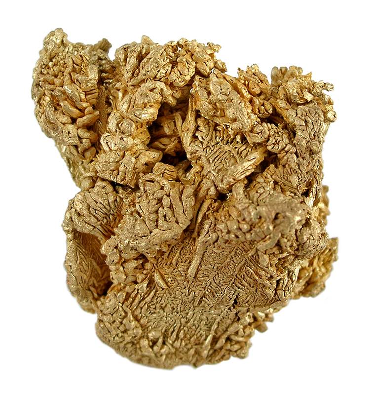
County Lake County Seat[1] Founded 1877 Incorporated February 18, 1878[2] Government - Type Statutory City[1] Area - Total 1.1 sq mi (2.7 km2) - Land 1.1 sq mi (2.7 km2) - Water 0.0 sq mi (0.0 km2) Elevation 10,152 ft (3,094 m) Population (2005) - Total 2,688 - Density 2,659.5/sq mi (1,026.8/km2) Time zone Mountain (MST) (UTC-7) - Summer (DST) MDT (UTC-6) ZIP codes[3] 80429 (PO Box), 80461 Area code(s) 719 FIPS code 08-44320 GNIS feature ID 0204683 Highest city in the United States 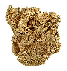 Crystalline gold specimen from the old Ibex Mine, Breece Hill, Leadville mining district. 19th century specimen, 3.3 x 3.2 x 1.7 cm.
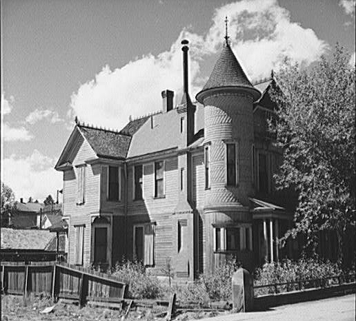
 Old Victorian house, Leadville. Marion Post Wolcott, photographer
Leadville is a Statutory City that is the county seat of, and the only municipality in, Lake County, Colorado, United States.[4] Situated at an elevation of 10,152 feet (3,094 m), Leadville is the highest incorporated city and the second highest incorporated municipality in the United States. A former silver mining town that lies near the headwaters of the Arkansas River in the heart of the Rocky Mountains, the city includes the Leadville Historic District, which preserves many historic structures and sites from Leadville's dynamic mining era.
In the late 19th century, Leadville was the second most populous city in Colorado, after Denver. The United States Census Bureau estimates that the city population has shrunk to only 2,688 in 2005.[5]
Contents
History
Oro City
Placer gold was discovered in California Gulch in 1860, during the Pikes Peak Gold Rush, and the town of Oro City sprung up near present-day Leadville. The boom was brief, and Oro City never became a major settlement. The placer gold mining was hampered by heavy brown sand in the sluice boxes.
Discovery of silver
In 1874, gold miners at Oro City discovered that the heavy sand that impeded their gold recovery was the lead mineral cerussite, that carried a high content of silver. Prospectors traced the cerussite to its source, and by 1876, had discovered several lode silver-lead deposits. The city of Leadville was founded near to the new silver deposits in 1877 by mine owners Horace Austin Warner Tabor and August Meyer,[6] setting off the Colorado Silver Boom. By 1880, Leadville was one of the world's largest silver camps, with a population of over 40,000.
Confederate scout, cowboy and stage actor with "Buffalo Bill" Cody's travelling revue, Texas Jack Omohundro died here in the summer of 1880, of pneumonia, one month before his 34th birthday. He was living there on a small estate with his wife, ballerina Giuseppina Morlacchi. It was during this period that Leadville saw its most dangerous days, finally brought under control by little-known American Old West lawman Mart Duggan.
In 1882, the Tabor Opera House hosted Oscar Wilde during his lecture tour, one of many celebrities who graced the city. Mayor David H. Dougan invited Wilde to tour the Matchless silver mine and open their new lode: "The Oscar." Wilde later recounted a visit to a local saloon, "where I saw the only rational method of art criticism I have ever come across. Over the piano was printed a notice – 'Please do not shoot the pianist. He is doing his best.'"
Around 1883, outlaw Doc Holliday moved to Leadville, shortly after the gun fight at the O.K. Corral. On August 19, 1884, Holliday shot ex-Leadville policeman, Billy Allen, after Allen threatened Holliday for failing to pay a $5 debt. Despite overwhelming evidence implicating him, a jury found Holliday not-guilty of the shooting or attempted murder.[7]
In its early years, Leadville was the site of famous mining swindles. When the Little Pittsburg mine exhausted its rich ore body, the managers sold their shares while concealing the actual condition of the mine from other stockholders. "Chicken Bill" Lovell dumped a wheelbarrow of rich silver ore into a barren pit on his Chrysolite mining claim in order to sell the claim to Horace Tabor for a large price. Tabor had the last laugh when his miners dug a few feet farther and discovered a rich ore body. Later, the manager of the Chrysolite mine fooled an outside mining engineer into overestimating the ore reserves of that mine.[8]
A bitter strike of hard rock miners in 1896–97 led to bloodshed, at least five deaths, and the burning of the Coronado Mine.[9]
Decline
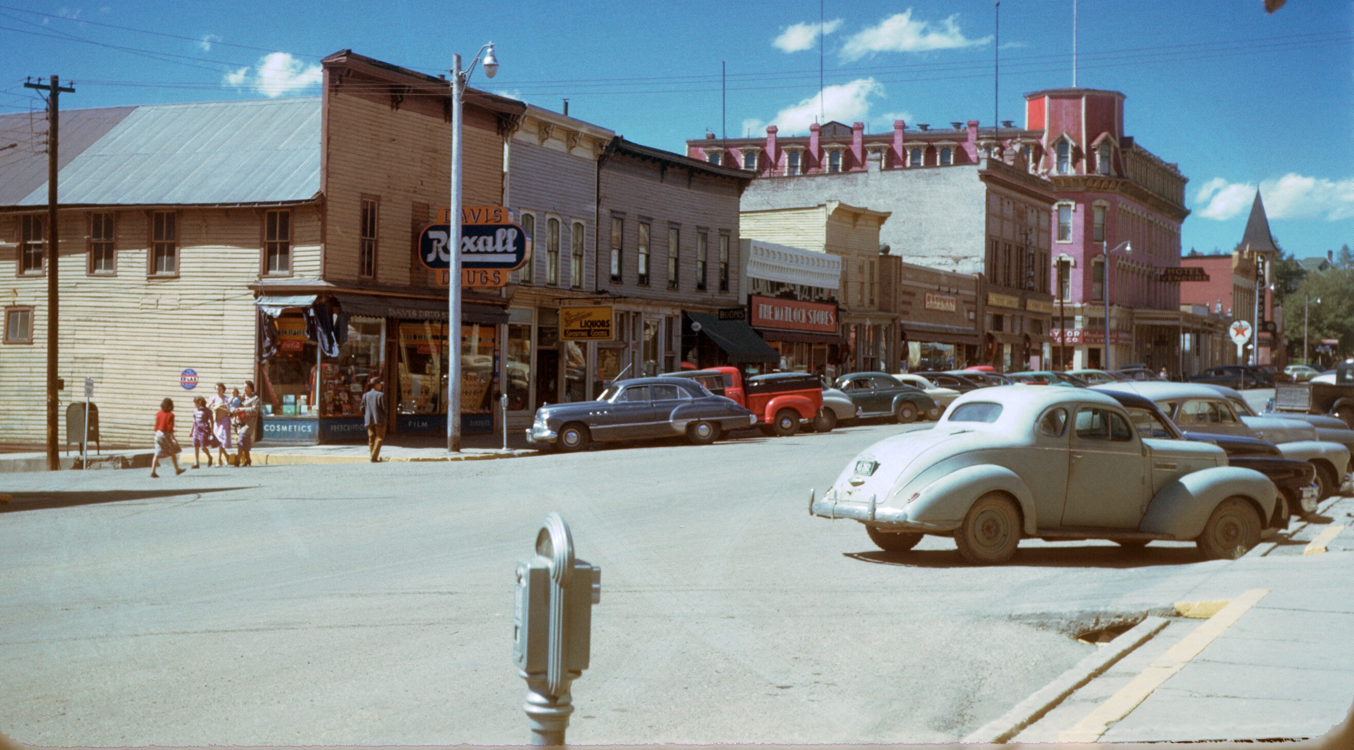
 Leadville in the 1950s
The city's fortunes declined with the repeal of the Sherman Silver Purchase Act in 1893, although afterwards there was another small gold boom. Mining companies came to rely increasingly on income from the lead and zinc.
The district is credited with producing over 2.9 million troy ounces of gold, 240 million troy ounces of silver, 1 million short tons of lead, 785 thousand short tons of zinc, and 53 thousand short tons of copper[10]
During World War II, Leadville was a popular spot for visits by soldiers at nearby Camp Hale, but only after the town acted to curb prostitution; until then, the United States Army declared the town off-limits for its personnel. The Army Air Forces built the Leadville Army Airfield northwest of the city.[11] The war also caused an increase in the mining of molybdenum at the nearby Climax mine, which at one time produced 75 percent of the world's molybdenum.
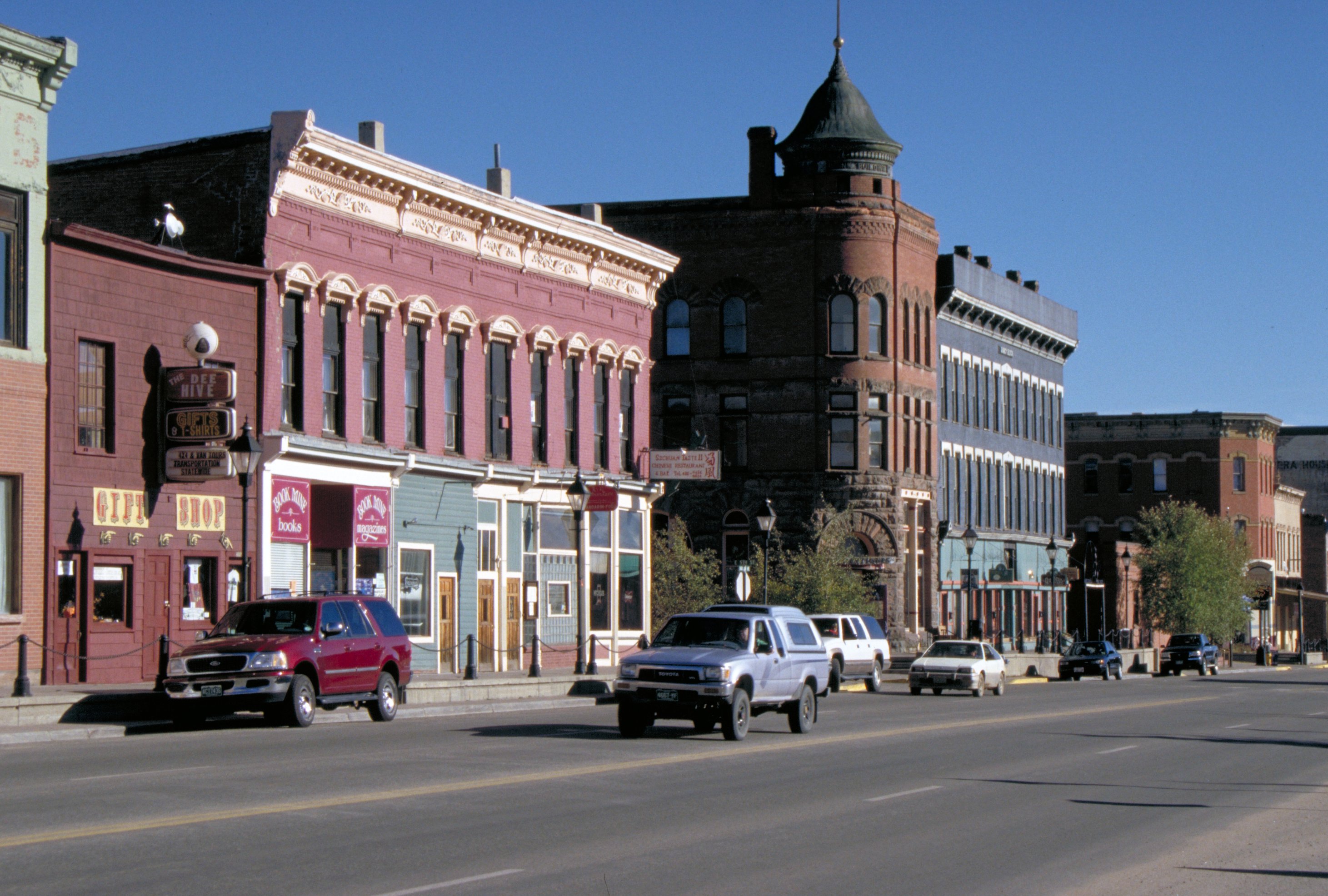
Historic district
 Downtown Leadville June 2005
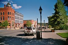 Downtown Leadville June 2005Main article: Leadville Historic District
The Leadville Historic District was designated a National Historic Landmark District in 1961. It includes 67 mines in the mining district east of the city up to the 12,000 foot (3658 m) level, and a defined portion of the village area, with specific exclusion of various buildings. Principal historic buildings in the district are: Tabor Grand Hotel, St. George's Church, Annunciation Church, Tabor Opera House, City Hall, Healy House, Dexter Cabin, Engelbach House, and Tabor House, as well as mining structures and small homes. Structures built after 1917 are considered non-contributing.
Historic district and life after mining
The closing of the Climax mine in the 1980s was a major blow to the town's economy. In addition, the many years of mining left behind substantial contamination of the soil and water, so that the Environmental Protection Agency designated some former mining sites in Leadville as Superfund sites. The town is now 98% cleaned up and the Superfund designation is about to expire. The town has made major efforts to improve its economy by encouraging tourism and emphasizing its history and opportunities for outdoor recreation.
The National Mining Museum and Hall of Fame opened in 1987 with a federal charter. The town's altitude and rugged terrain contributes to a number of challenging racing events, such as the Leadville Trail 100 series of races. It is often used as a base for altitude training and hosts a number of other events for runners and mountain bicyclists.
Leadville is known for its festive atmosphere. Boom Days, held on the first full weekend of August, is a tribute to the city's mining past. The festivities include mining competitions and burro racing. Crystal Carnival, held late in winter, features a skijoring competition on Harrison Avenue. Additionally, Leadville has frequent, though sometimes small parades held in the downtown area, such as the quirky "St. Patrick's Day Practice Parade".
Geography
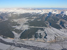 Aerial view of Lake County Airport and Leadville, December 2006
Leadville is the highest incorporated city in the United States. Higher towns and unincorporated settlements do exist. See Extreme points of the United States.
At an elevation of 9,927 feet (3,026 m) the Leadville Airport (Lake County Airport, KLXV) is the highest airport in the United States. At 9,680 feet (2,950 m), the Mount Massive Golf Course is the highest golf course in the United States.
Leadville is located at 39°14′50″N 106°17′33″W / 39.24722°N 106.2925°W (39.247200, −106.292414).[12]
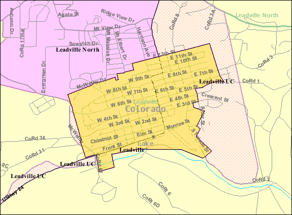
According to the United States Census Bureau, the city has a total area of 1.1 square miles (2.8 km2), all of it land.
Climate
Leadville has a semiarid climate with cold winters and mild summers. The average January temperatures are a maximum of 31.1 °F (−0.5 °C) and a minimum of 3.1 °F (−16.1 °C). The average July temperatures are a maximum of 72.2 °F (22.3 °C) and a minimum of 37.8 °F (3.2 °C). There are an average of 278 days annually with freezing temperatures, which can occur in any month of the year. The record high temperature was 86 °F (30 °C) on June 23, 1954. The record low temperature was −38 °F (−39 °C) on February 21, 1995.
Average annual precipitation is 12.19 inches (310 mm). The wettest year was 1957 with 22.14 inches (562 mm) and the driest year was 1994 with 8.81 inches (224 mm). The most precipitation in one month was 4.83 inches (123 mm) in January 1996. The most precipitation in 24 hours was 2.10 inches (53 mm) on December 24, 1983. Average annual snowfall is 142.7 inches (3,620 mm). The most snowfall in one year was 247.9 inches (6,300 mm) in 1996. The most snowfall in one month was 63.2 inches (1,610 mm) in February 1995.[13]
Demographics
Historical populations Census Pop. %± 1880 14,820 — 1890 10,384 −29.9% 1900 12,455 19.9% 1910 7,508 −39.7% 1920 4,959 −34.0% 1930 3,771 −24.0% 1940 4,774 26.6% 1950 2,987 −37.4% 1960 4,008 34.2% 1970 4,314 7.6% 1980 3,879 −10.1% 1990 2,629 −32.2% 2000 2,821 7.3% 2010 2,602 −7.8% As of the census[14] of 2000, there were 2,821 people, 1,253 households, and 675 families residing in the city. The population density was 2,659.5 people per square mile (1,027.5/km²). There were 1,514 housing units at an average density of 1,427.3 per square mile (551.5/km²). The racial makeup of the city was 83.52% White, 0.14% African American, 1.28% Native American, 0.32% Asian, 0.11% Pacific Islander, 12.34% from other races, and 2.30% from two or more races. Hispanic or Latino of any race were 25.45% of the population.
There were 1,253 households out of which 24.7% had children under the age of 18 living with them, 40.7% were married couples living together, 8.5% had a female householder with no husband present, and 46.1% were non-families. 35.0% of all households were made up of individuals and 9.2% had someone living alone who was 65 years of age or older. The average household size was 2.23 and the average family size was 2.91.
In the city the population was spread out with 21.1% under the age of 18, 12.1% from 18 to 24, 34.4% from 25 to 44, 22.0% from 45 to 64, and 10.4% who were 65 years of age or older. The median age was 34 years. For every 100 females there were 109.1 males. For every 100 females age 18 and over, there were 107.8 males.
The median income for a household in the city was $36,714, and the median income for a family was $44,444. Males had a median income of $28,125 versus $23,512 for females. The per capita income for the city was $20,607. About 9.1% of families and 13.3% of the population were below the poverty line, including 18.5% of those under age 18 and 7.5% of those age 65 or over.
Community
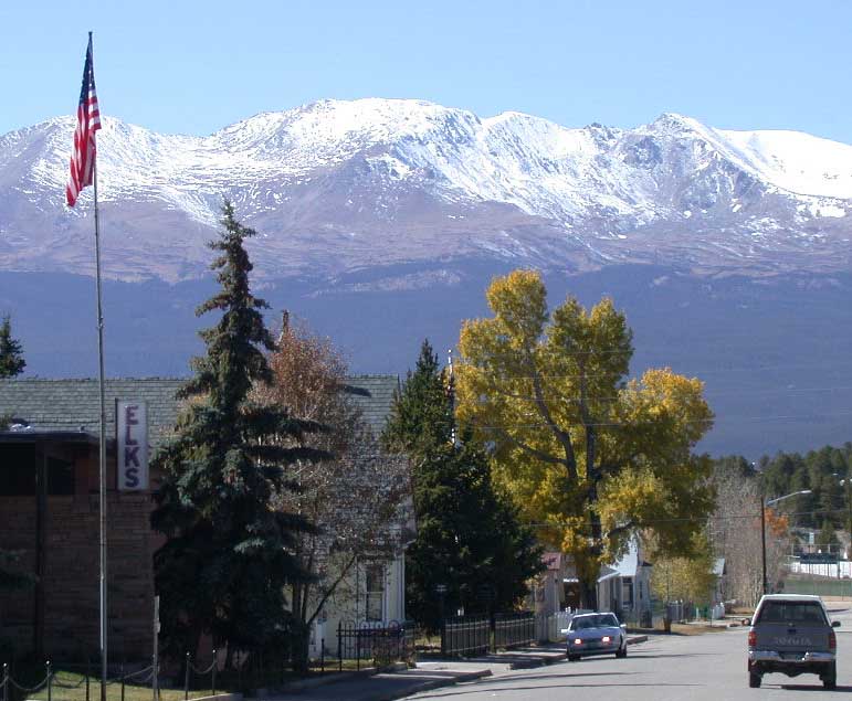
 View of Mount Massive looking west from Harrison Street in downtown Leadville
 The Delaware Hotel in downtown Leadville
Leadville hosts an annual skiing event called Skijoring and Crystal Carnival in March.[15] This is a horse-drawn skiing for the family since the 1960s.[16]
Leadville's Annual Boom Days, which takes place the first full weekend in August, has been honored by the United States Congress as a Local Legacy Event. This three-day celebration of the area's mining heritage offers entertainment for people of all ages and interests, from mining competitions, motorcycle games and a rod and gun show, to live music, a craft fair and parade.
The 21-mile Leadville Boom Days International Pack Burro Race — the second leg of Pack Burro Racing's Triple Crown — is always a crowd favorite.
Transportation
Leadville is served by Lake County Airport. However, there are no scheduled airline services available from this airport. The closest airports to provide scheduled services are Eagle County Airport and Aspen-Pitkin County Airport, both located 62 miles (100 km) away.
All of the highways in Lake County are part of the Top of the Rockies Scenic and Historic Byway.
Highways
 US 24 is an east-west highway running from Interstate 75 near Clarkston, Michigan to the intersection with Interstate 70, near Minturn, Colorado. Its western terminus is located just 32 miles (51 km) north of Leadville. It is also the main route to the Eagle-Vail valley and Colorado Springs.
 State Highway 91 is a 22.5-mile (36.2 km) stretch that connects Leadville to the intersection with Interstate 70, near Copper Mountain. It is the quickest route to get from Leadville to Denver.
Notable residents
- Jesse Fuller McDonald, Mayor of Leadville (1899–1905), Lt. Governor of Colorado (1904–1905), and Governor of Colorado (1905–1907).
- Harvey Seeley Mudd, famous mining engineer and founder of Cyprus Mines Corporation. Harvey Mudd College is named in his memory.
- Jamie Paulin-Ramirez, American Muslim convert arrested in the Jihad Jane plot to kill a Danish artist.
- Barry Sadler- United States Army Green Beret and songwriter
- Baby Doe Tabor, second wife of Horace Tabor
- Horace Tabor, prospector, businessman, and politician.
In popular culture
- Film
- The Unsinkable Molly Brown
- The Silver King[disambiguation needed
 ] with Edgar G. Robinson playing Horace A. W. Tabor
 - Day of the Dead, setting but not filming location.
- Under Siege 2: Dark Territory: the Leadville Airport in the first few minutes was dressed as the National Guard Leadville Airbase.
- Silver City: The downtown strip of Leadville, plus locations around the county were featured.
- Switchback, some filming locations.
- Television/Music
- Pepsi's Super Bowl XXX ad, "Northern Exposure" dressed Leadville as an Alaskan logging town.
- The Ballad of Baby Doe, 1956 opera by Douglas Moore
- "Incommunicado", by Jimmy Buffett, M.L. Benoit, and Deborah McColl. Buffett mentions Leadville in the lyrics of this song.
- Literature
- Angle of Repose, a 1972 novel by Wallace Stegner
- Plague Year, a bestselling 2007 novel by Jeff Carlson. In this novel, Leadville is the new U.S. capital with a population of 650,000 refugees.
- Plague War, a 2008 award-nominated sequel by Jeff Carlson. Leadville becomes the scene of international espionage and betrayal as world war consumes the planet.
- Denver Cereal by Claudia Hall Christian. A psychic lives as the Oracle Tabor at the Leadville Institute for Psychic Phenomena.
- The Canary Trainer, a 1993 novel by Nicholas Meyer.
- Born to Run, a 2009 nonfiction title by Christopher McDougall
See also
- Colorado municipalities
- Edwards Micropolitan Statistical Area
- Leadville mining district
- High Mountain Institute
- Granite, Colorado
References
- ^ a b "Active Colorado Municipalities". State of Colorado, Department of Local Affairs. http://www.dola.state.co.us/dlg/local_governments/municipalities.html. Retrieved 2007-09-01.
- ^ "Colorado Municipal Incorporations". State of Colorado, Department of Personnel & Administration, Colorado State Archives. 2004-12-01. http://www.colorado.gov/dpa/doit/archives/muninc.html. Retrieved 2007-09-02.
- ^ "ZIP Code Lookup" (JavaScript/HTML). United States Postal Service. http://zip4.usps.com/zip4/citytown.jsp. Retrieved November 14, 2007.
- ^ "Find a County". National Association of Counties. http://www.naco.org/Counties/Pages/FindACounty.aspx. Retrieved 2011-06-07.
- ^ "Annual Estimates of the Population for All Incorporated Places: April 1, 2000 to July 1, 2005" (CSV). 2005 Population Estimates. United States Census Bureau, Population Division. 2006-06-20. http://www.census.gov/popest/cities/files/SUB-EST2005-ip.csv. Retrieved 2007-05-26.
- ^ Meyer, August 1851–1905, Parks -georgekessler.org
- ^ HistoryNet: Spitting Lead in Leadville: Doc Holliday’s Last Stand
- ^ Mining Swindles: Leadville
- ^ William Philpott, The Lessons of Leadville, Colorado Historical Society, 1995, pages 3–4.
- ^ Ogden Tweto (1968) Leadville district, Colorado, in Ore Deposits in the United States 1933/1967, New York: American Institute of Mining Engineers, p.683.
- ^ Air Fields Database: Leadville
- ^ "US Gazetteer files: 2010, 2000, and 1990". United States Census Bureau. 2011-02-12. http://www.census.gov/geo/www/gazetteer/gazette.html. Retrieved 2011-04-23.
- ^ http://www.wrcc.dri.edu/cgi-bin/cliMAIN.pl?co4885; http://www.wrcc.dri.edu/cgi-bin/cliMAIN.pl?co4884
- ^ "American FactFinder". United States Census Bureau. http://factfinder.census.gov. Retrieved 2008-01-31.
- ^ Leadville Community Calendar
- ^ Leadville Chronicle
Further reading
- Plazak, Dan. A Hole in the Ground with a Liar at the Top ISBN 978-0-87480-840-7. Includes a chapter on mining in early Leadville.
External links
- City contacts
- "Leadville Today"
- Twin Lakes Chamber of Commerce history
- VisitLeadvilleColorado.com
- "Leadville Lifestyle – Community Portal"
- Leadville.com – Great travel resource
- Today in Literature remembers Leadville's introduction to Aestheticism
- Leadville photos and information at Western Mining History
- Information for Visiting Leadville
Coordinates: 39°14′50″N 106°17′33″W / 39.2472°N 106.292414°W
Municipalities and communities of Lake County, Colorado County seat: LeadvilleCity Leadville
CDPs Ghost towns Protected Areas of the State of Colorado Federal National ParksNational MonumentsNational Recreation AreasNational Historic SitesNational Historic TrailsOld Spanish Trail · Pony Express Trail · Santa Fe TrailNational Scenic TrailContinental Divide TrailArapaho · Grand Mesa · Gunnison · Pike · Rio Grande · Roosevelt · Routt · San Isabel · San Juan · Uncompahgre · White RiverNational WildernessBlack Canyon of the Gunnison · Black Ridge Canyons · Buffalo Peaks · Byers Peak · Cache La Poudre · Collegiate Peaks · Comanche Peak · Dominguez · Eagles Nest · Flat Tops · Fossil Ridge · Great Sand Dunes · Greenhorn Mountain · Gunnison Gorge · Holy Cross · Hunter-Fryingpan · Indian Peaks · James Peak · La Garita · Lizard Head · Lost Creek · Maroon Bells-Snowmass · Mesa Verde · Mount Evans · Mount Massive · Mount Sneffels · Mount Zirkel · Neota · Never Summer · Platte River · Powderhorn · Ptarmigan Peak · Raggeds · Rawah · Sangre de Cristo · Sarvis Creek · South San Juan · Spanish Peaks · Uncompahgre · Vasquez Peak · Weminuche · West ElkNational Conservation AreasGunnison Gorge · McInnis CanyonsNational Wildlife RefugesAlamosa · Arapaho · Baca · Browns Park · Monte Vista · Rocky Flats · Rocky Mountain Arsenal · Two PondsState Arkansas Headwaters · Barr Lake · Bonny Lake · Boyd Lake · Castlewood Canyon · Chatfield · Cherry Creek · Cheyenne Mountain · Crawford · Eldorado Canyon · Eleven Mile · Golden Gate Canyon · Harvey Gap · Highline Lake · Jackson Lake · James M. Robb - Colorado River · John Martin Reservoir · Lake Pueblo · Lathrop · Lone Mesa · Lory · Mancos · Mueller · Navajo · North Sterling · Paonia · Pearl Lake · Ridgway · Rifle Falls · Rifle Gap · Roxborough · San Luis · Spinney Mountain · St. Vrain · Stagecoach · State Forest · Staunton · Steamboat Lake · Sweitzer Lake · Sylvan Lake · Trinidad Lake · Vega · Yampa RiverByers-Evans House · Colorado History Museum · El Pueblo · Fort Garland · Fort Vasquez · Georgetown Loop · Healy House Museum and Dexter Cabin · Pearce-McAllister Cottage · Pike Stockade · Trinidad History Museum · Ute Indian MuseumOther Beaver Meadows · Burlington Carousel · Black Hawk · Central City · Colorado Chautauqua · Cripple Creek · Durango-Silverton Railroad · Georgetown · Granada · Leadville · Lindenmeier Site · Lowry Ruin · Mesa Verde · Pikes Peak · Pike's Stockade · Raton Pass · Shenandoah-Dives Mill · Silver Plume · Silverton · Telluride · U.S. Air Force Academy Cadet AreaGarden of the Gods · Garden Park Fossil Area · Indian Springs Trace Fossil · Lost Creek Scenic Area · Morrison Fossil Area · Raton Mesa · Roxborough Park · Russell Lakes · Sand Creek · Slumgullion Earthflow · Spanish Peaks · Summit LakeAmerican Discovery Trail · Colorado Trail · Continental Divide Trail · Great Divide Trail · Kokopelli's Trail · Paradox Trail · Tabeguache TrailAlpine Loop · Cache la Poudre-North Park · Colorado River Headwaters · Dinosaur Diamond · Flat Tops · Frontier Pathways · Gold Belt · Grand Mesa · Guanella Pass · Highway of Legends · Lariat Loop · Los Caminos Antiguos · Mount Evans · Pawnee Pioneer · Peak to Peak · San Juan Skyway · Santa Fe Trail · Silver Thread · South Platte River Trail · Top of the Rockies · Trail of the Ancients · Trail Ridge · Unaweep/Tabeguache · West Elk LoopU.S. National Register of Historic Places Topics Lists by states Alabama • Alaska • Arizona • Arkansas • California • Colorado • Connecticut • Delaware • Florida • Georgia • Hawaii • Idaho • Illinois • Indiana • Iowa • Kansas • Kentucky • Louisiana • Maine • Maryland • Massachusetts • Michigan • Minnesota • Mississippi • Missouri • Montana • Nebraska • Nevada • New Hampshire • New Jersey • New Mexico • New York • North Carolina • North Dakota • Ohio • Oklahoma • Oregon • Pennsylvania • Rhode Island • South Carolina • South Dakota • Tennessee • Texas • Utah • Vermont • Virginia • Washington • West Virginia • Wisconsin • WyomingLists by territories Lists by associated states Other Categories:- Cities in Colorado
- County seats in Colorado
- Populated places in Lake County, Colorado
- Mining communities in Colorado
- National Historic Landmarks in Colorado
- Populated places established in 1877


Wikimedia Foundation. 2010.