- Collegiate Peaks Wilderness
-
Collegiate Peaks Wilderness IUCN Category Ib (Wilderness Area)

Location Colorado, USA Nearest city Colorado Springs, CO Coordinates 38°58′10″N 106°29′34″W / 38.96944°N 106.49278°WCoordinates: 38°58′10″N 106°29′34″W / 38.96944°N 106.49278°W Area 167,414 acres (677 km2) Established January 1, 1980 Governing body U.S. Forest Service The Collegiate Peaks Wilderness is a 168,000-acre (680 km2) area located in central Colorado between Leadville and Buena Vista to the east and Aspen to the west and Crested Butte to the southwest. Most of the area is in the San Isabel and Gunnison National Forests, with a smaller area in the White River National Forest southeast of Aspen. Most of the area is in northwest Chaffee County with smaller portions in Gunnison, Pitkin, and Lake counties.
Geography
The Collegiate Peaks area includes much of the Sawatch Range and has the highest average elevation of any wilderness area in the United States. Five of the area's 14,000-foot (4,300 m) peaks are named for famous universities and colleges, including Mt. Harvard, Mt. Oxford, Mt. Yale, Mt. Princeton and Mt. Columbia. These peaks are the source of the name for the wilderness area. Other fourteeners in the area include La Plata Peak, Mount Belford, Huron Peak, and Missouri Mountain. The Collegiate Peaks also includes several notable 13,000-foot (4,000 m) peaks including the Three Apostles, a chain of three mountains about six miles (10 km) south of the ghost town of Winfield. The middle peak of the Three Apostles is also referred to as Ice Mountain and is generally recognized as one of the most difficult peaks to climb in the Sawatch Range. Notably, the Collegiate Peaks also has two peaks named Grizzly Peak one is south of Independence Pass at 13,988, and the other is north of Taylor Reservoir on the Continental Divide at 13,281.
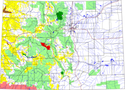 Colorado with Collegiate Peaks Wilderness in red
The area is an important watershed for three rivers on both sides of the Continental Divide: the upper Arkansas River, the Gunnison River, and the Roaring Fork River. There are numerous alpine creeks in the area's wide valleys and these are all quite marshy. Snow does not usually begin to melt until May or June and it remains year-round in places on some of the high peaks.
Both the Continental Divide Trail and the Colorado Trail cross the area. The Continental Divide Trail follows the course of the Continental Divide itself with several side spurs. The Colorado Trail passes through the lower eastern portion of the area and crosses Pine Creek, Frenchman Creek and Three Elk Creek all of which drain into the Arkansas River north of Buena Vista.
History
In earlier times the area was inhabited by various people. There are groves of old growth Ponderosa Pine on the eastern side which bear evidence of stripping by bands of native Utes who inhabited the area and used the bark from living trees for clothing and food. The area is also dotted with the evidence of mining operations from the last century. In the Pine Creek valley - one of the central valleys between Mounts Oxford, Belford and Missouri to the north and Mt. Harvard and Columbia to the south, there is evidence of an earlier settlement on both sides of the stream comprising four cabins and a horse corral. South of the town of Winfield are the spare remains of the town of Harrison at the base of Mt. Huron.
The Collegiate Peaks borders several other Colorado wilderness areas including: Buffalo Peaks, Maroon Bells-Snowmass, Hunter-Fryingpan, and Mount Massive. It was designated by congress as a wilderness area in 1980 in accordance with the provisions of the Wilderness Act of 1964.
External links
- Collegiate Peaks Webpage. USDA Forest Service.
- Collegiate Peaks Wilderness Map. Wilderness.net.
- Collegiate Peaks Wilderness. Wilderness.net.
Protected Areas of the State of Colorado Federal National ParksNational MonumentsNational Recreation AreasNational Historic SitesNational Historic TrailsOld Spanish Trail · Pony Express Trail · Santa Fe TrailNational Scenic TrailContinental Divide TrailArapaho · Grand Mesa · Gunnison · Pike · Rio Grande · Roosevelt · Routt · San Isabel · San Juan · Uncompahgre · White RiverNational WildernessBlack Canyon of the Gunnison · Black Ridge Canyons · Buffalo Peaks · Byers Peak · Cache La Poudre · Collegiate Peaks · Comanche Peak · Dominguez · Eagles Nest · Flat Tops · Fossil Ridge · Great Sand Dunes · Greenhorn Mountain · Gunnison Gorge · Holy Cross · Hunter-Fryingpan · Indian Peaks · James Peak · La Garita · Lizard Head · Lost Creek · Maroon Bells-Snowmass · Mesa Verde · Mount Evans · Mount Massive · Mount Sneffels · Mount Zirkel · Neota · Never Summer · Platte River · Powderhorn · Ptarmigan Peak · Raggeds · Rawah · Sangre de Cristo · Sarvis Creek · South San Juan · Spanish Peaks · Uncompahgre · Vasquez Peak · Weminuche · West ElkNational Conservation AreasGunnison Gorge · McInnis CanyonsNational Wildlife RefugesAlamosa · Arapaho · Baca · Browns Park · Monte Vista · Rocky Flats · Rocky Mountain Arsenal · Two PondsState Arkansas Headwaters · Barr Lake · Bonny Lake · Boyd Lake · Castlewood Canyon · Chatfield · Cherry Creek · Cheyenne Mountain · Crawford · Eldorado Canyon · Eleven Mile · Golden Gate Canyon · Harvey Gap · Highline Lake · Jackson Lake · James M. Robb - Colorado River · John Martin Reservoir · Lake Pueblo · Lathrop · Lone Mesa · Lory · Mancos · Mueller · Navajo · North Sterling · Paonia · Pearl Lake · Ridgway · Rifle Falls · Rifle Gap · Roxborough · San Luis · Spinney Mountain · St. Vrain · Stagecoach · State Forest · Staunton · Steamboat Lake · Sweitzer Lake · Sylvan Lake · Trinidad Lake · Vega · Yampa RiverByers-Evans House · Colorado History Museum · El Pueblo · Fort Garland · Fort Vasquez · Georgetown Loop · Healy House Museum and Dexter Cabin · Pearce-McAllister Cottage · Pike Stockade · Trinidad History Museum · Ute Indian MuseumOther Beaver Meadows · Burlington Carousel · Black Hawk · Central City · Colorado Chautauqua · Cripple Creek · Durango-Silverton Railroad · Georgetown · Granada · Leadville · Lindenmeier Site · Lowry Ruin · Mesa Verde · Pikes Peak · Pike's Stockade · Raton Pass · Shenandoah-Dives Mill · Silver Plume · Silverton · Telluride · U.S. Air Force Academy Cadet AreaGarden of the Gods · Garden Park Fossil Area · Indian Springs Trace Fossil · Lost Creek Scenic Area · Morrison Fossil Area · Raton Mesa · Roxborough Park · Russell Lakes · Sand Creek · Slumgullion Earthflow · Spanish Peaks · Summit LakeAmerican Discovery Trail · Colorado Trail · Continental Divide Trail · Great Divide Trail · Kokopelli's Trail · Paradox Trail · Tabeguache TrailAlpine Loop · Cache la Poudre-North Park · Colorado River Headwaters · Dinosaur Diamond · Flat Tops · Frontier Pathways · Gold Belt · Grand Mesa · Guanella Pass · Highway of Legends · Lariat Loop · Los Caminos Antiguos · Mount Evans · Pawnee Pioneer · Peak to Peak · San Juan Skyway · Santa Fe Trail · Silver Thread · South Platte River Trail · Top of the Rockies · Trail of the Ancients · Trail Ridge · Unaweep/Tabeguache · West Elk LoopCategories:- IUCN Category Ib
- Protected areas of Chaffee County, Colorado
- Protected areas of Gunnison County, Colorado
- Protected areas of Lake County, Colorado
- Protected areas of Pitkin County, Colorado
- Wilderness Areas of Colorado
- Protected areas established in 1980


Wikimedia Foundation. 2010.