- Cheyenne Mountain State Park
-
Cheyenne Mountain State Park 
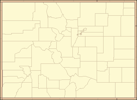
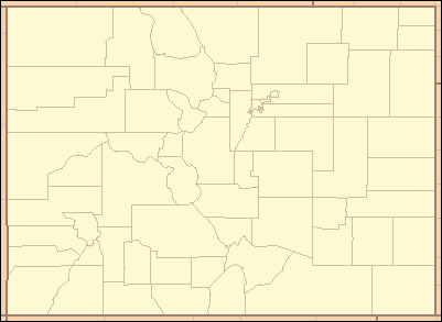
Location El Paso County, Colorado, USA Nearest city Colorado Springs, CO Coordinates 38°44′01″N 104°49′40″W / 38.73361°N 104.82778°WCoordinates: 38°44′01″N 104°49′40″W / 38.73361°N 104.82778°W Area 1,680 acres (6.8 km2) Established 2006 Governing body Colorado State Parks Cheyenne Mountain State Park is a Colorado state park that was acquired in June 2000 through a partnership between the City of Colorado Springs, Colorado State Parks, Great Outdoors Colorado (GOCO), Colorado Lottery, El Paso County, and other local private organizations.
Formerly the JL Ranch, the park is situated just south of Colorado Springs and represents the protection of one of the last significant open spaces along the southern section of the Colorado Front Range. The 1,680-acre (6.8 km2) park lies beneath the eastern flank of Cheyenne Mountain, and borders the plains of Colorado in a stunning transition from plains to peaks. The land is in remarkable natural condition, and wildlife is abundant as well as diverse due to the property's relatively undisturbed and unfragmented nature. Wildlife in the park includes deer, elk, black bears, cougar, coyotes, foxes, prairie dogs, red-tailed hawks, golden eagles and wild turkeys.
The park opened in October 2006 and is the only state park located in El Paso County. There are 20 miles (32 km) of trails throughout the park which are open to hikers and bikers. Dogs and horses are not permitted on the trails in order to keep the surrounding ecosystems intact and to avoid disturbing the ground-nesting birds that reside in the park.
Cheyenne Mountain also has day-use picnic sites and a visitor center where educational displays and interpretive programs are available for visitors. Evening programs and nature hikes are available during the spring and summer months and periodically during the fall and winter months. The park is open for day use, camping with full hookup and walk-in camping sites, and a camper services building.
References
- "Cheyenne Mountain State Park". Colorado State Parks. http://parks.state.co.us/Parks/cheyennemountain.
Protected Areas of the State of Colorado Federal National ParksNational MonumentsNational Recreation AreasNational Historic SitesNational Historic TrailsOld Spanish Trail · Pony Express Trail · Santa Fe TrailNational Scenic TrailContinental Divide TrailArapaho · Grand Mesa · Gunnison · Pike · Rio Grande · Roosevelt · Routt · San Isabel · San Juan · Uncompahgre · White RiverNational WildernessBlack Canyon of the Gunnison · Black Ridge Canyons · Buffalo Peaks · Byers Peak · Cache La Poudre · Collegiate Peaks · Comanche Peak · Dominguez · Eagles Nest · Flat Tops · Fossil Ridge · Great Sand Dunes · Greenhorn Mountain · Gunnison Gorge · Holy Cross · Hunter-Fryingpan · Indian Peaks · James Peak · La Garita · Lizard Head · Lost Creek · Maroon Bells-Snowmass · Mesa Verde · Mount Evans · Mount Massive · Mount Sneffels · Mount Zirkel · Neota · Never Summer · Platte River · Powderhorn · Ptarmigan Peak · Raggeds · Rawah · Sangre de Cristo · Sarvis Creek · South San Juan · Spanish Peaks · Uncompahgre · Vasquez Peak · Weminuche · West ElkNational Conservation AreasGunnison Gorge · McInnis CanyonsNational Wildlife RefugesAlamosa · Arapaho · Baca · Browns Park · Monte Vista · Rocky Flats · Rocky Mountain Arsenal · Two PondsState Arkansas Headwaters · Barr Lake · Bonny Lake · Boyd Lake · Castlewood Canyon · Chatfield · Cherry Creek · Cheyenne Mountain · Crawford · Eldorado Canyon · Eleven Mile · Golden Gate Canyon · Harvey Gap · Highline Lake · Jackson Lake · James M. Robb - Colorado River · John Martin Reservoir · Lake Pueblo · Lathrop · Lone Mesa · Lory · Mancos · Mueller · Navajo · North Sterling · Paonia · Pearl Lake · Ridgway · Rifle Falls · Rifle Gap · Roxborough · San Luis · Spinney Mountain · St. Vrain · Stagecoach · State Forest · Staunton · Steamboat Lake · Sweitzer Lake · Sylvan Lake · Trinidad Lake · Vega · Yampa RiverByers-Evans House · Colorado History Museum · El Pueblo · Fort Garland · Fort Vasquez · Georgetown Loop · Healy House Museum and Dexter Cabin · Pearce-McAllister Cottage · Pike Stockade · Trinidad History Museum · Ute Indian MuseumOther Beaver Meadows · Burlington Carousel · Black Hawk · Central City · Colorado Chautauqua · Cripple Creek · Durango-Silverton Railroad · Georgetown · Granada · Leadville · Lindenmeier Site · Lowry Ruin · Mesa Verde · Pikes Peak · Pike's Stockade · Raton Pass · Shenandoah-Dives Mill · Silver Plume · Silverton · Telluride · U.S. Air Force Academy Cadet AreaGarden of the Gods · Garden Park Fossil Area · Indian Springs Trace Fossil · Lost Creek Scenic Area · Morrison Fossil Area · Raton Mesa · Roxborough Park · Russell Lakes · Sand Creek · Slumgullion Earthflow · Spanish Peaks · Summit LakeAmerican Discovery Trail · Colorado Trail · Continental Divide Trail · Great Divide Trail · Kokopelli's Trail · Paradox Trail · Tabeguache TrailAlpine Loop · Cache la Poudre-North Park · Colorado River Headwaters · Dinosaur Diamond · Flat Tops · Frontier Pathways · Gold Belt · Grand Mesa · Guanella Pass · Highway of Legends · Lariat Loop · Los Caminos Antiguos · Mount Evans · Pawnee Pioneer · Peak to Peak · San Juan Skyway · Santa Fe Trail · Silver Thread · South Platte River Trail · Top of the Rockies · Trail of the Ancients · Trail Ridge · Unaweep/Tabeguache · West Elk LoopColorado Department of Natural Resources (web) Categories:- Colorado state parks
- Protected areas of El Paso County, Colorado
- Protected areas established in 2006
Wikimedia Foundation. 2010.