- McInnis Canyons National Conservation Area
-
McInnis Canyons National Conservation Area IUCN Category V (Protected Landscape/Seascape)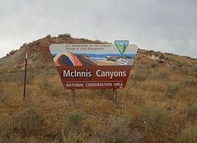
McInnis Canyons National Conservation Area sign close to Grand Junction

Location Mesa County, Colorado Nearest city Grand Junction Coordinates 39°06′19″N 108°55′50″W / 39.10526°N 108.93066°WCoordinates: 39°06′19″N 108°55′50″W / 39.10526°N 108.93066°W Area 123,400 acres (499 km2) Established 2000 Governing body U.S. Bureau of Land Management Official website  Knowles Canyon, Black Ridge Canyons Wilderness, MCNCA
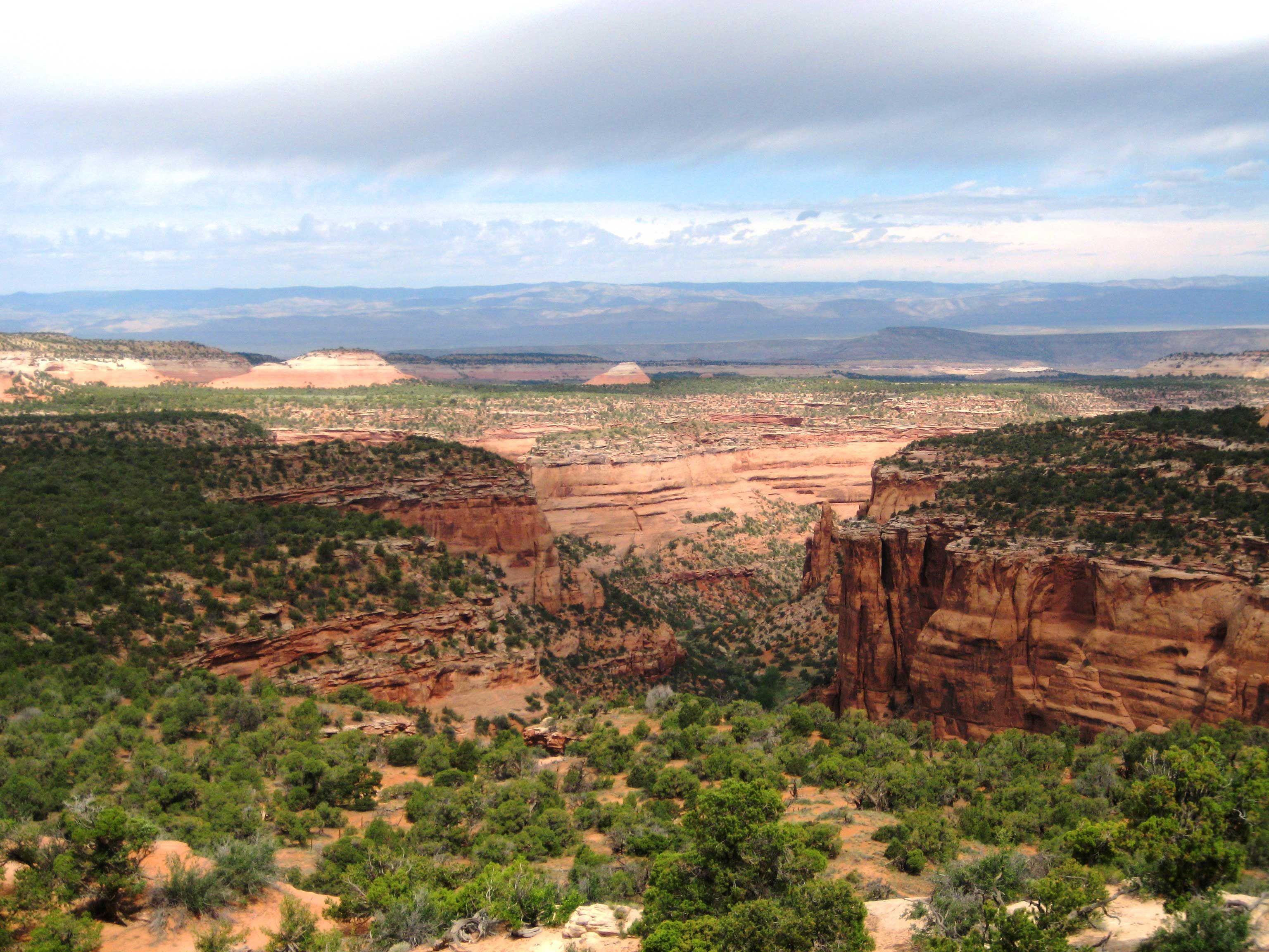
The McInnis Canyons National Conservation Area (MCNCA) is a 123,400-acre (499 km2) National Conservation Area located in Mesa County, west of Grand Junction, Colorado. The MCNCA has rugged sandstone canyons, natural arches, spires, and alcoves carved into the Colorado Plateau, through which runs a 24-mile (39 km) stretch of the Colorado River. Included in the MCNCA is the 75,500-acre (306 km2) Black Ridge Canyons Wilderness (BRCW) with 5,200 acres (21 km2) extending into eastern Grand County, Utah at the MCNCA's western boundary.
The MCNCA was officially designated on October 24, 2000, when the Colorado Canyons National Conservation Area and Black Ridge Canyons Wilderness Act of 2000 became Public Law 106-353. The NCA was renamed after Congressman Scott McInnis on January 1, 2005.
McInnis Canyons NCA has a variety of resources and recreation opportunities resulting in users with diverse interests, including hiking, biking, float boating, off-highway vehicle (OHV) use, horseback riding, hunting, wildlife watching, backpacking, camping, and grazing resources; as well as geological, paleontological and scientific sites.
McInnis Canyons NCA is also home to the Rattlesnake Arches. This area houses the highest concentration of naturally occurring arches in Colorado, and even the second most in the world, behind Arches National Park. It is located in the Black Ridge Canyons Wilderness and comprises sandstone formations, and is not able to be reached by vehicle.[1]
Management
McInnis Canyons is located within the Bureau of Land Management's Grand Junction Field Office. A Resource Management Plan (RMP) was written and approved for the NCA in 2004. Four alternatives were proposed and open to public review. The BLM's preferred alternative, adaptive management, was approved and enacted under the RMP. The plan states:[2]
this alternative’s emphasis is on maintaining the current level of experience and enjoyment of the area’s recreational opportunities and unique characteristics while recognizing that increased future use would trigger the need for increased levels of management. Monitoring for land health and visitors’ experiences would determine when adjustments to management would be required. Objectives for this alternative include preserving the character of the area and enhancing traditional recreation, while maintaining land health and improving priority areas of concern.
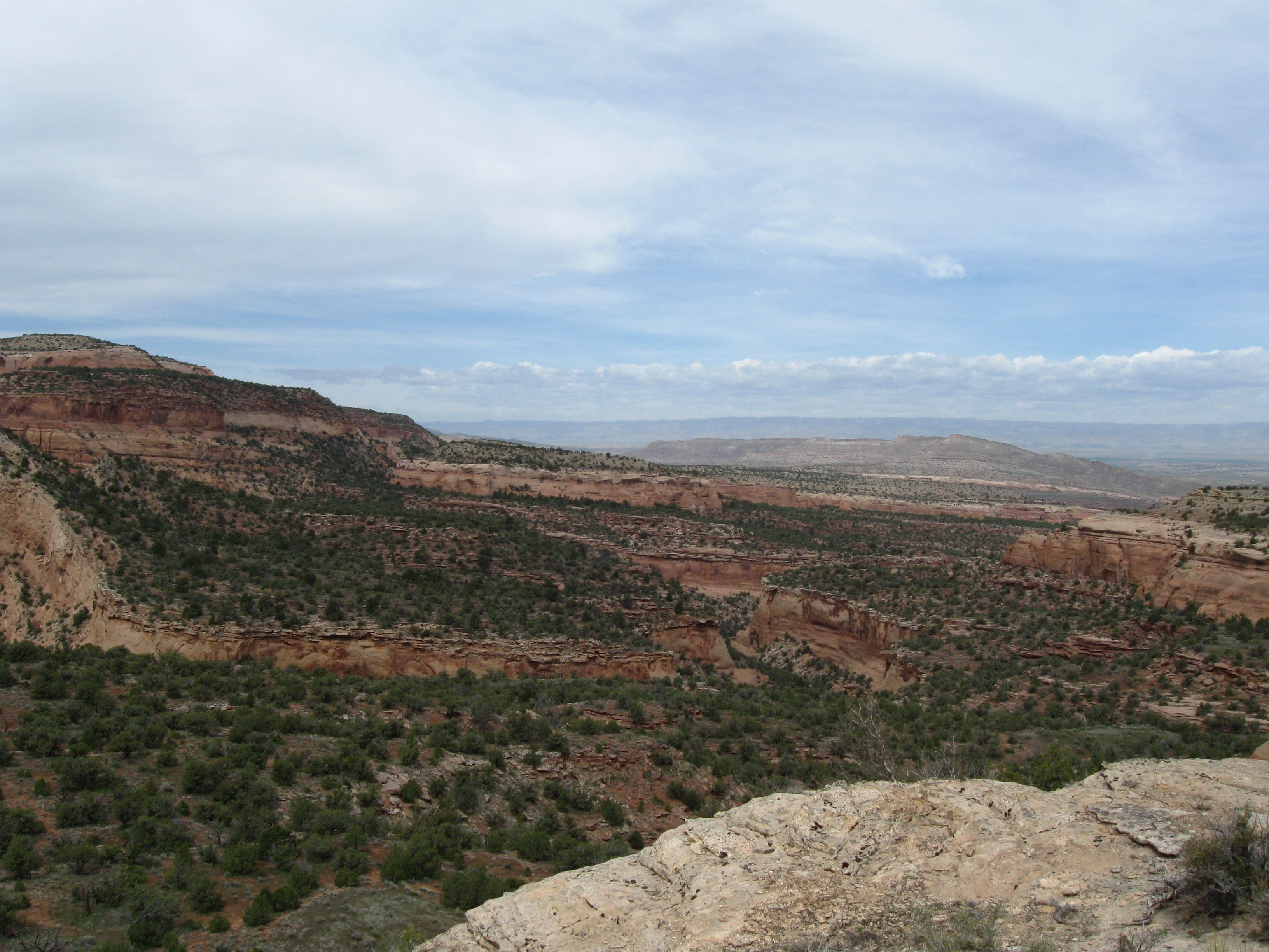
 Pollock Canyon from south, MCNCA
Notes
- ^ "Rattlesnake Arches - Pollock Bench". http://www.blm.gov/co/st/en/nca/mcnca/recreation/Hiking/Rattlesnake_Arches_-_Pollock_Bench.html. Retrieved 2011-04-23.
- ^ "Resource Management Plan and Record of Decision for the Colorado Canyons National Conservation Area and Black Ridge Canyons Wilderness". Grand Junction Field Office, Bureau of Land Management. http://www.blm.gov/pgdata/etc/medialib/blm/co/field_offices/MCNCA/MCNCA_RMP_2004.Par.65207.File.dat/RMP%20ROD%20combined.pdf. Retrieved 2011-09-20.
External links
- "McInnis Canyons National Conservation Area". Bureau of Land Management Grand Junction Field Office.. http://www.blm.gov/co/st/en/nca/mcnca.html.
Protected Areas of the State of Colorado Federal National ParksNational MonumentsNational Recreation AreasNational Historic SitesNational Historic TrailsOld Spanish Trail · Pony Express Trail · Santa Fe TrailNational Scenic TrailContinental Divide TrailArapaho · Grand Mesa · Gunnison · Pike · Rio Grande · Roosevelt · Routt · San Isabel · San Juan · Uncompahgre · White RiverNational WildernessBlack Canyon of the Gunnison · Black Ridge Canyons · Buffalo Peaks · Byers Peak · Cache La Poudre · Collegiate Peaks · Comanche Peak · Dominguez · Eagles Nest · Flat Tops · Fossil Ridge · Great Sand Dunes · Greenhorn Mountain · Gunnison Gorge · Holy Cross · Hunter-Fryingpan · Indian Peaks · James Peak · La Garita · Lizard Head · Lost Creek · Maroon Bells-Snowmass · Mesa Verde · Mount Evans · Mount Massive · Mount Sneffels · Mount Zirkel · Neota · Never Summer · Platte River · Powderhorn · Ptarmigan Peak · Raggeds · Rawah · Sangre de Cristo · Sarvis Creek · South San Juan · Spanish Peaks · Uncompahgre · Vasquez Peak · Weminuche · West ElkNational Conservation AreasGunnison Gorge · McInnis CanyonsNational Wildlife RefugesAlamosa · Arapaho · Baca · Browns Park · Monte Vista · Rocky Flats · Rocky Mountain Arsenal · Two PondsState Arkansas Headwaters · Barr Lake · Bonny Lake · Boyd Lake · Castlewood Canyon · Chatfield · Cherry Creek · Cheyenne Mountain · Crawford · Eldorado Canyon · Eleven Mile · Golden Gate Canyon · Harvey Gap · Highline Lake · Jackson Lake · James M. Robb - Colorado River · John Martin Reservoir · Lake Pueblo · Lathrop · Lone Mesa · Lory · Mancos · Mueller · Navajo · North Sterling · Paonia · Pearl Lake · Ridgway · Rifle Falls · Rifle Gap · Roxborough · San Luis · Spinney Mountain · St. Vrain · Stagecoach · State Forest · Staunton · Steamboat Lake · Sweitzer Lake · Sylvan Lake · Trinidad Lake · Vega · Yampa RiverByers-Evans House · Colorado History Museum · El Pueblo · Fort Garland · Fort Vasquez · Georgetown Loop · Healy House Museum and Dexter Cabin · Pearce-McAllister Cottage · Pike Stockade · Trinidad History Museum · Ute Indian MuseumOther Beaver Meadows · Burlington Carousel · Black Hawk · Central City · Colorado Chautauqua · Cripple Creek · Durango-Silverton Railroad · Georgetown · Granada · Leadville · Lindenmeier Site · Lowry Ruin · Mesa Verde · Pikes Peak · Pike's Stockade · Raton Pass · Shenandoah-Dives Mill · Silver Plume · Silverton · Telluride · U.S. Air Force Academy Cadet AreaGarden of the Gods · Garden Park Fossil Area · Indian Springs Trace Fossil · Lost Creek Scenic Area · Morrison Fossil Area · Raton Mesa · Roxborough Park · Russell Lakes · Sand Creek · Slumgullion Earthflow · Spanish Peaks · Summit LakeAmerican Discovery Trail · Colorado Trail · Continental Divide Trail · Great Divide Trail · Kokopelli's Trail · Paradox Trail · Tabeguache TrailAlpine Loop · Cache la Poudre-North Park · Colorado River Headwaters · Dinosaur Diamond · Flat Tops · Frontier Pathways · Gold Belt · Grand Mesa · Guanella Pass · Highway of Legends · Lariat Loop · Los Caminos Antiguos · Mount Evans · Pawnee Pioneer · Peak to Peak · San Juan Skyway · Santa Fe Trail · Silver Thread · South Platte River Trail · Top of the Rockies · Trail of the Ancients · Trail Ridge · Unaweep/Tabeguache · West Elk LoopCategories:- IUCN Category V
- Bureau of Land Management areas in Colorado
- Protected areas of Grand County, Utah
- National Conservation Areas of the United States
- Parks in Colorado
- Parks in Utah
- Protected areas established in 2000
- Protected areas on the Colorado River
- Protected areas of Mesa County, Colorado


Wikimedia Foundation. 2010.