- Colorado Plateau
-
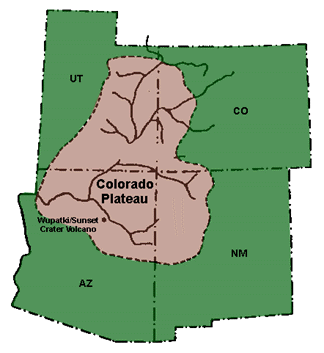
 A map of the Colorado Plateau.
 The Four Corners Monument is where the states of Arizona, Utah, Colorado, and New Mexico meet. (The states are listed in clockwise order.)
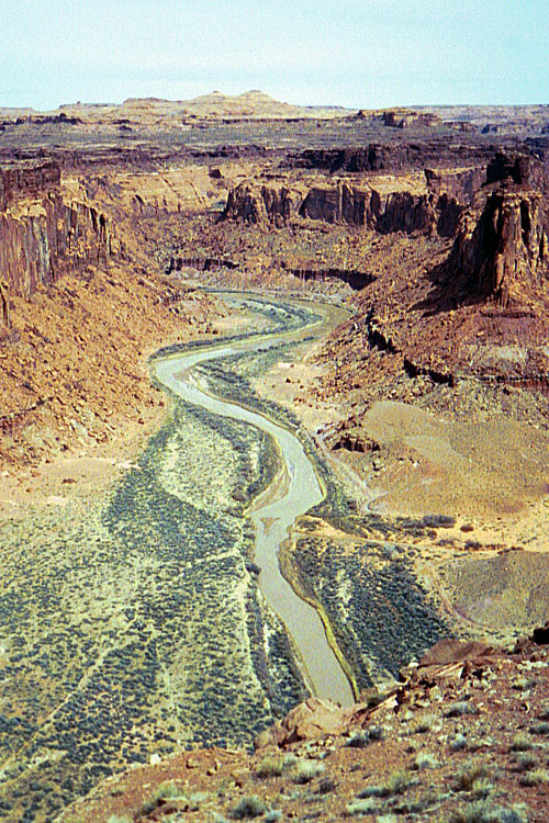
The Colorado Plateau, also called the Colorado Plateau Province, is a physiographic region of the Intermontane Plateaus, roughly centered on the Four Corners region of the southwestern United States. The province covers an area of 337,000 km2 (130,000 mi2) within western Colorado, northwestern New Mexico, southern and eastern Utah, and northern Arizona. About 90% of the area is drained by the Colorado River and its main tributaries: the Green, San Juan, and Little Colorado.[1][2]
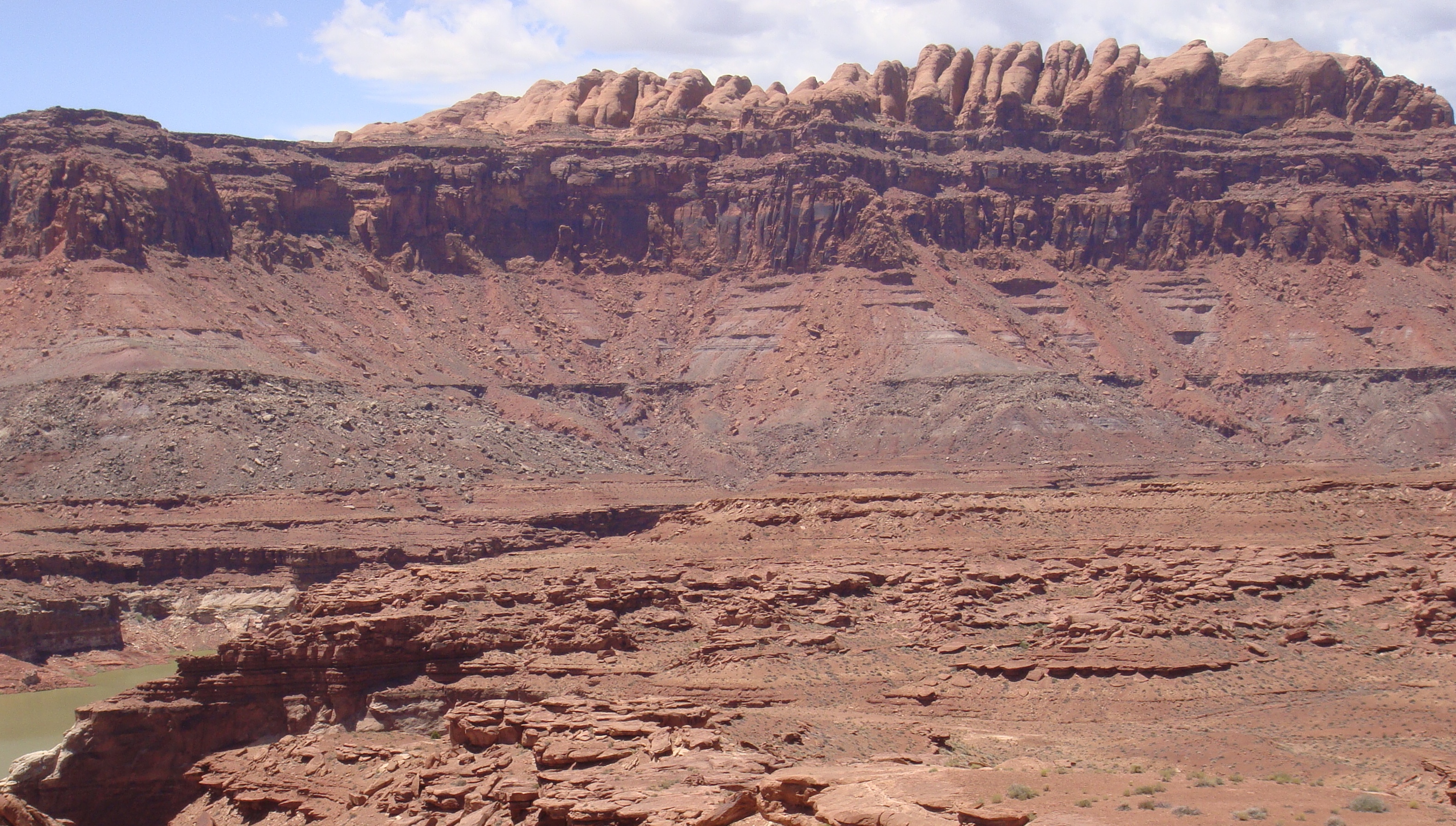
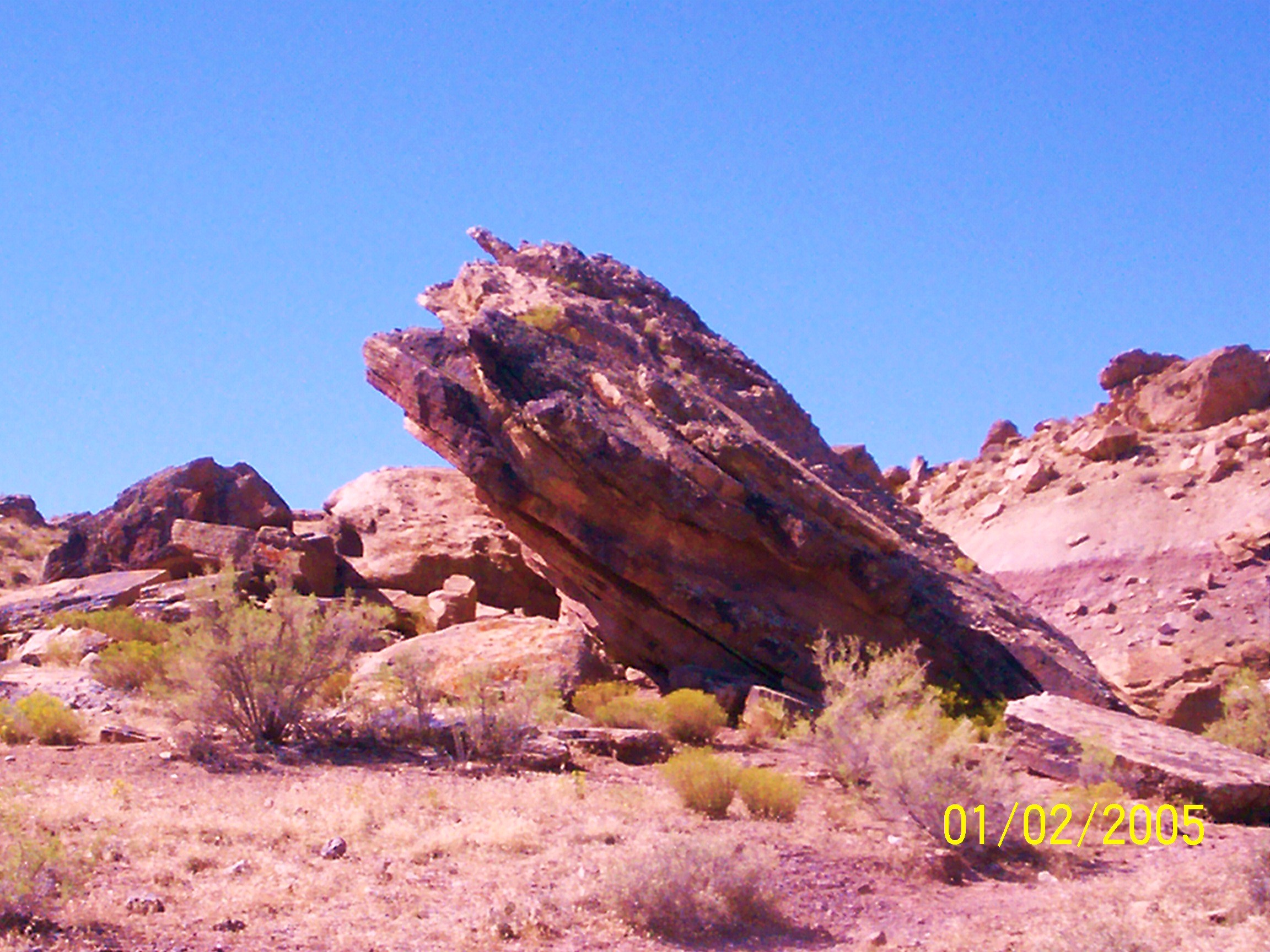
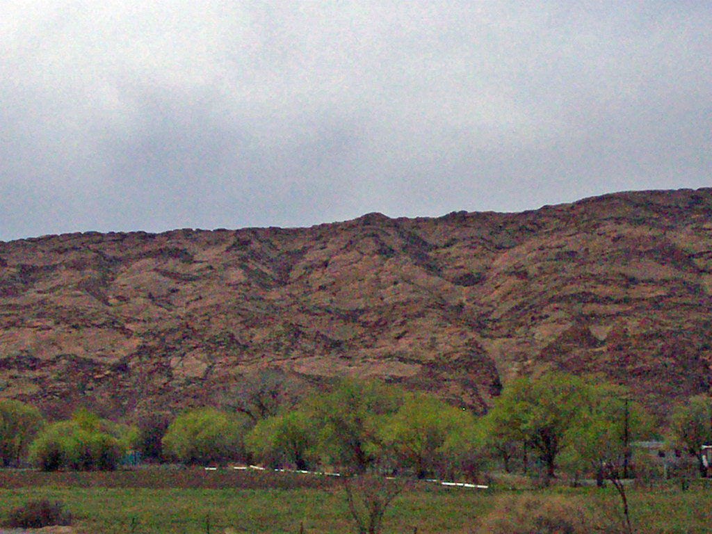
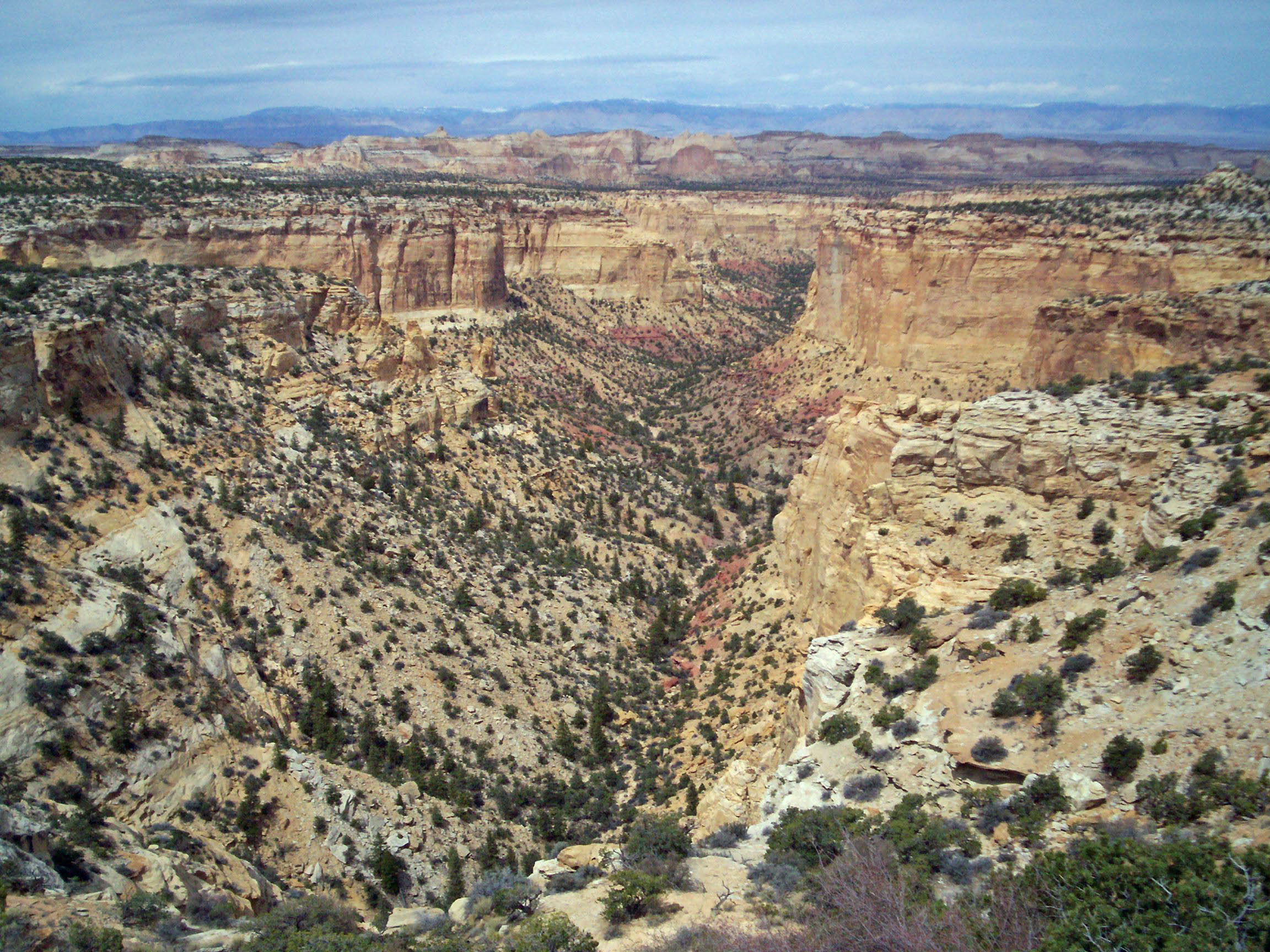
The Colorado Plateau is largely made up of deserts, with scattered areas of forests. In the southwest corner of the Colorado Plateau lies the Grand Canyon of the Colorado River. Much of the Plateau's landscape is related, in both appearance and geologic history, to the Grand Canyon. The nickname "Red Rock Country" suggests the brightly colored rock left bare to the view by dryness and erosion. Domes, hoodoos, fins, reefs, goblins, river narrows, natural bridges, and slot canyons are only some of the additional features typical of the Plateau.
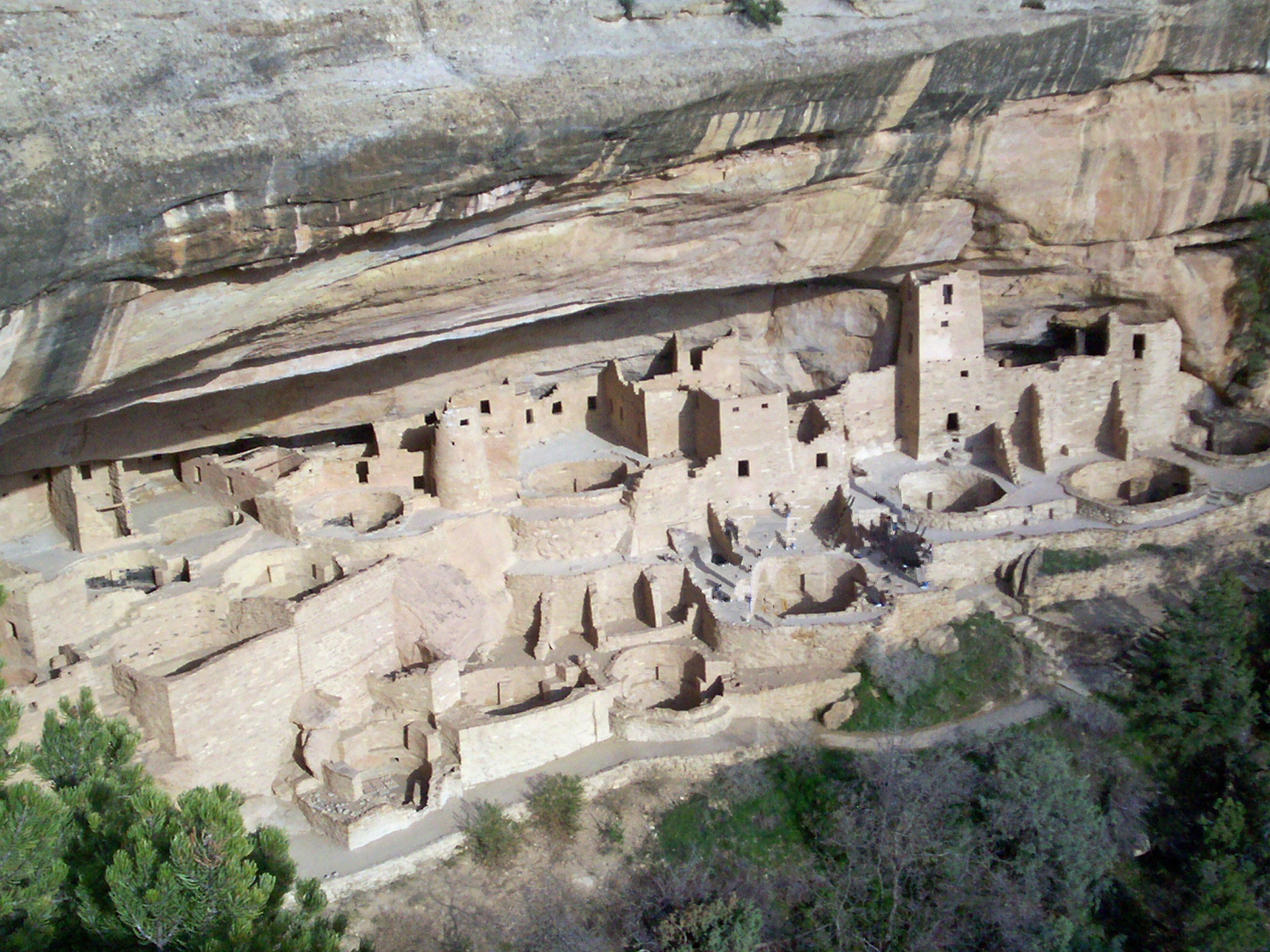
The Colorado Plateau has the greatest concentration of national parks in the United States. Among its parks are Grand Canyon National Park, Zion National Park, Bryce Canyon National Park, Capitol Reef National Park, Canyonlands National Park, Arches National Park, Mesa Verde National Park, and Petrified Forest National Park. Among the national monuments are Dinosaur National Monument, Hovenweep National Monument, Wupatki National Monument, Grand Staircase-Escalante National Monument, Natural Bridges National Monument, Canyons of the Ancients National Monument, and Colorado National Monument.
Contents
Geography
 The Four Corners region and Colorado Plateau.
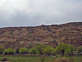
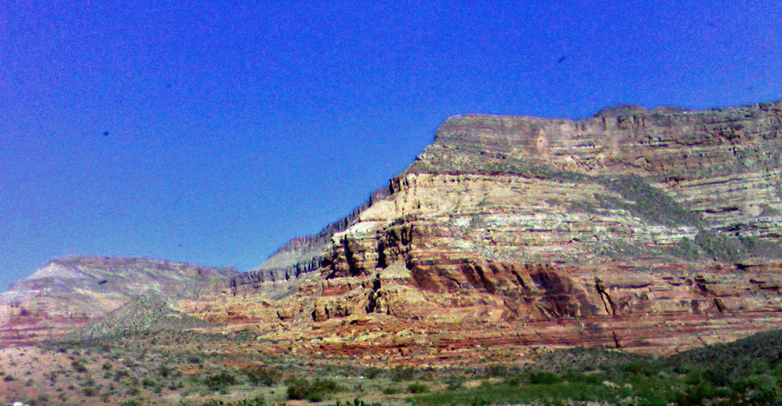
 The Book Cliffs of western Colorado.
 The Green River runs north to south from Wyoming, briefly through Colorado, and converges with the Colorado River in southeastern Utah.
The province is bounded by the Rocky Mountains in Colorado, and by the Uinta Mountains and Wasatch Mountains branches of the Rockies in northern and central Utah. It is also bounded by the Rio Grande Rift, Mogollon Rim and the Basin and Range. Isolated ranges of the Southern Rocky Mountains such as the San Juan Mountains in Colorado and the La Sal Mountains in Utah intermix into the central and southern parts of the Colorado Plateau. It is composed of seven sections:[3]
- Uinta Basin Section
- High Plateaus Section
- Grand Canyon Section
- Canyon Lands Section
- Navajo Section
- Datil-Mogollon Section[4]
- Acoma-Zuni Section[4]
As the name implies, the High Plateaus Section is, on average, the highest section. North-south trending normal faults that include the Hurricane, Sevier, Grand Wash, and Paunsaugunt separate the section's component plateaus.[5] This fault pattern is caused by the tensional forces pulling apart the adjacent Basin and Range province to the west, making this section transitional.
Occupying the southeast corner of the Colorado Plateau is the Datil Section. Thick sequences of mid-Tertiary to late-Cenozoic-aged lava covers this section.
Development of the province has in large part been influenced by structural features in its oldest rocks. Part of the Wasatch Line and its various faults form the western edge of the province. Faults that run parallel to the Wasatch Fault that lies along the Wasatch Range form the boundaries between the plateaus in the High Plateaus Section.[6] The Uinta Basin, Uncompahgre Uplift, and the Paradox Basin were also created by movement along structural weaknesses in the region's oldest rock.
In Utah, the province includes several higher fault-separated plateaus:
- Awapa Plateau
- Aquarius Plateau
- Kaiparowits Plateau
- Markagunt Plateau
- Paunsaugunt Plateau
- Sevier Plateau
- Fishlake Plateau
- Pavant Plateau
- Gunnison Plateau and the
- Tavaputs Plateau.
Some sources also include the Tushar Mountain Plateau as part of the Colorado Plateau, but others do not. The mostly flat-lying sedimentary rock units that make up these plateaus are found in component plateaus that are between 1500 m (5000 ft) to over 3350 m (11,000 ft) above sea level. A supersequence of these rocks is exposed in the various cliffs and canyons (including the Grand Canyon) that make up the Grand Staircase. Increasingly younger east-west trending escarpments of the Grand Staircase extend north of the Grand Canyon and are named for their color:
- Chocolate Cliffs,
- Vermillion Cliffs,
- White Cliffs,
- Gray Cliffs, and the
- Pink Cliffs.[7]
Within these rocks are abundant mineral resources that include uranium, coal, petroleum, and natural gas. Study of the area's unusually clear geologic history (which is laid bare due to the arid and semiarid conditions) has greatly advanced that science.
A rain shadow from the Sierra Nevada far to the west and the many ranges of the Basin and Range means that the Colorado Plateau receives 15 to 40 cm (6 to 16 in.) of annual precipitation.[8] Higher areas receive more precipitation and are covered in forests of pine, fir, and spruce.
Though it can be said that the Plateau roughly centers on the Four Corners, Black Mesa in northern Arizona is much closer to the east-west, north-south midpoint of the Plateau Province. Lying southeast of Glen Canyon and southwest of Monument Valley at the north end of the Hopi Reservation, this remote coal-laden highland has about half of the Colorado Plateau's acreage north of it, half south of it, half west of it, and half east of it.
History
The Ancestral Puebloan People lived in the region from around 2000 to 700 years ago.[9]
A party from Santa Fe led by Fathers Dominguez and Escalante, unsuccessfully seeking an overland route to California, made a five-month out-and-back trip through much of the Plateau in 1776-1777.[10]
U.S. Army Major and geologist John Wesley Powell explored the area in 1869 and 1872 despite having lost one arm in the American Civil War. Using fragile boats and small groups of men the Powell Geographic Expedition charted this largely unknown region of the United States for the federal government.
Construction of the Hoover Dam in the 1930s and the Glen Canyon Dam in the 1960s changed the character of the Colorado River. Dramatically reduced sediment load changed its color from reddish brown (Colorado is Spanish for "colored" referring to its red color) to mostly clear. The apparent green color is from algae on the riverbed's rocks, not from any significant amount of suspended material. The lack of sediment has also starved sand bars and beaches but an experimental 12 day long controlled flood from Glen Canyon Dam in 1996 showed substantial restoration. Similar floods are planned for every 5 to 10 years.[11]
Geology
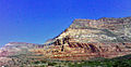
 The red cliffs of the Colorado Plateau tower above the northern Mojave Desert.
 The Permian through Jurassic stratigraphy of the Colorado Plateau area of southeastern Utah that makes up much of the famous prominent rock formations in protected areas such as Capitol Reef National Park and Canyonlands National Park. From top to bottom: Rounded tan domes of the Navajo Sandstone, layered red Kayenta Formation, cliff-forming, vertically-jointed, red Wingate Sandstone, slope-forming, purplish Chinle Formation, layered, lighter-red Moenkopi Formation, and white, layered Cutler Formation sandstone. Picture from Glen Canyon National Recreation Area, Utah.
 Erosion-resistant sandstones of Mesozoic age result in bands of continuous cliffs, central Colorado Plateau.
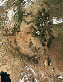
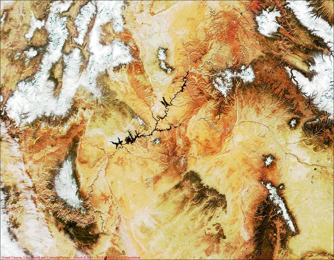
 MODIS image of Grand Canyon, Lake Powell and the Colorado Plateau.
One of the most geologically intriguing features of the Colorado Plateau is its remarkable stability. Relatively little rock deformation such as faulting and folding has affected this high, thick crustal block within the last 600 million years or so. In contrast, provinces that have suffered severe deformation surround the plateau. Mountain building thrust up the Rocky Mountains to the north and east and tremendous, earth-stretching tension created the Basin and Range province to the west and south. Sub ranges of the Southern Rocky Mountains are scattered throughout the Colorado Plateau.
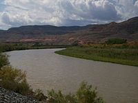 The Colorado River near Grand Junction, Colorado.
The Precambrian and Paleozoic history of the Colorado Plateau is best revealed near its southern end where the Grand Canyon has exposed rocks with ages that span almost 2 billion years. The oldest rocks at river level are igneous and metamorphic and have been lumped together as "Vishnu Basement Rocks"; the oldest ages recorded by these rocks fall in the range 1950 to 1680 million years. An erosion surface on the "Vishnu Basement Rocks" is covered by sedimentary rocks and basalt flows, and these rocks formed in the interval from about 1250 to 750 million years ago: in turn, they were uplifted and split into a range of fault-block mountains.[12] Erosion greatly reduced this mountain range prior to the encroachment of a seaway along the passive western edge of the continent in the early Paleozoic. At the canyon rim is the Kaibab Formation, limestone deposited in the late Paleozoic (Permian) about 270 million years ago.
A 12,000 to 15,000 ft. (3700 to 4600 m) high extension of the Ancestral Rocky Mountains called the Uncompahgre Mountains were uplifted and the adjacent Paradox Basin subsided. Almost 4 mi. (6.4 km) of sediment from the mountains and evaporites from the sea were deposited (see geology of the Canyonlands area for detail).[13] Most of the formations were deposited in warm shallow seas and near-shore environments (such as beaches and swamps) as the seashore repeatedly advanced and retreated over the edge of a proto-North America (for detail, see geology of the Grand Canyon area). The province was probably on a continental margin throughout the late Precambrian and most of the Paleozoic era. Igneous rocks injected millions of years later form a marbled network through parts of the Colorado Plateau's darker metamorphic basement. By 600 million years ago North America had been leveled off to a remarkably smooth surface.
Throughout the Paleozoic Era, tropical seas periodically inundated the Colorado Plateau region. Thick layers of limestone, sandstone, siltstone, and shale were laid down in the shallow marine waters. During times when the seas retreated, stream deposits and dune sands were deposited or older layers were removed by erosion. Over 300 million years passed as layer upon layer of sediment accumulated.
It was not until the upheavals that coincided with the formation of the supercontinent Pangea began about 250 million years ago that deposits of marine sediment waned and terrestrial deposits dominate. In late Paleozoic and much of the Mesozoic era the region was affected by a series of orogenies (mountain-building events) that deformed western North America and caused a great deal of uplift. Eruptions from volcanic mountain ranges to the west buried vast regions beneath ashy debris. Short-lived rivers, lakes, and inland seas left sedimentary records of their passage. Streams, ponds and lakes created formations such as the Chinle, Moenave, and Kayenta in the Mesozoic era. Later a vast desert formed the Navajo and Temple Cap formations and dry near-shore environment formed the Carmel (see geology of the Zion and Kolob canyons area for details).
The area was again covered by a warm shallow sea when the Cretaceous Seaway opened in late Mesozoic time. The Dakota Sandstone and the Tropic Shale were deposited in the warm shallow waters of this advancing and retreating seaway. Several other formations were also created but were mostly eroded following two major periods of uplift.
The Laramide orogeny closed the seaway and uplifted a large belt of crust from Montana to Mexico, with the Colorado Plateau region being the largest block. Thrust faults in Colorado are thought to have formed from a slight clockwise movement of the region, which acted as a rigid crustal block. The Colorado Plateau Province was uplifted largely as a single block, possibly due to its relative thickness. This relative thickness may be why compressional forces from the orogeny were mostly transmitted through the province instead of compacting it.[6] Pre-existing weaknesses in Precambrian rocks were reactivated by the compression. It was along these ancient faults and other deeply-buried structures that much of the province's relatively small and gently-inclined flexures (such as anticlines, synclines, and monoclines) formed.[6] Some of the prominent isolated mountain ranges of the Plateau, such as Ute Mountain and the Carrizo Mountains, both near the Four Corners, are cored by igneous rocks that were intruded about 70 million years ago, during the Laramide orogeny.
Minor uplift events continued through the start of the Cenozoic era and were accompanied by some basaltic lava eruptions and mild deformation. The colorful Claron Formation that forms the delicate hoodoos of Bryce Amphitheater and Cedar Breaks was then laid down as sediments in cool streams and lakes (see geology of the Bryce Canyon area for details). The flat-lying Chuska Sandstone was deposited about 34 million years ago; the sandstone is predominantly of eolian origin and locally more than 500 meters thick. The Chuska Sandstone caps the Chuska mountains, and it lies unconformably on Mesozoic rocks deformed during the Laramide orogeny.
Younger igneous rocks form spectacular topographic features. The Henry Mountains, La Sal Range, and Abajo Mountains, ranges that dominate many views in southeastern Utah, are formed about igneous rocks that were intruded in the interval from 20 to 31 million years: some igneous intrusions in these mountains form laccoliths, a form of intrusion recognized by Grove Karl Gilbert during his studies of the Henry Mountains. Ship Rock (also called Shiprock), in northwestern New Mexico, and Church Rock and Agathla, near Monument Valley, are erosional remnants of potassium-rich igneous rocks and associated breccias of the Navajo Volcanic Field, produced about 25 million years ago. The Hopi Buttes in northeastern Arizona are held up by resistant sheets of sodic volcanic rocks, extruded about 7 million years ago. More recent igneous rocks are concentrated nearer the margins of the Colorado Plateau. The San Francisco Peaks near Flagstaff, south of the Grand Canyon, are volcanic landforms produced by igneous activity that began in that area about 6 million years ago and continued until 1064 C.E., when basalt erupted in Sunset Crater National Monument. Mount Taylor, near Grants, New Mexico, is a volcanic structure with a history similar to that of the San Francisco Peaks: a basalt flow closer to Grants was extruded only about 3000 years ago (see El Malpais National Monument). These young igneous rocks may record processes in the Earth's mantle that are eating away at deep margins of the relatively stable block of the Plateau.
Tectonic activity resumed in Mid Cenozoic time and started to unevenly uplift and slightly tilt the Colorado Plateau region and the region to the west some 20 million years ago (as much as 3 kilometers of uplift occurred). Streams had their gradient increased and they responded by downcutting faster. Headward erosion and mass wasting helped to erode cliffs back into their fault-bounded plateaus, widening the basins in-between. Some plateaus have been so severely reduced in size this way that they become mesas or even buttes. Monoclines form as a result of uplift bending the rock units. Eroded monoclines leave steeply tilted resistant rock called a hogback and the less steep version is a cuesta.
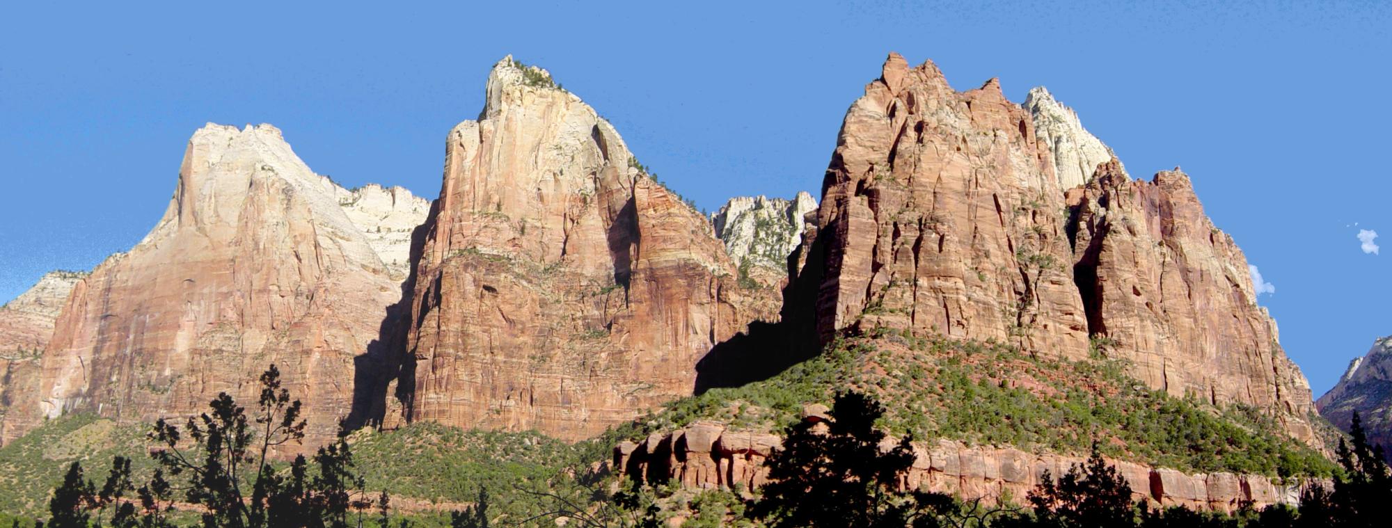
 Cliffs of Navajo Sandstone in Zion National Park
Great tension developed in the crust, probably related to changing plate motions far to the west. As the crust stretched, the Basin and Range province broke up into a multitude of down-dropped valleys and elongate mountains. Major faults, such as the Hurricane Fault, developed that separate the two regions. The dry climate was in large part a rainshadow effect resulting from the rise of the Sierra Nevada further west. Yet for some reason not fully understood, the neighboring Colorado Plateau was able to preserve its structural integrity and remained a single tectonic block.
A second mystery was that while the lower layers of the Plateau appeared to be sinking, overall the Plateau was rising. The reason for this was discovered upon analyzing data from the USARRAY project. It was found that the asthenosphere had invaded the overlying lithosphere. The asthenosphere erodes the lower levels of the Plateau. At the same time, as it cools, it expands and lifts the upper layers of the Plateau.[14] Eventually, the great block of Colorado Plateau crust rose a kilometer higher than the Basin and Range. As the land rose, the streams responded by cutting ever deeper stream channels. The most well-known of these streams, the Colorado River, began to carve the Grand Canyon less than 6 million years ago in response to sagging caused by the opening of the Gulf of California to the southwest.
The Pleistocene epoch brought periodic ice ages and a cooler, wetter climate. This increased erosion at higher elevations with the introduction of alpine glaciers while mid-elevations were attacked by frost wedging and lower areas by more vigorous stream scouring. Pluvial lakes also formed during this time. Glaciers and pluvial lakes disappeared and the climate warmed and became drier with the start of Holocene epoch.
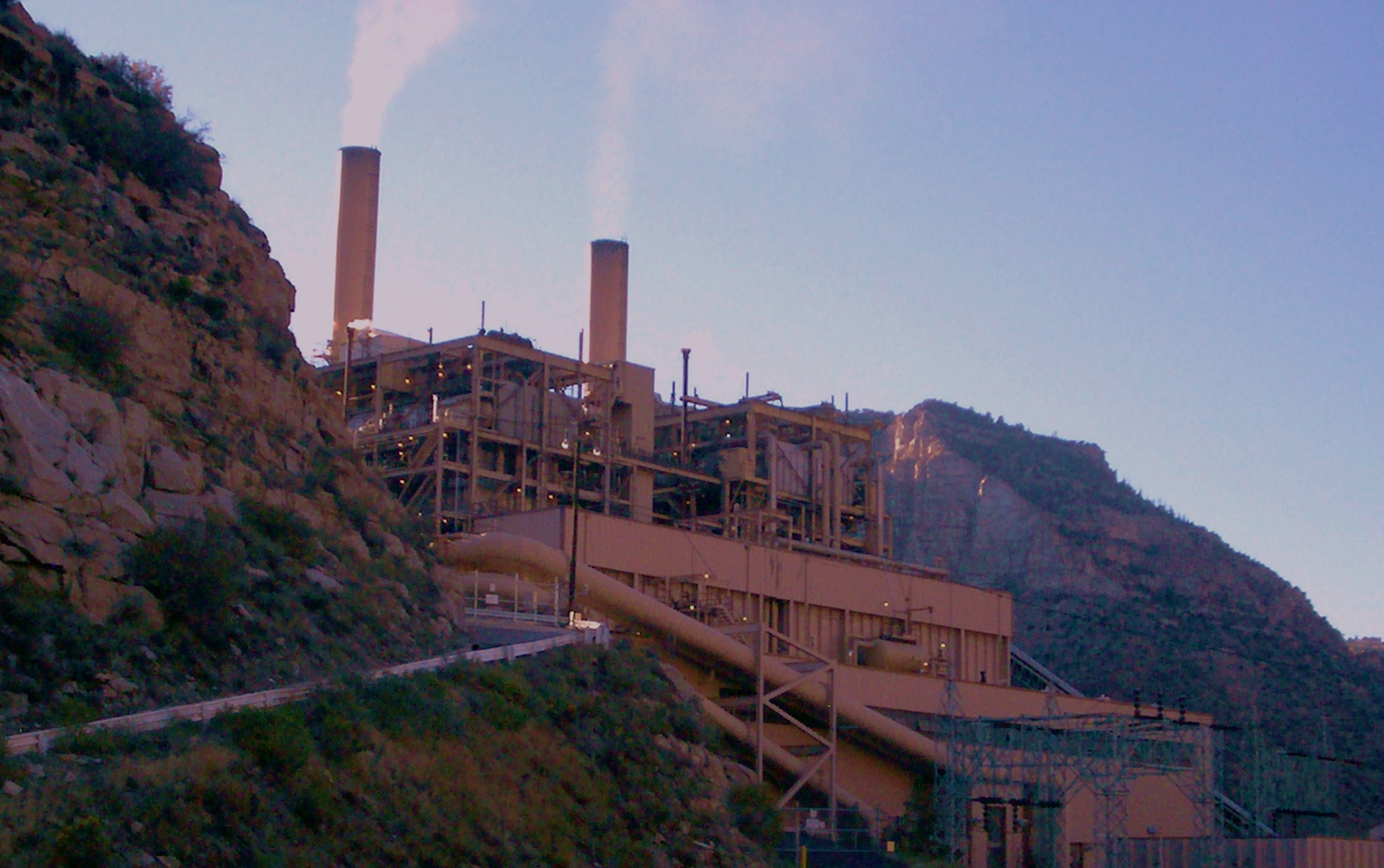
Energy generation

 Coal mine in Carbon County, UT.
Electrical power generation is one of the major industries that takes place in the Colorado Plateau region. Most electrical generation comes from coal fired power plants.
Natural resources
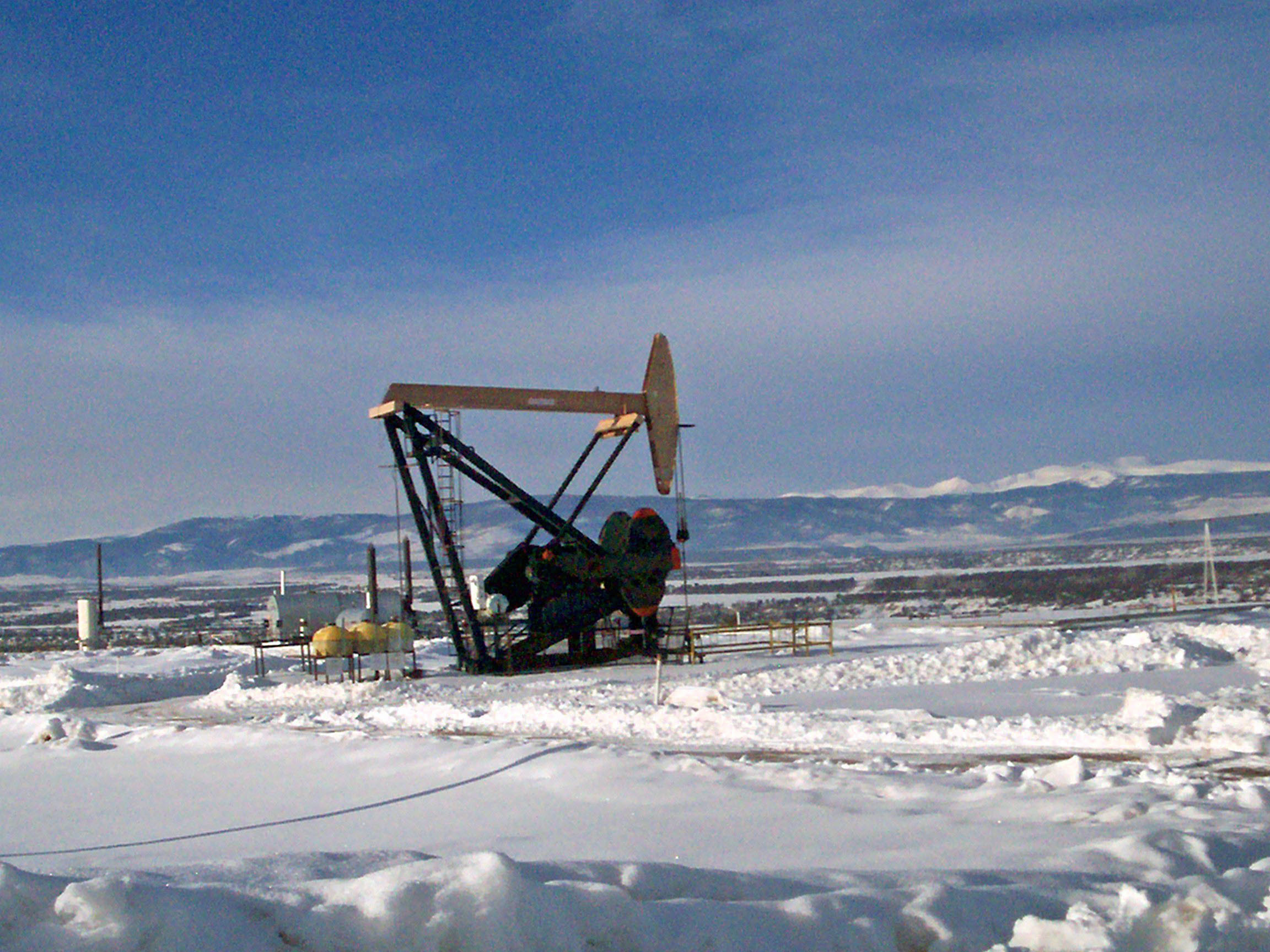
Petroleum
The rocks of the Colorado Plateau are a source of oil and a major source of natural gas. Major petroleum deposits are present in the San Juan Basin of New Mexico and Colorado, the Uinta Basin of Utah, the Piceance Basin of Colorado, and the Paradox Basin of Utah, Colorado, and Arizona.
Uranium
The Colorado Plateau holds major uranium deposits, and there was a Uranium boom in the 1950s. (See Uranium mining in Utah and Uranium mining in the United States). The Atlas Uranium Mill near Moab has left a problematic tailings pile for cleanup.
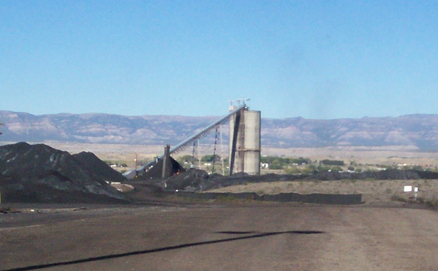
Coal
Major coal deposits are being mined in the Colorado Plateau in Utah, Arizona, Colorado, and New Mexico, though large coal mining projects, such as on the Kaiparowits Plateau, have been proposed and defeated politically. The ITT Power Project, eventually located in Lynndyl, Utah, near Delta, was originally suggested for Salt Wash near Capitol Reef National Park. After a firestorm of opposition, it was moved to a less beloved site. In Utah the largest deposits are in aptly named Carbon County. In Arizona the biggest operation is on Black Mesa, supplying coal to Navajo Power Plant.
Gilsonite and uintatite
Perhaps the only one of its kind, a gilsonite plant near Bonanza, southeast of Vernal, Utah, mines this unique, lustrous, brittle form of asphalt, for use in "varnishes, paints,...ink, waterproofing compounds, electrical insulation,...roofing materials."[15]
Oil shale
Huge deposits of oil shale, primarily in the northeastern Colorado Plateau, lie waiting for improved technology to tap their riches.
Scenic beauty
The scenic appeal of this unique landscape had become, well before the end of the twentieth century, its greatest financial natural resource. The amount of commercial benefit to the four states of the Colorado Plateau from tourism exceeded that of any other natural resource.
Protected lands
 Erosional features within Glen Canyon National Recreation Area.
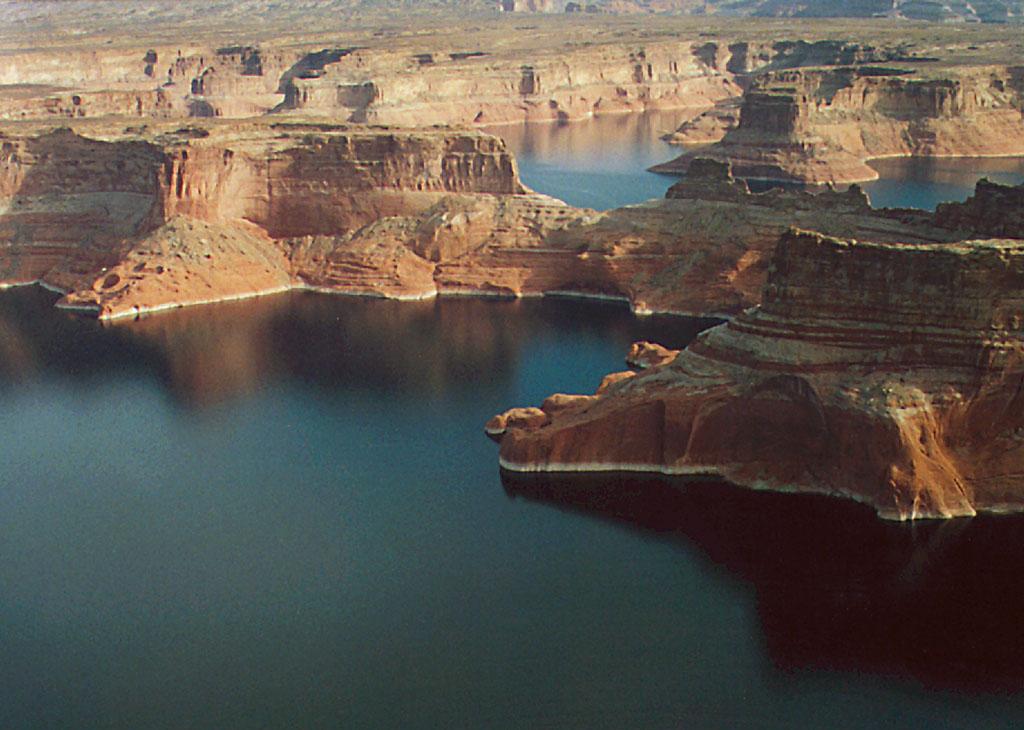
This relatively high semi-arid province produces many distinctive erosional features such as arches, arroyos, canyons, cliffs, fins, natural bridges, pinnacles, hoodoos, and monoliths that, in various places and extents, have been protected. Also protected are areas of historic or cultural significance, such as the pueblos of the Anasazi culture. There are nine U.S. National Parks, a National Historical Park, sixteen U.S. National Monuments and dozens of wilderness areas in the province along with millions of acres in U.S. National Forests, many state parks, and other protected lands. In fact, this region has the highest concentration of parklands in North America.[16] Lake Powell, in foreground, is not a natural lake but a reservoir impounded by Glen Canyon Dam.
National parks (from south to north to south clockwise):
- Petrified Forest National Park
- Grand Canyon National Park
- Zion National Park
- Bryce Canyon National Park
- Capitol Reef National Park
- Canyonlands National Park
- Arches National Park
- Black Canyon of the Gunnison National Park
- Mesa Verde National Park
- Chaco Culture National Historical Park
National Monuments (alphabetical):
- Aztec Ruins National Monument
- Canyon De Chelly National Monument
- Canyons of the Ancients National Monument
- Cedar Breaks National Monument
- Colorado National Monument
- Grand Canyon-Parashant National Monument
- Grand Staircase-Escalante National Monument
- El Malpais National Monument
- El Morro National Monument
- Hovenweep National Monument
- Navajo National Monument
- Natural Bridges National Monument
- Rainbow Bridge National Monument
- Sunset Crater National Monument
- Vermilion Cliffs National Monument
- Walnut Canyon National Monument
- Wupatki National Monument
Wilderness areas:
- Kachina Peaks Wilderness
- Strawberry Crater Wilderness
- Kendrick Mountain Wilderness
- Beaver Dam Mountains Wilderness
- Paiute Wilderness
- Grand Wash Cliffs Wilderness
- Mount Logan Wilderness
- Mount Trumbull Wilderness
- Kanab Creek Wilderness
- Cottonwood Point Wilderness
- Paria Canyon-Vermilion Cliffs Wilderness
- Saddle Mountain Wilderness
- Mount Baldy Wilderness
- Escudilla Wilderness
- Black Ridge Canyons Wilderness
- Flat Tops Wilderness
- Uncompahgre Wilderness
- Mount Sneffels Wilderness
- Lizard Head Wilderness
- Weminuche Wilderness
- South San Juan Wilderness
- Cebolla Wilderness
- Ojito Wilderness
- West Malpais Wilderness
- Bisti/De-Na-Zin Wilderness
- Pine Valley Mountain Wilderness
- Ashdown Gorge Wilderness
- Box-Death Hollow Wilderness
- Dark Canyon Wilderness
- High Uintas Wilderness
Other notable protected areas include: Glen Canyon National Recreation Area, Dead Horse Point State Park, Goosenecks State Park, the San Rafael Swell, the Grand Gulch Primitive Area, Kodachrome Basin State Park, Goblin Valley State Park and Barringer Crater.
Sedona, Arizona and Oak Creek Canyon lie on the south-central border of the Plateau. Many but not all of the Sedona area's cliff formations are protected as wilderness. The area has the visual appeal of a national park, but with a small, rapidly growing town in the center.
Gallery
-
View of the Western Slope of the Rocky Mountains near Grand Junction, Colorado.
-
The Virgin River Gorge, Arizona. This is where the Colorado Plateau and the Mojave Desert meet.
-

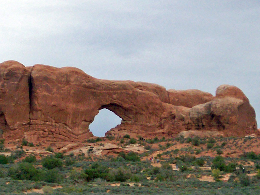
North Window at Arches National Park, Utah.
-
Spring in northwestern New Mexico.
-

San Rafael Swell in central Utah.
See also
References
- ^ Leighty, Dr. Robert D. = (2001). "Colorado Plateau Physiographic Province". Contract Report. Defense Advanced Research Projects Agency (DOD) Information Sciences Office. http://www.tec.army.mil/publications/ifsar/lafinal08_01/five/5.1.5_frame.htm. Retrieved 2007-12-25.
- ^ Kiver, Eugene P. and David V. Harris, 1999, Geology of U.S. Parklands, Wiley, 5th ed., page 395, ISBN 0-471-33218-6
- ^ Geology of U.S. Parklands, page 367, figure 8-1
- ^ a b Hawley, John W.. "New Mexico’s Environment, Physiographic Provinces". http://www.nmmastergardeners.org/Pdf%20FILES/NM's%20Environment.pdf. Retrieved 2007-12-25.
- ^ Geology of U.S. Parklands, page 366
- ^ a b c Geology of U.S. Parklands, page 376
- ^ Geology of U.S. Parklands, page 369
- ^ Geology of U.S. Parklands, page 369
- ^ Geology of U.S. Parklands, page 374, "Trouble in Paradise"
- ^ Gregory Crampton, Standing Up Country, Alfred Knopf, NY, 1964, pp. 43-46
- ^ Geology of U.S. Parklands, page 375
- ^ For the whole paragraph except where noted: Geology of U.S. Parklands, page 383, "Precambrian and Paleozoic"
- ^ Geology of U.S. Parklands, page 383
- ^ "Why is the Colorado Plateau Rising?". Geology.com. http://geology.com/press-release/colorado-plateau/. Retrieved 9 May 2011.
- ^ Utah: A Guide to the State. 1982. p. 590.
- ^ Geology of U.S. Parklands, page 365
- Kiver, Eugene P. and David V. Harris, 1999, Geology of U.S. Parklands, Wiley, 5th ed., ISBN 0-471-33218-6
Further reading
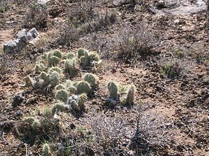 Prickly Pear cactus are common throughout the Colorado Plateau region.
- Donald L. Baars, Red Rock Country: The Geologic History of the Colorado Plateau, Doubleday (1972), hardcover, ISBN 0-385-01341-8
- Donald L. Baars, Traveler's Guide to the Geology of the Colorado Plateau, University of Utah Press (2002), trade paperback, 250 pages, ISBN 0-87480-715-8
- W. Scott Baldridge, Geology of the American Southwest: A Journey Through Two Billion Years of Plate-Tectonic History, Cambridge University Press (2004), 280 pages, ISBN 0-521-01666-5
- Crampton, C. Gregory, Standing Up Country: The Canyon Lands of Utah and Arizona, Rio Nuevo Publishers (September 2000), ISBN 1-887896-15-5
- Fillmore, Robert. Geological Evolution of the Colorado Plateau of Eastern Utah and Western Colorado. University of Utah Press (2011). ISBN 978-1-60781-004-9
- Geology of National Parks: Fifth Edition, Ann G. Harris, Esther Tuttle, Sherwood D., Tuttle (Iowa, Kendall/Hunt Publishing; 1997), pages 2–3, 19-20, 25 ISBN 0-7872-5353-7
- Physical Geology: Eight Edition, Plummer, McGeary, Carlson, (McGraw-Hill: Boston; 1999), page 320 ISBN 0-697-37404-1
- Earth System History, Steven M. Stanley, (W.H. Freeman and Company; 1999), pages 511-513, 537 ISBN 0-7167-2882-6
- USGS - Geologic Provinces of the United States: Colorado Plateau Province (some adapted public domain text)
- Annabelle Foos, Geology of the Colorado Plateau, National Park Service PDF Accessed 12/21/2005.
- Ward Roylance, Utah: A Guide to the State, Utah: A Guide to the State Foundation; Salt Lake City; 1982; 779 pp
- Look, Al, 1947, A Thousand Million Years on the Colorado Plateau, Golden Bell Publications, Fifth printing 1971, 300 pages.
- The Bright Edge, Subtitle: Guide to the National Parks of the Colorado Plateau.
External links
Geography History · Index/Outline · Portal Branches Behavioral · Cultural · Demography · Development · Economic · Feminist · Health · Historical · Political · Regional · UrbanTechniques and tools Societies American Geographical Society · Association of American Geographers · European Geography Association · Geographical Association · Hong Kong Geographical Association · International Geographical Union · National Geographic Society · Royal Canadian Geographical Society · Royal Geographical Society · Royal Scottish Geographical Society · Russian Geographical Society · Saudi Geographical Society · Société de Géographie · Society of Woman GeographersGeographers World deserts Africa Asia - Ad-Dahna
- Arabian
- Aral Karakum
- Aralkum
- Badain Jaran
- Betpak-Dala
- Cholistan
- Dasht-e Kavir
- Dasht-e Lut
- Dasht-e Margoh
- Dasht-e Naomid
- Gurbantünggüt
- Gobi
- Hami
- Indus Valley
- Judean
- Karakum
- Kharan
- Kumtag
- Kyzyl Kum
- Lop
- Nefud
- Negev
- Ordos
- Qaidam
- Rub' al Khali
- Russian Arctic
- Registan
- Saryesik-Atyrau
- Syrian
- Taklamakan
- Tengger
- Thal
- Thar
- Tihamah
- Ustyurt Plateau
- Wahiba Sands
- Liwa
Europe North America - Alvord
- Amargosa
- Baja California
- Black Rock
- Carcross
- Channeled scablands
- Chihuahuan
- Escalante
- Forty Mile
- Gran Desierto de Altar
- Great Basin
- Great Salt Lake
- Great Sandy
- Jornada del Muerto
- Kaʻū
- Lechuguilla
- Mojave
- North American Arctic
- Owyhee
- Painted Desert
- Red Desert
- Sevier
- Smoke Creek
- Sonoran
- Tule (Arizona)
- Tule (Nevada)
- Yp
- Yuha
- Yuma
Australia South America Polar regions New Zealand  State of Colorado
Denver (capital) Topics Index · Coloradans · Economy · Geography · Highways · History · Images · Law and government · Military · Mountains · Museums · Federal lands · Rivers · Symbols · Visitor attractions
Regions Central Colorado · Colorado Piedmont · Colorado Plateau · Denver-Aurora Metropolitan Area · Eastern Plains · Front Range · Grand Valley · High Rockies · Mineral Belt · Roaring Fork Valley · Sangre de Cristo Mountains · San Luis Valley · South‑Central Colorado · Southwest Colorado · Uinta Mountains · Western Slope
Municipalities Akron · Alamosa · Arvada · Aspen · Aurora · Boulder · Breckenridge · Brighton · Broomfield · Cañon City · Castle Rock · Centennial · Colorado Springs · Commerce City · Cortez · Craig · Delta · Denver · Durango · Englewood · Erie · Evans · Fairplay · Federal Heights · Fort Collins · Fort Morgan · Fountain · Golden · Glenwood Springs · Grand Junction · Greeley · Greenwood Village · Gunnison · Lafayette · La Junta · Lakewood · Lamar · Leadville · Littleton · Longmont · Louisville · Loveland · Montrose · Northglenn · Parker · Platteville · Pueblo · Salida · Steamboat Springs · Sterling · Superior · Thornton · Trinidad · Vail · Westminster · Wheat Ridge · Windsor
Counties Adams · Alamosa · Arapahoe · Archuleta · Baca · Bent · Boulder · Broomfield · Chaffee · Cheyenne · Clear Creek · Conejos · Costilla · Crowley · Custer · Delta · Denver · Dolores · Douglas · Eagle · El Paso · Elbert · Fremont · Garfield · Gilpin · Grand · Gunnison · Hinsdale · Huerfano · Jackson · Jefferson · Kiowa · Kit Carson · La Plata · Lake · Larimer · Las Animas · Lincoln · Logan · Mesa · Mineral · Moffat · Montezuma · Montrose · Morgan · Otero · Ouray · Park · Phillips · Pitkin · Prowers · Pueblo · Rio Blanco · Rio Grande · Routt · Saguache · San Juan · San Miguel · Sedgwick · Summit · Teller · Washington · Weld · Yuma
 State of Utah
Salt Lake City (capital) Topics Cities | Congressional districts | Counties | Flag | Geography | Government | Governors | History | People | Portal | Symbols | Visitor Attractions
Society Crime · Demographics · Economy · Politics
Regions Cache Valley | Colorado Plateau | Dixie | Great Basin | Great Salt Lake | Great Salt Lake Desert | Mojave Desert | Monument Valley | San Rafael Swell | Uinta Mountains | Wasatch Back | Wasatch Front | Wasatch Range
Largest cities American Fork | Bountiful | Cedar City | Clearfield | Cottonwood Heights | Draper | Holladay | Kaysville | Layton | Lehi | Logan | Midvale | Murray | Ogden | Orem | Pleasant Grove | Provo | Riverton | Roy | St. George | Salt Lake City | Sandy | South Jordan | South Salt Lake | Spanish Fork | Springville | Taylorsville | Tooele | West Jordan | West Valley City
Counties Attractions  State of Arizona
Phoenix (capital) Topics Index | Climate | Delegations | Geography | History | Museums | Music | People | Transportation | Visitor Attractions
Society Culture · Demographics · Economy · Education · Politics
Regions Arizona Strip | Arizona Sun Corridor | Coconino Plateau | Colorado Plateau | Grand Canyon | Kaibab Plateau | Mogollon Plateau | Mogollon Rim | Mojave Desert | Monument Valley | North Central Arizona | Northeast Arizona | Northern Arizona | Oak Creek Canyon | Phoenix Metropolitan Area | Safford area | San Francisco Volcanic Field | Sonoran Desert | Southern Arizona | Verde Valley | White Mountains
Counties Cities Chandler | Flagstaff | Gilbert | Glendale | Kingman | Lake Havasu City | Mesa | Peoria | Phoenix | Prescott | Scottsdale | Sierra Vista | Tempe | Tucson | Yuma
 State of New Mexico
Santa Fe (capital) Topics Delegations · Geography · Government · History · Landmarks · Military · Natural history · New Mexicans · Settlements · Transportation · Tribes · Visitor attractions
Society Culture · Demographics · Economy · Education · Politics
Regions Central New Mexico · Colorado Plateau · Eastern New Mexico · Llano Estacado · Northern New Mexico · Permian Basin · Sangre de Cristo Mountains · San Luis Valley · Southwestern New Mexico
Cities Alamogordo · Albuquerque · Artesia · Carlsbad · Clovis · Corrales · Deming · Española · Farmington · Gallup · Grants · Hobbs · Las Cruces · Las Vegas · Los Alamos · Los Lunas · Lovington · Portales · Raton · Rio Rancho · Roswell · Ruidoso · Santa Fe · Silver City · Socorro · Sunland Park · Taos · Tucumcari
Counties Bernalillo · Catron · Chaves · Cibola · Colfax · Curry · De Baca · Doña Ana · Eddy · Grant · Guadalupe · Harding · Hidalgo · Lea · Lincoln · Los Alamos · Luna · McKinley · Mora · Otero · Quay · Rio Arriba · Roosevelt · Sandoval · San Juan · San Miguel · Santa Fe · Sierra · Socorro · Taos · Torrance · Union · Valencia
Categories:- Colorado Plateau
- Physiographic provinces
- Deserts of North America
- Deserts of the United States
- Deserts of Arizona
- Deserts of Colorado
- Deserts of New Mexico
- Deserts of Utah
- Regions of Arizona
- Regions of Colorado
- Regions of New Mexico
- Regions of Utah


Wikimedia Foundation. 2010.