- Chinle Formation
-
Chinle Formation
Stratigraphic range: Triassic
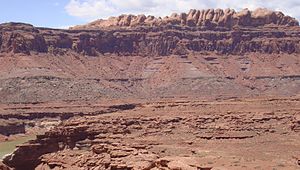
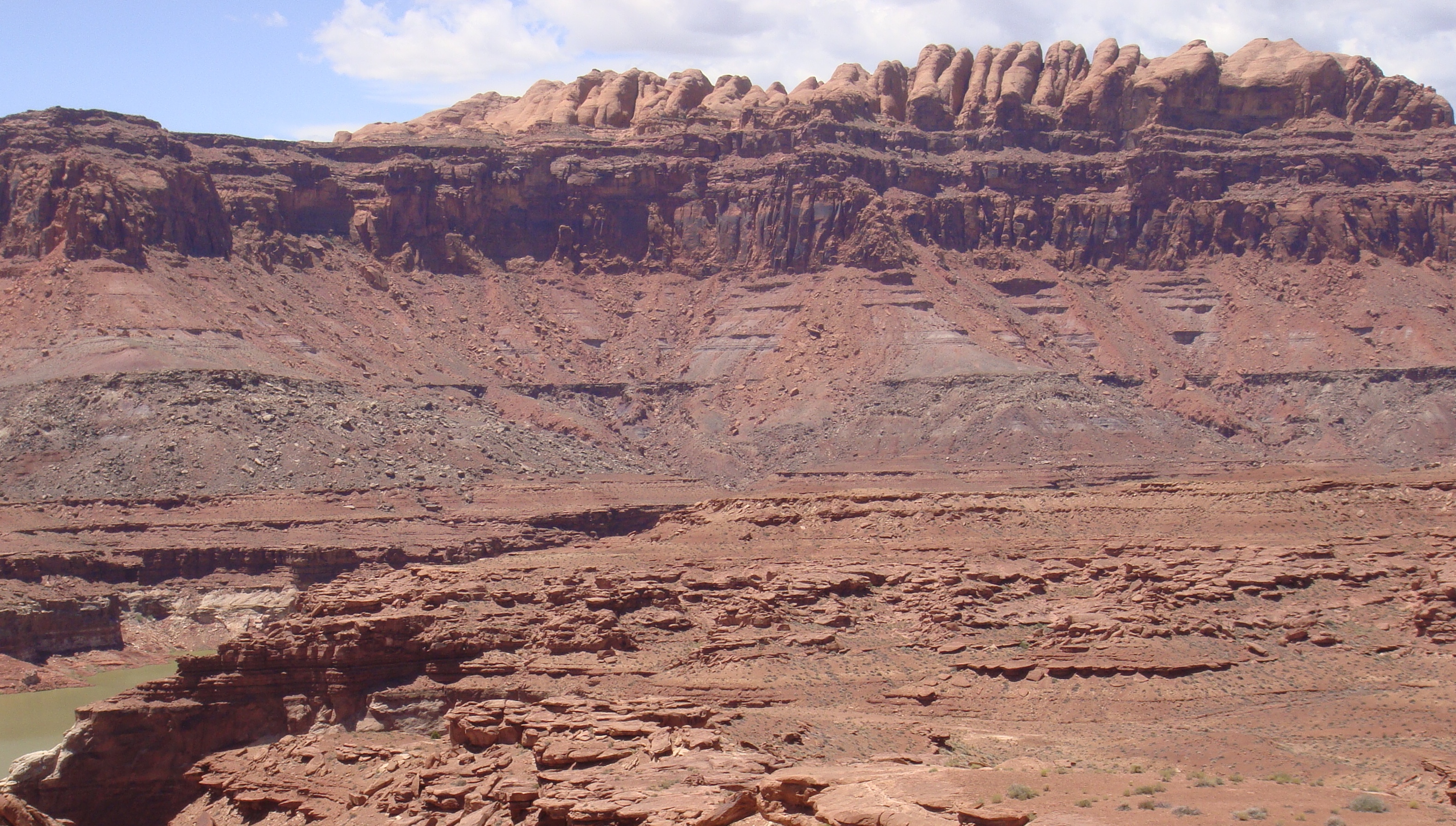
Chinle Badlands, Grand Staircase-Escalante National Monument, Utah, US.Type Geological formation The Chinle is a geologic formation that is spread across the U.S. states of northern Arizona, Nevada, Utah, western New Mexico, and western Colorado. The Chinle is controversially considered to be synonymous to the Dockum Group in eastern Colorado, eastern New Mexico, southwestern Kansas, the Oklahoma panhandle, and western Texas. The Chinle is sometimes colloquially used as a geologic formation within the Dockum in New Mexico and occasionally in Texas. Part of the Colorado Plateau, the Basin and Range, and the southern section of the Interior Plains, this formation was laid down in the Late Triassic.[1]
A probable separate depositional basin within the Chinle is found in northwestern Colorado and northeastern Utah. In the southern portion of the Chinle, it reaches a maximum thickness of a little over 520 m. Typically, the Chinle rests unconformably on the Moenkopi Formation.
Contents
History of investigation
There is no designated type locality for this formation. It was named for Chinle Valley in Apache County, Arizona by Gregory in 1917 (he first used the name two years before but did not indicate a wish to officially name it). Members were first assigned by Robeck in 1956 and Stewart in 1957. An overview was created by Poole and Stewart in 1964. Sikich revised the unit and assigned more members assigned in 1965. The areal extent of the unit was mapped by Wilson and Stewart in 1967. In 1972 the areal limits were modified and an overview created by Stewart and others (they published a revision the same year). Kelley assigned more members and revised the unit in 1972. Lucas and Hayden did the same thing in 1989. The Rock Point Member was assigned by Dubiel in 1989.[2] The Chinle was raised to group status by Lucas in 1993,[3] thus also raising many of the members to formation status. He also included the formations of the Dockum Group of eastern New Mexico and west Texas within the "Chinle Group" . This modified nomenclature is controversial; many still retain the Chinle as a formation and separate out the Dockum Group (e.g., USGS). It should be pointed out that the Dockum was named in 1890, before the Chinle. If Lucus is correct, his "Chinle Group" should be named the Dockum Group due to stratigraphic nomenclature rules. Overviews of the Chinle were created by Dubiel and others (1992) and Hintze and Axen (1995).[4]
Stratigraphy
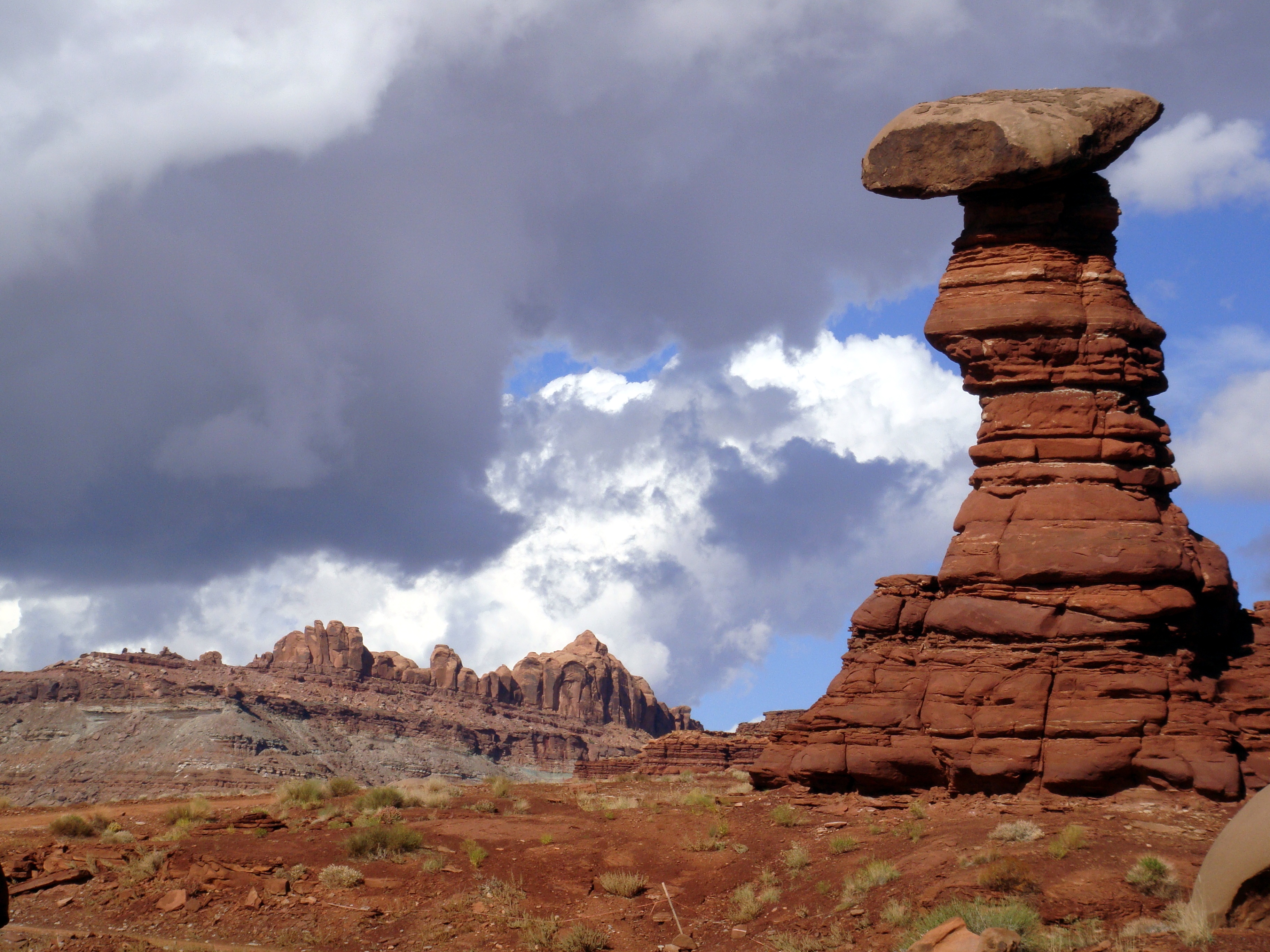
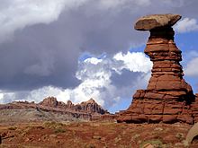 Hoodoo within the Chinle Formation, west of Moab, Utah, along the Chicken Corners off-road trail. Ridge in background is part of the Wingate Sandstone.
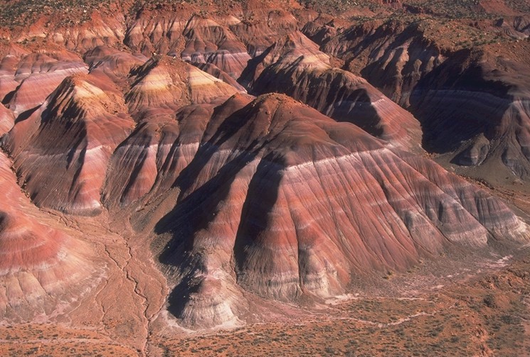
The formation members and their thicknesses are highly variable across the Chinle. The stratigraphically lowest formation is the Temple Mountain Member. However, in most areas, the basal member is the Shinarump Member.[5] The Shinarump is a braided-river system channel-deposit facies.[2] The Monitor Butte Member overlies the Shinarump in most areas. The Monitor Butte is an overbank (distal floodplain) facies with lacustrine deposits. This is overlain in western areas by the channel-deposit facies Moss Back Member. More commonly, the Monitor Butte grades into the Petrified Forest Member. The Petrified Forest is predominately overbank deposits with thin lenses of channel-deposit facies and lacustrine deposits.
The Petrified Forest Member can be divided into the Lower Petrified Forest Member and Upper Petrified Forest Member in Arizona and New Mexico, separated by the Sonsela Sandstone. The Sonsela Sandstone is a braided-stream channel facies. The Petrified Forest grades into the Owl Rock Member. The Owl Rock is a marginal lacustrine to lacustrine facies possibly representing a large lake system. Finally, either the Rock Point or Church Rock Members overlie the Owl Rock. Some researchers feel the two Members may be synonymous. The two Members are complex heterolithic units, representing variously braided-river facies, lacustrine, and overbank deposits.
Ages of Chinle Members
Age correlation based on Lucas' Land Vertebrate Faunachrons. The faunachrons are based on first and last appearances of phytosaurs. Simplified stratigraphy based on Litwin.[6]
Sub-stage Faunachron Chinle Member(s) Late Norian-Rhaetian Apachean Rock Point/Church Rock Early to Middle Norian Revueltian Owl Rock Upper Petrified Forest
upper Late Carnian Adamanian Sonsela Sandstone Lower Petrified Forest
Moss Back
Monitor Butte
lower Late Carnian Otischalkian Shinarump Temple Mountain
Subunits
Asterisks (*) indicate usage by the U.S. Geological Survey. Other usages by state geological surveys.
Group rank (alphabetical - rank and formations not recognized by the USGS)[1]
- San Pedro Arroyo Formation (NM),
- Santa Rosa Formation (NM),
- Shinarump Formation (NM).
- Petrified Forest Formation (AZ, UT, NM)
- Many others - see members below
Formation rank (alphabetical - several members not recognized by the USGS):[1]
- Agua Zarca Sandstone Member (NM),
- Bluewater Creek Member (AZ,CO,NM),
- Church Rock Member (AZ*,CO*,UT*),
- Correo Sandstone Member (NM),
- Cuervo Sandstone Member (NM),
- Duffin Sandstone Member (UT),
- Gartra Member (CO*,UT*),
- Mesa Redondo Member (AZ*,NM*),
- Monitor Butte Member (AZ*,CO*,UT*),
- Moss Back Member (AZ*,CO*,UT*),
- Newspaper Rock Sandstone Bed (AZ),
- Owl Rock Member (AZ*,NM*,UT*),
- Petrified Forest Member (AZ*,CO*,NV*,NM*,UT*),
- Poleo Sandstone Lentil (NM),
- Redonda Member (NM),
- Rock Point Member (AZ*,NM*),
- Salitral Shale Tongue (NM*),
- Shinarump Member (AZ*,NV*,NM*,UT*),
- Silver Reef Sandstone Member (UT),
- Stanaker Member (UT),
- Temple Mountain Member (UT*),
- Trail Hill Sandstone [Member] (UT).
Places found
 The Permian through Jurassic stratigraphy of the Colorado Plateau area of southeastern Utah that makes up much of the famous prominent rock formations in protected areas such as Capitol Reef National Park and Canyonlands National Park. From top to bottom: Rounded tan domes of the Navajo Sandstone, layered red Kayenta Formation, cliff-forming, vertically-jointed, red Wingate Sandstone, slope-forming, purplish Chinle Formation, layered, lighter-red Moenkopi Formation, and white, layered Cutler Formation sandstone. Picture from Glen Canyon National Recreation Area, Utah.
Geologic Province:[1]
- Black Mesa Basin*
- Great Basin province*
- Geen River Basin*
- Ghost Ranch*
- Las Vegas-Raton Basin*
- Orogrande Basin
- Palo Duro Basin*
- Paradox Basin*
- Permian Basin
- Piceance Basin*
- Plateau sedimentary province*
- San Juan Basin*
- Sierra Grande Uplift*
- Uinta Basin*
- Uinta Uplift*
- Wasatch Uplift*
Parklands (incomplete list):
- Canyonlands National Park - see geology of the Canyonlands area
- Capitol Reef National Park - see geology of the Capitol Reef area
- Glen Canyon National Recreation Area - see geology of the Glen Canyon area
- Petrified Forest National Park - see geology of the Petrified Forest area
- Zion National Park - see geology of the Zion and Kolob canyons area
Paleobiota
Main article: Paleobiota of the Chinle FormationSee also
References
- ^ a b c d GEOLEX database entry for Chinle, USGS (viewed 19 March 2006)
- ^ a b Dubiel, R.F., 1989. Depositional and climatic setting of the Upper Triassic Chinle Formation, Colorado Plateau. In Lucas, S.G., and Hunt, A.P. (eds.): Dawn of the Age of Dinosaurs: New Mexico Museum of Natural History, p. 171-187.
- ^ Lucas, S.G., 1993. The Chinle Group: revised stratigraphy and biochronology of Upper Triassic Nonmarine strata in the western United States. Museum of Northern Arizona Bulletin, v. 59, p. 27-50.
- ^ GEOLEX database bibliographic references for Chinle (viewed 19 March 2006)
- ^ "Shinarump Member of Chinle Formation". Colorado River Basin Stratigraphy. USGS. 2006- 05-06. http://3dparks.wr.usgs.gov/coloradoplateau/lexicon/chinle_shinarump.htm. Retrieved 2011-01-10.
- ^ Litwin, R.J., Traverse, A., and Ash, S.R., 1991. Preliminary palynological zonation of the Chinle Formation, southwestern U.S.A., and its correlation to the Newark Supergroup (eastern U.S.A.). Review of Paleobotany and Palynology, v. 77, p. 269-287.
- Lehman, T.M., 1994. The saga of the Dockum Group and the case of the Texas/New Mexico boundary fault. New Mexico Bureau of Mines & Mineral Resources Bulletin, v. 150, p. 37-51.
- Lucas, S.G., 1998. Global Triassic tetrapod biostratigraphy and biochronology. Palaeogeography, Palaeoclimatology, and Palaeoecology, v. 143, p. 347-384.
External links
Categories:- Geology of Nevada
- Geology of New Mexico
- Geology of Colorado
- Geology of Utah
- Geology of Arizona
- Chinle Formation
- Geologic formations of the United States
Wikimedia Foundation. 2010.