- Cutler Formation
-
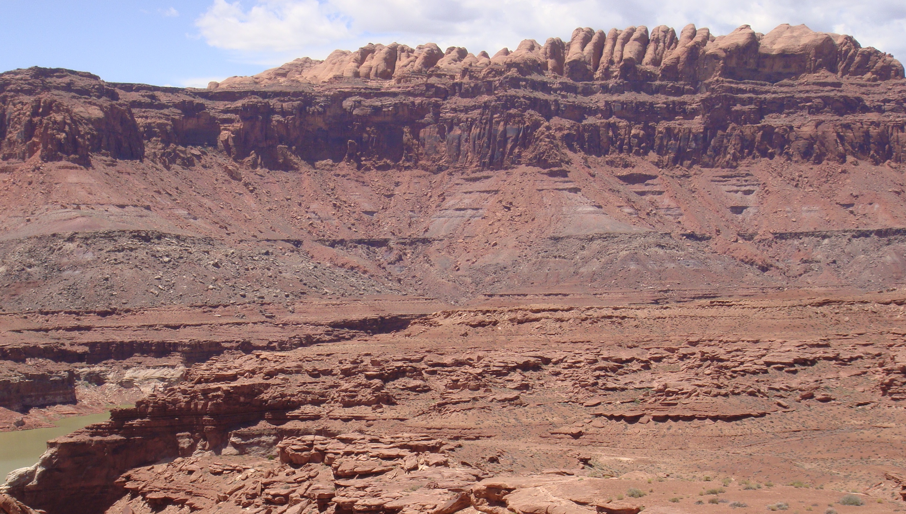
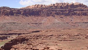 The Permian through Jurassic stratigraphy of the Colorado Plateau area of southeastern Utah that makes up much of the famous prominent rock formations in protected areas such as Capitol Reef National Park and Canyonlands National Park. From top to bottom: Rounded tan domes of the Navajo Sandstone, layered red Kayenta Formation, cliff-forming, vertically-jointed, red Wingate Sandstone, slope-forming, purplish Chinle Formation, layered, lighter-red Moenkopi Formation, and white, layered Cutler Formation sandstone. Picture from Glen Canyon National Recreation Area, Utah.
The Cutler is a rock unit that is spread across the U.S. states of Arizona, northwest New Mexico, southeast Utah and southwest Colorado. It was laid down in the Early Permian during the Wolfcampian stage. In Arizona and Utah it is often called the Cutler Group but the preferred USGS name is Cutler Formation'.[1] Its subunits, therefore, are variously called formations or members depending on the publication. This article will use the national standard set by the USGS. Members (oldest to youngest [age sorting needs to be checked]):
- Elephant Canyon (Utah)
- Halgaito (Arizona, Colorado, New Mexico, Utah)
- Cedar Mesa Sandstone (Arizona, Utah)
- Organ Rock Shale (Arizona, Colorado, New Mexico, Utah)
- White Rim Sandstone (Utah)
- De Chelly Sandstone (Arizona, Colorado, New Mexico, Utah)
There is no designated type locality for the Cutler.It was named by Cross and Howe in 1905 after Cutler Creek, which enters Uncompahgre River about 4 miles north of Ouray, Colorado. Baker and Reeside revised Cross and Howe's work in 1929 by dividing the formation into the Halgaito Tongue (base), Cedar Mesa Sandstone Member, Organ Rock Tongue, and White Rim Sandstone Member. Cutler's geographic extent was established by Wood and Northrop in 1946. In 1958 Wengerd and Matheny raised the formation to group rank, but as of 2005[update] the USGS does not recognize the suggested change.
Cutler outcrops are found in these geologic locations:
- Black Mesa Basin
- Paradox Basin
- Piceance Basin
- San Juan Mountains province
- San Juan Basin
- Uinta Basin
References
Works cited
- Cross, C.W. and Howe, Ernest, 1905, "Geography and general geology of the quadrangle, IN Description of the Silverton quadrangle [Colorado]", U.S. Geological Survey Geologic Atlas of the United States, Silverton folio, no. 120, 34 p.
- Baker, A.A. and Reeside, J.B., Jr., 1929, "Correlation of the Permian of southern Utah, northern Arizona, northwestern New Mexico, and southwestern Colorado", American Association of Petroleum Geologists Bulletin, v. 13, no. 11, p. 1413-1448
- Wood, G.H. and Northrop, S.A., 1946, "Geology of Nacimiento Mountains, San Pedro Mountain, and adjacent plateaus in parts of Sandoval and Rio Arriba Counties, New Mexico", U.S. Geological Survey Oil and Gas Investigations Map, OM-57, 1 sheet, scale 1:95,040
- Wengerd, S.A. and Matheny, M.L., 1958, "Pennsylvanian system of the Four Corners region", American Association of Petroleum Geologists Bulletin, v. 42, no. 9, p. 2048-2106
- USGS GEOLEX database entry for 'Cutler' Accessed 18 March 2006 (public domain text)
Notes
- ^ GEOLEX database entry for 'Cutler' Accessed 18 March 2006
Categories:- Geologic formations of the United States
- Permian geologic formations
- Geology of Arizona
- Geology of Utah
- Geology of Colorado
- Geology of New Mexico
Wikimedia Foundation. 2010.