- Ouray, Colorado
-
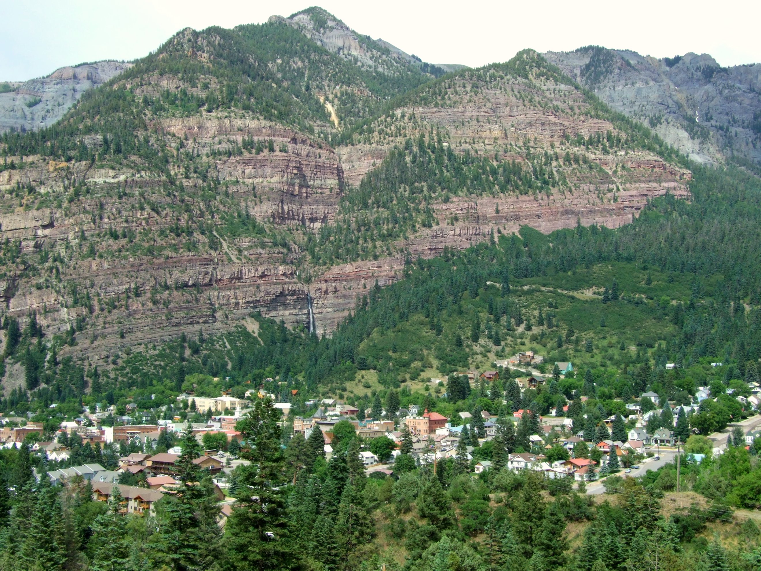
City of Ouray, Colorado — City — Ouray viewed above from Box Canyon
Nickname(s): Switzerland of America Location in Ouray County and the State of Colorado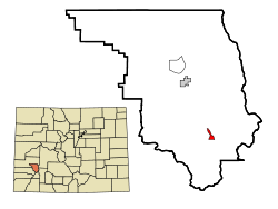
Coordinates: 38°1′24″N 107°40′20″W / 38.02333°N 107.67222°WCoordinates: 38°1′24″N 107°40′20″W / 38.02333°N 107.67222°W Country  United States
State  State of Colorado
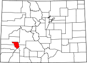
County Ouray County Seat[1] Incorporated 1884-03-24[2] Government - Type Home Rule Municipality[1] - Mayor Bob Risch Area - Total 0.8 sq mi (2.2 km2) - Land 0.8 sq mi (2.2 km2) - Water 0.0 sq mi (0.0 km2) Elevation[3] 7,792 ft (2,375 m) Population (2010) - Total 1,000 - Density 965.3/sq mi (372.7/km2) Time zone Mountain (MST) (UTC-7) - Summer (DST) MDT (UTC-6) ZIP code[4] 81427 (PO Box) Area code(s) 970 FIPS code 08-56420 GNIS feature ID 0204753 Website www.ci.ouray.co.us City of Ouray The historic City of Ouray (
 /ˈjʊəreɪ/) is a Home Rule Municipality that is the county seat and the most populous city of Ouray County, Colorado, United States.[5] The city population was 813 at the U.S. Census 2000 and 1,000 as of the U.S. Census 2010.[5][6] The Ouray Post Office has the ZIP Code 81427.
Contents
History
 The Ouray County Courthouse, constructed in 1888.
Originally established by miners chasing silver and gold in the surrounding mountains, the town at one time boasted more horses and mules than people. Prospectors arrived in the area in 1875. At the height of the mining, Ouray had more than 30 active mines. The town—after changing its name and that of the county it was in several times—was incorporated on October 2, 1876, named after Chief Ouray of the Utes, a Native American tribe. By 1877 Ouray had grown to over 1,000 in population and was named county seat of the newly formed Ouray County on March 8, 1877.
The Denver & Rio Grande Railway arrived in Ouray on December 21, 1887. It would stay until the automobile and trucks caused a decline in traffic. The last regularly scheduled passenger train was September 14, 1930. The line between Ouray and Ridgway was abandoned on March 21, 1953.
In 1986, Bill Fries aka C.W. McCall was elected Mayor, ultimately serving for six years.[7]
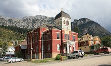
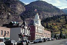
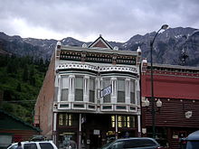
The entirety of Main St. is registered as a National Historic District with most of the buildings dating back to the late nineteenth century. The Beaumont Hotel and the Ouray City Hall and Walsh Library are listed on the National Register of Historic Places individually, while the Ouray County Courthouse, St. Elmo Hotel, St. Joseph's Miners' Hospital (currently housing the Ouray County Historical Society and Museum), Western Hotel, and Wright's Opera House are included in the historic district.
Geography
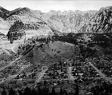 View of Ouray, circa 1910
Ouray is located at 38°1′24″N 107°40′20″W / 38.02333°N 107.67222°W (38.023217, −107.672178)[8], in the San Juan Mountains of southwestern Colorado. It is about 40 miles (64 km) south of Montrose. It is only 10 miles (16 km) northeast of Telluride, but due to the severity of the landscape, the drive is about 50 miles (80 km). Ouray is connected to Silverton and then Durango to the south by Red Mountain Pass which crests at just over 11,000 feet (3,400 m). The drive along the Uncompahgre River and over the pass is nicknamed the Million Dollar Highway, although the exact origin of the name is disputed. Yankee Boy Basin, located a few miles from town, boasts a beautiful spectacle called Twin Falls.
According to the United States Census Bureau, the city has a total area of 0.8 square miles (2.1 km2), all of it land.
Climate
Ouray experiences four distinct seasons. Summers are warm in the day and mild to cool at night with brief thunderstorms often occurring in the afternoons in July and August sometimes resulting in intense, though short lived, rainfall. Autumn is cool and mostly clear with occasional rain. Winters are long and cold--though seldom extremely so--with considerable snowfall. Spring is generally cool with early spring often bringing the largest snowfalls; late spring into early summer (mid-May through late June) is mild to warm and is usually the driest time of year. The Köppen climate classification for Ouray is Dfb.[9]
Climate data for Ouray, Colorado Month Jan Feb Mar Apr May Jun Jul Aug Sep Oct Nov Dec Year Record high °F (°C) 60
(16)61
(16)68
(20)75
(24)84
(29)92
(33)91
(33)90
(32)87
(31)84
(29)75
(24)60
(16)92
(33)Average high °F (°C) 37.0
(2.8)39.2
(4.0)44.7
(7.1)53.7
(12.1)63.6
(17.6)73.9
(23.3)78.5
(25.8)76.1
(24.5)70.1
(21.2)59.5
(15.3)45.2
(7.3)37.6
(3.1)56.6 Average low °F (°C) 15.0
(−9.4)17.2
(−8.2)22.5
(−5.3)29.7
(−1.3)37.9
(3.3)45.1
(7.3)51.2
(10.7)50.0
(10.0)43.6
(6.4)34.1
(1.2)23.3
(−4.8)16.3
(−8.7)32.2 Record low °F (°C) −22
(−30)−21
(−29)−7
(−22)2
(−17)18
(−8)27
(−3)33
(1)34
(1)16
(−9)8
(−13)−4
(−20)−17
(−27)−22
(−30)Precipitation inches (mm) 1.72
(43.7)1.73
(43.9)2.25
(57.2)2.07
(52.6)1.76
(44.7)1.15
(29.2)2.10
(53.3)2.29
(58.2)2.02
(51.3)2.15
(54.6)2.06
(52.3)1.62
(41.1)22.92
(582.2)Snowfall inches (cm) 24.7
(62.7)22.8
(57.9)25.5
(64.8)13.1
(33.3)3.2
(8.1).2
(0.5)0
(0)0
(0).2
(0.5)5.8
(14.7)20.4
(51.8)21.9
(55.6)137.8
(350)Source: Western Regional Climate Center [10] Economy
 Ouray City Hall and fire station
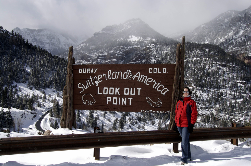
The entire present-day economy of Ouray is based on tourism. Ouray bills itself as the "Switzerland of America" because of its setting at the narrow head of a valley, enclosed on three and a half sides by steep mountains.
Much of the town tourism is focused on ice climbing, mountain biking, hiking and off-roading in four wheel drive(4WD) expeditions into the San Juan Mountains. 4WD vehicles, often called "jeeps" regardless of make, can be rented from a number of outfitters downtown. Ouray has also become a popular destination for motorcyclists, as it marks the beginning of the Million Dollar Highway. This stretch of highway connects Ouray to its neighboring cities of Silverton and Durango. The Million Dollar Highway is frequently regarded as one of the most beautiful roads in Colorado, but is also considered one of the most dangerous due to its sharp turns, steep ledges, and lack of guard rails.[11] Popular destinations include Yankee Boy Basin, Engineer Mountain, and Black Bear Road. Recording artist (and later Ouray mayor) C.W. McCall helped make Black Bear famous in the area. His song "Black Bear Road" borrowed the phrase, "you don't have to be crazy to drive this road, but it helps," from a sign once posted somewhere at the beginning of Black Bear Pass.[12]
Ouray is the winter ice-climbing capital of the U.S.[13] The world's first ice climbing park, expanding on previously-popular natural falls, consists of dozens of frozen waterfalls from 80 to 200 feet (61 m) high farmed along more than a mile of the Uncompahgre Gorge. The water is supplied by a sprinkler system developed and maintained by a volunteer organization and supported by donations from local businesses, gear manufacturers and climbers. The Ouray Ice Park is free and attracts climbers from around the world. The annual Ice Festival is a weekend-long extravaganza of contests, exhibitions and instruction with many of the world's top ice climbers. Ice climbing has been a boon to the local economy as well, with hotels and restaurants that previously closed through the winter months now staying open to accommodate climbers.
There are numerous waterfalls along the road from Durango to Ouray, and within the city limits there are 2 waterfalls within easy reach. Cascade Falls [14] is a short, 1/4 mile hike accessible from a parking lot on 8th Avenue. Box Canyon Falls is at the southwest edge of Ouray.
Like most towns in the Colorado mountains, Ouray was originally a mining town. However the evidence does not dominate the town. The largest and most famous mine is the Camp Bird Mine, the second largest gold mine in Colorado, established by Thomas Walsh in 1896.[15] Even though there was an operation permit filed in 2007, the mine still remains inactive.[16] During its lifespan, the mine produced about 1.5 million troy ounces of gold, and 4 million troy ounces of silver, from 1896 to 1990.[17] In 1995 the old milling equipment "The Crusher" was disassembled and sold to a smaller mine located in Mongolia where it operated for about two years.[15] The vacant mine can be seen on the steep 2WD road leading to the 4WD roads to Yankee Boy Basin and Imogene Pass.
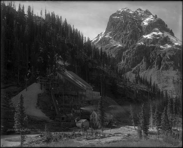
 Atlas Mill and Stony Mountain, both near Ouray, around 1915
Ouray in popular culture
In the fall of 1968 the film True Grit was filmed in Ouray County, including some scenes in the city of Ouray and the nearby town of Ridgway and, possibly most notably, the interior of the Ouray County Court House.
In Ayn Rand's novel Atlas Shrugged, the protagonist's secret hideaway was in a beautiful valley in the Rocky Mountains called Mulligan's Valley or "Galt's Gulch." Galt's Gulch was inspired by Ouray, where Rand found inspiration to complete the novel, though she greatly expanded the small valley to include her many ideas for the story.[18]
Telluride native David Lavender related his experiences working at the Camp Bird Mine in the 1930s in his memoir One Man's West.
Coors and Chevrolet have both filmed commercials in the area, particularly Twin Falls in Yankee Boy Basin.
Famous baseball pitcher Smoky Joe Wood was born in Kansas City but grew up in Ouray.[19]
The opening scene to the movie Over the Top with Sylvester Stallone runs straight through downtown.
Demographics
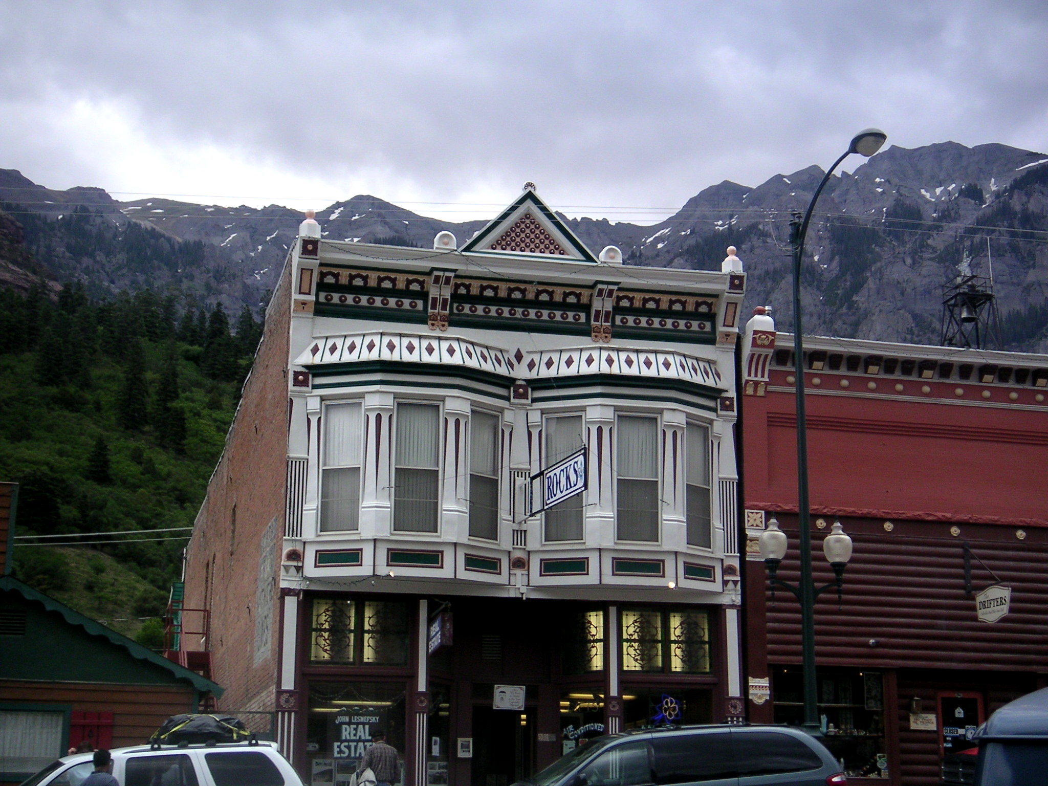
 Building in Ouray
As of the census of 2010,[20] there were 1,000 people, 457 households, and 283 families residing in the city. The population density was 1,250 people per square mile (454.5/km²). There were 800 housing units at an average density of 1,000 per square mile (363.6/km²). The racial makeup of the city was 95.2% White, 0.1% (1) African American, 0.4% (4) Native American, 0.8% (8) Asian, 1.9% (19) from other races, and 1.6% (16) from two or more races. Hispanic or Latino of any race were 8.2% of the population.
There were 457 households out of which 26.5% had children under the age of 18 living with them, 48.1% were married couples living together, 7.7% had a female householder with no husband present, 6.1% had a male householder with no wife present, and 38.1% were non-families. 32.4% of all households were made up of individuals and 10.9% had someone living alone who was 65 years of age or older. The average household size was 2.19 and the average family size was 2.76.
In the city the population was spread out with 21.7% under the age of 18, 28.1% from 18 to 44, 33.2% from 45 to 64, and 17.0% who were 65 years of age or older. The median age was 45.1 years. For every 100 females there were 101.6 males. For every 100 females age 18 and over, there were 101.8 males.
The median income for a household in the city was $36,094, and the median income for a family was $45,313. Males had a median income of $35,217 versus $27,083 for females. The per capita income for the city was $23,127. About 9.3% of families and 8.1% of the population were below the poverty line, including 7.1% of those under age 18 and 6.4% of those age 65 or over.
Transportation
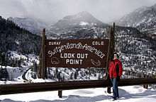 Switzerland of America sign on the Million Dollar Highway
The nearest airport with scheduled service is Montrose Regional Airport, located approximately 40 miles (64 km) to the north.
 US 550 is the only paved road into or out of Ouray. U.S. Route 550 begins roughly 40 miles (64 km) north of Ouray in Montrose. It runs south to Bernalillo, New Mexico, near Albuquerque, New Mexico via Durango, Colorado and Aztec, New Mexico. The stretch of US 550 that runs south from Ouray to Silverton is known as the Million Dollar Highway.
See also
- Communities of Ouray County
- Colorado municipalities
- San Juan Skyway National Scenic Byway
References
- ^ a b "Active Colorado Municipalities". State of Colorado, Department of Local Affairs. http://www.dola.state.co.us/dlg/local_governments/municipalities.html. Retrieved 2009-07-20.
- ^ "Colorado Municipal Incorporations". State of Colorado, Department of Personnel & Administration, Colorado State Archives. 2004-12-01. http://www.colorado.gov/dpa/doit/archives/muninc.html. Retrieved 2007-09-02.
- ^ "US Board on Geographic Names". United States Geological Survey. 2007-10-25. http://geonames.usgs.gov. Retrieved 2008-01-31.
- ^ "ZIP Code Lookup" (JavaScript/HTML). United States Postal Service. http://zip4.usps.com/zip4/citytown.jsp. Retrieved November 28, 2007.
- ^ a b "Find a County". National Association of Counties. http://www.naco.org/Counties/Pages/FindACounty.aspx. Retrieved 2011-06-07.
- ^ Colorado Trend Report 2: State and Complete Places (Sub-state 2010 Census Data). Missouri Census Data Center. Accessed 2011-02-25.
- ^ "'McCall' Leaves Office", Rocky Mountain News, January 14, 1992. Accessed March 25, 2008
- ^ "US Gazetteer files: 2010, 2000, and 1990". United States Census Bureau. 2011-02-12. http://www.census.gov/geo/www/gazetteer/gazette.html. Retrieved 2011-04-23.
- ^ "Köppen Climate Classification Criteria". University of Idaho. http://snow.cals.uidaho.edu/Clim_Map/koppen_criteria.htm. Retrieved July 20, 2011.
- ^ "Ouray, Colorado Climate Summary 1948-2005". Western Regional Climate Center. http://www.wrcc.dri.edu/cgi-bin/cliMAIN.pl?cooura. Retrieved 2011-06-21.
- ^ http://www.roadtripamerica.com/places/million.htm
- ^ http://www.silverstage.net/OurayMagazine/OurayRecreation/OurayRecreation.htm
- ^ Ybarra, Michael J. (January 30, 2008). "Where Ice Climbing Is King". The Wall Street Journal. http://online.wsj.com/article/SB120165127715226915.html?mod=opinion_journal_leisure_art.
- ^ "BeforeYouGo.com". BeforeYouGo.com. http://beforeyougo.com/content/ouray-colorado-switzerland-america.
- ^ a b http://www.ouraycolorado.com/Ghost+Towns
- ^ http://www.amazines.com/Camp_Bird_Mine_related.html
- ^ Camp Bird Mine, Ouray, Sneffels District (Mount Sneffels District), Ouray Co., Colorado, USA
- ^ "Speaking of Atlas Shrugged... That is the little town [Ouray] I had picked for Galt's Gulch..." --Ayn Rand, 1960, quoted at http://groups.msn.com/AtlasShruggedCelebrationDayinOurayColorado
- ^ Vaccaro, Mike. The First Fall Classic: the Red Sox, the Giants, and the Cast of Players, Pugs and Politicos Who Reinvented the World Series in 1912. Doubleday, 2009, ISBN 9780385532181, p. 30
- ^ "Profile of General Population and Housing Characteristics: 2010". United States Census Bureau. http://factfinder2.census.gov/. Retrieved July 14, 2011.
External links
- City of Ouray website
- History of Ouray @ the City site
- Ouray photos and information at Western Mining History
- Ouray Chamber Resort Association -- Lodging, Restaurants, Activities, Shops, Relocation Information
- A live webcam overlooking the city from The Blowout, a nearby rock formation at approximately 10,000 feet (3,000 m) above sealevel
- Ouray County's Newspaper ---->
Municipalities and communities of Ouray County, Colorado County seat: Ouray City Ouray
Town CDPs Colona | Loghill Village | Portland
Unincorporated
communitiesCamp Bird | Dallas | Eldredge | Thistledown
Ghost towns Ironton | Sneffels
Passes Towns National Forests Other Categories:- Cities in Ouray County, Colorado
- Cities in Colorado
- County seats in Colorado
- Hot springs of Colorado


Wikimedia Foundation. 2010.