- Fairplay, Colorado
Infobox Settlement
official_name = Town of Fairplay, Colorado
other_name =
native_name =
nickname = The Real South Park
settlement_type = Town
motto =
imagesize = 275px
image_caption = Fairplay dredge, 1940s, the largestgold dredge in Colorado
flag_size =
image_
seal_size =
image_shield =
shield_size =
image_blank_emblem =
blank_emblem_type =
blank_emblem_size =
flag_size =
image_
seal_size =
image_shield =
shield_size =
image_blank_emblem =
blank_emblem_type =
blank_emblem_size =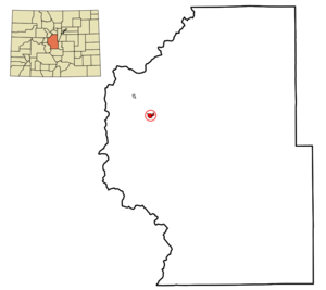
mapsize = 250x200px
map_caption = Location in Park County and theState of Colorado
mapsize1 =
map_caption1 =
image_dot_
dot_mapsize =
dot_map_caption =
dot_x =
dot_y =
pushpin_
pushpin_label_position =
pushpin_map_caption =
pushpin_mapsize =
subdivision_type = Country
subdivision_name = USA
subdivision_type1 = State
subdivision_name1 = flag|Colorado|name=State of Colorado
subdivision_type2 = County
subdivision_name2 = Park County Seatcite web | url = http://www.dola.state.co.us/dlg/local_governments/municipalities.html | title = Active Colorado Municipalities | format =HTML | publisher = State of Colorado, Department of Local Affairs | accessdate = 2007-09-01]
subdivision_type3 =
subdivision_name3 =
subdivision_type4 =
subdivision_name4 =
government_footnotes =
government_type = Statutory Town
leader_title = Mayor
leader_name = Fred R. Boyce [cite web | url = http://fairplayco.us/town_elections.htm | title = Town Elections | format =HTML | publisher = Town of Fairplay | accessdate = 2007-09-14]
leader_title1 =
leader_name1 =
leader_title2 =
leader_name2 =
leader_title3 =
leader_name3 =
leader_title4 =
leader_name4 =
established_title = Founded
established_date = 1859
established_title2 = Incorporated
established_date2 =November 15 ,1872 cite web | url = http://www.colorado.gov/dpa/doit/archives/muninc.html | title = Colorado Municipal Incorporations | format =HTML | publisher = State of Colorado, Department of Personnel & Administration, Colorado State Archives | date =2004-12-01 | accessdate = 2007-09-02]
established_title3 =
established_date3 =
area_magnitude =
unit_pref = Imperial
area_footnotes =
area_total_km2 = 2.7
area_land_km2 = 2.7
area_water_km2 = 0
area_total_sq_mi = 1.1
area_land_sq_mi = 1.1
area_water_sq_mi = 0
area_water_percent =
area_urban_km2 =
area_urban_sq_mi =
area_metro_km2 =
area_metro_sq_mi =
area_blank1_title =
area_blank1_km2 =
area_blank1_sq_mi =
population_as_of = 2000
population_footnotes =
population_note =
population_total = 610
population_density_km2 = 225.9
population_density_sq_mi = 554.5
population_metro =
population_density_metro_km2 =
population_density_metro_sq_mi =
population_urban =
population_density_urban_km2 =
population_density_urban_sq_mi =
population_blank1_title =
population_blank1 =
population_density_blank1_km2 =
population_density_blank1_sq_mi =
timezone = MST
utc_offset = -7
timezone_DST = MDT
utc_offset_DST = -6
latd = 39 |latm = 13 |lats = 28 |latNS = N
longd = 105 |longm = 59 |longs = 53 |longEW = W
elevation_footnotes = cite web | url = http://www.mesalek.com/colo/trivia/elev.html | title = Colorado Highways: Elevation-Related Trivia Items | format =HTML | publisher = Matthew E. Salek | accessdate = 2007-09-14]
elevation_m = 3034
elevation_ft = 9953
postal_code_type =ZIP code cite web | url = http://zip4.usps.com/zip4/citytown.jsp | title = ZIP Code Lookup| format =JavaScript /HTML | publisher =United States Postal Service | accessdate = September 14 | accessyear = 2007]
postal_code = 80440 & 80456, 80432 (PO Box )
area_code = 719
blank_name = FIPS code
blank_info = 08-25610
blank1_name = GNIS feature ID
blank1_info = 0169534
website = [http://fairplayco.us/ Town of Fairplay]
footnotes =The historic Town of Fairplay is a Statutory Town that is the
county seat and the most populous town of Park County,Colorado ,United States .GR|6 Fairplay is located in South Park at an elevation of convert|9953|ft|m|0|sp=us. The town is the fifth-highest incorporated place in theState of Colorado . The population was 610 at theU.S. Census 2000 . A historicgold mining settlement, the town was founded in 1859 during the early days of thePike's Peak Gold Rush . It is the largest community in the grassland basin of Colorado known as South Park, sitting on the west edge of the basin at the junction of U.S. Highway 285 and State Highway 9. It is on a hillside just east of theMiddle Fork South Platte River , near where Highway 9 ascends the river valley northward to Alma andHoosier Pass . It is a quiet town, and the roads surrounding it have a low volume of traffic. Although it was founded during the initialplacer mining boom, the mines in the area continued to produce gold and silverore for many decades up through the middle of the 20th century.The town consists of modern retail businesses along the highway, as well as a historic town on the bluff above the river along Front Street. The northern extension of Front Street along the river has been preserved and has become the site of relocated historic structures as an
open air museum calledSouth Park City , intended to recreate the early days of the Colorado Gold Rush. Most of the residences in town are located on the hillside east of State Highway 9, in the vicinity of the schools and Park County Courthouse. The majority of the streets in town were finally paved in 2005.The Town of Fairplay, Colorado, is the basis for the Town of South Park, Colorado, in the television series
South Park ."South Park" animated series
The town has become mildly famous in recent years as the town depicted in the "
South Park " animated television series onComedy Central . Although the geographical references contained in several episodes imply that Fairplay is the model for South Park, it is much smaller and more rustic than its fictional counterpart, which has a moresuburban character. Co-creatorTrey Parker grew up in Conifer and went to high school in Evergreen, both of which are somewhat more affluent mountain communities immediately west of Denver in Jefferson County. Co-creatorMatt Stone lived in the Denver suburb of Littleton.Because the town is a regional center of government and commerce, the term "South Park" has historically been used in the town in the naming of institutions and business, including South Park High School (the namesake of which appears in the series). The elementary school is Edith Teeter Elementary and the middle school is Silverheels Middle School.
Although South Park is based upon the real life town of Fairplay, it is mentioned by
Gerald Broflovski in the episode "Night of the Living Homeless " and described as "4 miles away" in "Jakovasaurs ", which implies that it is a separate town in the show. The county seat offices in Fairplay are seen, though it is not mentioned by name, in the episode "Stanley's Cup ".Burro Days
Burro Days is a festival held on the last weekend of July. The event celebrates the town's mining heritage. The main feature of the festival is a 29-mile burro race over rough terrain and elevation gain from downtown Fairplay to the 13,000-ft summit of
Mosquito Pass . Teams consist of one person and one burro. The race takes about five hours to complete; first prize is $1,000. There are several other burro races in Colorado, the most notable takes place in Leadville. The Fairplay race is considered the World Championships of Burro Racing. For many years (in the 1960s and early 1970s) the Burro race took place from Leadville to Fairplay, or vice versa, crossing over Mosquito Pass. This followed the route thatFather Dyer used for carrying mail and his preaching circuit. With time the rivalry between the two cities proved the demise of this cooperative endeavor. A South Park parallel to the Burro race can be found in theCow Days episode.Geography
Fairplay is located at coor dms|39|13|28|N|105|59|53|W|city (39.224384, -105.998132)GR|1.
According to the
United States Census Bureau , the town has a total area of 1.1 square miles (2.7 km²), all of it land.Demographics
As of the
census GR|2 of 2000, there were 610 people, 259 households, and 169 families residing in the town. Thepopulation density was 576.3 people per square mile (222.2/km²). There were 337 housing units at an average density of 318.4/sq mi (122.8/km²). The racial makeup of the town was 93.11% White, 1.31% African American, 0.98% Native American, 0.33% Asian, 2.79% from other races, and 1.48% from two or more races. Hispanic or Latino of any race were 4.92% of the population.There were 259 households out of which 31.7% had children under the age of 18 living with them, 51.0% were married couples living together, 7.7% had a female householder with no husband present, and 34.4% were non-families. 25.9% of all households were made up of individuals and 3.9% had someone living alone who was 65 years of age or older. The average household size was 2.36 and the average family size was 2.79.
In the town the population was spread out with 23.9% under the age of 18, 8.5% from 18 to 24, 37.5% from 25 to 44, 24.9% from 45 to 64, and 5.1% who were 65 years of age or older. The median age was 35 years. For every 100 females there were 109.6 males. For every 100 females age 18 and over, there were 111.9 males.
The median income for a household in the town was $50,385, and the median income for a family was $51,979. Males had a median income of $34,286 versus $26,429 for females. The
per capita income for the town was $21,742. About 6.6% of families and 9.5% of the population were below thepoverty line , including 10.4% of those under age 18 and 5.4% of those age 65 or over.ee also
*
Colorado municipalities
*Denver-Aurora Metropolitan Statistical Area
*Denver-Aurora-Boulder Combined Statistical Area
*Front Range Urban Corridor
*Park County, Colorado
*State of Colorado References
External links
* [http://fairplayco.us/ Town of Fairplay website]
** [http://www.dot.state.co.us/App_DTD_DataAccess/Downloads/CityMaps/Fairplay.pdf CDOT map of the Town of Fairplay]
* [http://southparkchamber.com/ South Park Chamber of Commerce]
Wikimedia Foundation. 2010.