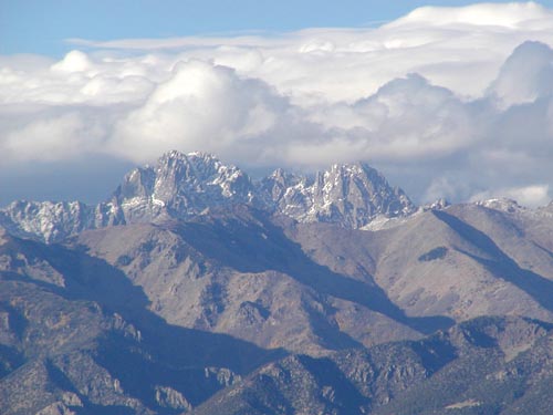
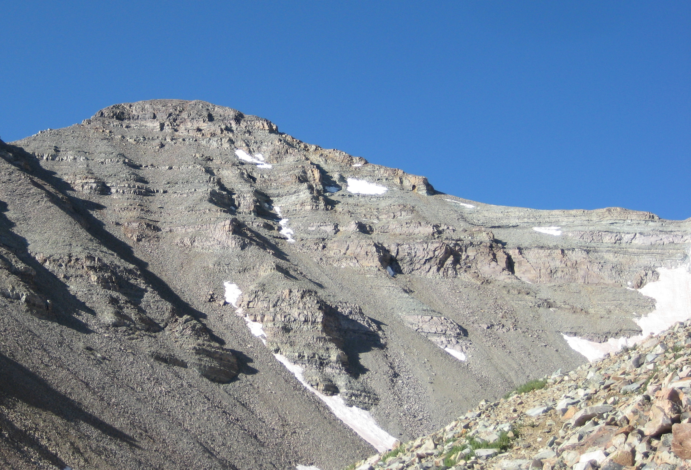
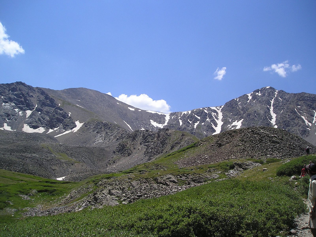
- Mountain peaks of Colorado
-
 Mount Elbert is the highest peak of both the State of Colorado and the Rocky Mountains of North America.
Contents
Main article: Geography of ColoradoSee also: Southern Rocky Mountains, Colorado mountain ranges, and Colorado mountain passesThis article comprises three sortable tables of the major mountain peaks of the U.S. State of Colorado.
Topographic elevation is the vertical distance above the reference geoid, a precise mathematical model of the Earth's sea level as an equipotential gravitational surface. Topographic prominence is the elevation difference between the summit and the highest or key col to a higher summit. Topographic isolation is the minimum great circle distance to a point of higher elevation.
This article defines a significant summit as a summit with at least 100 meters (328.1 feet) of topographic prominence, and a major summit as a summit with at least 500 meters (1640.4 feet) of topographic prominence. An ultra-prominent summit is a summit with at least 1500 meters (4921.3 feet) of topographic prominence.
All elevations in this article include an elevation adjustment from the National Geodetic Vertical Datum of 1929 (NGVD 29) to the North American Vertical Datum of 1988 (NAVD 88). For further information, please see this United States National Geodetic Survey note.
Highest major summits
Main article: Table of the highest major summits of ColoradoThe following sortable table lists the 55 highest Colorado mountain peaks with at least 500 meters (1640.4 feet) of topographic prominence. Each of these 55 summits exceeds 4000 meters (13,123.4 feet) of topographic elevation.
Note: Compare this table with the List of Colorado fourteeners which includes peaks with at least 4267.2 meters (14,000 feet) of elevation and at least 91.44 meters (300 feet) of topographic prominence. The 11 highest peaks are the same on both lists, but this list of 4000 meter peaks excludes low prominence summits like Torreys Peak, and includes high prominence, although slightly lower, peaks like Mount Ouray.
Most prominent summits
The following sortable table lists the 50 most topographically prominent Colorado mountain peaks.
Most isolated major summits
The following sortable table lists the 40 most topographically isolated Colorado mountain peaks with at least 500 meters (1640.4 feet) of topographic prominence.
The 40 most isolated Colorado mountain peaks with at least
500 meters of topographic prominence
Rank Mountain Peak Mountain Range Elevation Prominence Isolation Location 1 Mount Elbert[1][2][3][4] Sawatch Range 14,440 ft
4401 m9,093 ft
2772 m671 mi
1,079 km39.1178°N
106.4454°W2 Blanca Peak[14][15][16] Sangre de Cristo Range 14,351 ft
4374 m5,326 ft
1623 m103 mi
166 km37.5775°N
105.4857°W3 Uncompahgre Peak[17][18][19] San Juan Mountains 14,321 ft
4365 m4,277 ft
1304 m85 mi
137 km38.0717°N
107.4621°W4 Pikes Peak[59][60][61] Pikes Peak Massif 14,115 ft
4302 m5,530 ft
1686 m61 mi
98 km38.8405°N
105.0442°W5 Longs Peak[38][39][40] Front Range 14,259 ft
4346 m2,940 ft
896 m44 mi
70 km40.2550°N
105.6151°W6 Flat Top Mountain[148][149][150] Flat Tops 12,361 ft
3768 m4,054 ft
1236 m43 mi
69 km40.0147°N
107.0833°W7 Summit Peak[124][125][126] San Juan Mountains 13,308 ft
4056 m2,760 ft
841 m40 mi
64 km37.3506°N
106.6968°W8 Ute Peak[151][152][153] Ute Mountain 9,984 ft
3043 m4,039 ft
1231 m39 mi
63 km37.2841°N
108.7787°W9 Mount Zirkel[160][161] Park Range 12,185 ft
3714 m3,470 ft
1058 m38 mi
61 km40.8313°N
106.6631°W10 Culebra Peak[67][68] Culebra Range 14,053 ft
4283 m4,827 ft
1471 m35 mi
57 km37.1224°N
105.1858°W11 Mount Wilson[41][42] San Miguel Mountains 14,252 ft
4344 m4,024 ft
1227 m33 mi
53 km37.8391°N
107.9916°W12 Fishers Peak[217][218][219] Raton Mesa 9,633 ft
2936 m1,847 ft
563 m32 mi
52 km37.0982°N
104.4628°W13 Piñon Mesa High Point[181][182] Uncompahgre Plateau 9,705 ft
2958 m2,680 ft
817 m31 mi
49 km38.8260°N
108.7719°W14 Diamond Peak[172][173] Diamond Peak 9,665 ft
2946 m2,845 ft
867 m30 mi
49 km40.9504°N
108.8782°W15 Crestone Peak[20][21] Sangre de Cristo Range 14,300 ft
4359 m4,554 ft
1388 m27 mi
44 km37.9668°N
105.5855°W16 San Luis Peak[69][70][71] La Garita Mountains 14,022 ft
4274 m3,113 ft
949 m27 mi
43 km37.9868°N
106.9313°W17 Greenhorn Mountain[154][155][156] Wet Mountains 12,352 ft
3765 m3,777 ft
1151 m26 mi
41 km37.8815°N
105.0133°W18 Grays Peak[28][29][30][31] Front Range 14,278 ft
4352 m2,769 ft
844 m25 mi
40 km39.6339°N
105.8176°W19 Hesperus Mountain[134][135] La Plata Mountains 13,237 ft
4035 m2,852 ft
869 m25 mi
40 km37.4451°N
108.0890°W20 Zenobia Peak[211][212][213] Uinta Mountains 9,022 ft
2750 m2,395 ft
730 m24 mi
38 km40.6072°N
108.8701°W21 Mount Lincoln[22][23][24] Mosquito Range 14,293 ft
4357 m3,862 ft
1177 m23 mi
36 km39.3515°N
106.1116°W22 Mount Powell[101][102] Gore Range 13,586 ft
4141 m3,000 ft
914 m22 mi
35 km39.7601°N
106.3407°W23 North Mamm Peak[162][163][164] Grand Mesa 11,126 ft
3391 m3,103 ft
946 m21 mi
34 km39.3865°N
107.8660°W24 South River Peak[145][146][147] San Juan Mountains 13,154 ft
4009 m2,448 ft
746 m21 mi
34 km37.5741°N
106.9815°W25 Castle Peak[25][26][27] Elk Mountains 14,279 ft
4352 m2,365 ft
721 m21 mi
34 km39.0097°N
106.8614°W26 West Spanish Peak[98][99][100] Spanish Peaks 13,631 ft
4155 m3,685 ft
1123 m20 mi
33 km37.3756°N
104.9934°W27 Waugh Mountain[220][221] South Park Hills 11,716 ft
3571 m2,330 ft
710 m20 mi
32 km38.6022°N
105.6955°W28 Bison Peak[200][201][202] Tarryall Mountains 12,432 ft
3789 m2,451 ft
747 m19 mi
31 km39.2384°N
105.4978°W29 Castle Peak[170][171] Sawatch Range 11,305 ft
3446 m3,040 ft
927 m19 mi
30 km39.7732°N
106.8345°W30 Mount of the Holy Cross[72][73][74] Sawatch Range 14,011 ft
4271 m2,111 ft
643 m19 mi
30 km39.4668°N
106.4817°W31 Meaden Peak[222][223] Elkhead Mountains 10,884 ft
3317 m2,179 ft
664 m18 mi
29 km40.7636°N
107.0575°W32 Crater Peak[224][225][226] Grand Mesa 11,333 ft
3454 m2,307 ft
703 m18 mi
29 km39.0396°N
107.6628°W33 Mount Antero[32][33][34] Sawatch Range 14,276 ft
4351 m2,503 ft
763 m18 mi
29 km38.6741°N
106.2462°W34 Sawtooth Mountain[227][228][229] La Garita Mountains 12,153 ft
3704 m1,927 ft
587 m18 mi
28 km38.2740°N
106.8670°W35 Blair Mountain[230][231] White River Plateau 11,445 ft
3488 m1,736 ft
529 m18 mi
28 km39.7943°N
107.4176°W36 Bennett Peak[138][139] San Juan Mountains 13,209 ft
4026 m1,743 ft
531 m17 mi
28 km37.4833°N
106.4343°W37 Clark Peak[174][175][176] Medicine Bow Mountains 12,954 ft
3948 m2,771 ft
845 m17 mi
27 km40.6068°N
105.9300°W38 Black Mountain[203][204] Elkhead Mountains 10,865 ft
3312 m2,440 ft
744 m16 mi
26 km40.7835°N
107.3691°W39 Mount Mestas[232][233][234] Sangre de Cristo Range 11,574 ft
3528 m2,229 ft
679 m16 mi
26 km37.5830°N
105.1473°W40 Hagues Peak[103][104][105] Mummy Range 13,573 ft
4137 m2,421 ft
738 m16 mi
26 km40.4845°N
105.6464°WGallery
-
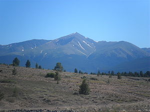
Mount Elbert in the Sawatch Range is the highest peak of the Rocky Mountains.
-
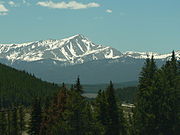
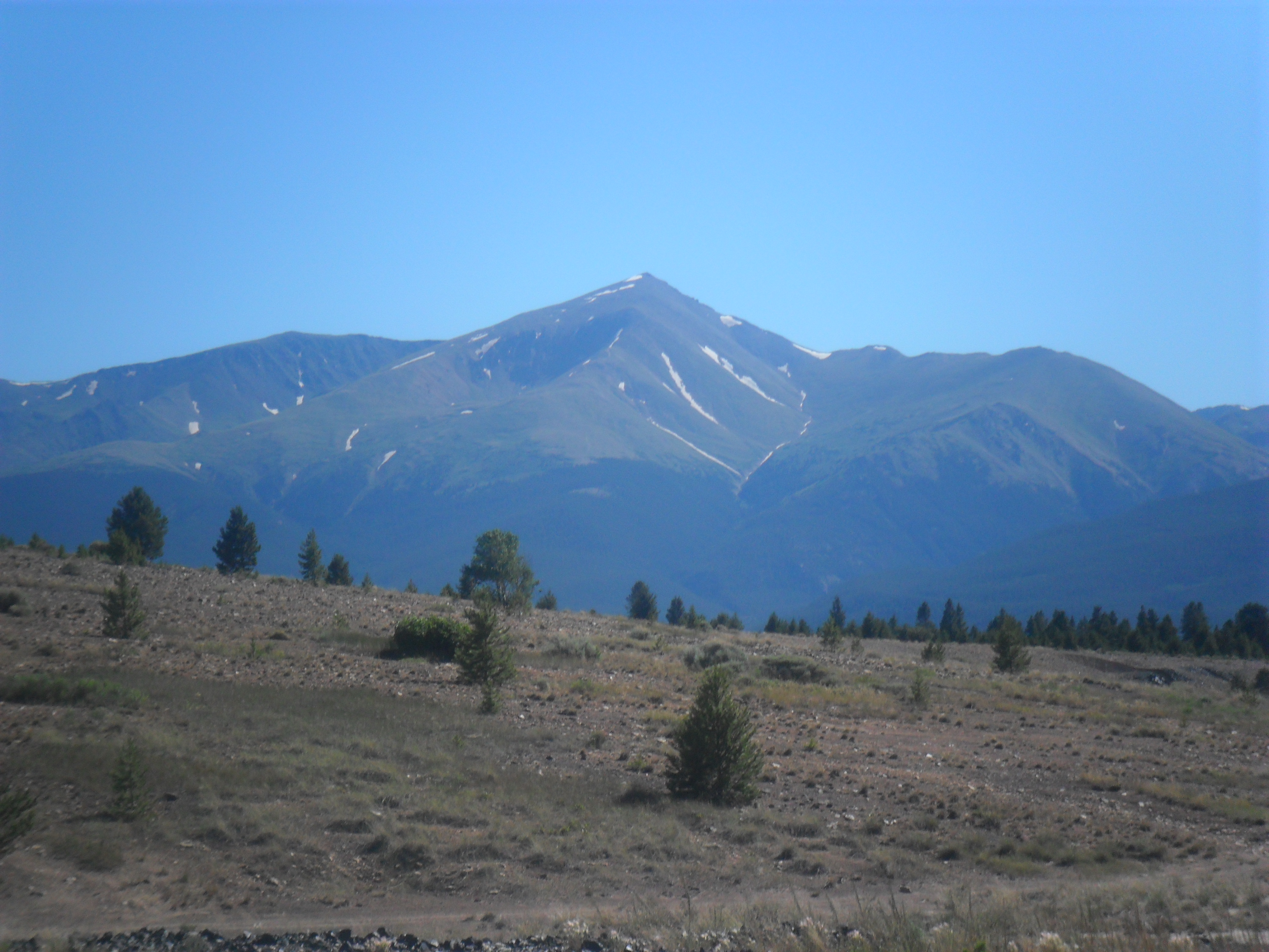
Mount Massive in the Sawatch Range is the second highest peak of the Rocky Mountains.
-

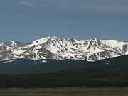
Mount Harvard is the highest of the Collegiate Peaks and the third highest peak of the Rocky Mountains.
-

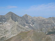
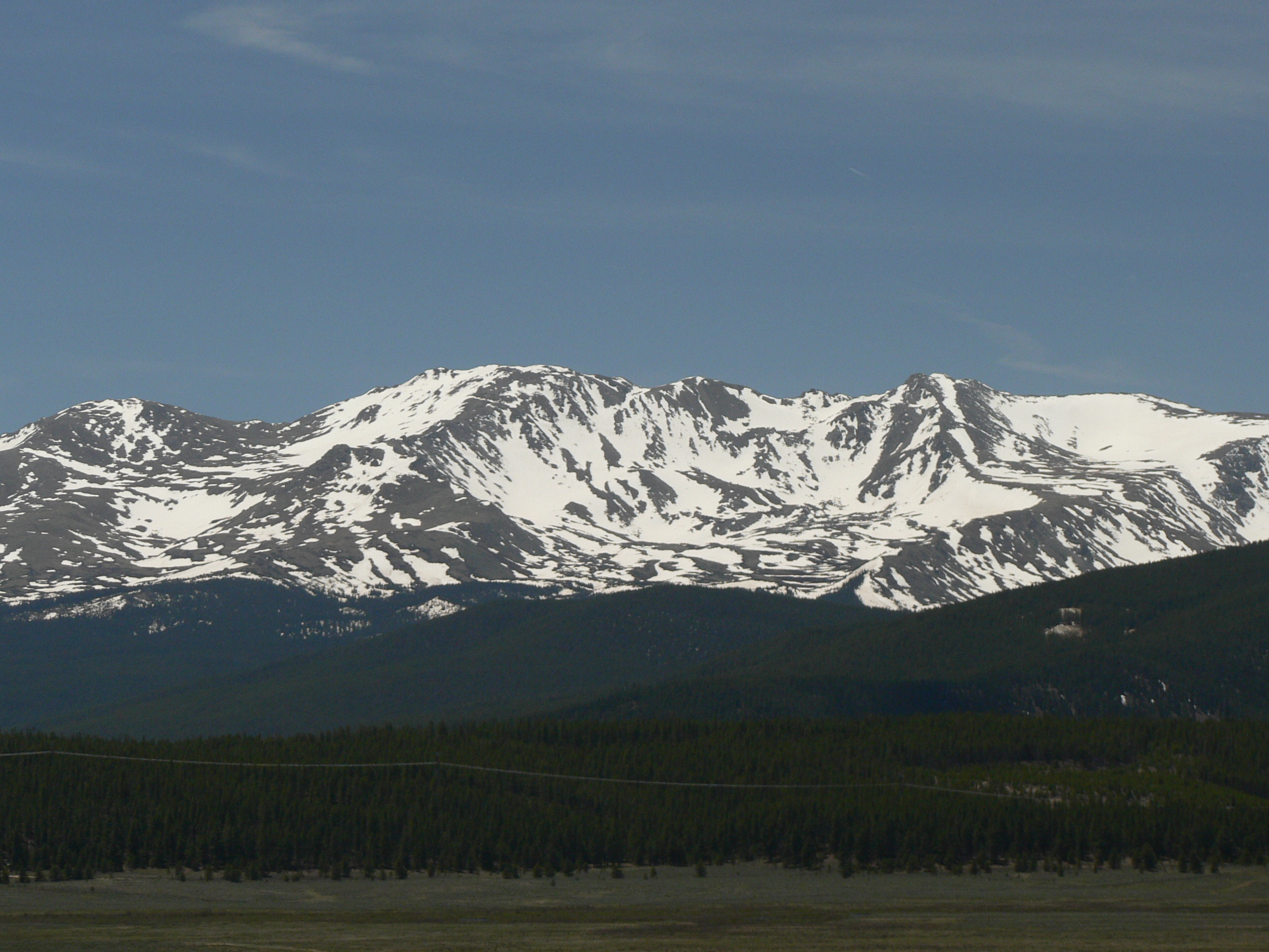
La Plata Peak in the Collegiate Peaks is the fourth highest peak of the Rocky Mountains.
-
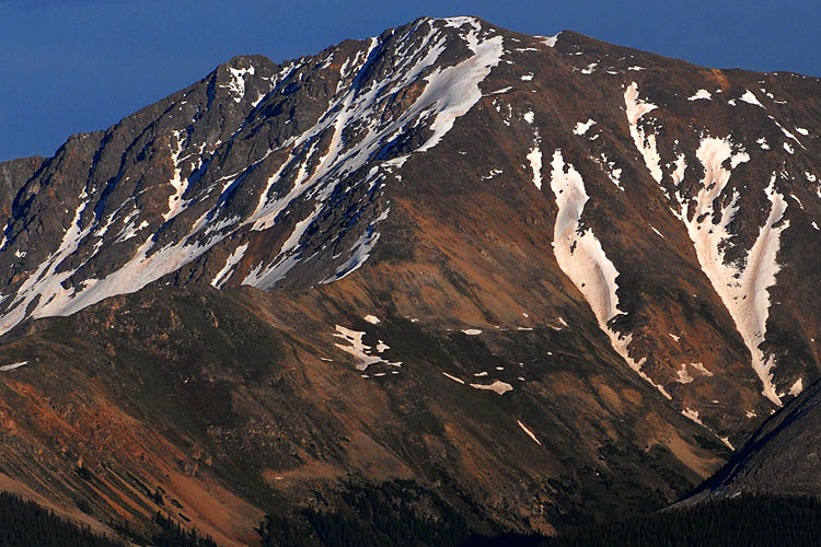
A remnant of an enormous stratovolcano, Blanca Peak is the highest peak of the Sangre de Cristo Mountains and the second most topographically isolated peak of Colorado.
-
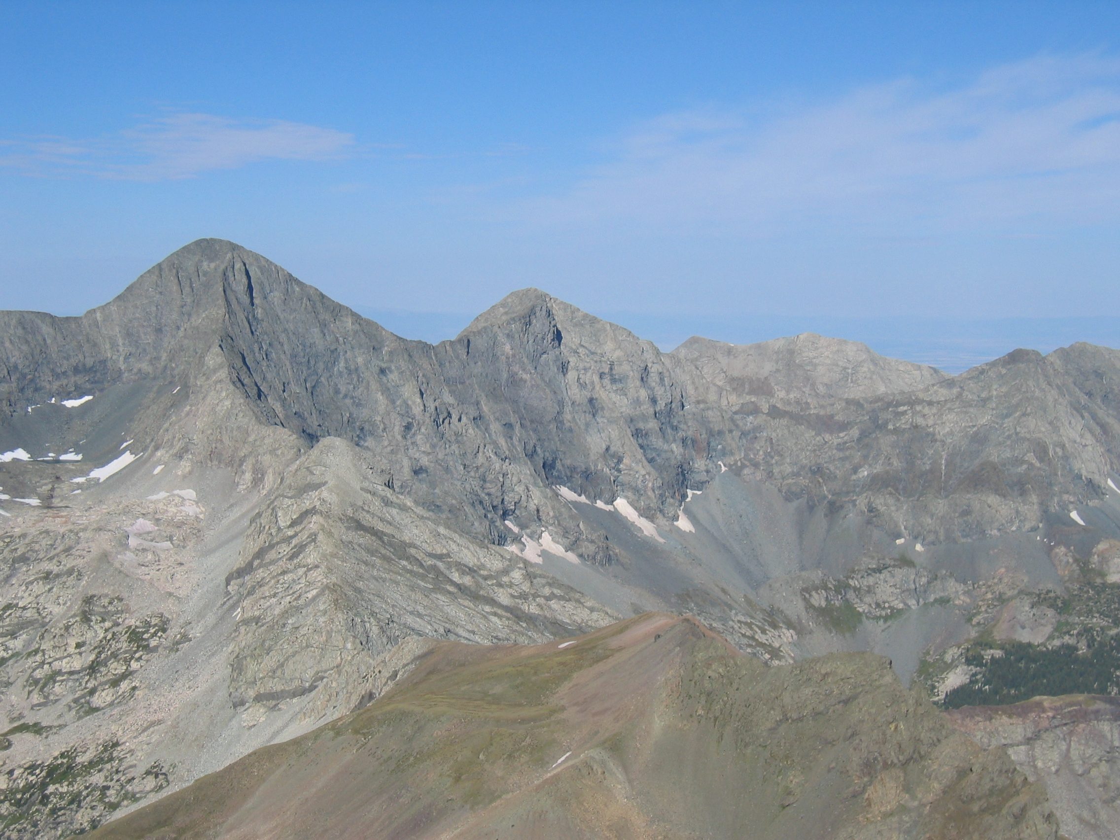
Uncompahgre Peak is the highest peak of the San Juan Mountains and the sixth highest peak of the Rocky Mountains.
-

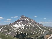
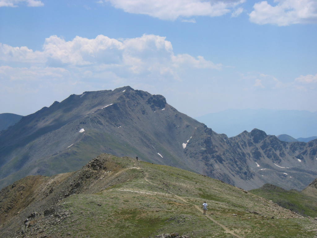
Crestone Peak is the highest peak of the Crestones and the seventh highest peak of the Rocky Mountains.
-
Mount Lincoln is the highest peak of the Mosquito Range and the eighth highest peak of the Rocky Mountains.
-
Castle Peak is the highest peak of the Elk Mountains and the ninth highest peak of the Rocky Mountains.
-
Grays Peak is the highest peak of the Front Range and the tenth highest peak of the Rocky Mountains.
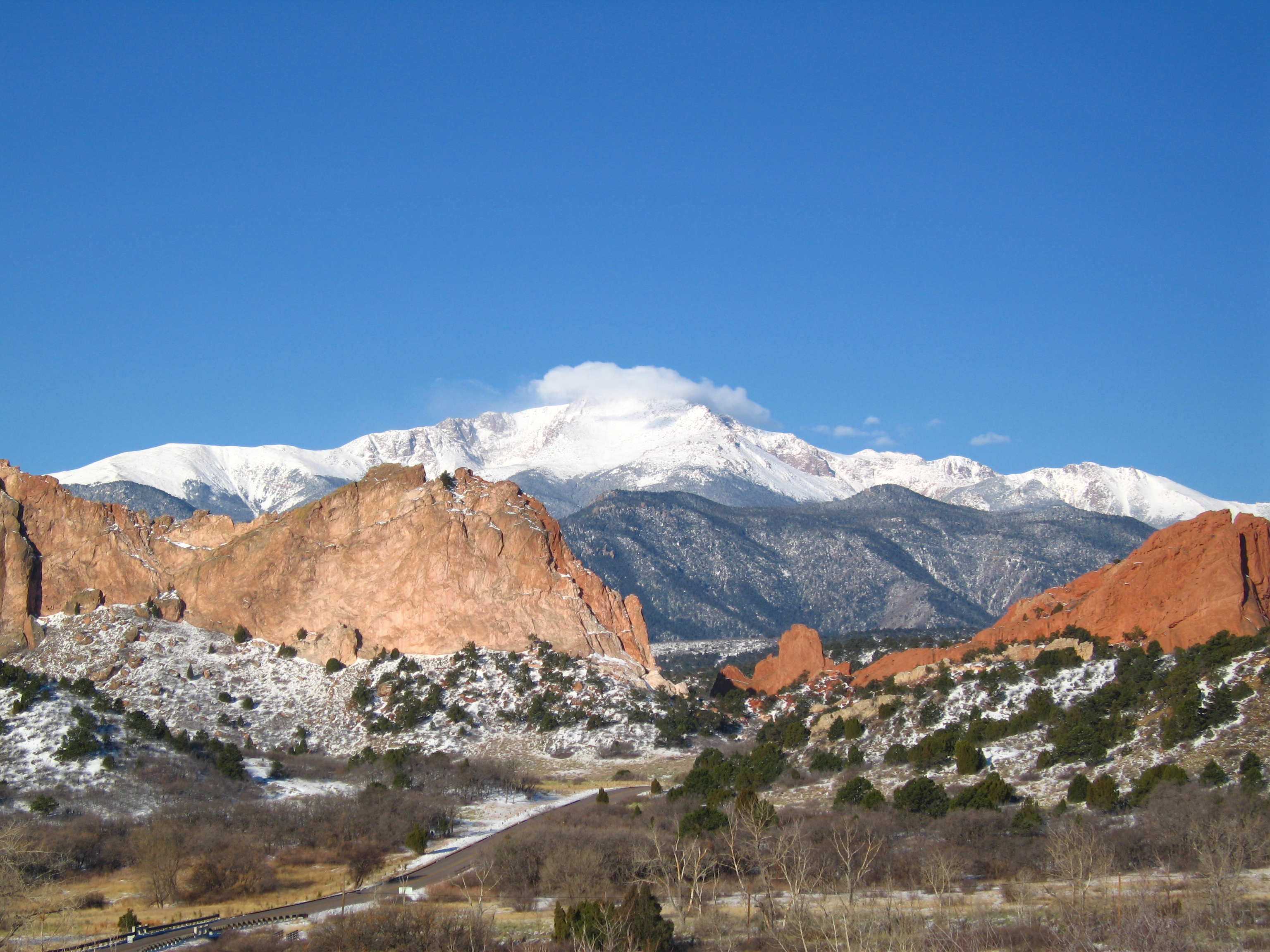
-
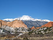
Pikes Peak is the second most topographically prominent mountain peak of Colorado.
-
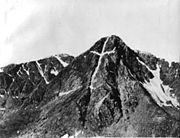
This photograph of the legendary Mount of the Holy Cross was taken by William Henry Jackson in 1874.
See also
- Outline of Colorado
- Index of Colorado-related articles
- Lists of mountains
- List of mountains of the United States
- List of mountains of Colorado
- List of mountains of the United States
- Mountain peaks of North America
- Mountain peaks of Greenland
- Mountain peaks of Canada
- Mountain peaks of the Rocky Mountains
- Mountain peaks of the United States
- Mountain peaks of Alaska
- Mountain peaks of California
- Mountain peaks of Colorado
- The 100 highest major summits of Colorado
- Mountain peaks of México
- Mountain peaks of Central America
- Mountain peaks of the Caribbean
- Physical geography
- Topography
- Topographic elevation
- Topographic isolation
- Topographic prominence
- Topographic summit
- Topography
- Rocky Mountains
- State of Colorado
- Geography of Colorado
- Mountain ranges of Colorado
- Mountain passes of Colorado
- Category:Mountains of Colorado
- Geography of Colorado
References
- ^ a b c The summit of Mount Elbert is the highest point of the Rocky Mountains and the state of Colorado.
- ^ a b c "Mount Elbert". NGS Station Datasheet. United States National Geodetic Survey. http://www.ngs.noaa.gov/cgi-bin/ds_mark.prl?PidBox=KL0637. Retrieved January 17, 2010.
- ^ a b c "Mount Elbert". Summits of the World. peakbagger.com. http://www.peakbagger.com/peak.aspx?pid=5736. Retrieved January 17, 2010.
- ^ a b c The summit elevation of Mount Elbert includes a vertical adjustment of +1.995 m (+6.5 ft).
- ^ "Mount Massive". NGS Station Datasheet. United States National Geodetic Survey. http://www.ngs.noaa.gov/cgi-bin/ds_mark.prl?PidBox=KL0640. Retrieved January 17, 2010.
- ^ "Mount Massive". Summits of the World. peakbagger.com. http://www.peakbagger.com/peak.aspx?pid=5729. Retrieved January 17, 2010.
- ^ The summit elevation of Mount Massive includes a vertical adjustment of +2.087 m (+6.8 ft).
- ^ "Mount Harvard". NGS Station Datasheet. United States National Geodetic Survey. http://www.ngs.noaa.gov/cgi-bin/ds_mark.prl?PidBox=JL0879. Retrieved January 17, 2010.
- ^ "Mount Harvard". Summits of the World. peakbagger.com. http://www.peakbagger.com/peak.aspx?pid=5754. Retrieved January 17, 2010.
- ^ The summit elevation of Mount Harvard includes a vertical adjustment of +2.084 m (+6.8 ft).
- ^ The summit elevation of Mount Harvard includes a vertical offset of +1.8 m (+5.9 ft) from the benchmark.
- ^ "La Plata Peak". Summits of the World. peakbagger.com. http://www.peakbagger.com/peak.aspx?pid=5744. Retrieved January 28, 2010.
- ^ The summit elevation of La Plata Peak includes a vertical adjustment of +1.983 m (+6.5 ft).
- ^ a b c "Blanca Peak". NGS Station Datasheet. United States National Geodetic Survey. http://www.ngs.noaa.gov/cgi-bin/ds_mark.prl?PidBox=HK0514. Retrieved January 2, 2010.
- ^ a b c "Blanca Peak". Summits of the World. peakbagger.com. http://www.peakbagger.com/peak.aspx?pid=5921. Retrieved January 2, 2010.
- ^ a b c The summit elevation of Blanca Peak includes a vertical adjustment of +1.755 m (+5.8 ft).
- ^ a b c "Uncompahgre Peak". NGS Station Datasheet. United States National Geodetic Survey. http://www.ngs.noaa.gov/cgi-bin/ds_mark.prl?PidBox=JL0798. Retrieved January 17, 2010.
- ^ a b c "Uncompahgre Peak". Summits of the World. peakbagger.com. http://www.peakbagger.com/peak.aspx?pid=5836. Retrieved January 17, 2010.
- ^ a b c The summit elevation of Uncompahgre Peak includes a vertical adjustment of +1.967 m (+6.5 ft).
- ^ a b c "Crestone Peak". Summits of the World. peakbagger.com. http://www.peakbagger.com/peak.aspx?pid=5908. Retrieved January 2, 2010.
- ^ a b c The summit elevation of Crestone Peak includes a vertical adjustment of +1.76 m (+5.8 ft).
- ^ a b c "Mount Lincoln". NGS Station Datasheet. United States National Geodetic Survey. http://www.ngs.noaa.gov/cgi-bin/ds_mark.prl?PidBox=KL0627. Retrieved January 17, 2010.
- ^ a b c "Mount Lincoln". Summits of the World. peakbagger.com. http://www.peakbagger.com/peak.aspx?pid=5793. Retrieved January 17, 2010.
- ^ a b c The summit elevation of Mount Lincoln includes a vertical adjustment of +2.098 m (+6.9 ft).
- ^ a b c "Castle Peak". NGS Station Datasheet. United States National Geodetic Survey. http://www.ngs.noaa.gov/cgi-bin/ds_mark.prl?PidBox=KL0659. Retrieved January 17, 2010.
- ^ a b c "Castle Peak". Summits of the World. peakbagger.com. http://www.peakbagger.com/peak.aspx?pid=5709. Retrieved January 17, 2010.
- ^ a b c The summit elevation of Castle Peak includes a vertical adjustment of +2.165 m (+7.1 ft).
- ^ a b c The summit of Grays Peak is the highest point on the Continental Divide of North America.
- ^ a b c "Grays Peak". NGS Station Datasheet. United States National Geodetic Survey. http://www.ngs.noaa.gov/cgi-bin/ds_mark.prl?PidBox=KK2036. Retrieved January 17, 2010.
- ^ a b c "Grays Peak". Summits of the World. peakbagger.com. http://www.peakbagger.com/peak.aspx?pid=5664. Retrieved January 17, 2010.
- ^ a b c The summit elevation of Grays Peak includes a vertical adjustment of +1.881 m (+6.2 ft).
- ^ a b c "Mount Antero". NGS Station Datasheet. United States National Geodetic Survey. http://www.ngs.noaa.gov/cgi-bin/ds_mark.prl?PidBox=JL0883. Retrieved January 17, 2010.
- ^ a b c "Mount Antero". Summits of the World. peakbagger.com. http://www.peakbagger.com/peak.aspx?pid=5759. Retrieved January 17, 2010.
- ^ a b c The summit elevation of Mount Antero includes a vertical adjustment of +2.071 m (+6.8 ft).
- ^ a b "Mount Evans". NGS Station Datasheet. United States National Geodetic Survey. http://www.ngs.noaa.gov/cgi-bin/ds_mark.prl?PidBox=KK2030. Retrieved January 17, 2010.
- ^ a b "Mount Evans". Summits of the World. peakbagger.com. http://www.peakbagger.com/peak.aspx?pid=5676. Retrieved January 17, 2010.
- ^ a b The summit elevation of Mount Evans includes a vertical adjustment of +1.827 m (+6.0 ft).
- ^ a b c "Longs Peak". NGS Station Datasheet. United States National Geodetic Survey. http://www.ngs.noaa.gov/cgi-bin/ds_mark.prl?PidBox=LL1346. Retrieved January 17, 2010.
- ^ a b c "Longs Peak". Summits of the World. peakbagger.com. http://www.peakbagger.com/peak.aspx?pid=5642. Retrieved January 17, 2010.
- ^ a b c The summit elevation of Longs Peak includes a vertical adjustment of +1.652 m (+5.4 ft).
- ^ a b c "Mount Wilson". Summits of the World. peakbagger.com. http://www.peakbagger.com/peak.aspx?pid=5820. Retrieved January 2, 2010.
- ^ a b c The summit elevation of Mount Wilson includes a vertical adjustment of +1.899 m (+6.2 ft).
- ^ "Mount Princeton". NGS Station Datasheet. United States National Geodetic Survey. http://www.ngs.noaa.gov/cgi-bin/ds_mark.prl?PidBox=JL0886. Retrieved January 17, 2010.
- ^ "Mount Princeton". Summits of the World. peakbagger.com. http://www.peakbagger.com/peak.aspx?pid=5757. Retrieved January 17, 2010.
- ^ The summit elevation of Mount Princeton includes a vertical adjustment of +2.075 m (+6.8 ft).
- ^ "Mount Yale". NGS Station Datasheet. United States National Geodetic Survey. http://www.ngs.noaa.gov/cgi-bin/ds_mark.prl?PidBox=JL0889. Retrieved January 17, 2010.
- ^ "Mount Yale". Summits of the World. peakbagger.com. http://www.peakbagger.com/peak.aspx?pid=5756. Retrieved January 17, 2010.
- ^ The summit elevation of Mount Yale includes a vertical adjustment of +2.036 m (+6.7 ft).
- ^ The summit elevation of Mount Yale includes a vertical offset of +0.6 m (+2.0 ft) from the benchmark.
- ^ "Maroon Peak". NGS Station Datasheet. United States National Geodetic Survey. http://www.ngs.noaa.gov/cgi-bin/ds_mark.prl?PidBox=KL0805. Retrieved January 17, 2010.
- ^ "Maroon Peak". Summits of the World. peakbagger.com. http://www.peakbagger.com/peak.aspx?pid=5701. Retrieved January 17, 2010.
- ^ The summit elevation of Maroon Peak includes a vertical adjustment of +2.048 m (+6.7 ft).
- ^ a b "Mount Sneffels". NGS Station Datasheet. United States National Geodetic Survey. http://www.ngs.noaa.gov/cgi-bin/ds_mark.prl?PidBox=JL0826. Retrieved January 17, 2010.
- ^ a b "Mount Sneffels". Summits of the World. peakbagger.com. http://www.peakbagger.com/peak.aspx?pid=5830. Retrieved January 17, 2010.
- ^ a b The summit elevation of Mount Sneffels includes a vertical adjustment of +1.879 m (+6.2 ft).
- ^ "Capitol Peak". NGS Station Datasheet. United States National Geodetic Survey. http://www.ngs.noaa.gov/cgi-bin/ds_mark.prl?PidBox=KL0688. Retrieved January 17, 2010.
- ^ "Capitol Peak". Summits of the World. peakbagger.com. http://www.peakbagger.com/peak.aspx?pid=5695. Retrieved January 17, 2010.
- ^ The summit elevation of Capitol Peak includes a vertical adjustment of +1.991 m (+6.5 ft).
- ^ a b c "Pikes Peak". NGS Station Datasheet. United States National Geodetic Survey. http://www.ngs.noaa.gov/cgi-bin/ds_mark.prl?PidBox=JK1242. Retrieved January 17, 2010.
- ^ a b c "Pikes Peak". Summits of the World. peakbagger.com. http://www.peakbagger.com/peak.aspx?pid=5689. Retrieved January 17, 2010.
- ^ a b c The summit elevation of Pikes Peak includes a vertical adjustment of +1.678 m (+5.5 ft).
- ^ "Mount Eolus". Summits of the World. peakbagger.com. http://www.peakbagger.com/peak.aspx?pid=5860. Retrieved January 28, 2010.
- ^ The summit elevation of Mount Eolus includes a vertical adjustment of +1.756 m (+5.8 ft).
- ^ "Handies Peak". NGS Station Datasheet. United States National Geodetic Survey. http://www.ngs.noaa.gov/cgi-bin/ds_mark.prl?PidBox=HL0635. Retrieved January 17, 2010.
- ^ "Handies Peak". Summits of the World. peakbagger.com. http://www.peakbagger.com/peak.aspx?pid=5840. Retrieved January 17, 2010.
- ^ The summit elevation of Handies Peak includes a vertical adjustment of +1.994 m (+6.5 ft).
- ^ a b c "Culebra Peak". Summits of the World. peakbagger.com. http://www.peakbagger.com/peak.aspx?pid=5924. Retrieved January 2, 2010.
- ^ a b c The summit elevation of Culebra Peak includes a vertical adjustment of +1.74 m (+5.7 ft).
- ^ a b c "San Luis Peak". NGS Station Datasheet. United States National Geodetic Survey. http://www.ngs.noaa.gov/cgi-bin/ds_mark.prl?PidBox=HL0570. Retrieved January 17, 2010.
- ^ a b c "San Luis Peak". Summits of the World. peakbagger.com. http://www.peakbagger.com/peak.aspx?pid=5874. Retrieved January 17, 2010.
- ^ a b c The summit elevation of San Luis Peak includes a vertical adjustment of +2.098 m (+6.9 ft).
- ^ a b "Mount of the Holy Cross". NGS Station Datasheet. United States National Geodetic Survey. http://www.ngs.noaa.gov/cgi-bin/ds_mark.prl?PidBox=KL0649. Retrieved January 17, 2010.
- ^ a b "Mount of the Holy Cross". Summits of the World. peakbagger.com. http://www.peakbagger.com/peak.aspx?pid=5725. Retrieved January 17, 2010.
- ^ a b The summit elevation of Mount of the Holy Cross includes a vertical adjustment of +1.926 m (+6.3 ft).
- ^ "Grizzly Peak". NGS Station Datasheet. United States National Geodetic Survey. http://www.ngs.noaa.gov/cgi-bin/ds_mark.prl?PidBox=KL0800. Retrieved January 17, 2010.
- ^ "Grizzly Peak". Summits of the World. peakbagger.com. http://www.peakbagger.com/peak.aspx?pid=5741. Retrieved January 17, 2010.
- ^ The summit elevation of Grizzly Peak includes a vertical adjustment of +2.035 m (+6.7 ft).
- ^ a b "Mount Ouray". NGS Station Datasheet. United States National Geodetic Survey. http://www.ngs.noaa.gov/cgi-bin/ds_mark.prl?PidBox=JL0672. Retrieved January 17, 2010.
- ^ a b "Mount Ouray". Summits of the World. peakbagger.com. http://www.peakbagger.com/peak.aspx?pid=5764. Retrieved January 17, 2010.
- ^ a b The summit elevation of Mount Ouray includes a vertical adjustment of +1.871 m (+6.1 ft).
- ^ "Vermilion Peak". Summits of the World. peakbagger.com. http://www.peakbagger.com/peak.aspx?pid=5828. Retrieved January 28, 2010.
- ^ The summit elevation of Vermilion Peak includes a vertical adjustment of +1.827 m (+6.0 ft).
- ^ "Mount Silverheels". NGS Station Datasheet. United States National Geodetic Survey. http://www.ngs.noaa.gov/cgi-bin/ds_mark.prl?PidBox=KL0629. Retrieved January 17, 2010.
- ^ "Mount Silverheels". Summits of the World. peakbagger.com. http://www.peakbagger.com/peak.aspx?pid=5681. Retrieved January 17, 2010.
- ^ The summit elevation of Mount Silverheels includes a vertical adjustment of +1.982 m (+6.5 ft).
- ^ "Rio Grande Pyramid". NGS Station Datasheet. United States National Geodetic Survey. http://www.ngs.noaa.gov/cgi-bin/ds_mark.prl?PidBox=HL0589. Retrieved January 17, 2010.
- ^ "Rio Grande Pyramid". Summits of the World. peakbagger.com. http://www.peakbagger.com/peak.aspx?pid=5869. Retrieved January 17, 2010.
- ^ The summit elevation of Rio Grande Pyramid includes a vertical adjustment of +1.801 m (+5.9 ft).
- ^ "Bald Mountain". Summits of the World. peakbagger.com. http://www.peakbagger.com/peak.aspx?pid=16675. Retrieved January 28, 2010.
- ^ The summit elevation of Bald Mountain includes a vertical adjustment of +1.922 m (+6.3 ft).
- ^ "Mount Oso". Summits of the World. peakbagger.com. http://www.peakbagger.com/peak.aspx?pid=7854. Retrieved September 20, 2010.
- ^ The summit elevation of Mount Oso includes a vertical adjustment of +1.776 m (+5.8 ft).
- ^ "Mount Jackson". NGS Station Datasheet. United States National Geodetic Survey. http://www.ngs.noaa.gov/cgi-bin/ds_mark.prl?PidBox=KL0650. Retrieved January 17, 2010.
- ^ "Mount Jackson". Summits of the World. peakbagger.com. http://www.peakbagger.com/peak.aspx?pid=16632. Retrieved January 17, 2010.
- ^ The summit elevation of Mount Jackson includes a vertical adjustment of +1.922 m (+6.3 ft).
- ^ "Bard Peak". Summits of the World. peakbagger.com. http://www.peakbagger.com/peak.aspx?pid=16639. Retrieved January 28, 2010.
- ^ The summit elevation of Bard Peak includes a vertical adjustment of +1.707 m (+5.6 ft).
- ^ a b c The summit of West Spanish Peak is the easternmost 4000 m (13,123-foot) summit of the United States.
- ^ a b c "West Spanish Peak". Summits of the World. peakbagger.com. http://www.peakbagger.com/peak.aspx?pid=5928. Retrieved January 28, 2010.
- ^ a b c The summit elevation of West Spanish Peak includes a vertical adjustment of +1.468 m (+4.8 ft).
- ^ a b c "Mount Powell". Summits of the World. peakbagger.com. http://www.peakbagger.com/peak.aspx?pid=5774. Retrieved January 28, 2010.
- ^ a b c The summit elevation of Mount Powell includes a vertical adjustment of +1.771 m (+5.8 ft).
- ^ a b c "Hagues Peak". NGS Station Datasheet. United States National Geodetic Survey. http://www.ngs.noaa.gov/cgi-bin/ds_mark.prl?PidBox=LL1350. Retrieved January 17, 2010.
- ^ a b c "Hagues Peak". Summits of the World. peakbagger.com. http://www.peakbagger.com/peak.aspx?pid=5590. Retrieved January 17, 2010.
- ^ a b c The summit elevation of Hagues Peak includes a vertical adjustment of +1.719 m (+5.6 ft).
- ^ "Tower Mountain". Summits of the World. peakbagger.com. http://www.peakbagger.com/peak.aspx?pid=16643. Retrieved January 28, 2010.
- ^ The summit elevation of Tower Mountain includes a vertical adjustment of +1.796 m (+5.9 ft).
- ^ a b "Treasure Mountain". Summits of the World. peakbagger.com. http://www.peakbagger.com/peak.aspx?pid=5707. Retrieved January 28, 2010.
- ^ a b The summit elevation of Treasure Mountain includes a vertical adjustment of +2.008 m (+6.6 ft).
- ^ "North Arapaho Peak". NGS Station Datasheet. United States National Geodetic Survey. http://www.ngs.noaa.gov/cgi-bin/ds_mark.prl?PidBox=LL1357. Retrieved January 17, 2010.
- ^ "North Arapaho Peak". Summits of the World. peakbagger.com. http://www.peakbagger.com/peak.aspx?pid=5646. Retrieved January 17, 2010.
- ^ The summit elevation of North Arapaho Peak includes a vertical adjustment of +1.763 m (+5.8 ft).
- ^ "Parry Peak". Summits of the World. peakbagger.com. http://www.peakbagger.com/peak.aspx?pid=16682. Retrieved January 28, 2010.
- ^ The summit elevation of Parry Peak includes a vertical adjustment of +1.763 m (+5.8 ft).
- ^ "Williams Mountains High Point". Summits of the World. peakbagger.com. http://www.peakbagger.com/peak.aspx?pid=16642. Retrieved January 3, 2010.
- ^ The summit elevation of Williams Mountains High Point includes a vertical adjustment of +2.044 m (+6.7 ft).
- ^ "Sultan Mountain". Summits of the World. peakbagger.com. http://www.peakbagger.com/peak.aspx?pid=16630. Retrieved January 28, 2010.
- ^ The summit elevation of Sultan Mountain includes a vertical adjustment of +1.649 m (+5.4 ft).
- ^ "Mount Herard". Summits of the World. peakbagger.com. http://www.peakbagger.com/peak.aspx?pid=5911. Retrieved January 28, 2010.
- ^ The summit elevation of Mount Herard includes a vertical adjustment of +1.64 m (+5.4 ft).
- ^ "West Buffalo Peak". NGS Station Datasheet. United States National Geodetic Survey. http://www.ngs.noaa.gov/cgi-bin/ds_mark.prl?PidBox=JL0653. Retrieved January 28, 2010.
- ^ "West Buffalo Peak". Summits of the World. peakbagger.com. http://www.peakbagger.com/peak.aspx?pid=5808. Retrieved January 28, 2010.
- ^ The summit elevation of West Buffalo Peak includes a vertical adjustment of +1.834 m (+6.0 ft).
- ^ a b c "Summit Peak". NGS Station Datasheet. United States National Geodetic Survey. http://www.ngs.noaa.gov/cgi-bin/ds_mark.prl?PidBox=HL0503. Retrieved January 17, 2010.
- ^ a b c "Summit Peak". Summits of the World. peakbagger.com. http://www.peakbagger.com/peak.aspx?pid=5882. Retrieved January 17, 2010.
- ^ a b c The summit elevation of Summit Peak includes a vertical adjustment of +1.877 m (+6.2 ft).
- ^ "Dolores Peak". Summits of the World. peakbagger.com. http://www.peakbagger.com/peak.aspx?pid=5818. Retrieved January 2, 2010.
- ^ The summit elevation of Dolores Peak includes a vertical adjustment of +1.8 m (+5.9 ft).
- ^ a b "Antora Peak". NGS Station Datasheet. United States National Geodetic Survey. http://www.ngs.noaa.gov/cgi-bin/ds_mark.prl?PidBox=JL0670. Retrieved January 28, 2010.
- ^ a b "Antora Peak". Summits of the World. peakbagger.com. http://www.peakbagger.com/peak.aspx?pid=5766. Retrieved January 28, 2010.
- ^ a b The summit elevation of Antora Peak includes a vertical adjustment of +1.884 m (+6.2 ft).
- ^ "Henry Mountain". Summits of the World. peakbagger.com. http://www.peakbagger.com/peak.aspx?pid=5758. Retrieved January 28, 2010.
- ^ The summit elevation of Henry Mountain includes a vertical adjustment of +2.037 m (+6.7 ft).
- ^ a b c "Hesperus Mountain". Summits of the World. peakbagger.com. http://www.peakbagger.com/peak.aspx?pid=5849. Retrieved January 3, 2010.
- ^ a b c The summit elevation of Hesperus Mountain includes a vertical adjustment of +1.65 m (+5.4 ft).
- ^ "Jacque Peak". Summits of the World. peakbagger.com. http://www.peakbagger.com/peak.aspx?pid=5781. Retrieved January 28, 2010.
- ^ The summit elevation of Jacque Peak includes a vertical adjustment of +1.866 m (+6.1 ft).
- ^ a b "Bennett Peak". Summits of the World. peakbagger.com. http://www.peakbagger.com/peak.aspx?pid=5880. Retrieved January 28, 2010.
- ^ a b The summit elevation of Bennett Peak includes a vertical adjustment of +1.782 m (+5.8 ft).
- ^ "Conejos Peak". NGS Station Datasheet. United States National Geodetic Survey. http://www.ngs.noaa.gov/cgi-bin/ds_mark.prl?PidBox=HL0502. Retrieved January 17, 2010.
- ^ "Conejos Peak". Summits of the World. peakbagger.com. http://www.peakbagger.com/peak.aspx?pid=5883. Retrieved January 17, 2010.
- ^ The summit elevation of Conejos Peak includes a vertical adjustment of +1.792 m (+5.9 ft).
- ^ "Twilight Peak". Summits of the World. peakbagger.com. http://www.peakbagger.com/peak.aspx?pid=16612. Retrieved January 28, 2010.
- ^ The summit elevation of Twilight Peak includes a vertical adjustment of +1.537 m (+5.0 ft).
- ^ a b c "South River Peak". NGS Station Datasheet. United States National Geodetic Survey. http://www.ngs.noaa.gov/cgi-bin/ds_mark.prl?PidBox=HL0558. Retrieved January 28, 2010.
- ^ a b c "South River Peak". Summits of the World. peakbagger.com. http://www.peakbagger.com/peak.aspx?pid=16516. Retrieved January 28, 2010.
- ^ a b c The summit elevation of South River Peak includes a vertical adjustment of +1.879 m (+6.2 ft).
- ^ a b "Flat Top Mountain". NGS Station Datasheet. United States National Geodetic Survey. http://www.ngs.noaa.gov/cgi-bin/ds_mark.prl?PidBox=LM0694. Retrieved January 17, 2010.
- ^ a b "Flat Top Mountain". Summits of the World. peakbagger.com. http://www.peakbagger.com/peak.aspx?pid=5574. Retrieved January 17, 2010.
- ^ a b The summit elevation of Flat Top Mountain includes a vertical adjustment of +1.698 m (+5.6 ft).
- ^ a b "Ute Peak". NGS Station Datasheet. United States National Geodetic Survey. http://www.ngs.noaa.gov/cgi-bin/ds_mark.prl?PidBox=HM0511. Retrieved January 2, 2010.
- ^ a b "Ute Peak". Summits of the World. peakbagger.com. http://www.peakbagger.com/peak.aspx?pid=3983. Retrieved January 2, 2010.
- ^ a b The summit elevation of Ute Peak includes a vertical adjustment of +1.139 m (+3.7 ft).
- ^ a b "Greenhorn Mountain". NGS Station Datasheet. United States National Geodetic Survey. http://www.ngs.noaa.gov/cgi-bin/ds_mark.prl?PidBox=HK0512. Retrieved January 17, 2010.
- ^ a b "Greenhorn Mountain". Summits of the World. peakbagger.com. http://www.peakbagger.com/peak.aspx?pid=5915. Retrieved January 17, 2010.
- ^ a b The summit elevation of Greenhorn Mountain includes a vertical adjustment of +1.401 m (+4.6 ft).
- ^ "Mount Gunnison". NGS Station Datasheet. United States National Geodetic Survey. http://www.ngs.noaa.gov/cgi-bin/ds_mark.prl?PidBox=JL0762. Retrieved January 17, 2010.
- ^ "Mount Gunnison". Summits of the World. peakbagger.com. http://www.peakbagger.com/peak.aspx?pid=16508. Retrieved January 17, 2010.
- ^ The summit elevation of Mount Gunnison includes a vertical adjustment of +1.886 m (+6.2 ft).
- ^ a b "Mount Zirkel". Summits of the World. peakbagger.com. http://www.peakbagger.com/peak.aspx?pid=5547. Retrieved January 28, 2010.
- ^ a b The summit elevation of Mount Zirkel includes a vertical adjustment of +1.632 m (+5.4 ft).
- ^ a b "North Mamm Peak". NGS Station Datasheet. United States National Geodetic Survey. http://www.ngs.noaa.gov/cgi-bin/ds_mark.prl?PidBox=KL0716. Retrieved January 17, 2010.
- ^ a b "North Mamm Peak". Summits of the World. peakbagger.com. http://www.peakbagger.com/peak.aspx?pid=5690. Retrieved January 17, 2010.
- ^ a b The summit elevation of North Mamm Peak includes a vertical adjustment of +1.563 m (+5.1 ft).
- ^ "West Elk Peak". NGS Station Datasheet. United States National Geodetic Survey. http://www.ngs.noaa.gov/cgi-bin/ds_mark.prl?PidBox=JL0755. Retrieved January 17, 2010.
- ^ "West Elk Peak". Summits of the World. peakbagger.com. http://www.peakbagger.com/peak.aspx?pid=5717. Retrieved January 17, 2010.
- ^ The summit elevation of West Elk Peak includes a vertical adjustment of +2.105 m (+6.9 ft).
- ^ "Huntsman Mountain Northwest". Summits of the World. peakbagger.com. http://www.peakbagger.com/peak.aspx?pid=16509. Retrieved January 28, 2010.
- ^ The summit elevation of Huntsman Mountain Northwest includes a vertical adjustment of +1.711 m (+5.6 ft).
- ^ a b "Castle Peak". Summits of the World. peakbagger.com. http://www.peakbagger.com/peak.aspx?pid=16510. Retrieved January 28, 2010.
- ^ a b The summit elevation of Castle Peak includes a vertical adjustment of +1.575 m (+5.2 ft).
- ^ a b "Diamond Peak". Summits of the World. peakbagger.com. http://www.peakbagger.com/peak.aspx?pid=5419. Retrieved January 2, 2010.
- ^ a b The summit elevation of Diamond Peak includes a vertical adjustment of +1.436 m (+4.7 ft).
- ^ a b "Clark Peak". NGS Station Datasheet. United States National Geodetic Survey. http://www.ngs.noaa.gov/cgi-bin/ds_mark.prl?PidBox=LL1388. Retrieved January 17, 2010.
- ^ a b "Clark Peak". Summits of the World. peakbagger.com. http://www.peakbagger.com/peak.aspx?pid=5556. Retrieved January 17, 2010.
- ^ a b The summit elevation of Clark Peak includes a vertical adjustment of +1.628 m (+5.3 ft).
- ^ "Marcellina Mountain". Summits of the World. peakbagger.com. http://www.peakbagger.com/peak.aspx?pid=16511. Retrieved January 28, 2010.
- ^ The summit elevation of Marcellina Mountain includes a vertical adjustment of +1.658 m (+5.4 ft).
- ^ "Mount Richthofen". Summits of the World. peakbagger.com. http://www.peakbagger.com/peak.aspx?pid=5577. Retrieved January 28, 2010.
- ^ The summit elevation of Mount Richthofen includes a vertical adjustment of +1.658 m (+5.4 ft).
- ^ a b "Piñon Mesa High Point". Summits of the World. peakbagger.com. http://www.peakbagger.com/peak.aspx?pid=16512. Retrieved January 28, 2010.
- ^ a b The summit elevation of Piñon Mesa High Point includes a vertical adjustment of +1.408 m (+4.6 ft).
- ^ "Parkview Mountain". NGS Station Datasheet. United States National Geodetic Survey. http://www.ngs.noaa.gov/cgi-bin/ds_mark.prl?PidBox=LM0574. Retrieved January 17, 2010.
- ^ "Parkview Mountain". Summits of the World. peakbagger.com. http://www.peakbagger.com/peak.aspx?pid=5770. Retrieved January 17, 2010.
- ^ The summit elevation of Parkview Mountain includes a vertical adjustment of +1.589 m (+5.2 ft).
- ^ "Crested Butte". Summits of the World. peakbagger.com. http://www.peakbagger.com/peak.aspx?pid=5714. Retrieved January 28, 2010.
- ^ The summit elevation of Crested Butte includes a vertical adjustment of +1.94 m (+6.4 ft).
- ^ "Graham Peak". NGS Station Datasheet. United States National Geodetic Survey. http://www.ngs.noaa.gov/cgi-bin/ds_mark.prl?PidBox=HL0620. Retrieved January 17, 2010.
- ^ "Graham Peak". Summits of the World. peakbagger.com. http://www.peakbagger.com/peak.aspx?pid=16513. Retrieved January 17, 2010.
- ^ The summit elevation of Graham Peak includes a vertical adjustment of +1.625 m (+5.3 ft).
- ^ "East Beckwith Mountain". NGS Station Datasheet. United States National Geodetic Survey. http://www.ngs.noaa.gov/cgi-bin/ds_mark.prl?PidBox=JL0741. Retrieved January 17, 2010.
- ^ "East Beckwith Mountain". Summits of the World. peakbagger.com. http://www.peakbagger.com/peak.aspx?pid=16514. Retrieved January 17, 2010.
- ^ The summit elevation of East Beckwith Mountain includes a vertical adjustment of +1.924 m (+6.3 ft).
- ^ "Chair Mountain". NGS Station Datasheet. United States National Geodetic Survey. http://www.ngs.noaa.gov/cgi-bin/ds_mark.prl?PidBox=KL0696. Retrieved January 17, 2010.
- ^ "Chair Mountain". Summits of the World. peakbagger.com. http://www.peakbagger.com/peak.aspx?pid=5704. Retrieved January 17, 2010.
- ^ The summit elevation of Chair Mountain includes a vertical adjustment of +1.835 m (+6.0 ft).
- ^ "Whetstone Mountain". NGS Station Datasheet. United States National Geodetic Survey. http://www.ngs.noaa.gov/cgi-bin/ds_mark.prl?PidBox=JL0732. Retrieved January 17, 2010.
- ^ "Whetstone Mountain". Summits of the World. peakbagger.com. http://www.peakbagger.com/peak.aspx?pid=16515. Retrieved January 17, 2010.
- ^ The summit elevation of Whetstone Mountain includes a vertical adjustment of +1.922 m (+6.3 ft).
- ^ a b "Bison Peak". NGS Station Datasheet. United States National Geodetic Survey. http://www.ngs.noaa.gov/cgi-bin/ds_mark.prl?PidBox=KK1966. Retrieved January 17, 2010.
- ^ a b "Bison Peak". Summits of the World. peakbagger.com. http://www.peakbagger.com/peak.aspx?pid=5683. Retrieved January 17, 2010.
- ^ a b The summit elevation of Bison Peak includes a vertical adjustment of +1.623 m (+5.3 ft).
- ^ a b "Black Mountain". Summits of the World. peakbagger.com. http://www.peakbagger.com/peak.aspx?pid=5541. Retrieved January 28, 2010.
- ^ a b The summit elevation of Black Mountain includes a vertical adjustment of +1.537 m (+5.0 ft).
- ^ "Mount Guero". NGS Station Datasheet. United States National Geodetic Survey. http://www.ngs.noaa.gov/cgi-bin/ds_mark.prl?PidBox=JL0894. Retrieved January 17, 2010.
- ^ "Mount Guero". Summits of the World. peakbagger.com. http://www.peakbagger.com/peak.aspx?pid=16517. Retrieved January 17, 2010.
- ^ The summit elevation of Mount Guero includes a vertical adjustment of +1.815 m (+6.0 ft).
- ^ "Bushnell Peak". NGS Station Datasheet. United States National Geodetic Survey. http://www.ngs.noaa.gov/cgi-bin/ds_mark.prl?PidBox=JK1305. Retrieved January 28, 2010.
- ^ "Bushnell Peak". Summits of the World. peakbagger.com. http://www.peakbagger.com/peak.aspx?pid=5893. Retrieved January 28, 2010.
- ^ The summit elevation of Bushnell Peak includes a vertical adjustment of +1.737 m (+5.7 ft).
- ^ a b "Zenobia Peak". NGS Station Datasheet. United States National Geodetic Survey. http://www.ngs.noaa.gov/cgi-bin/ds_mark.prl?PidBox=LN0571. Retrieved January 3, 2010.
- ^ a b "Zenobia Peak". Summits of the World. peakbagger.com. http://www.peakbagger.com/peak.aspx?pid=16602. Retrieved January 3, 2010.
- ^ a b The summit elevation of Zenobia Peak includes a vertical adjustment of +1.409 m (+4.6 ft).
- ^ "East Spanish Peak". NGS Station Datasheet. United States National Geodetic Survey. http://www.ngs.noaa.gov/cgi-bin/ds_mark.prl?PidBox=HK0488. Retrieved January 17, 2010.
- ^ "East Spanish Peak". Summits of the World. peakbagger.com. http://www.peakbagger.com/peak.aspx?pid=16610. Retrieved January 17, 2010.
- ^ The summit elevation of East Spanish Peak includes a vertical adjustment of +1.372 m (+4.5 ft).
- ^ "Fishers Peak". NGS Station Datasheet. United States National Geodetic Survey. http://www.ngs.noaa.gov/cgi-bin/ds_mark.prl?PidBox=HK0441. Retrieved January 17, 2010.
- ^ "Fishers Peak". Summits of the World. peakbagger.com. http://www.peakbagger.com/peak.aspx?pid=6320. Retrieved January 17, 2010.
- ^ The summit elevation of Fishers Peak includes a vertical adjustment of +1.145 m (+3.8 ft).
- ^ "Waugh Mountain". Summits of the World. peakbagger.com. http://www.peakbagger.com/peak.aspx?pid=16613. Retrieved January 28, 2010.
- ^ The summit elevation of Waugh Mountain includes a vertical adjustment of +1.702 m (+5.6 ft).
- ^ "Meaden Peak". Summits of the World. peakbagger.com. http://www.peakbagger.com/peak.aspx?pid=16619. Retrieved January 28, 2010.
- ^ The summit elevation of Meaden Peak includes a vertical adjustment of +1.502 m (+4.9 ft).
- ^ "Crater Peak". NGS Station Datasheet. United States National Geodetic Survey. http://www.ngs.noaa.gov/cgi-bin/ds_mark.prl?PidBox=KL0706. Retrieved January 17, 2010.
- ^ "Crater Peak". Summits of the World. peakbagger.com. http://www.peakbagger.com/peak.aspx?pid=5693. Retrieved January 17, 2010.
- ^ The summit elevation of Crater Peak includes a vertical adjustment of +1.75 m (+5.7 ft).
- ^ "Sawtooth Mountain". NGS Station Datasheet. United States National Geodetic Survey. http://www.ngs.noaa.gov/cgi-bin/ds_mark.prl?PidBox=JL0697. Retrieved January 17, 2010.
- ^ "Sawtooth Mountain". Summits of the World. peakbagger.com. http://www.peakbagger.com/peak.aspx?pid=16627. Retrieved January 17, 2010.
- ^ The summit elevation of Sawtooth Mountain includes a vertical adjustment of +1.82 m (+6.0 ft).
- ^ "Blair Mountain". Summits of the World. peakbagger.com. http://www.peakbagger.com/peak.aspx?pid=16681. Retrieved January 28, 2010.
- ^ The summit elevation of Blair Mountain includes a vertical adjustment of +1.565 m (+5.1 ft).
- ^ "Mount Mestas". NGS Station Datasheet. United States National Geodetic Survey. http://www.ngs.noaa.gov/cgi-bin/ds_mark.prl?PidBox=HK0579. Retrieved January 28, 2010.
- ^ "Mount Mestas". Summits of the World. peakbagger.com. http://www.peakbagger.com/peak.aspx?pid=16617. Retrieved January 28, 2010.
- ^ The summit elevation of Mount Mestas includes a vertical adjustment of +1.372 m (+4.5 ft).
External links
Categories:- Geography of Colorado
- Lists of mountains of the United States
- Mountains of Colorado
- Rocky Mountains
- Lists of mountains by elevation
- Lists of mountains by prominence
- Lists of mountains by isolation
-


Wikimedia Foundation. 2010.