Summit (topography)

Summit (topography)
The summit of Mount Damavand, Iran, in winter
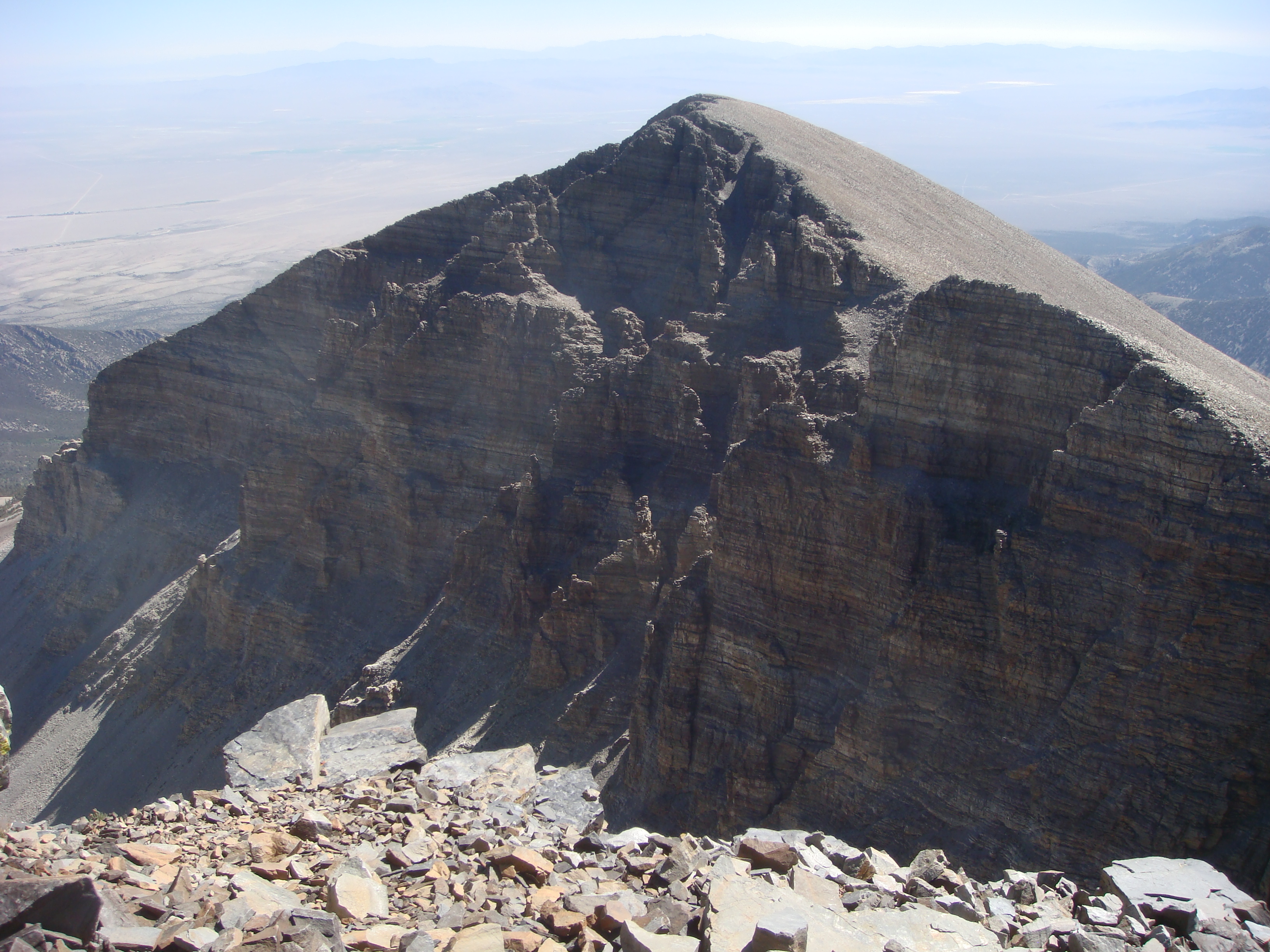
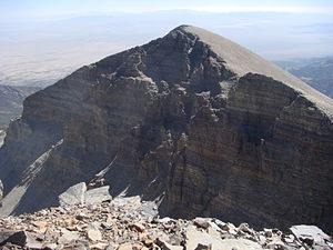
Jeff Davis Peak, one of the highest peaks entirely within Nevada
"Mountaintop" redirects here. This can also refer to the speech by Dr. Martin Luther King.

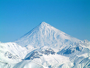
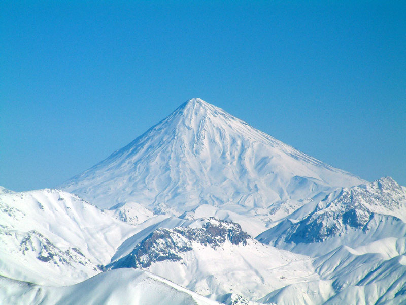
In topography, a summit is a point on a surface that is higher in elevation than all points immediately adjacent to it. Mathematically, a summit is a local maximum in elevation. The topographic terms "acme", "apex", "peak", and "zenith" are synonyms.

The term "summit" is generally only used for a mountain peak with some significant amount of topographic prominence (height above the lowest point en route to the nearest higher peak) or topographic isolation (distance from the nearest point of higher elevation); for example, a boulder next to the main summit of a mountain is not considered a summit. Summits near a higher peak, with some prominence or isolation, but not reaching a certain cutoff value for these quantities, are often considered subsummits (or subpeaks) of the higher peak, and are considered as part of the same mountain. The UIAA definition is that a summit is independent if it has a prominence of 30 metres (98 ft) or more; it is a mountain if it has a prominence of at least 300 metres (980 ft). This can be summarised as follows:

Term Prominence
Subpeak < 30 m
Independent peak or summit 30 m or more
Mountain 300 m or more

A pyramidal peak is an exaggerated form produced by ice erosion of a mountain top.

Summit may also refer to the highest point along a line, trail, or route. In many parts of the western United States, the term refers to the highest point along a road, highway, or railroad. For example, the highest point along Interstate 80 in California is referred to as Donner Summit (not to be confused with Donner Pass, which is located just to the south.)

See also


Wikimedia Foundation. 2010.

Игры ⚽ Поможем написать курсовую

Look at other dictionaries:

  • Summit — may refer to: * Summit (topography), the highest point of a hill or mountainLocationsUnited States: * Summit, Arizona * Summit, Arkansas * Summit, California * Summit, Illinois * Summit, DeKalb County, Indiana * Summit, Greene County, Indiana *… …   Wikipedia

  • Summit, New Jersey — Infobox Settlement official name = City of Summit native name = settlement type = City (New Jersey) nickname = Hill City motto = imagesize = 250px image caption = Downtown Summit from the southwest image image shield = mapsize = 250x200px map… …   Wikipedia

  • Topography of Romania — Romania s natural landscape is almost evenly divided among mountains (31 percent), hills (33 percent), and plains (36 percent). These varied relief forms spread rather symmetrically from the Carpathian Mountains, which reach elevations of more… …   Wikipedia

  • Nadir (topography) — For other uses, see Nadir (disambiguation). The Badwater Basin in Death Valley, California, the nadir of the North American Continent In topography, a nadir is a point on a surface that is lower in elevation than all points immediately adjacent… …   Wikipedia

  • Shuttle Radar Topography Mission — The Shuttle Radar Topography Mission (SRTM) is an international research effort that obtained digital elevation models on a near global scale from 56 °S to 60 °N, to generate the most complete high resolution digital topographic database of Earth …   Wikipedia

  • soil — soil1 soilless, adj. /soyl/, n. 1. the portion of the earth s surface consisting of disintegrated rock and humus. 2. a particular kind of earth: sandy soil. 3. the ground as producing vegetation or as cultivated for its crops: fertile soil. 4. a… …   Universalium

  • Topographic prominence — Prominence redirects here. For other uses, see Prominence (disambiguation). In topography, prominence, also known as autonomous height, relative height, shoulder drop (in North America), or prime factor (in Europe), categorizes the height of the… …   Wikipedia

  • List of mountains of the United States — This list of mountains of the United States includes significant mountain peaks and high points located in the United States of America arranged alphabetically by state, district, or territory.ignificant mountain peaks and high points Alabama… …   Wikipedia

  • Elevation — The elevation of a geographic location is its height above a fixed reference point, often the mean sea level. Elevation, or geometric height, is mainly used when referring to points on the Earth s surface, while altitude or geopotential height is …   Wikipedia

  • Topographic isolation — The topographic isolation of a summit is the minimum horizontal (great circle) distance to the nearest point of higher elevation. Topographic isolation represents a radius of dominance in which the summit is the highest point. Topographic… …   Wikipedia

Share the article and excerpts

Direct link
Do a right-click on the link above
and select “Copy Link”