- Donner Pass
-
Donner Pass 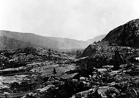
Donner Pass in the 1870s facing EastElevation 7,056 ft (2,151 m) Traversed by California Trail
Lincoln Highway
US 40 (until 1964)
Overland Route
I-80 (Indirectly, See below)Location Location Nevada County, California,  United States
Range Sierra Nevada Coordinates 39°18′57″N 120°19′17″W / 39.31583°N 120.32139°W Donner Pass (el. 7,056 ft (2,151 m))[1] is a mountain pass in the northern Sierra Nevada, located above Donner Lake about nine miles (14 km) west of Truckee, California. It has a steep approach from the east and a gradual approach from the west.
To reach California from the East, pioneer emigrants had to get their wagons over the Sierra. In 1844, the Stephens-Townsend-Murphy Party followed the Truckee River up into the mountains. At the head of what is now called Donner Lake, they found a low notch in the mountains and became the first overland emigrants to use the pass.[2]
The pass received its name, however, from another group of California-bound emigrants. In early November 1846, the Donner Party found the route blocked by snow and was forced to spend the winter on the eastern side of the mountains. Of the 81 emigrants, only 45 survived to reach California;[3] some of them are alleged to have resorted to cannibalism to survive.[4]
On January 13, 1952, another group became stranded about seventeen miles (27 km) west of Donner pass at Yuba Pass on Track #1 adjacent to Tunnel 35 (on Track #2) at about MP 176.5.[5] Southern Pacific Railroad's passenger train City of San Francisco was en route westbound through the gap when a raging blizzard slowed the train to a halt. The passengers and crew were stranded for three days until the nearby highway could be plowed enough for a caravan of automobiles to carry them the few miles to Nyack Lodge.[6]
The pass has been used by numerous transcontinental transportation arteries, including the California Trail, First Transcontinental Railroad, Overland Route, Lincoln Highway, U.S. Route 40 and indirectly by Interstate 80. The pass is a prominent feature along the California Zephyr passenger train.
Today the area is home to a thriving seasonal recreational community with several alpine lakes and ski resorts Donner Ski Ranch, Boreal and Sugar Bowl. The permanent communities in the area include Kingvale and Soda Springs, as well as the larger community below the pass surrounding Donner Lake.
Contents
Central Pacific Railroad & Donner Pass
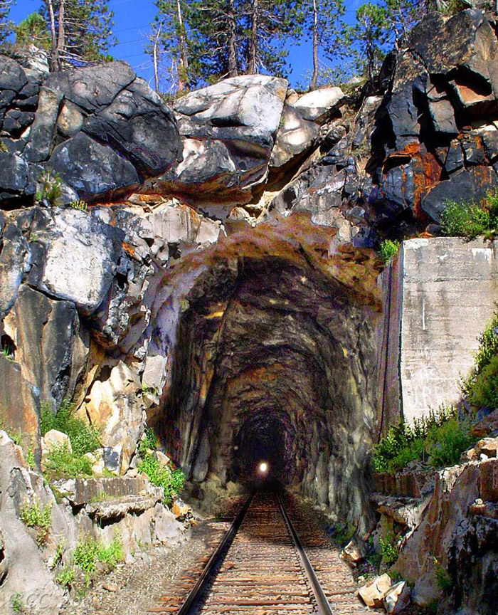
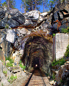 Summit Tunnel, West Portal (Composite image with the tracks removed in 1993 digitally restored)
In the spring of 1868, the Sierra Nevada were finally "conquered" by the Central Pacific Railroad after almost five years of sustained construction effort with the successful completion at Donner Pass of its 1,659-foot (506 m) Tunnel #6 (aka the Summit Tunnel) and associated grade thus permitting the establishment of commercial transportation en masse of passengers and freight over the Sierras for the first time. Following a route first surveyed and proposed by the CPRR's original Chief Engineer, Theodore D. Judah (1826–1863), the construction of the four tunnels, several miles of snowsheds, and two "Chinese Walls" necessary to breach Donner Summit constituted by far the most difficult engineering and construction challenge of the entire original Sacramento to Ogden CPRR route.
 CPRR Engineers L.M. Clement & T.D. Judah
Principally designed and built under the personal, often on-site direction of the CPRR's Chief Assistant Engineer, Lewis M. Clement (1837–1914), the original (Track 1) summit grade remained in daily use from June 18, 1868, when the first CPRR passenger train ran through the Summit Tunnel,[7] until 1993 when the Southern Pacific Railroad (which operated the CPRR-built Oakland-Ogden line until its 1996 merger with the Union Pacific Railroad) abandoned and pulled up the 6.7 mile (10.7 km) section of Track #1 over the summit running between the Norden complex (Shed 26, MP 192.1)[8] and the covered crossovers in Shed #47 (MP 198.8)[9] about a mile east of the old flyover at Eder.[10] Since then all East and Westbound traffic has been run over the Track #2 grade crossing the summit about one mile (1.6 km) south of Donner Pass through the 10,322-foot (3,146 m) long Tunnel #41 (aka "The Big Hole") running under Mt. Judah between Soda Springs and Eder. Then operator SPRR made this change because the railroad considered Track 2 and Tunnel 41 (which was opened in 1925 when the summit section of the grade was finally double tracked) to be far easier and less expensive to maintain and keep open in the harsh Sierra winters than the Track 1 tunnels and snow sheds over the summit.[11]
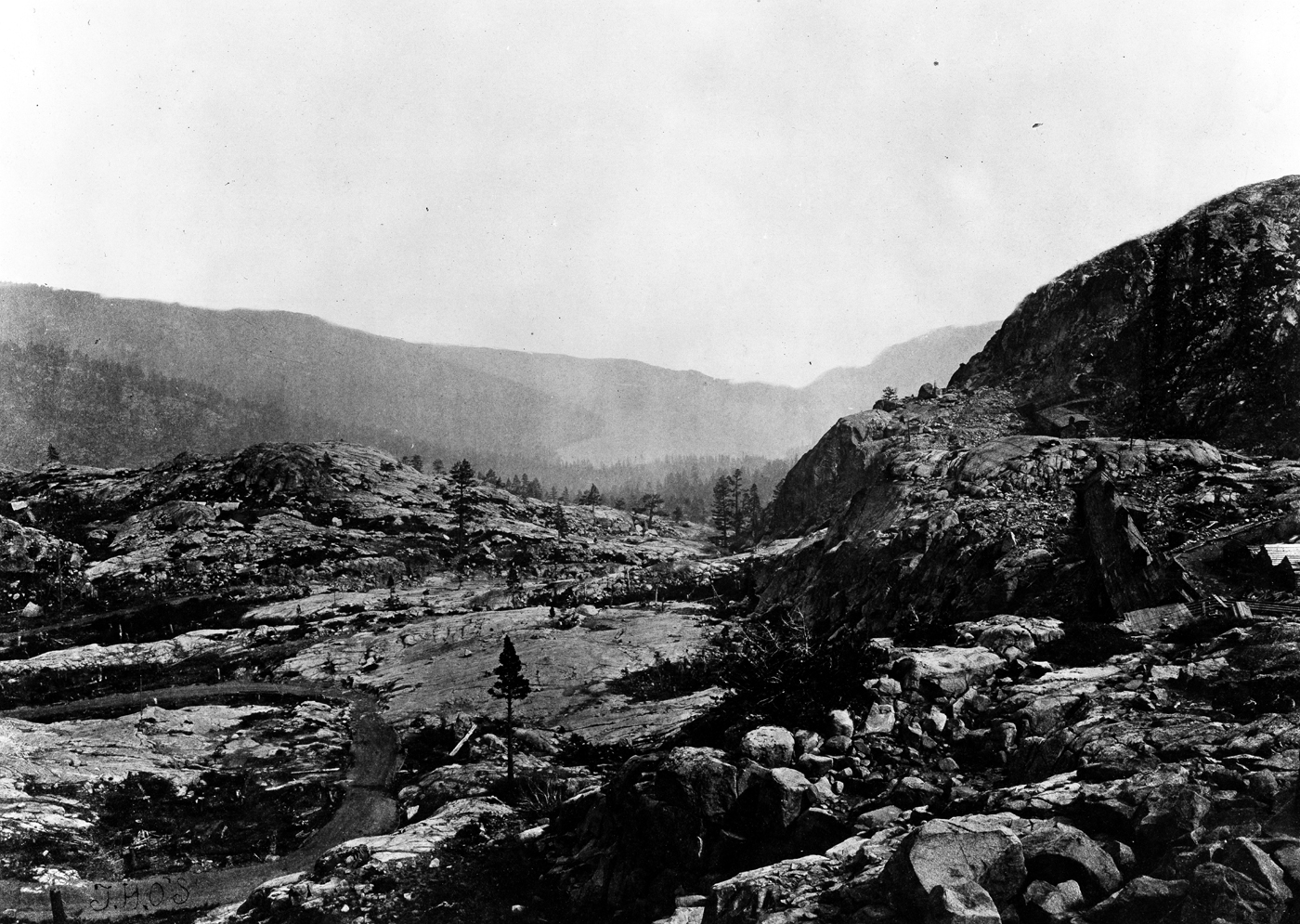
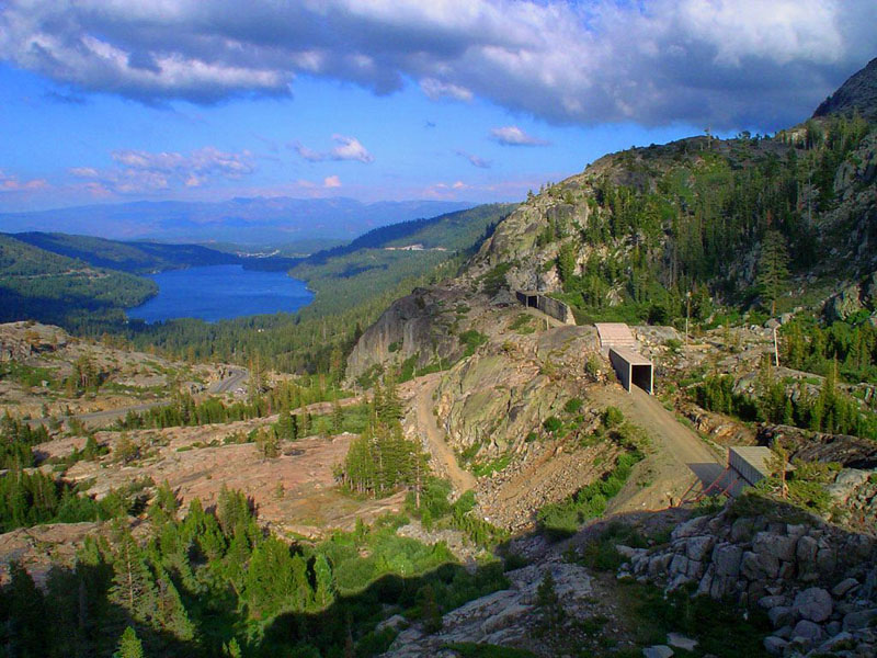
 Donner Lake (left) and the now abandoned original CPRR (later SPRR Track 1) grade over Donner Pass. The Lincoln Highway can be seen in the middle of the photo, climbing the pass, to the left of the railroad bed.
In conjunction with major ongoing upgrades and expansions being made to the Port of Oakland in order to better accommodate the rapidly growing North American trade with Asia and the Pacific, the cooperation of the UPRR, the Port's principal rail partner, has been sought to "construct a second track and raise tunnel clearances over Donner Pass for container trains linking California with the rest of the country."[12] This would likely require either a new parallel tunnel next to Tunnel 41 or the replacement of the summit section of Track 1 between the Norden complex and Shed 47; either would increase capacity and effectively eliminate delays currently caused by having to run all east and west bound traffic between Norden and Shed 47 over a single track. (To fully eliminate "bottleneck" delays the now single track 7.1-mile (11.4 km) section between Switch 9 (MP 171.9)[13] and Shed 10 (MP 179.0)[14] west of Cisco would likely also have to be restored to double track.) Improvements were completed on the Sierra grade in November, 2009, including increasing 18,000 lineal feet of tunnel clearances in 15 restricted tunnels between Rocklin and Truckee and upgrading 30 miles of signals to CTC, although the original Donner Pass grade (Track 1) was not restored. Since then trains of full-height (20 ft 2 inch) double-stack container cars have run over Donner Pass; some tunnels on Track 2 between Bowman and Colfax were not enlarged, so stack trains in both directions must use the older, tunnel-free Track 1 between those points.[15]
 Route of the original CPRR grade at Donner Pass.
Highways
The historic Lincoln Highway, the first road across America (later U.S. Route 40 and now named Donner Pass Road), crosses Donner Pass. Interstate 80 was constructed through this area in 1960. While I-80 generally parallels the old route of US 40 through the Sierra Nevada, I-80 crosses the Sierra crest at the Euer Saddle, approximately two miles north of Donner Pass. Euer Saddle is also commonly called "Donner Summit"; at 7,240 feet (2,210 m), it is about 150 feet (46 m) higher than Donner Pass, but it is much wider and has a gentler approach that aided construction to Interstate Highway standards, which do not allow the switchbacks used by the Donner Pass Road to approach its crest. The original concrete highway has been preserved as a scenic alternative to I-80.
 Approaching Donner Pass from the east on Lincoln Highway / old US 40, April 2007
Weather
Winter weather in Donner Pass can be brutal. Precipitation averages 54 inches (140 cm) per month, most of which falls as snow. At 415 inches (10.5 m) per year, Donner Pass is one of the snowiest places in the United States. To take advantage of the heavy snows, the Boreal Ski Resort was built to the north. Ski resorts in the Lake Tahoe area report an average of 300 to 500 inches (7.6 to 13 m) of snowfall per season.[16] Winds in the pass can also become extreme and wind gusts in excess of 100 miles per hour (160 km/h) are common during winter storms. Winter temperatures in the area drop below zero several times each year; the all-time record low for California of −45 °F (−43 °C) was recorded at the Boca Reservoir (east of Truckee) in January 1937.
In the winter of 2010-11 over 700 inches (1,800 cm) have fallen as of May 23, 2011. Snow depth peaked in early April of 2011 with over 250 inches (21 ft) of snow on the ground
The winter of 1846-47 was especially severe, and this is generally cited as the single most important factor in the disaster of the Donner Party.
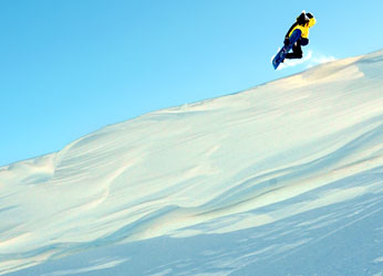
 Snowboarder at Sugar Bowl Ski Resort located near the top of Donner Pass
Recreation
Summer and winter offers a wide variety of recreation and lifestyle sports such as backpacking, alpine and cross-country skiing, rock and ice climbing. The region became world famous during the early 1990s from snowboard films by Fall Line Films (FFL) and Standard Films for its easy access to frontcountry and backcountry terrain. However, its fame and quick access from Old Highway 40 or nearby Sugar Bowl Resort has led to a large number of avalanche fatalities including professional snowboarder Jamil Khan.[17]
Popular culture
Albert Bierstadt painting "View of Donner Lake" (1871–72).[18]
The Donner Pass was featured in the History Channel special, America: The Story of Us in the Westward Episode.
Notes
- ^ Gannett, Henry. A Dictionary of Altitudes in the United States (3rd Edition), Bulletin of the U.S. Geological Survey, No. 160, Department of the Interior, Washington, D.C., 1899. p. 54
- ^ Stephens-Murphy-Townsend Party
- ^ Statistics
- ^ America The Story Of Us - "Westward" episode
- ^ East end of Tunnel 35 at 39.3268 N 120.5917 W
- ^ Central Pacific Railroad Museum
- ^ East end of original summit tunnel (#6) at 39.3159 N 120.3239 W
- ^ Norden at 39°19′03″N 120°21′30″W / 39.3176°N 120.3584°W
- ^ Shed 47 visible at 39°18′42″N 120°16′08″W / 39.3116°N 120.269°W
- ^ East end of Tunnel 41 at 39°18′04″N 120°18′01″W / 39.301°N 120.3003°W with former track 1 passing above
- ^ Cooper, Bruce C. (August, 2003). "Summit Tunnel & Donner Pass". CPRR.org. http://cprr.org/Museum/Sierra_Grade_8-2003/Donner_Pass-Summit_Tunnel/index.html.
- ^ "Newsroom". Port of Oakland. http://www.portofoakland.com/newsroom/pressrel/view.asp?id=26. Retrieved 2010-05-14.
- ^ Switch 9 is beneath Interstate 80 at 39°17′58″N 120°40′16″W / 39.2994°N 120.671°W
- ^ Shed 10 is visible at 39°18′47″N 120°33′40″W / 39.313°N 120.561°W
- ^ http://www.railwayage.com/breaking-news/doublestacks-on-donner-pass.html
- ^ Sierra Snowfall
- ^ "MountainZone.com | Mountain Zone News: Pro Snowboarder Jamil Khan Killed by Avalanche". Classic.mountainzone.com. 1998-02-13. http://classic.mountainzone.com/news/khan.html. Retrieved 2010-05-14.
- ^ Glenda Moore. "Albert Bierstadt Paintings". Xmission.com. http://www.xmission.com/~emailbox/glenda/bierstadt/bierstadt25.html. Retrieved 2010-05-14.
References
- Margie Powell, Donner Summit. A Brief History, Cottage Hill Publishing, Grass Valley, CA 2003, ISBN 0-9658240-4-7
External links
- Central Pacific Railroad Photographic History Museum
- Sierra Grade Exhibit - Donner Pass (Central Pacific Railroad Photographic History Museum)
- 360º QTVR Panorama #1 Above Tunnel #6 (Central Pacific Railroad Photographic History Museum)
- 360º QTVR Panorama #2 Above Tunnel #7 (Central Pacific Railroad Photographic History Museum)
- Southern Pacific's "City of San Francisco" Stranded - 1952 (Central Pacific Railroad Photographic History Museum)
Categories:- Rail mountain passes of the United States
- Mountain passes of California
- Southern Pacific Railroad
- Lincoln Highway
- Donner party
- Landforms of Nevada County, California
- Sierra Nevada (U.S.)
- Transportation in Nevada County, California


Wikimedia Foundation. 2010.