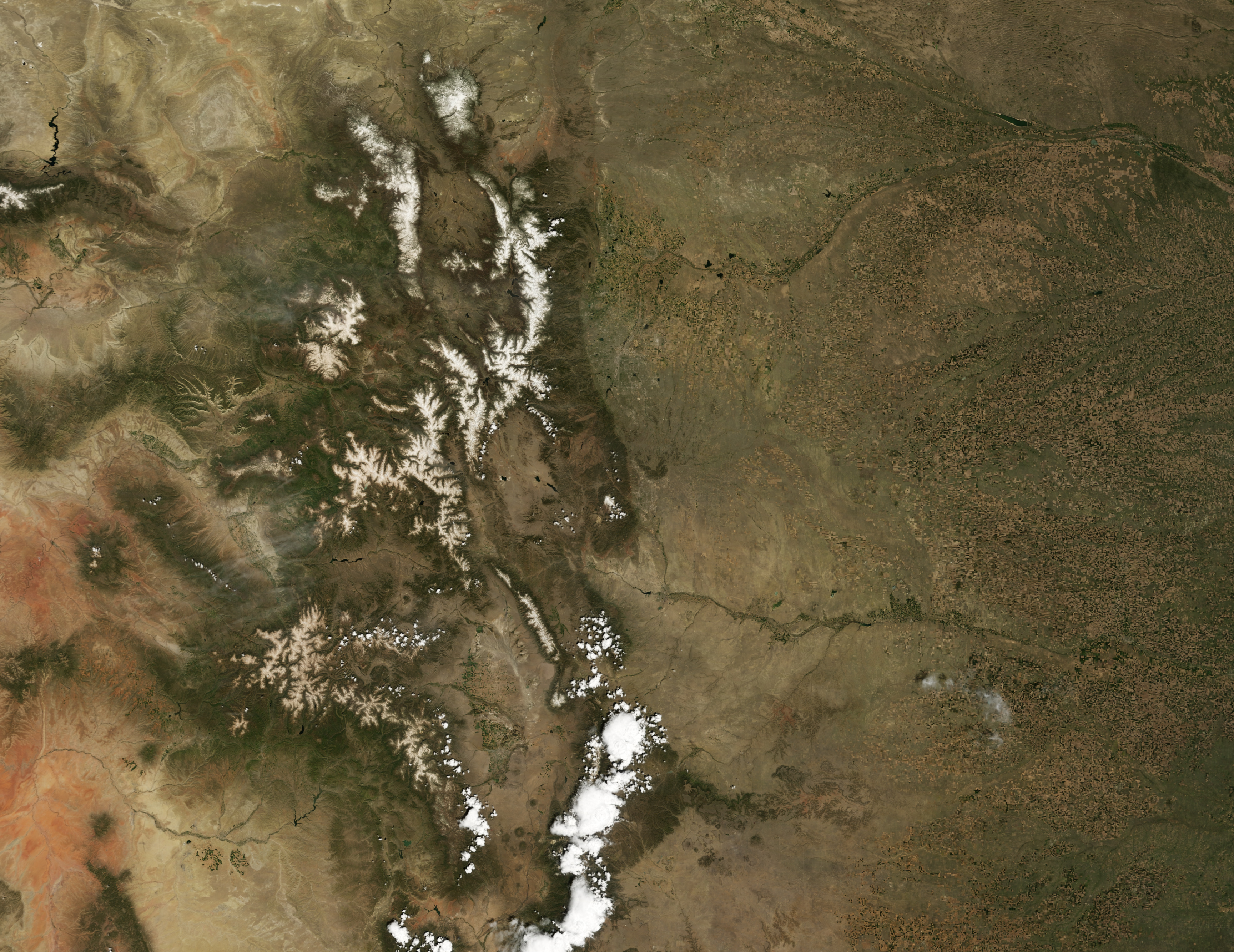
- San Juan Mountains
-
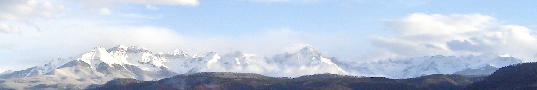
San Juan Mountains Range 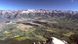 San Juan Mountains, looking northeast from Mt. Wilson
Country United States State Colorado Part of Rocky Mountains Highest point Uncompahgre Peak - elevation 14,309 ft (4,361 m) - coordinates 38°04′18″N 107°27′14″W / 38.07167°N 107.45389°W The San Juan Mountains are a high and rugged mountain range in the Rocky Mountains in southwestern Colorado. The area is highly mineralized (the Colorado Mineral Belt) and figured in the gold and silver mining industry of early Colorado. Major towns, all old mining camps, include Creede, Lake City, Silverton, Ouray, and Telluride. Large scale mining has ended in the region, although independent prospectors still work claims throughout the range. The last large scale mines were the Sunnyside Mine near Silverton, which operated until late in the 20th century and the Idarado Mine on Red Mountain Pass that closed down in the 1970s. Famous old San Juan mines include the Camp Bird and Smuggler Union mines, both located between Telluride and Ouray.
The Summitville mine was the scene of a major environmental disaster in the 1990s when the liner of a cyanide-laced tailing pond began leaking heavily. Summitville is in the Summitville caldera, one of many extinct volcanoes making up the San Juan volcanic field. One, La Garita Caldera, is 35 miles (56 km) in diameter. Large beds of lava, some extending under the floor of the San Luis Valley, are characteristic of the eastern slope of the San Juans.
Tourism is now a major part of the regional economy, with the narrow gauge railway between Durango and Silverton being an attraction in the summer. Jeeping is popular on the old trails which linked the historic mining camps, including the notorious Black Bear Road. Visiting old ghost towns is popular, as is wilderness trekking and mountain climbing. Many of the old mining camps are now popular sites of summer homes. The San Juans are extremely steep; only Telluride has made the transition to a major ski resort. Purgatory (now known as Durango Mountain Resort) is a small ski area north of Durango near the Tamarron Resort. There is also skiing on Wolf Creek Pass at the Wolf Creek ski area. Recently Silverton Mountain ski area has begun operation near Silverton.
The Rio Grande rises on the east side of the range. The other side of the San Juans, the western slope of the continental divide, is drained by tributaries of the San Miguel, Dolores and Gunnison rivers, which all flow into the Colorado River.
The San Juan and Uncompahgre National Forests cover a large portion of the San Juan Mountains.


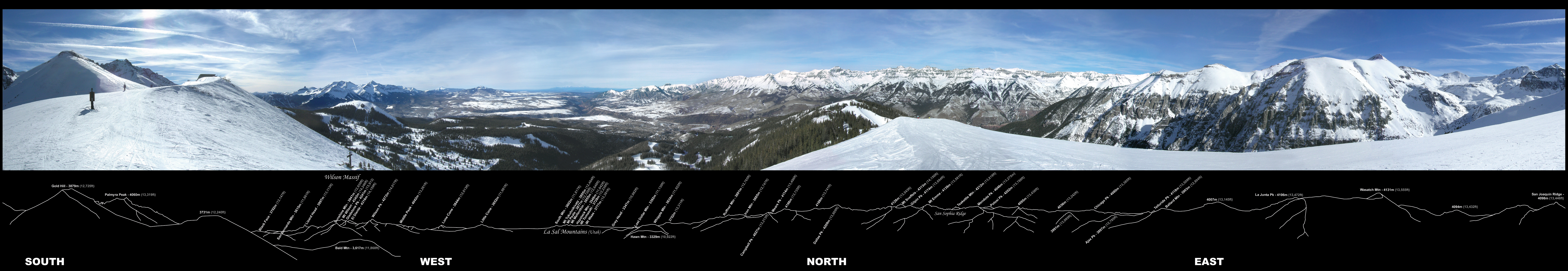
360° panorama of the southwestern San Juans, photographed from the Gold Hill Ridge of the Telluride Ski Resort. Ridgeline annotation indicates the names and elevations of 43 visible peaks 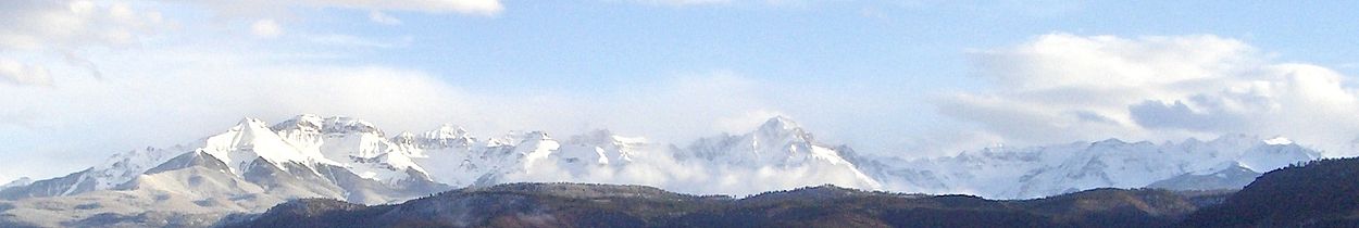
Panorama of the San Juan Mountains' Sneffels Range looking south. Contents
Prominent peaks
- Note: This is only a partial list of important peaks in the San Juans, listing peaks by prominence only. There are dozens more summits over 12,000 feet.
The 28 peaks of the San Juan Mountains with at least 500 meters of prominence Rank Mountain Peak Elevation Prominence Isolation 1 Uncompahgre Peak NGS 4365 m
14,321 ft1304 m
4,277 ft137 km
85 mi2 Mount Wilson[1] 4344 m
14,252 ft1227 m
4,024 ft53 km
33 mi3 Mount Sneffels NGS 4315 m
14,158 ft930 m
3,050 ft25 km
16 mi4 Mount Eolus[1] 4294 m
14,089 ft665 m
2,183 ft40 km
25 mi5 Handies Peak NGS 4285 m
14,058 ft575 m
1,888 ft18 km
11 mi6 San Luis Peak NGS 4274 m
14,022 ft949 m
3,113 ft43 km
27 mi7 Vermilion Peak[1] PB 4237 m
13,900 ft642 m
2,105 ft15 km
9 mi8 Rio Grande Pyramid NGS PB 4214 m
13,827 ft567 m
1,861 ft17 km
11 mi9 Mount Oso[1] 4173 m
13,690 ft507 m
1,664 ft8.8 km
5.5 mi10 Tower Mountain[1] PB 4132 m
13,558 ft504 m
1,652 ft8.6 km
5.4 mi11 Sultan Mountain[1] PB 4076 m
13,373 ft569 m
1,868 ft7.4 km
4.6 mi12 Summit Peak NGS PB 4056 m
13,307 ft841 m
2,760 ft64 km
40 mi13 Dolores Peak[1] PB 4053 m
13,296 ft594 m
1,950 ft8.0 km
5.0 mi14 Lavender Peak[1] PB 4037 m
13,245 ft872 m
2,860 ft40 km
25 mi15 Bennett Peak[1] PB 4026 m
13,209 ft531 m
1,743 ft28 km
17 mi16 Conejos Peak NGS PB 4017 m
13,179 ft583 m
1,912 ft13 km
8 mi17 Twilight Peak[1] 4012 m
13,163 ft713 m
2,338 ft7.9 km
4.9 mi18 South River Peak[1] PB 4009 m
13,154 ft746 m
2,448 ft35 km
22 mi19 Peak 13,010[1] PB 3967 m
13,016 ft546 m
1,790 ft15 km
10 mi20 Lone Cone[1] PB 3846 m
12,618 ft693 m
2,273 ft15 km
9 mi21 Graham Peak NGS PB 3821 m
12,536 ft778 m
2,551 ft17 km
10 mi22 Elliott Mountain[1] PB 3763 m
12,346 ft683 m
2,240 ft8.3 km
5.1 mi23 Cornwall Mountain[1] PB 3746 m
12,291 ft532 m
1,744 ft8.4 km
5.2 mi24 Sawtooth Mountain NGS PB 3704 m
12,153 ft587 m
1,927 ft28 km
18 mi25 Chalk Benchmark NGS PB 3669 m
12,038 ft601 m
1,971 ft12 km
7 mi26 Little Cone NGS PB 3654 m
11,988 ft561 m
1,841 ft9.7 km
6.0 mi27 Cochetopa Dome 3395 m
11,138 ft537 m
1,762 ft9.9 km
6.2 mi28 Horse Mountain[1] PB 3033 m
9,952 ft575 m
1,887 ft22 km
14 miHistory of the area
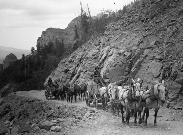
 Ore wagons, San Juan Mountains, circa 1900?
Mining operators in the San Juan mountain area formed the San Juan District Mining Association (SJDMA) in 1903, as a direct result of a Western Federation of Miners proposal to the Telluride Mining Association for the eight hour day, which had been approved in a referendum by 72 percent of Colorado voters.[2] The new association consolidated the power of thirty-six mining properties in San Miguel, Ouray, and San Juan counties.[3] The SJDMA refused to consider any reduction in hours or increase in wages, helping to provoke a bitter strike.
See also
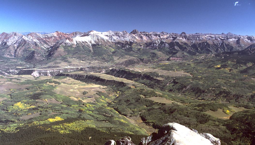
 San Juans in the fall of 2008, viewed from north of Durango
Subranges
- Sneffels Range
- Cimmaron Range
- Needle Mountains
- La Garita Mountains
- La Plata Mountains
Other
- Geography of Colorado
- Mountain peaks of Colorado
- Mountain peaks of the Rocky Mountains
- Mountain ranges of Colorado
- Rocky Mountains
References
- ^ a b c d e f g h i j k l m n o p The elevation of this summit has been converted from the National Geodetic Vertical Datum of 1929 (NGVD 29) to the North American Vertical Datum of 1988 (NAVD 88). National Geodetic Survey
- ^ Roughneck—The Life and Times of Big Bill Haywood, Peter Carlson, 1983, page 65.
- ^ The Corpse On Boomerang Road, Telluride's War On Labor 1899-1908, MaryJoy Martin, 2004, page 201.
Further reading
- Bove, D. et al. (2001). Geochronology and geology of Late Oligocene through Miocene volcanism and mineralization in the western San Juan Mountains, Colorado [U.S. Geological Survey Professional Paper 1642]. Washington, D.C.: U.S. Department of the Interior, U.S. Geological Survey.
- Lippman, P.W. (2006). Geologic map of the central San Juan Caldera Cluster, southwestern Colorado [Geologic Investigations Series I-2799]. Reston, VA: U.S. Department of the Interior, U.S. Geological Survey.
External links
Categories:- Mountain ranges of Colorado
- Ranges of the Rocky Mountains
- Geography of San Juan County, Colorado
- Mountain ranges of Ouray County, Colorado
- Geography of San Miguel County, Colorado
- Geography of Hinsdale County, Colorado

Wikimedia Foundation. 2010.