- Sterling, Colorado
Infobox Settlement
official_name = City of Sterling, Colorado
other_name =
native_name =
nickname =
settlement_type =City
motto = A Colorado Treasure
imagesize =
image_caption = Main Street
flag_size =
image_
seal_size =
image_shield =
shield_size =
image_blank_emblem =
blank_emblem_type =
blank_emblem_size =
flag_size =
image_
seal_size =
image_shield =
shield_size =
image_blank_emblem =
blank_emblem_type =
blank_emblem_size =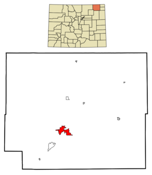
mapsize = 250x200px
map_caption = Location in Logan County and theState of Colorado
mapsize1 =
map_caption1 =
image_dot_
dot_mapsize =
dot_map_caption =
dot_x =
dot_y =
pushpin_
pushpin_label_position =
pushpin_map_caption =
pushpin_mapsize =
subdivision_type = Country
subdivision_name = USA
subdivision_type1 = State
subdivision_name1 = flag|Colorado|name=State of Colorado
subdivision_type2 = Countycite web | url = http://www.dola.state.co.us/dlg/local_governments/municipalities.html | title = Active Colorado Municipalities | format =HTML | publisher = State of Colorado, Department of Local Affairs | accessdate = 2007-09-01]
subdivision_name2 = Logan County - seatcite web|url=http://www.cdphe.state.co.us/hs/cntyseat.html|title=Colorado County Seats|format=HTML |publisher=State of Colorado , Department of Public Health and Environment|accessdate=2007-12-31]
subdivision_type3 =
subdivision_name3 =
subdivision_type4 =
subdivision_name4 =
government_footnotes =
government_type = Home Rule Municipality
leader_title = [http://www.sterlingcolo.com/gov/council.php Mayor]
leader_name = Dan Jones
leader_title1 = [http://www.sterlingcolo.com/gov/manager.php City Manager]
leader_name1 =
leader_title2 = [http://www.sterlingcolo.com/gov/council.php City Council]
leader_name2 =
leader_title3 =
leader_name3 =
leader_title4 =
leader_name4 =
established_title =Settled
established_date = 1871
established_title2 =Platted
established_date2 = 1881
established_title3 = Incorporated
established_date3 =December 3 ,1884 cite web | url = http://www.colorado.gov/dpa/doit/archives/muninc.html | title = Colorado Municipal Incorporations | format =HTML | publisher = State of Colorado, Department of Personnel & Administration, Colorado State Archives | date =2004-12-01 | accessdate = 2007-09-02]The City of Sterling is a Home Rule Municipality that is the
county seat and the most populous city of Logan County,Colorado ,United States .GR|6 TheUnited States Census Bureau estimates that the city population was 12,589 in 2005.cite web | date =June 21 2006 | url = http://www.census.gov/popest/cities/tables/SUB-EST2005-04-08.csv | title = Annual Estimates of the Population for All Incorporated Places in Colorado | format = CSV | work = 2005 Population Estimates | publisher = U.S. Census Bureau, Population Division | accessmonthday = November 17 | accessyear = 2006]Geography
Sterling is located at coor dms|40|37|32|N|103|12|42|W|city (40.625430, -103.211783).GR|1 It is 128 road miles northeast of Denver, and is located on Interstate 76. It is in what is called the 'eastern plains' of Colorado.
According to the
United States Census Bureau , the city has a total area of 6.9 square miles (17.8 km²), all of it land.History
The original inhabitants of the Colorado High Plains near Sterling, Colorado were native Americans of the
Arapaho ,Cheyenne , Crow,Blackfoot ,Sioux ,Kiowa , andPawnee tribes. The earliest European visitors to the area were primarily French fur trappers on their way to the fertile beaver trapping areas of the Colorado mountains. Organized exploration of the area by Americans began with the visit onJune 26 ,1820 of the expedition of [http://www.topogs.org/b_long.html Major Stephen Harriman Long] , who referred to the much of the area between theMissouri River and theRocky Mountains as “The Great American Desert.” One of the final battles of the Indian wars, the Battle of Summit Springs between Tall Bull and his Cheyenne Dog Soldiers and Colonel Eugene A. Carr and the U.S. Army took place near Sterling, Colorado onJuly 11 ,1869 .The [http://books.google.com/books?id=ikVVRYxBaVwC&dq=overland+trail&printsec=frontcover&source=web&ots=VAIQbAK__C&sig=PPCHMpPahYUyi_0ZXtIAMv1PLHA#PPA90,M1 Overland Trail] , a branch of the
Oregon Trail , was one of the most heavily traveled in the country. Between 1862-1868, thousands of brave and adventurous people pressed across the unmarked prairie in search of opportunity. Early settlers in northeastern Colorado such as John Iliff developed huge cattle ranching empires in the region, leading to the first economic base. Businesses, stores, and other operations soon followed, especially after the arrival of the railroads in 1881. [http://www.sterlingcolo.com/dept/plr/vtour/hadfield.php William Hadfield] arrived in the northeastern Colorado in 1871 and established his home on an island in theSouth Platte River , a few miles south of present day Sterling, where a post office was soon established. Mr. Hadfield is credited with being the first permanent white settler in the area.A number of early settlers first settled in the Union Colony, now
Greeley, Colorado , but found the best farmland already taken, so came back east along the South Platte river and formed the first town of Sterling, about four miles (6 km) north of the present town site. Here they built sod huts and dugouts along the treeless river valley.In 1881 news arrived that the
Union Pacific Railroad was going to extend its line fromJulesburg, Colorado toLa Salle, Colorado . Citizens from “old Sterling” knew that if a railroad came through this territory, a town would be established somewhere near their settlement. Local leader Minos King therefore traveled toOmaha, Nebraska to meet with railroad officials to offer them 80 acres of land for a right-of-way if shops and a roundhouse were located there.The current site where Sterling stands was owned John E. Boyd, who sold it to King for $400. The site for the new town was surveyed and platted by railroad surveyor David Leavitt, from Sterling, Illinois. While living in Sterling (Colorado) Mr. Leavitt was also Justice of the Peace, lawyer, and civil engineer. Mrs. Leavitt was a physician who also served as the first postmistress in the new town of Sterling.
The new town was composed of 19 blocks bordered by what is now Front Street, Cedar Street, Fourth Street, and Division Avenue. The northern boundary was a diagonal line extending a little north of the corner of what is now Chestnut and Front Streets – to about where the railroad tracks cross Main Street. The railroad tracks followed the diagonal of the South Platte River; hence, the old part of Sterling is on the diagonal. From Division Avenue westward the streets now run true north and south (and east and west). To encourage development of the town, King donated lots for a church, for schools, other public buildings, and for a cemetery – the old cemetery north of town now abandoned.
After laying out the new town, most of the settlers from the old Sterling settlement moved to the new locality. King and R.E. Smith opened the first lumberyard and general store. As soon as the railroad went through in 1881, a section house and depot were built. It was not long before the Pacific Hotel near the depot was built. In 1884, city articles of incorporation were completed, with George Wilson elected as mayor. In 1887 with the creation of Logan County, Sterling was made the county seat by governor Alva Adams.
Infrastructure
Sterling is the largest city in Northeastern Colorado and the county seat of Logan County and the site of the beautiful domed Logan County courthouse, built in 1909.
Sterling is the home of the highly respected [http://www.njc.edu Northeastern Junior College] , the premier residential two year liberal arts college in Colorado.
Sterling is also the location of the award winning [http://www.re1valleyschools.org/ RE-1 Valley School District] , excepting the principals of the High School, whose academics, music programs, and athletics programs are consistently among the most highly rated in the state of Colorado.
Major employers in Sterling include Northeastern Junior College, the RE-1 Valley School system, [http://www.fundinguniverse.com/company-histories/Sykes-Enterprises-Inc-Company-History.html Sykes Enterprises] , a computer software customer services company, and the newly built Sterling Correctional Facility
Sterling is the major shopping hub for most of northeastern Colorado and hosts stores like Wal-Mart, The Home Depot, and J. C. Penney, as well as many local retailers located primarily on Main Street. Six different banks have branches in Sterling and there are local AM and FM radio stations as well as a local television station, and a long established regional newspaper, the [http://www.journal-advocate.com/ Sterling Journal-Advocate] and South Platte Sentinel [http://www.southplattesentinel.com] .
Sterling is a regional center for health care as well, and is the home of the [http://www.bannerhealth.com/Locations/Colorado/Sterling+Regional+MedCenter/About+Us/About-Us.htm Sterling Regional Medical Center.]
Recreation
Just a few miles northeast of Sterling is located the [http://parks.state.co.us/parks/northsterling North Sterling State Park] , situated on the [http://www.fishexplorer.com/fx/lakedet.asp?lid=2130 North Sterling Reservoir] , a man-made lake fed by waters from the South Platte River. This new state park has three state of the art boat ramps, and three modern camping areas with over 150 camping sites, as well as multiple picnicking sites. The park is famous for its superb swimming, boating, waterskiing, [http://coloradostateparks.reserveamerica.com/campgroundDetails.do?subTabIndex=0&agency=co&parkCode=nost camping] , and [http://www.fishexplorer.com/fx/lakedet.asp?lid=2130 fishing] .
Pheasant, duck, and deer hunting are excellent in the high plains and South Platte River Valley surrounding Sterling.
Sterling is the home of two beautiful golf courses, [http://www.golflink.com/golf-courses/course.asp?course=134045 Riverview Golf Course] and the [http://www.sterlingcountryclub.org/ Sterling Country Club] , each offering excellent 18-hole courses.
The [http://www.sterlingcolo.com/dept/plr/vtour/overlandtrail.php Overland Trail Museum] , located east of Sterling near interstate 76 houses an eclectic mix of historical items in the main building, which resembles an early fort, as well as a restored local one-room schoolhouse and other restored historical buildings. Museum admission is free, and picnic grounds are adjacent. The [http://www.sterlingcolo.com/dept/plr/parks.php Overland Trail Recreation Area] features a convert|5|acre|m2|sing=on fishing pond open to all ages as well as biking trails, grass, trees, fishing, picnic tables, BBQ grills, walking path, off road parking, restroom, and fishing pier.
Each summer, Sterling hosts the annual [http://www.loganco.gov/commissioners/fair.htm Logan County Fair] , a typical old-time county fair complete with 4-H animal shows, baked goods competitions, a carnival, music shows, demolition derby, and a rodeo as well as the annual [http://www.sugarbeetdays.com/ Sugar Beet Days] harvest festival in the fall.
Transportation
Crosson Field Municipal Airport serves Sterling, but there are no scheduled flights available from there. The closest airport served by scheduled flights is
Denver International Airport , located 121 miles (193 km) away.Sterling is also served by railroads, although only freight carriers serve the town. The main rail operator is Burlington Northern Santa Fe (
BNSF ), but other operators, likeUnion Pacific , serve Sterling as well. The closestAmtrak station is located in Fort Morgan, about 47 miles (75 km) away.Major Highways
*.
*.
* and 8 other states.
*.
* located convert|102|mi|km to the west.Demographics
As of the
census GR|2 of 2000, there were 11,360 people, 4,604 households, and 2,790 families residing in the city. Thepopulation density was 1,653.1 people per square mile (638.4/km²). There were 5,171 housing units at an average density of 752.5/sq mi (290.6/km²). The racial makeup of the city was 90.75%Caucasian American , 0.75% African American, 0.79% Native American, 0.41% Asian, 0.08% Pacific Islander, 5.60% from other races, and 1.62% from two or more races. Hispanic or Latino of any race were 14.20% of the population.There were 4,604 households out of which 30.6% had children under the age of 18 living with them, 46.2% were married couples living together, 10.8% had a female householder with no husband present, and 39.4% were non-families. 34.1% of all households were made up of individuals and 14.7% had someone living alone who was 65 years of age or older. The average household size was 2.34 and the average family size was 3.03.
In the city the population was spread out with 25.5% under the age of 18, 12.9% from 18 to 24, 25.5% from 25 to 44, 19.6% from 45 to 64, and 16.4% who were 65 years of age or older. The median age was 35 years. For every 100 females there were 94.7 males. For every 100 females age 18 and over, there were 91.2 males.
The median income for a household in the city was $27,337, and the median income for a family was $39,103. Males had a median income of $27,921 versus $20,508 for females. The
per capita income for the city was $15,287.Historic Pictures
ee also
*
Colorado municipalities
*Logan County, Colorado
*State of Colorado
*Sterling Micropolitan Statistical Area References
External links
* [http://www.sterlingcolo.com/ City of Sterling website]
** [http://www.dot.state.co.us/App_DTD_DataAccess/Downloads/CityMaps/Sterling.pdf CDOT map of the City of Sterling]
* [http://www.journal-advocate.com/ Sterling Journal-Advocate] (local newspaper website)
* [http://www.city-data.com/city/Sterling-Colorado.html Sterling at City-Data.com]
*Stephen Harriman Long
*Historical account of travel on the [http://books.google.com/books?id=ikVVRYxBaVwC&dq=overland+trail&printsec=frontcover&source=web&ots=VAIQbAK__C&sig=PPCHMpPahYUyi_0ZXtIAMv1PLHA#PPA90,M1 Overland Trail]
* [http://www.time.com/time/magazine/article/0,9171,780088,00.html Blizzard of '49]
*Willa Cather short story [http://gaslight.mtroyal.ca/atgrover.htm "The Affair at Grover Station"] about Sterling, Colorado
* [http://video.google.com/videoplay?docid=-904025423175938409&q=sterling+colorado&total=158&start=0&num=10&so=0&type=search&plindex=7 Video welcome to Sterling]
* [http://video.google.com/videoplay?docid=-3982568294861974428&q=sterling+colorado&total=158&start=0&num=10&so=0&type=search&plindex=1 Sterling Quality of Life]
* [http://video.google.com/videoplay?docid=6150384966526042084&q=sterling+colorado&total=158&start=0&num=10&so=0&type=search&plindex=4 Economic Opportunities in Sterling, Colorado]area_magnitude = 1 E7
unit_pref =
area_footnotes =
unit_pref = Imperial
area_total_km2 = 17.8
area_land_km2 = 17.8
area_water_km2 = 0.0
area_total_sq_mi = 6.9
area_land_sq_mi = 6.9
area_water_sq_mi = 0.0
area_water_percent = 0.0
area_urban_km2 =
area_urban_sq_mi =
area_metro_km2 =
area_metro_sq_mi =
area_blank1_title =
area_blank1_km2 =
area_blank1_sq_mi =
population_as_of = 2005
population_footnotes =
population_note =
population_total = 12,589
population_density_km2 = 747.25
population_density_sq_mi = 1824.49
population_metro =
population_density_metro_km2 =
population_density_metro_sq_mi =
population_urban =
population_density_urban_km2 =
population_density_urban_sq_mi =
population_blank1_title =
population_blank1 =
population_density_blank1_km2 =
population_density_blank1_sq_mi =
timezone = MST
utc_offset = -7
timezone_DST = MDT
utc_offset_DST = -6
latd = 40 |latm = 37 |lats = 32 |latNS = N
longd = 103 |longm = 12 |longs = 42 |longEW = W
elevation_footnotes =
elevation_m = 1181
elevation_ft = 3935
postal_code_type =ZIP code cite web|url = http://zip4.usps.com/zip4/citytown.jsp | title = ZIP Code Lookup| format =JavaScript /HTML | publisher =United States Postal Service | accessdate=2008-01-05]
postal_code = 80751
area_code = 970
blank_name = FIPS code
blank_info = 08-73935
blank1_name = GNIS feature ID
blank1_info = [http://geonames.usgs.gov/pls/gnispublic/f?p=gnispq:3:::NO::P3_FID:0202901 0202901]
website = [http://www.sterlingcolo.com/ City of Sterling]
footnotes =
Wikimedia Foundation. 2010.