- Englewood, Colorado
Infobox Settlement
official_name = City of Englewood, Colorado
other_name =
native_name =
nickname =
settlement_type =City
motto =
imagesize =
image_caption =
flag_size =
image_
seal_size =
image_shield =
shield_size =
image_blank_emblem =
blank_emblem_type =
blank_emblem_size =
imagesize =
image_caption =
flag_size =
image_
seal_size =
image_shield =
shield_size =
image_blank_emblem =
blank_emblem_type =
blank_emblem_size =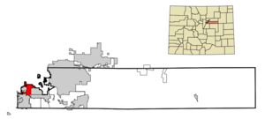
mapsize = 250px
map_caption = Location in Arapahoe County and theState of Colorado
mapsize1 =
map_caption1 =
image_dot_
dot_mapsize =
dot_map_caption =
dot_x =
dot_y =
pushpin_
pushpin_label_position =
pushpin_map_caption =
pushpin_mapsize =
subdivision_type = Country
subdivision_name = USA
subdivision_type1 = State
subdivision_name1 = flag|Colorado|name=State of Colorado
subdivision_type2 = County
subdivision_name2 = Arapahoe Countycite web | url = http://www.dola.state.co.us/dlg/local_governments/municipalities.html | title = Active Colorado Municipalities | format =HTML | publisher = State of Colorado, Department of Local Affairs | accessdate = 2007-09-01]
subdivision_type3 =
subdivision_name3 =
subdivision_type4 =
subdivision_name4 =
government_footnotes =
government_type = Home Rule Municipality
leader_title = Mayor
leader_name = Jim Woodward (pro tem) [cite web | url = http://www.ci.englewood.co.us/index.aspx?page=101 | title = City of Englewood: City Council | format =HTML | publisher = City of Englewood | accessdate = 2007-09-12]
leader_title1 =
leader_name1 =
leader_title2 =
leader_name2 =
leader_title3 =
leader_name3 =
leader_title4 =
leader_name4 =
established_title =
established_date =
established_title2 = Incorporated
established_date2 =May 9 ,1903 cite web | url = http://www.colorado.gov/dpa/doit/archives/muninc.html | title = Colorado Municipal Incorporations | format =HTML | publisher = State of Colorado, Department of Personnel & Administration, Colorado State Archives | date =2004-12-01 | accessdate = 2007-09-02]
established_title3 =
established_date3 =
area_magnitude =
unit_pref = Imperial
area_footnotes =
area_total_km2 = 17.1
area_land_km2 = 17
area_water_km2 = 0.1
area_total_sq_mi = 6.7
area_land_sq_mi = 6.6
area_water_sq_mi = 0.1
area_water_percent =
area_urban_km2 =
area_urban_sq_mi =
area_metro_km2 =
area_metro_sq_mi =
area_blank1_title =
area_blank1_km2 =
area_blank1_sq_mi =
population_as_of = 2000
population_footnotes =
population_note =
population_total = 31727
population_density_km2 = 1855.4
population_density_sq_mi = 4735.4
population_metro =
population_density_metro_km2 =
population_density_metro_sq_mi =
population_urban =
population_density_urban_km2 =
population_density_urban_sq_mi =
population_blank1_title =
population_blank1 =
population_density_blank1_km2 =
population_density_blank1_sq_mi =
timezone = MST
utc_offset = -7
timezone_DST = MDT
utc_offset_DST = -6
latd = 39 |latm = 38 |lats = 49 |latNS = N
longd = 104 |longm = 59 |longs = 31 |longEW = W
elevation_footnotes = GR|3
elevation_m = 1637
elevation_ft = 5371
postal_code_type =ZIP code scite web | url = http://zip4.usps.com/zip4/citytown.jsp | title = ZIP Code Lookup| format =JavaScript /HTML | publisher =United States Postal Service | accessmonthday = September 12 | accessyear = 2007]
postal_code = 80110 & 80113,PO Box es 80150 & 80151 & 80155
area_code = Both 303 and 720
blank_name = FIPS code
blank_info = 08-24785
blank1_name = GNIS feature ID
blank1_info = 0204715
website = [http://www.ci.englewood.co.us/ City of Englewood]
footnotes =
Origin of thePike's Peak Gold Rush The City of Englewood is a Home Rule Municipality located in Arapahoe County,
Colorado ,United States . As of 2005, the city is estimated to have a total population of 32,350.cite web | date =June 21 2006 | url = http://www.census.gov/popest/cities/tables/SUB-EST2005-04-08.csv | title = Annual Estimates of the Population for All Incorporated Places in Colorado | format = CSV | work = 2005 Population Estimates | publisher = U.S. Census Bureau, Population Division | accessmonthday = November 16 | accessyear = 2006] Englewood is part of theDenver Metropolitan Area .Geography
Englewood is located at coor dms|39|38|49|N|104|59|31|W|city (39.646837, -104.991986)GR|1.
According to the
United States Census Bureau , the city has a total area of 6.6square mile s (17.1km² ), of which, 6.6 square miles (17.0 km²) of it is land and 0.1 square miles (0.1 km²) of it (0.76%) is water.Demographics
As of the
census GR|2 of 2000, there were 41,727 people, 14,392 households, and 7,469 families residing in the city. Thepopulation density was 4,842.0 people per square mile (1,870.2/km²). There were 14,916 housing units at an average density of 2,276.4/sq mi (879.3/km²). The racial makeup of the city was 87.77% White, 1.46% African American, 1.31% Native American, 1.86% Asian, 0.09% Pacific Islander, 4.99% from other races, and 2.52% from two or more races. Hispanic or Latino of any race were 13.05% of the population.There were 14,392 households out of which 23.6% had children under the age of 18 living with them, 36.7% were married couples living together, 10.8% had a female householder with no husband present, and 48.1% were non-families. 37.9% of all households were made up of individuals and 9.5% had someone living alone who was 65 years of age or older. The average household size was 2.15 and the average family size was 2.88.
In the city the population was spread out with 20.3% under the age of 18, 9.6% from 18 to 24, 35.9% from 25 to 44, 20.0% from 45 to 64, and 14.2% who were 65 years of age or older. The median age was 36 years. For every 100 females there were 98.1 males. For every 100 females age 18 and over, there were 96.4 males.
The median income for a household in the city was $38,943, and the median income for a family was $47,290. Males had a median income of $32,636 versus $28,480 for females. The
per capita income for the city was $20,904. About 4.9% of families and 8.2% of the population were below thepoverty line , including 9.0% of those under age 18 and 7.5% of those age 65 or over.Points of interest
*
Merrill Wheel-Balancing System ee also
*
Colorado municipalities
*Denver-Aurora Metropolitan Statistical Area
*Denver-Aurora-Boulder Combined Statistical Area
*Front Range Urban Corridor References
External links
* [http://www.ci.englewood.co.us/ City of Englewood website]
** [http://www.dot.state.co.us/App_DTD_DataAccess/Downloads/CityMaps/Englewood.pdf CDOT map of the City of Englewood]
Wikimedia Foundation. 2010.