- Dolores River
-
Dolores River[1] 
Origin 37°43′18″N 107°52′47″W / 37.72167°N 107.87972°W Mouth Confluence with Colorado River
38°49′00″N 109°16′02″W / 38.8166667°N 109.26722°WCoordinates: 38°49′00″N 109°16′02″W / 38.8166667°N 109.26722°WProgression Colorado Mouth elevation 4,390 ft (1,340 m)  The Dolores River, a tributary of the Colorado, is shown highlighted on a map of the western United States
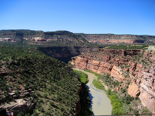
The Dolores River is a tributary of the Colorado River, approximately 250 mi (402 km) long, in the U.S. states of Colorado and Utah.
It rises in southwestern Colorado near Dolores Peak and Mount Wilson in the San Miguel Mountains. It flows southwest, past the town of Dolores, where it turns, flowing north and northwest. It flows through the Dolores River Canyon, then cuts across Paradox Valley[2] before receiving the San Miguel River (incidentally, both the Dolores and the San Miguel have their headwaters to either side of Lizard Head Pass) in Montrose County and crossing into Utah, where it joins the Colorado in Grand County near the former Dewey Bridge.
The river was explored and possibly named by Juan Maria Antonio Rivera during an 1765 expedition from Santa Fe.
The Dolores is navigable by rafts and kayaks (up to class IV) from McPhee Reservoir to its confluence with the Colorado. When water is restricted from the reservoir it may be possible to boat down stream from the San Miguel River. However, the river is extensively used for irrigation and during low water years is wholly unnavigable. The mean annual flow of the Dolores is approximately 1,240 cu ft/s (35 m3/s).
In high-runoff years, the section from Bradfield Ranch near Cahone, Colorado down to Slickrock, Colorado, offers scenery, camping, and rapids for inflatables and kayaks. The section from Slickrock to Bedrock, Colorado goes through the goosenecks of a sandstone canyon with several mostly class II rapids. The Bureau of Land Management recommends minimum flows of 200 cubic feet per second (5.7 m3/s) for canoes, kayaks, and inflatable kayaks, 800 cu ft/s (23 m3/s) for small rafts of up to 14 feet (4.3 m), and 1,000 cu ft/s (28 m3/s) for larger rafts of up to 18 feet (5.5 m) in size. The BLM does not require permits for groups running the river in Colorado, though permits are required from the Moab BLM office for boaters wishing to make the run from Gateway, CO into Utah and to the confluence with the Colorado River near Dewey Bridge.
Dam releases from McPhee reservoir are a controversial topic. Currently, the Bureau of Reclamation, which manages the dam, operates it on a "fill, then spill" policy, where the dam is filled first, and only then if any "extra" water is available are larger flows released for recreational boaters. This fact aggrevies recreational boaters, who claim it is difficult for anyone but a local resident closely watching the gauges to plan trips in advance on the river. The San Juan Citizens' Alliance has worked to start a dialogue between Dolores River stakeholders in the hopes of shifting release policy to one that allows for greater, planned releases.
See also
- List of rivers of Colorado
- List of tributaries of the Colorado River
- Dolores River Bridge
- Dolores Water Conservancy District
- Current Dam Releases Below McPhee Reservoir
- BLM Dolores Info
- BLM's Other Dolores Info Page
- San Juan Citizens' Alliance Dolores River Page
References
- ^ "Dolores River". Geographic Names Information System, U.S. Geological Survey. http://geonames.usgs.gov/pls/gnispublic/f?p=gnispq:3:::NO::P3_FID:1440517. Retrieved 2011-01-27.
- ^ "Paradox Valley". Geographic Names Information System, U.S. Geological Survey. 13 October 1978. http://geonames.usgs.gov/pls/gnispublic/f?p=gnispq:3:::NO::P3_FID:185690. Retrieved 28 November 2009.
Categories:- Tributaries of the Colorado River in Utah
- Rivers of Colorado
- Rivers of Utah
- Landforms of Grand County, Utah
- Tributaries of the Colorado River in Colorado
- Geography of Montezuma County, Colorado
- Geography of Montrose County, Colorado
Wikimedia Foundation. 2010.