- Dirty Devil River
-
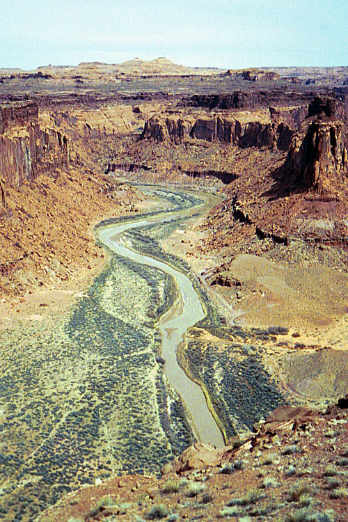
Dirty Devil River River 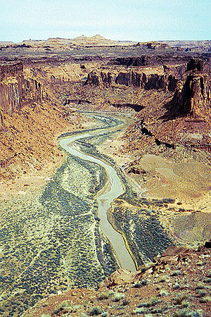 The Dirty Devil River near Twin Corral Box Canyon
Country United States State Utah County Wayne County, Garfield County Tributaries - left Muddy Creek - right Fremont River City Salt Lake City Source Confluence of Fremont River and Muddy Creek - elevation 4,266 ft (1,300 m) [1] - coordinates 38°24′9″N 110°41′35″W / 38.4025°N 110.69306°W [2] Mouth Colorado River - location Lake Powell, Glen Canyon National Recreation Area, Garfield County, Utah - elevation 3,703 ft (1,129 m) [3] - coordinates 37°53′30″N 110°23′33″W / 37.89167°N 110.3925°W [2] Length 80 mi (129 km) [4] 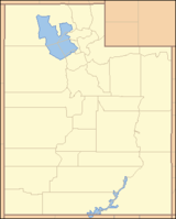
 Location of the mouth of the Dirty Devil River in Utah
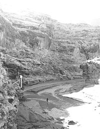 Dirty Devil River on February 16, 1954 near crossover by Poison Springs Wash Road in Hanksville, Utah.
The Dirty Devil River is a 80-mile (130 km) long tributary of the Colorado River, located in the U.S. state of Utah. It flows through southern Utah from the confluence of Fremont River and Muddy Creek to the Colorado River.
Contents
Course
The Dirty Devil River is formed in Wayne County near Hanksville at the confluence of the Fremont River and Muddy Creek. It flows generally south through a 2,000 feet (610 m) deep canyon in Wayne and Garfield counties. Its lower 20 miles (32 km) flows through Glen Canyon National Recreation Area. It disembogues into Lake Powell on the Colorado.
The canyon of the river is particularly isolated and is seldom visited compared to other natural areas in the region.
History
The Dirty Devil River was named during the 1869 Colorado River expedition led by John Wesley Powell.[5]
The outlaw Butch Cassidy used tributary canyons of the Dirty Devil as a hideout in the 1890s.[5]
Geology
The Dirty Devil River and its tributaries contribute approximately 150,000 tons of salt to the Colorado River, with the Muddy Creek tributary contributing an annual average of 86,000 tons by itself. The Fremont River tributary does not contribute significant amounts of salt. The Bureau of Reclamation has created a plan to reduce the salinity of the Dirty Devil River by collecting salty spring water and using deep-well injection to dispose of it. The plan, completed in 1987, has not been implemented due to its marginal cost effectiveness.[6]
Bridges
The river is spanned by a steel arch bridge on State Route 95 near milepost 45 in Garfield County.
See also
- List of Utah rivers
- List of tributaries of the Colorado River
References
- ^ Source elevation derived from Google Earth search using GNIS source coordinates.
- ^ a b U.S. Geological Survey Geographic Names Information System: Dirty Devil River
- ^ Mouth elevation derived from Google Earth search using GNIS mouth coordinates.
- ^ Dirty Devil River, The Columbia Gazetteer of North America
- ^ a b Dirty Devil River, Bureau of Land Management
- ^ Colorado River Basin Salinity Control Program, Dirty Devil, Utah, USBR
Categories:- Tributaries of the Colorado River in Utah
- Rivers of Utah
- Landforms of Wayne County, Utah
- Colorado Plateau
- Landforms of Garfield County, Utah


Wikimedia Foundation. 2010.