- Gunnison River
Geobox River
name = Gunnison River
native_name =
other_name =
image_size = 300
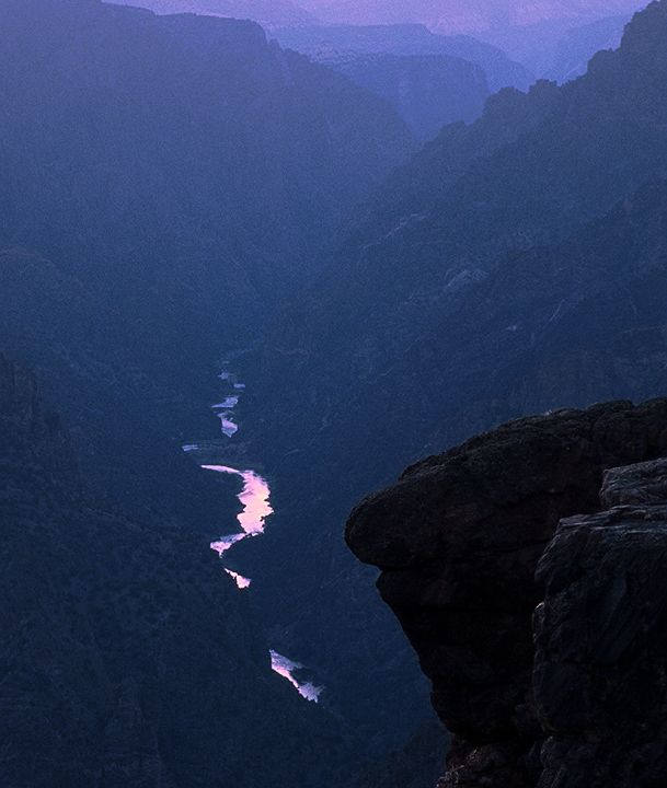
image_caption = The Gunnison River at twilight, from Sunset View inBlack Canyon of the Gunnison National Park .
etymology =
country = United States
country1 =
state = Colorado
state1 =
region_type =
region =
region1 =
city = Gunnison
city1 = Grand Junction
landmark =
landmark1 =
length_imperial = 180
length_note = [http://www.bartleby.com/69/8/G06408.html Gunnison River] , The Columbia Gazetteer of North America. 2000.]
watershed_imperial = 7928
watershed_note = [http://pubs.usgs.gov/wdr/wdr-co-03-1/vol1/pdf/WDR_CO-03-2.pdf Water Data Report, Colorado 2003] , from [http://pubs.usgs.gov/wdr/wdr-co-03-1/ Water Resources Data Colorado Water Year 2003] , USGS.]
discharge_location = Near Grand Junction
discharge_imperial = 2570
discharge_max_imperial = 35200
discharge_min_imperial = 106
discharge_round = 1
discharge_note =
discharge1_location =
discharge1_imperial =
source_name = Rocky Mountains
source_location =
source_district =
source_region =
source_state =
source_country =
source_lat_d = 38
source_lat_m = 39
source_lat_s = 49
source_lat_NS = N
source_long_d = 106
source_long_m = 50
source_long_s = 50
source_long_EW = W
source_coordinates_note = Gnis|201748|Gunnison River, USGS GNIS.]
source_elevation_imperial = 8008
source_elevation_note =Google Earth elevation for GNIS coordinates.]
source_length_imperial =
mouth_name = Colorado River
mouth_location =
mouth_district =
mouth_region =
mouth_state =
mouth_country =
mouth_lat_d = 39
mouth_lat_m = 3
mouth_lat_s = 42
mouth_lat_NS = N
mouth_long_d = 108
mouth_long_m = 34
mouth_long_s = 42
mouth_long_EW = Wmouth_coordinates_note =
The Gunnison River is a tributary of the Colorado River, approximately 180 mi (290 km) long, in the
mouth_elevation_imperial = 4553
mouth_elevation_note =
tributary_left = Tomichi Creek
tributary_left1 = Lake Fork Gunnison River
tributary_left2 = Cimarron River
tributary_left3 = Uncompahgre River
tributary_right = Smith Fork
tributary_right1 = North Fork Gunnison River
free_name =
free_value =

map_size = 300
map_caption = The Gunnison River highlighted on a map of the western United States.U.S. state ofColorado . It is the fifth largest tributary of the Colorado River, with a mean flow of 4320 ft³/s (122 m³/s).It rises in west central Colorado, in eastern Gunnison County, formed by the confluence of Taylor and East rivers. Just past the town of Gunnison, the river begins to swell into the expanse of
Blue Mesa Reservoir , a 12 mile (20 km) long reservoir formed by Blue Mesa Dam, where it receives the Lake Fork of the Gunnison. Just downstream it is dammed again to formMorrow Point Reservoir , then just downstream of that dammed for the final time to formCrystal Reservoir . The reservoirs produce hydroelectric power and supply water for the surrounding areas for both municipal and irrigation use. The reservoirs are the upper part of theBlack Canyon of the Gunnison , one of the longest, narrowest, and deepest gorges in the world. Below Crystal Dam it begins to roar through massive cataracts and flows through the deepest part of the gorge. At the outlet of the canyon it receives the North Fork River, then downstream near Delta is joined by the Uncompahgre River. It then winds through desert canyonlands until it empties into the Colorado near Grand Junction, carrying almost as much water as the former.The Gunnison River ranges in width from 100 to 1000 feet (30 to 300 m) and 3 to 50 feet (1 to 15 m) in depth. The river's powerful current and many rapids make upstream travel nearly impossible. It is navigable for small craft throughout its course and by larger boats below the Black Canyon. Parts of the Black Canyon are unnavigable to any sorts of craft because of giant cataracts. Navigation through the entire canyon is dangerous and for experienced boaters only.
Part of the river's water is diverted to irrigate the
Uncompahgre Valley via the 5 mi (8 km) longGunnison Tunnel , which was built between 1905 and 1909.The Gunnison River is mentioned in the
Townes Van Zandt song "Snowin' on Raton":"When the Wind don't blow in Amarillo/and the moon along the Gunnison don't rise/can I cast my dreams upon your love babe/and lie beneath the laughter of your eyes?"Dams
*
Blue Mesa Dam
*Morrow Point Dam
*Crystal Dam References
External links
*cite web | url=http://earthobservatory.nasa.gov/Newsroom/NewImages/images.php3?img_id=17051 | title=Black Canyon National Park, Colorado | publisher=
NASA Earth Observatory | accessdate=2006-05-05
Wikimedia Foundation. 2010.