- Gunnison, Colorado
Infobox Settlement
official_name = City of Gunnison, Colorado
other_name =
native_name =
nickname =
settlement_type =City
motto =
imagesize =
image_caption =
flag_size =
image_
seal_size =
image_shield =
shield_size =
image_blank_emblem =
blank_emblem_type =
blank_emblem_size =
imagesize =
image_caption =
flag_size =
image_
seal_size =
image_shield =
shield_size =
image_blank_emblem =
blank_emblem_type =
blank_emblem_size =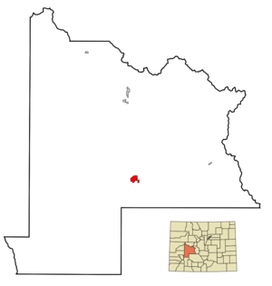
mapsize = 250x200px
map_caption = Location in Gunnison County and theState of Colorado
mapsize1 =
map_caption1 =
image_dot_
dot_mapsize =
dot_map_caption =
dot_x =
dot_y =
pushpin_
pushpin_label_position =
pushpin_map_caption =
pushpin_mapsize =
subdivision_type = Country
subdivision_name =USA
subdivision_type1 = State
subdivision_name1 =Colorado
subdivision_type2 = County
subdivision_name2 = Gunnison County Seatcite web | url = http://www.dola.state.co.us/dlg/local_governments/municipalities.html | title = Active Colorado Municipalities | format =HTML | publisher = State of Colorado, Department of Local Affairs | accessdate = 2007-09-01]
subdivision_type3 =
subdivision_name3 =
subdivision_type4 =
subdivision_name4 =
named_for =John W. Gunnison
government_footnotes =
government_type = Home Rule Municipality
leader_title = Mayor
leader_name = Stu Ferguson
leader_title1 = City Manager
leader_name1 = Ken Coleman
leader_title2 =
leader_name2 =
leader_title3 =
leader_name3 =
leader_title4 =
leader_name4 =
established_title =
established_date =
established_title2 = Incorporated
established_date2 =March 1 ,1880 cite web | url = http://www.colorado.gov/dpa/doit/archives/muninc.html | title = Colorado Municipal Incorporations | format =HTML | publisher = State of Colorado, Department of Personnel & Administration, Colorado State Archives | date =2004-12-01 | accessdate = 2007-09-02]
established_title3 =
established_date3 =
area_magnitude =
unit_pref = Imperial
area_footnotes =
area_total_km2 = 8.3
area_land_km2 = 8.3
area_water_km2 = 0
area_total_sq_mi = 3.2
area_land_sq_mi = 3.2
area_water_sq_mi = 0
area_water_percent =
area_urban_km2 =
area_urban_sq_mi =
area_metro_km2 =
area_metro_sq_mi =
area_blank1_title =
area_blank1_km2 =
area_blank1_sq_mi =
population_as_of = 2000
population_footnotes =
population_note =
population_total = 5409
population_density_km2 = 651.7
population_density_sq_mi = 1690.3
population_metro =
population_density_metro_km2 =
population_density_metro_sq_mi =
population_urban =
population_density_urban_km2 =
population_density_urban_sq_mi =
population_blank1_title =
population_blank1 =
population_density_blank1_km2 =
population_density_blank1_sq_mi =
timezone = MST
utc_offset = -7
timezone_DST = MDT
utc_offset_DST = -6
latd = 38 |latm = 32 |lats = 45 |latNS = N
longd = 106 |longm = 55 |longs = 31 |longEW = W
elevation_footnotes = GR|3
elevation_m = 2348
elevation_ft = 7703
postal_code_type =ZIP code scite web | url = http://zip4.usps.com/zip4/citytown.jsp | title = ZIP Code Lookup| format =JavaScript /HTML | publisher =United States Postal Service | accessdate = September 28 | accessyear = 2007]
postal_code = 81230-81231 & 81247
area_code = 970
blank_name = FIPS code
blank_info = 08-33640
blank1_name = GNIS feature ID
blank1_info = 0188995
website = [http://www.cityofgunnison-co.gov/ City of Gunnison]
footnotes =The historic City of Gunnison is a Home Rule Municipality that is the
county seat and the most populous city of Gunnison County,Colorado ,United States .GR|6 As of theU.S. Census 2000 , the city had a totalpopulation of 5,409. The city was named in honor ofJohn W. Gunnison , aUnited States Army officer who surveyed for the transcontinental railroad in 1853.Gunnison is the home of
Western State College . TheGunnison-Crested Butte Regional Airport serves the valley and nearbyCrested Butte, Colorado with both commercialairline andgeneral aviation flights.Weather
Gunnison is located at the bottom of several
valley s. Due to its location in theRocky Mountains , cold air in all the valleys settles into Gunnison at night, making it one of the coldest places in winter in the United States, especially when snowpack is present. The average January low is -7°F , and the average July high is 81°F . The record low is -47°F set onDecember 25 ,1924 . The record high is 98°F, set onAugust 15 ,1931 . [http://www.wrcc.dri.edu/cgi-bin/cliGCStT.pl?cogunn]The city typically experiences moderate snowfalls, with an average of 50 inches per year. Early fall and late spring snows are not uncommon and snow can remain on the ground in town from as early as November to as late as April. Surrounding mountains experience very heavy snowfall with longer periods of snow on the ground. Many locations average 300-400 inches of snow annually. The snow is welcome to the area, as it is beneficial to water supplies and local ski resorts. Total liquid precipitation averages nearly 11 inches per year in the city of Gunnison, while surrounding mountains may receive anywhere from 15 to over 40 inches annually, depending upon elevation and local topography.
History
After the killing of Curley Bill, the Earps left Arizona and headed to Colorado. In a stop over in Albuquerque, New Mexico, Wyatt and Holliday had a falling out but remained on fairly good terms. The group split up after that with Holliday heading to Pueblo and then Denver. The Earps and Texas Jack set up camp on the outskirts of Gunnison, Colorado, where they remained quiet at first, rarely going into town for supplies. Eventually, Wyatt took over a faro game at a local saloon.
Slowly all of the Earp assets in Tombstone were sold to pay for taxes, and the stake the family had amassed eroded. Wyatt and Warren joined Virgil in San Francisco in late 1882. While there, Wyatt rekindled a romance with Josie Marcus, Behan's one-time fiancée. His common-law wife, Mattie waited for him in Colton but eventually realized Wyatt was not coming back (Wyatt had left Mattie the house when he left Tombstone). Earp left San Francisco with Josie in 1883 and she became his companion for the next forty-six years (no marriage certificate has been found). Earp and Marcus returned to Gunnison where they settled down, where that state’s governor refused to extradite Wyatt back to Arizona on the grounds that he could not get a fair trial, and Earp continued to run a faro bank.
Gunnison isolated themselves from the surrounding area during the
Spanish Influenza epidemic for two months at the end of 1918. All highways were barricaded near the county lines. Train conductors warned all passengers that if they stepped outside of the train in Gunnison, the would be arrested and quarantined for five days. As a result of the isolation, no one died of influenza in Gunnison during the epidemic.Geography
Gunnison is located at
38°32'45" North, 106°55'54" West (38.545838, -106.931562)GR|1 andaltitude 7703 feet (2338metre s). [ [http://www.altimeters.net/cityaltitudes.html Altitude of major US Cities courtesy of Red Oaks Trading ] ]According to the
United States Census Bureau , the city has a total area of 3.2square mile s (8.3km² ). All of it is land and none of it is covered by water. Gunnison is near both Taylor Reservoir and Spring Creek Reservoir. One can travel to Gunnison from the towns of Salida and Buena Vista by going overMonarch Pass .Demographics
As of the
census GR|2 of 2000, there were 5,409 people, 2,083 households, and 904 families residing in the city. Thepopulation density was 1,684.6 people per square mile (650.6/km²). There were 2,276 housing units at an average density of 708.9/sq mi (273.8/km²). The racial makeup of the city was 93.49% White, 0.78% African American, 0.78% Native American, 0.55% Asian, 0.06% Pacific Islander, 1.79% from other races, and 2.55% from two or more races. Hispanic or Latino of any race were 6.91% of the population.There were 2,083 households out of which 21.1% had children under the age of 18 living with them, 32.3% were married couples living together, 7.6% had a female householder with no husband present, and 56.6% were non-families. 32.8% of all households were made up of individuals and 6.9% had someone living alone who was 65 years of age or older. The average household size was 2.17 and the average family size was 2.83.
In the city the population was spread out with 15.1% under the age of 18, 39.0% from 18 to 24, 24.9% from 25 to 44, 13.6% from 45 to 64, and 7.5% who were 65 years of age or older. The median age was 24 years. For every 100 females there were 120.1 males. For every 100 females age 18 and over, there were 122.4 males.
The median income for a household in the city was $25,768, and the median income for a family was $41,761. Males had a median income of $27,016 versus $21,194 for females. The
per capita income for the city was $15,196. About 10.1% of families and 24.7% of the population were below thepoverty line , including 13.8% of those under age 18 and 6.6% of those age 65 or over.In the media
Gunnison is the setting of the
science fiction film "", although the film was actually shot in the towns ofPort Coquitlam andPort Moody ,British Columbia .cite web | url = http://www.mtv.com/movies/news/articles/1569392/20070910/story.jhtml | title = Alien vs. Predator Sequel's R-rated Secrets Revealed | publisher = MTV.com | accessdate = 2007-12-14] cite web | url = http://www.thisisink.com/inkfolio/features/oh-the-places.php | title = Oh, the places she's been | publisher = The Block | accessdate = 2007-12-14]ee also
*
Curecanti National Recreation Area
*Gunnison County, Colorado
*Old Spanish National Historic Trail
*State of Colorado
**Colorado municipalities References
External links
* [http://www.cityofgunnison-co.gov/ City of Gunnison website]
** [http://www.dot.state.co.us/App_DTD_DataAccess/Downloads/CityMaps/Gunnison.pdf CDOT map of the City of Gunnison]
* [http://www.gunnisoncounty.org/ Gunnison County website]
* [http://www.gunnison.travel// Gunnison Tourism Office] (official tourism website)
* [http://www.western.edu Western State College of Colorado] (official website)
Wikimedia Foundation. 2010.