- Broomfield, Colorado
-
City and County of Broomfield, Colorado — Consolidated city-county —  Location in the State of Colorado
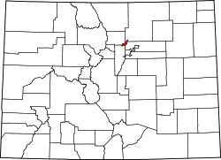
Coordinates: 39°55′55″N 105°3′57″W / 39.93194°N 105.06583°WCoordinates: 39°55′55″N 105°3′57″W / 39.93194°N 105.06583°W Country  United States
State  State of Colorado
City and County Broomfield County, Colorado Incorporated 1961-06-06[1] Consolidated 2001-11-15 Named for broomcorn grown in area Government – Type Consolidated City and County[2] – Mayor Patrick Quinn Area – Total 27.5 sq mi (71.1 km2) – Land 27.1 sq mi (70.2 km2) – Water 0.3 sq mi (0.9 km2) Elevation[3] 5,420 ft (1,629 m) Population (2010)[4] – Total 55,889 – Density 1,644.6/sq mi (635/km2) Time zone MST (UTC-7) – Summer (DST) MDT (UTC-6) ZIP codes[5] 80020, 80021, 80023,
80038 (PO Box)Area code(s) Both 303 and 720 FIPS code 08-09280 GNIS feature ID 1945881[6] Highways I-25, US 36, US 287, NW Parkway, SH 7, SH 121, SH 128 Website City and County of Broomfield The City and County of Broomfield is a prominent suburb and tier of the Denver metropolitan area in the State of Colorado of the United States. Broomfield has a consolidated city and county government which operates under Article XX, Sections 10-13 of the Constitution of the State of Colorado. The United States Census Bureau records stated that the population was 55,889 on April 1, 2010.[4] Broomfield is the 16th most populous city and the 16th most populous county in Colorado. Broomfield is a part of the Denver-Aurora-Broomfield, CO Metropolitan Statistical Area and the Denver-Aurora-Boulder Combined Statistical Area.
Contents
History
The municipality of Broomfield was incorporated in 1961 in the southeastern corner of Boulder County. It received its name from the broomcorn grown in the area. Over the next three decades, the city grew through annexations, many of which crossed the county line into three adjacent counties: Adams, Jefferson and Weld. In the 1990s, city leaders began to push for the creation of a separate county to avoid the inefficiencies of dealing with four separate court districts, four different county seats, and four separate county sales tax bases. It also had longstanding political differences with Boulder County, which impelled it to separate. Broomfield reasoned that it could provide services more responsively under its own county government, and sought an amendment to the Colorado State Constitution to create a new county. The amendment was passed in 1998, after which a three-year transition period followed. On November 15, 2001, Broomfield County became the 64th, newest and smallest county of Colorado.
Geography and Climate
Broomfield is located at 39°55′55″N 105°3′57″W / 39.93194°N 105.06583°W (39.931817, -105.065919).[7]
According to the United States Census Bureau, the city has a total area of 27.5 square miles (71.2 km2), of which 27.1 square miles (70.2 km2) is land and 0.3 square miles (0.8 km2) (1.24 percent) is water.
Broomfield has a semi-arid climate (Köppen climate classification BSk).
Climate data for Broomfield Month Jan Feb Mar Apr May Jun Jul Aug Sep Oct Nov Dec Year Record high °F (°C) 77
(25)77
(25)83
(28)90
(32)101
(38)103
(39)108
(42)104
(40)101
(38)91
(33)82
(28)77
(25)108
(42)Average high °F (°C) 44
(7)48
(9)54
(12)61
(16)71
(22)82
(28)88
(31)86
(30)78
(26)66
(19)52
(11)45
(7)65 Daily mean °F (°C) 30
(−1)34
(1)40
(4)47
(8)57
(14)66
(19)72
(22)70
(21)62
(17)51
(11)38
(3)31
(−1)50 Average low °F (°C) 16
(−9)20
(−7)26
(−3)33
(1)42
(6)51
(11)56
(13)55
(13)47
(8)36
(2)25
(−4)18
(−8)35 Record low °F (°C) −15
(−26)−17
(−27)−5
(−21)6
(−14)12
(−11)30
(−1)33
(1)41
(5)18
(−8)5
(−15)−6
(−21)−24
(−31)−24
(−31)Precipitation inches (mm) 0.39
(9.9)0.33
(8.4)0.92
(23.4)1.78
(45.2)2.25
(57.2)1.55
(39.4)1.71
(43.4)1.32
(33.5)0.88
(22.4)0.82
(20.8)0.83
(21.1)0.47
(11.9)13.25
(336.6)Source: Weather.com[8] Adjacent counties
- Weld County, Colorado - northeast
- Adams County, Colorado - southeast
- Jefferson County, Colorado - southwest
- Boulder County, Colorado - northwest

Boulder County Weld County 
 City and County of Broomfield, Colorado

Jefferson County Adams County Demographics
Historical populations Census Pop. %± 1970 7,261 — 1980 20,730 185.5% 1990 24,638 18.9% 2000 38,272 55.3% 2010 55,889 46.0% U.S. Decennial Census At the 2000 census,[9] there were 38,272 people, 13,842 households and 10,270 families residing in the city. The population density was 1,411.6 per square mile (545.1/km²). There were 14,322 housing units at an average density of 528.2 per square mile (204.0/km²). The racial makeup of the city was 88.62 percent White, 0.92 percent African American, 0.61 percent Native American, 4.14 percent Asian, 0.04 percent Pacific Islander, 3.21 percent from other races, and 2.45 percent from two or more races. Hispanic or Latino of any race were 9.07 percent of the population.
There were 13,842 households of which 41.2 percent had children under the age of 18 living with them, 61.8 percent were married couples living together, 8.2 percent had a female householder with no husband present, and 25.8 percent were non-families. 19.3 percent of all households were made up of individuals and 4.2 percent had someone living alone who was 65 years of age or older. The average household size was 2.76 people, and the average family size was 3.19 people.
Age distribution was 29.3 percent under the age of 18, 7.7 percent from 18 to 24, 36.3 percent from 25 to 44, 20.1 percent from 45 to 64, and 6.6 percent who were 65 years of age or older. The median age was 33 years. For every 100 females there were 101.0 males. For every 100 females age 18 and over, there were 100.2 males.
The median household income was $69,419 and the median family income was $82,106 in a 2007 estimate.[10] Males had a median income of $49,732 versus $31,864 for females. The per capita income for the city was $26,488. About 2.1 percent of families and 4.2 percent of the population were below the poverty line, including 4.3 percent of those under age 18 and 6.3 percent of those age 65 or over.
Economy
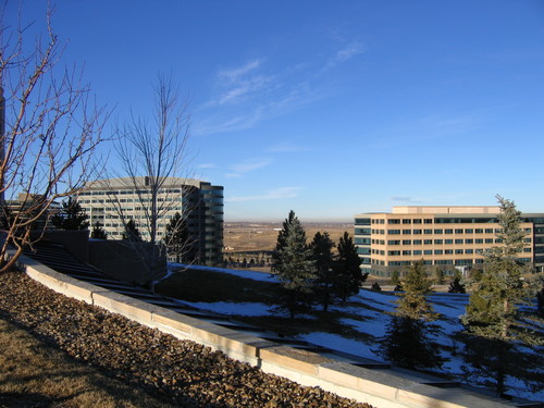
In the 1990s, Broomfield and other area suburbs experienced tremendous economic growth, much of it focused in technology. According to the Broomfield Economic Development Corporation website,[11] Broomfield's top three employers are IBM with 3,400 employees, Ball Corp. with 3,100 employees and Level 3 Communications with 2,089 employees. Seagate Technology and Oracle Corporation (formerly Sun Microsystems) are also notable technology companies with a presence in Broomfield.
Outdoors
Broomfield has an extensive trail system that connects the various lakes and parks. A scenic trail connects the Stearns Lake and the Josh's Pond on the west side of town. Broomfield also has a 9/11 memorial containing a piece of a steel beam from one of the towers.
Broomfield is home to many youth sports programs including Broomfield Blitz Youth Football, a non-profit 501c organization dedicated to providing exercise and athletic development.
Broomfield also has a skate park with many different features such as bowls, a large half pipe and several "street" obstacles.
Local business
The Flatiron Crossing Mall is a large shopping and entertainment center, anchored by Nordstrom, Macy's, The Great Indoors and Best Buy.
The Broomfield Enterprise is the local newspaper.
Broomfield Chamber of Commerce is the local business chamber.
Government
- Mayor - Patrick Quinn (term expires 2011)
- Mayor Pro-Tem - Walt Spader (term expires 2011)
- City & County Manager - Charles Ozaki
- City & County Attorney - William A. Tuthill III
Council members
- Ward 1
- Todd Schumacher (term expires 2011)
- Bob Gaiser (term expires 2013)
- Ward 2
- Lori Cox (term expires 2011)
- Dennis McCloskey (term expires 2013)
- Ward 3
- Kevin Jacobs (term expires 2011)
- Sam Taylor (term expires 2013)
- Ward 4
- Walt Spader (term expires 2011)
- Greg Stokes (term expires 2013)
- Ward 5
- Linda Reynolds (term expires 2011)
- Martha Derda (term expires 2013)
Education
Since Broomfield used to be divided among four counties, students living in the city were serviced by the appropriate school for their county. Even though the city is now united within one county, students attend the same schools they would have attended if county boundaries had remained the same.
The main school districts in Broomfield are Adams Twelve Five Star Schools and Boulder Valley School District.
Broomfield features two large public high schools (Broomfield High School, currently being remodeled, and Legacy High), two public middle schools and eight public elementary schools. There are three private schools: Broomfield Academy, with an academic preschool, an elementary school and a middle school for ages 3–14; Holy Family, a Catholic high school; and Nativity of Our Lord Parish, a Catholic elementary school. Broomfield also contains a K-12 charter school, Front Range Academy, which has two Broomfield campuses.
Sister cities/twin towns
Broomfield has two sister cities, as designated by Sister Cities International:
 Broomfield and Kingswood, Kent, United Kingdom
 Ueda, Nagano Prefecture, Japan (became a sister city after the former town of Maruko became part of the new city of Ueda on March 6, 2006)
See also
- State of Colorado
- Colorado cities and towns
- Colorado counties
- Colorado metropolitan areas
- Denver-Aurora Metropolitan Statistical Area
- Denver-Aurora-Boulder Combined Statistical Area
- North Central Colorado Urban Area
- Front Range Urban Corridor
- Northwest Parkway
- United States Government
- Rocky Flats National Wildlife Refuge
References
- ^ "Colorado Municipal Incorporations". State of Colorado, Department of Personnel & Administration, Colorado State Archives. 2004-12-01. http://www.colorado.gov/dpa/doit/archives/muninc.html. Retrieved 2007-09-02.
- ^ "Active Colorado Municipalities". State of Colorado, Department of Local Affairs. http://www.dola.state.co.us/dlg/local_governments/municipalities.html. Retrieved 2007-09-01.
- ^ "City & County of Broomfield: Community". City & County of Broomfield. http://www.ci.broomfield.co.us/community.shtml. Retrieved 2007-08-02.
- ^ a b "2010 Census Redistricting Data (Public Law 94-171) Summary File, Colorado" (CSV). 2010 Census Redistricting Data. United States Census Bureau, Population Division. http://www2.census.gov/census_2010/01-Redistricting_File--PL_94-171/Colorado/co2010.pl.zip. Retrieved 2011-04-03.
- ^ "ZIP Code Lookup" (JavaScript/HTML). United States Postal Service. http://zip4.usps.com/zip4/citytown.jsp. Retrieved September 4, 2007.
- ^ "Geographical Names Information System Search Result". United States Geological Survey. http://geonames.usgs.gov/pls/gnispublic/f?p=gnispq:3:4024066959192403::NO::P3_FID:1945881. Retrieved 2010-09-23.
- ^ "US Gazetteer files: 2010, 2000, and 1990". United States Census Bureau. 2011-02-12. http://www.census.gov/geo/www/gazetteer/gazette.html. Retrieved 2011-04-23.
- ^ Weather.com—[1]. Retrieved 31 July 2010.
- ^ "American FactFinder". United States Census Bureau. http://factfinder.census.gov. Retrieved 2008-01-31.
- ^ http://factfinder.census.gov/servlet/ACSSAFFFacts?_event=Search&geo_id=16000US0449360&_geoContext=01000US%7C04000US04%7C16000US0449360&_street=&_county=broomfield&_cityTown=broomfield&_state=04000US08&_zip=&_lang=en&_sse=on&ActiveGeoDiv=geoSelect&_useEV=&pctxt=fph&pgsl=160&_submenuId=factsheet_1&ds_name=ACS_2007_3YR_SAFF&_ci_nbr=null&qr_name=null®=null%3Anull&_keyword=&_industry=
- ^ BEDC website
External links
- City and County of Broomfield website
- Broomfield Chamber of Commerce
- Birth of a City 1950s-era video promoting Broomfield
- Colorado Historical Society
Categories:- Populated places in Broomfield County, Colorado
- Cities in Colorado
- Colorado counties
- Denver metropolitan area
- County seats in Colorado
- Populated places established in 1961
- Consolidated city–counties in the United States

Wikimedia Foundation. 2010.