- Crowley County, Colorado
-
Crowley County, Colorado 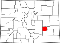
Location in the state of Colorado
Colorado's location in the U.S.Founded May 29, 1911 Named for John H. Crowley Seat Ordway Largest town Ordway Area
- Total
- Land
- Water
800.33 sq mi (2,073 km²)
788.99 sq mi (2,043 km²)
11.34 sq mi (29 km²), 1.42%Population
- (2000)
- Density
5,518
7/sq mi (3/km²)Time zone Mountain: UTC-7/-6 Website www.crowleycounty.net Crowley County is one of the 64 counties of the State of Colorado of the United States. The county population was 5,518 at U.S. Census 2000.[1] The county seat is Ordway.
Contents
History
Crowley County was created by the Colorado legislature on May 29, 1911, out of the northern portions of Otero County. Previously both were parts of Bent County. The county was named for John H. Crowley, senator from Otero County to the state legislature at the time of the split. Its original inhabitants decades earlier were native Americans, more Cheyenne than other tribes at the time the western expansion of the U.S. arrived.
The first significant development and settlement occurred in 1887 when the Missouri Pacific Railroad came through from the east, on its way to Pueblo and Colorado's rich gold fields of "Pikes Peak Or Bust".
The county seat is in Ordway, a town established in 1890 that quickly became the economic hub of the area. Other towns still existing along the Missouri Pacific Railroad's route are Sugar City, Crowley, and Olney Springs.
A few years later, developers brought a canal east from the Arkansas River, with ambitious plans to irrigate a million acres (4000 km²) in Kansas; instead, the canal petered out in Crowley County but did irrigate 57,000 acres (230 km2) along its length. This turned early Crowley County into a lush agricultural mecca...at first.
By the 1970s almost all the water rights were sold from what is now called the Twin Lakes Canal to the fast-growing cities of Colorado's Front Range corridor. The area's economic activity has shifted toward ranching. Much of the land has returned to its original sparse prairie grassland conditions.
Crowley County also today hosts a state prison. The 2000 census showed 5,518 county residents, of which 1,955 were prisoners, giving Crowley County the highest percentage of incarcerated prisoners of any county in the U.S. The county maintained this position in the 2010 census, with 2,682 prisoners out of 5,823 residents.
Geography
According to the 2000 census, the county has a total area of 800.33 square miles (2,072.8 km2), of which 788.99 square miles (2,043.5 km2) (or 98.58%) is land and 11.34 square miles (29.4 km2) (or 1.42%) is water.[2]
Adjacent counties
- Lincoln County, Colorado - (north)
- El Paso County, Colorado- (northwest)
- Otero County, Colorado - (south)
- Kiowa County, Colorado - (east)
- Pueblo County, Colorado - (west)
Demographics
As of the census[3] of 2000, there were 5,518 people, 1,358 households, and 957 families residing in the county. The population density was 7 people per square mile (3/km²). There were 1,542 housing units at an average density of 2 per square mile (1/km²). The racial makeup of the county was 82.95% White, 7.05% Black or African American, 2.59% Native American, 0.82% Asian, 0.02% Pacific Islander, 4.77% from other races, and 1.81% from two or more races. 22.54% of the population were Hispanic or Latino of any race.
There were 1,358 households out of which 34.50% had children under the age of 18 living with them, 55.10% were married couples living together, 11.00% had a female householder with no husband present, and 29.50% were non-families. 25.70% of all households were made up of individuals and 13.00% had someone living alone who was 65 years of age or older. The average household size was 2.59 and the average family size was 3.12.
In the county the population was spread out with 18.80% under the age of 18, 9.90% from 18 to 24, 39.60% from 25 to 44, 20.80% from 45 to 64, and 10.80% who were 65 years of age or older. The median age was 37 years. For every 100 females there were 205.40 males (this is the highest of any U.S. county/parish in 2000). For every 100 females age 18 and over, there were 240.90 males.
The median income for a household in the county was $26,803, and the median income for a family was $32,162. Males had a median income of $20,813 versus $21,920 for females. The per capita income for the county was $12,836. About 15.20% of families and 18.50% of the population were below the poverty line, including 23.60% of those under age 18 and 13.50% of those age 65 or over.
Census data for Crowley county includes 1,955 prisoners. The prison population is 19.23% Black, and 24.35% Hispanic. Without the prisoners, Crowley County would be 86.72% White, 0.36% Black, and 21.55% Hispanic. As a percentage of its population, Crowley County has more of its Census population in prison than any other county in the country.
Cities and towns
- Crowley
- Olney Springs
- Ordway (County Seat)
- Sugar City
Transcontinental bicycle route
- TransAmerica Trail Bicycle Route
See also
- Colorado census statistical areas
- Colorado counties
- Colorado municipalities
- Crowley (disambiguation)
- National Register of Historic Places listings in Crowley County, Colorado
- Pike's Peak Gold Rush
References
- ^ "Annual County Population Estimates and Estimated Components of Change: April 1, 2000 to July 1, 2006 (CO-EST2006-alldata)" (CSV). 2006 Population Estimates. United States Census Bureau, Population Division. 2007-03-22. http://www.census.gov/popest/counties/files/CO-EST2006-ALLDATA.csv. Retrieved 2007-05-17.
- ^ "Census 2000 U.S. Gazetteer Files: Counties". United States Census. http://www.census.gov/tiger/tms/gazetteer/county2k.txt. Retrieved 2011-02-13.
- ^ "American FactFinder". United States Census Bureau. http://factfinder.census.gov. Retrieved 2008-01-31.
External links
- Crowley County Government website
- Crowley County History
- Colorado County Evolution by Don Stanwyck
- Colorado Historical Society

El Paso County Lincoln County Pueblo County 
Kiowa County  Crowley County, Colorado

Otero County Municipalities and communities of Crowley County, Colorado Towns Crowley | Olney Springs | Ordway | Sugar City
 Categories:
- Colorado counties
- Crowley County, Colorado
- 1911 establishments in the United States
- Populated places established in 1911


Wikimedia Foundation. 2010.